Category:Burnham, Buckinghamshire
Jump to navigation
Jump to search
English: Burnham lies north of the River Thames, and sits on the border with Berkshire, between the towns of Maidenhead and Slough. It is served by Burnham railway station in the west of Slough on the main line between London and Reading. The M4 motorway passes through the south of the parish.
Italiano: Burnham è una cittadina di 11.512 abitanti della contea del Buckinghamshire, in Inghilterra.
Nederlands: Burnham is een plaats in het bestuurlijke gebied South Bucks, in het Engelse graafschap Buckinghamshire. De plaats telt 11.512 inwoners.
Norsk bokmål: Burnham er en by i Buckinghamshire i England. Den ligger ved Themsen på grensen til Berkshire, mellom Maidenhead og Slough. Sistnevnte by og Burnham har tildels vokst inn i hverandre, og Burnham regnes ofte som en forstad til Slough. Den har allikevel bevart mye av sin eldre karakter.
village and civil parish in Buckinghamshire, England  Eglwys Sant Pedr, Burnham | |||||
| Upload media | |||||
| Instance of | |||||
|---|---|---|---|---|---|
| Location | Buckinghamshire, South East England, England | ||||
| Area |
| ||||
| official website | |||||
 | |||||
Subcategories
This category has the following 9 subcategories, out of 9 total.
A
- St Anne's Church, Dropmore (4 F)
B
D
- Dropmore Park (3 F)
K
- Kilnwood Park (1 F)
L
- Littleworth Common (11 F)
N
P
- St Peter's Church, Burnham (7 F)
Media in category "Burnham, Buckinghamshire"
The following 200 files are in this category, out of 432 total.
(previous page) (next page)-
 A path on East Burnham Common - geograph.org.uk - 6120986.jpg 2,700 × 2,025; 700 KB
-
 A pleasant 'boozer' - geograph.org.uk - 3291340.jpg 640 × 480; 67 KB
-
 A355 at Dorney Hill - geograph.org.uk - 4862384.jpg 640 × 480; 65 KB
-
 A355 Collinswood Road - geograph.org.uk - 5646206.jpg 640 × 428; 100 KB
-
 Abbey Park Farm - geograph.org.uk - 3458764.jpg 800 × 600; 99 KB
-
 Abbey Park Lane, Littleworth Common - geograph.org.uk - 5667873.jpg 2,304 × 1,728; 1.15 MB
-
 Across the golf course - geograph.org.uk - 3434825.jpg 640 × 439; 280 KB
-
 Allerds Road, East Burnham - geograph.org.uk - 5988258.jpg 4,772 × 3,076; 3.57 MB
-
 AMS Burnham on Dropmore Road, Burnham - geograph.org.uk - 5663967.jpg 2,304 × 1,728; 827 KB
-
 Ant nest of heaped leaf litter in Burnham Beeches - geograph.org.uk - 5092429.jpg 3,648 × 2,736; 4.51 MB
-
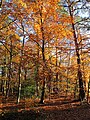
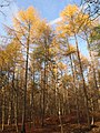
 Autumn colours at Burnham Beeches - geograph.org.uk - 2684673.jpg 3,968 × 2,976; 2.96 MB
-
 Autumn in Burnham Beeches - geograph.org.uk - 2302486.jpg 2,048 × 1,536; 642 KB
-
 Autumn leaves in Burnham Beeches, near cafe - geograph.org.uk - 5980246.jpg 3,648 × 2,736; 4.4 MB
-
 Autumnal hues at Littleworth Common (1) - geograph.org.uk - 2684653.jpg 3,968 × 2,976; 2.91 MB
-
 Autumnal hues at Littleworth Common (2) - geograph.org.uk - 2684657.jpg 3,968 × 2,976; 2.94 MB
-
 Barley and wheat by Dorney Wood - geograph.org.uk - 825609.jpg 640 × 480; 76 KB
-
 Barley by Dorney Wood - geograph.org.uk - 825599.jpg 640 × 480; 77 KB
-
 Barn at Little Jennings Farm - geograph.org.uk - 3458769.jpg 800 × 600; 159 KB
-
 Barn in Burnham Beeches - geograph.org.uk - 2699463.jpg 640 × 427; 218 KB
-
 Bath Road, Taplow - geograph.org.uk - 2811927.jpg 1,600 × 1,200; 526 KB
-
 Beech leaves changing colour, Burnham Beeches - geograph.org.uk - 4718351.jpg 3,648 × 2,736; 3.48 MB
-
-
 Beeches Cafe - geograph.org.uk - 5565954.jpg 5,202 × 3,465; 3.01 MB
-
 Beeches Road, Egypt - geograph.org.uk - 5664457.jpg 2,266 × 1,676; 960 KB
-
 Beeches Way (22) - geograph.org.uk - 3473806.jpg 800 × 600; 138 KB
-
 Beeches Way (23) - geograph.org.uk - 3473807.jpg 800 × 600; 202 KB
-
 Beeches Way (24) - geograph.org.uk - 3473809.jpg 800 × 600; 201 KB
-
 Beeches Way (24) - geograph.org.uk - 3473810.jpg 800 × 600; 163 KB
-
 Beeches Way (26) - geograph.org.uk - 3473811.jpg 600 × 800; 121 KB
-
 Beeches Way (27) - geograph.org.uk - 3473812.jpg 600 × 800; 269 KB
-
 Beeches Way (28) - geograph.org.uk - 3473814.jpg 800 × 600; 254 KB
-
 Beeches Way (29) - geograph.org.uk - 3473817.jpg 800 × 600; 209 KB
-
 Beeches Way (30) - geograph.org.uk - 3474233.jpg 800 × 600; 186 KB
-
 Beeches Way (31) - geograph.org.uk - 3474239.jpg 800 × 600; 165 KB
-
 Beeches Way (32) - geograph.org.uk - 3474244.jpg 800 × 600; 112 KB
-
 Beeches Way (33) - geograph.org.uk - 3474246.jpg 800 × 554; 91 KB
-
 Beeches Way, looking towards Farnham Common - geograph.org.uk - 5565959.jpg 5,202 × 3,465; 5.68 MB
-
 Blackwood Arms - geograph.org.uk - 2743416.jpg 640 × 480; 97 KB
-

-
 Bonfire at Burnham Beeches - geograph.org.uk - 6070252.jpg 3,906 × 3,277; 2.7 MB
-

-
 Boveney Wood Farm - geograph.org.uk - 2698991.jpg 640 × 391; 206 KB
-
 Boveney Wood Lane - geograph.org.uk - 2698974.jpg 640 × 427; 267 KB
-
 Brickfield Lane, Burnham - geograph.org.uk - 5666428.jpg 2,304 × 1,728; 851 KB
-
 Bridge over the M4 near Dorney - geograph.org.uk - 4470318.jpg 640 × 427; 211 KB
-
 Bridleway meeting Dropmore Road - geograph.org.uk - 2171574.jpg 640 × 480; 133 KB
-
 Bridleway near Dropmore Road - geograph.org.uk - 2171557.jpg 640 × 480; 165 KB
-
 Bridleway, Hitcham Ride - geograph.org.uk - 2171627.jpg 480 × 640; 132 KB
-
 Britwell Road at the junction of Farnham Lane - geograph.org.uk - 4377997.jpg 2,560 × 1,920; 1.51 MB
-
 Britwell Road at the junction of High Street Burnham - geograph.org.uk - 4376507.jpg 2,560 × 1,920; 1.98 MB
-
 Buildings at Hicknaham Farm - geograph.org.uk - 3458791.jpg 800 × 600; 95 KB
-
 Burnham - Old Five Bells - geograph.org.uk - 1118885.jpg 640 × 471; 84 KB
-
 Burnham Beeches - geograph.org.uk - 2171358.jpg 640 × 480; 156 KB
-
 Burnham Beeches - geograph.org.uk - 2699466.jpg 640 × 630; 327 KB
-
 Burnham Beeches - geograph.org.uk - 4645429.jpg 6,586 × 1,928; 3.76 MB
-
 Burnham Beeches cafe - geograph.org.uk - 2699441.jpg 640 × 413; 269 KB
-
 Burnham Beeches car park - geograph.org.uk - 2242213.jpg 3,648 × 2,736; 3.01 MB
-
 Burnham Beeches car park - geograph.org.uk - 2699436.jpg 640 × 441; 251 KB
-
 Burnham Beeches information board by Dukes Drive - geograph.org.uk - 5053183.jpg 3,648 × 2,736; 3.79 MB
-
 Burnham Beeches near Dukes Drive - geograph.org.uk - 5565938.jpg 5,202 × 3,465; 5.46 MB
-
 Burnham Beeches ranger on quad bike on autumn leaves - geograph.org.uk - 5980302.jpg 3,648 × 2,736; 5.1 MB
-
 Burnham Beeches sign at the north end of Green Lane - geograph.org.uk - 5562630.jpg 5,202 × 3,465; 5.86 MB
-
 Burnham Beeches with autumn leaves, Oak tree - geograph.org.uk - 5980128.jpg 3,461 × 2,592; 6.19 MB
-
 Burnham Beeches, autumn leaves against the light - geograph.org.uk - 5980310.jpg 2,501 × 1,877; 1.76 MB
-
 Burnham Beeches, autumn leaves by Sir Henry Peek's Drive - geograph.org.uk - 5980260.jpg 2,400 × 3,200; 4.35 MB
-
 Burnham Beeches, autumn leaves from Lord Mayor's Drive - geograph.org.uk - 5980282.jpg 2,050 × 2,736; 2.44 MB
-
 Burnham Beeches, autumn leaves in horizontal clusters - geograph.org.uk - 5980277.jpg 3,648 × 2,736; 4.71 MB
-
 Burnham Beeches, Halse Drive near Victoria Drive - geograph.org.uk - 5565945.jpg 5,202 × 3,465; 5.27 MB
-
 Burnham beeches, leaves changing colour - geograph.org.uk - 4718329.jpg 3,648 × 2,736; 4.52 MB
-

-
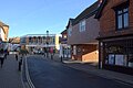 Burnham High Street - geograph.org.uk - 5561166.jpg 5,202 × 3,465; 3.88 MB
-
 Burnham library - geograph.org.uk - 5561154.jpg 5,202 × 3,465; 4.55 MB
-
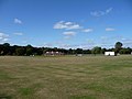 Burnham Memorial Cricket Ground - geograph.org.uk - 1506229.jpg 640 × 480; 59 KB
-
 Burnham Methodist Church - geograph.org.uk - 3771298.jpg 1,600 × 1,084; 299 KB
-
 Burnham old fire station - geograph.org.uk - 584000.jpg 640 × 427; 197 KB
-
 Burnham Park - geograph.org.uk - 84645.jpg 640 × 480; 144 KB
-
 Burnham Park from Lincoln Hatch Lane - geograph.org.uk - 5561156.jpg 5,202 × 3,465; 5.11 MB
-

-
 Burnham Park looking east - geograph.org.uk - 5561153.jpg 5,202 × 3,465; 4.85 MB
-
 Burnham Park looking west towards the playground - geograph.org.uk - 5561117.jpg 5,202 × 3,465; 6.26 MB
-
 Burnham Park looking west. - geograph.org.uk - 5561118.jpg 5,202 × 3,465; 4.21 MB
-
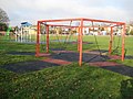
 Burnham Park. Exercise equipment and back of the library - geograph.org.uk - 5561123.jpg 5,202 × 3,465; 5.17 MB
-
 Burnham Telephone Exchange (1) - geograph.org.uk - 2186096.jpg 3,072 × 2,304; 1.78 MB
-
 Burnham Telephone Exchange (2) - geograph.org.uk - 2186119.jpg 3,072 × 2,304; 1.81 MB
-
 Burnham Telephone Exchange - geograph.org.uk - 5663966.jpg 2,304 × 1,728; 861 KB
-
 Burnham Working Men's Club - geograph.org.uk - 1126734.jpg 640 × 480; 82 KB
-
 Burnham, Dorney Wood - geograph.org.uk - 1047093.jpg 640 × 480; 147 KB
-
 Burnham, Dorney Wood pond - geograph.org.uk - 1047102.jpg 640 × 480; 136 KB
-
 Burnham, Garibaldi - geograph.org.uk - 1126647.jpg 640 × 480; 79 KB
-
 Burnham, Lent Green Pond - geograph.org.uk - 1118763.jpg 640 × 480; 120 KB
-
 Burnham, Lent Rise Road bridge - geograph.org.uk - 206687.jpg 640 × 480; 101 KB
-
 Burnham, Shakespeare's Way - geograph.org.uk - 1047112.jpg 640 × 480; 142 KB
-
-
 Burnham, The George Inn - geograph.org.uk - 1126619.jpg 640 × 493; 84 KB
-
 Burnham, The Priory - geograph.org.uk - 1118831.jpg 640 × 480; 84 KB
-
 Burnham, United Reformed Church - geograph.org.uk - 1126537.jpg 640 × 480; 62 KB
-
 Burnham, West Town Farm - geograph.org.uk - 71724.jpg 640 × 425; 77 KB
-
 Bus img 5897 (16333498475).jpg 3,072 × 2,304; 2.52 MB
-
 Bus img 5900 (16147310849).jpg 3,072 × 2,304; 2.82 MB
-
 Bus img 5903 (16145918698).jpg 3,072 × 2,304; 2.29 MB
-
 Cafe at Burnham Beeches - geograph.org.uk - 3057780.jpg 1,600 × 1,200; 1.05 MB
-
 Car park and drive - geograph.org.uk - 2743433.jpg 640 × 480; 80 KB
-
 Car park on Burnham Beeches - geograph.org.uk - 5667292.jpg 2,304 × 1,728; 831 KB
-
 Car Park on Hawthorn Lane, Burnham Beeches - geograph.org.uk - 5663973.jpg 2,266 × 1,676; 958 KB
-
 Carved Logs, Burnham Beeches - geograph.org.uk - 5988978.jpg 4,068 × 3,103; 2.26 MB
-
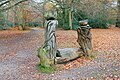 Carvings by the Track - geograph.org.uk - 5988365.jpg 1,600 × 1,067; 928 KB
-
 Cattle at Abbey Park Farm - geograph.org.uk - 2699223.jpg 640 × 396; 180 KB
-
 Clonmel Way, Burnham (Bucks) - geograph.org.uk - 104826.jpg 640 × 438; 70 KB
-
 Common Lane - Littleworth - geograph.org.uk - 3281015.jpg 640 × 421; 43 KB
-
 Common Lane, Littleworth Common - geograph.org.uk - 5564007.jpg 5,202 × 3,465; 3.53 MB
-
 Conifers, Egypt Woods - geograph.org.uk - 2171316.jpg 480 × 640; 124 KB
-

-
 Corporation of London sign at Park Lane - geograph.org.uk - 5562639.jpg 5,202 × 3,465; 5.6 MB
-
 Cows in Hitcham Park - geograph.org.uk - 3771308.jpg 1,024 × 770; 322 KB
-
 Crossroads, Farnham Common - geograph.org.uk - 2171156.jpg 640 × 480; 99 KB
-
 Crow Piece Lane - geograph.org.uk - 5987681.jpg 4,207 × 3,084; 2.22 MB
-
 Crown Lane - geograph.org.uk - 3291332.jpg 640 × 480; 72 KB
-
 Crown Lane - geograph.org.uk - 3291337.jpg 640 × 480; 84 KB
-
 Crown Lane, Burnham Beeches - geograph.org.uk - 5663974.jpg 2,304 × 1,728; 1.21 MB
-
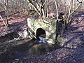 Culvert in Burnham Beeches - geograph.org.uk - 2242226.jpg 3,648 × 2,736; 3.81 MB
-
 Curriers Lane and Park Lane - geograph.org.uk - 5562634.jpg 5,202 × 3,465; 4.72 MB
-
 Curriers Lane approaching Dorney Wood Road - geograph.org.uk - 5562660.jpg 5,202 × 3,465; 3.91 MB
-
 Cyclist on Stewarts Drive, Burnham Beeches - geograph.org.uk - 5053180.jpg 3,648 × 2,736; 4.14 MB
-
 Cyclists at Burnham Beeches cafe - geograph.org.uk - 5528556.jpg 3,648 × 2,736; 3.11 MB
-
 Daisies at Burnham Arthur Hacker.jpg 1,200 × 686; 242 KB
-
 Damp area, Egypt Woods - geograph.org.uk - 4165681.jpg 640 × 480; 159 KB
-
 Damp area, Egypt Woods - geograph.org.uk - 4165686.jpg 640 × 480; 172 KB
-
 Deansway or the Highway - geograph.org.uk - 2149354.jpg 640 × 428; 162 KB
-
 Dorney Wood - geograph.org.uk - 5562627.jpg 5,202 × 3,465; 4.54 MB
-
 Dorney Wood - geograph.org.uk - 5667869.jpg 2,304 × 1,728; 851 KB
-
 Dorney Wood danger signs - geograph.org.uk - 5565904.jpg 5,202 × 3,465; 4.36 MB
-
 Dorney Wood Road near Snowball Farm - geograph.org.uk - 5561215.jpg 5,202 × 3,465; 5.01 MB
-
 Dorney Wood Road, Burnham - geograph.org.uk - 5561196.jpg 5,202 × 3,465; 3.87 MB
-
 Dropmore Lane at the junction of Pipers Close - geograph.org.uk - 4376485.jpg 2,560 × 1,920; 2.01 MB
-
 Dropmore Lane, Dropmore - geograph.org.uk - 4377433.jpg 2,560 × 1,920; 1.9 MB
-
 Dropmore Parish Hall - geograph.org.uk - 3458717.jpg 800 × 600; 192 KB
-
 Dropmore Road and Fairfield Road junction - geograph.org.uk - 5561183.jpg 4,557 × 2,726; 3.07 MB
-
 Dropmore Road, Burnham - geograph.org.uk - 4376480.jpg 2,560 × 1,920; 2.02 MB
-
 Dropmore Road, Burnham - geograph.org.uk - 5666227.jpg 2,286 × 1,704; 1.21 MB
-
 Dropmore Road, Burnham - geograph.org.uk - 5666228.jpg 2,304 × 1,728; 1.12 MB
-
 Dropmore Road, Littleworth Common - geograph.org.uk - 4376470.jpg 2,560 × 1,920; 1.95 MB
-
 Dropmore Road, Littleworth Common - geograph.org.uk - 5668022.jpg 2,238 × 1,636; 1.38 MB
-

-
 Druid's Oak - geograph.org.uk - 2699460.jpg 640 × 459; 293 KB
-
 Duke's Drive - geograph.org.uk - 2699470.jpg 640 × 427; 199 KB
-
 Dukes Drive, Burnham Beeches - geograph.org.uk - 6073835.jpg 5,000 × 3,543; 4.15 MB
-
 Dumping on Crow Piece Lane - geograph.org.uk - 5987690.jpg 5,184 × 3,456; 3.65 MB
-
 East Burnham Common - geograph.org.uk - 2176513.jpg 640 × 480; 88 KB
-
 East Burnham Common - geograph.org.uk - 6120977.jpg 2,700 × 2,025; 539 KB
-
 East Burnham Common - geograph.org.uk - 6120981.jpg 2,700 × 2,025; 547 KB
-
 East Burnham Common - geograph.org.uk - 6120983.jpg 2,700 × 2,025; 408 KB
-
 East Burnham Common - geograph.org.uk - 6120991.jpg 2,700 × 2,025; 408 KB
-
 East Burnham Common - geograph.org.uk - 6120995.jpg 2,700 × 2,025; 594 KB
-
 East Burnham Common - geograph.org.uk - 6120996.jpg 2,700 × 2,025; 503 KB
-
 Eastbound M4 at Junction 7 - geograph.org.uk - 4470319.jpg 640 × 480; 250 KB
-
 Eastbound M4, Lake End Road Bridge - geograph.org.uk - 4481351.jpg 640 × 427; 240 KB
-
 Eastfield Road - geograph.org.uk - 1504493.jpg 640 × 480; 66 KB
-
-
 Egypt Wood Cottages - geograph.org.uk - 2699234.jpg 640 × 428; 249 KB
-
 Egypt Wood Cottages from footpath in woods - geograph.org.uk - 5053171.jpg 3,648 × 2,736; 4.37 MB
-
 Electricity sub-station by Juniper Hill - geograph.org.uk - 825587.jpg 640 × 480; 105 KB
-
 Entrance to Burwood Estate - geograph.org.uk - 2171601.jpg 480 × 640; 137 KB
-
 Entrance to car park on Burnham Beeches - geograph.org.uk - 5663972.jpg 2,304 × 1,728; 857 KB
-
 Entrance to Dorney Wood - geograph.org.uk - 2699218.jpg 640 × 449; 254 KB
-
 Entrance to private estate off Nashdom Lane, Burnham - geograph.org.uk - 5666434.jpg 2,304 × 1,728; 1.35 MB
-
-
 Entrance to West Town Farm - geograph.org.uk - 3828846.jpg 1,024 × 768; 163 KB
-
 Farm road to Hicknaham Farm - geograph.org.uk - 3458779.jpg 800 × 600; 169 KB
-
 Farmland at Brook End - geograph.org.uk - 162761.jpg 640 × 480; 308 KB
-
 Farnham Lane at the end of Walton Lane, Britwell - geograph.org.uk - 4376496.jpg 2,560 × 1,920; 1.94 MB
-
 Field and field boundary, Dorney Wood - geograph.org.uk - 2171512.jpg 640 × 480; 134 KB
-
 Field and tree at Dorneywood Geograph-2171506-by-Derek-Harper.jpg 640 × 478; 136 KB
-
 Field at the back of the Blackwood Arms pub - geograph.org.uk - 2684659.jpg 3,968 × 2,976; 2.94 MB
-
 Field gate off Dorney Wood Road - geograph.org.uk - 5562602.jpg 5,202 × 3,465; 5.26 MB
-
 Field off Dorney Wood Road - geograph.org.uk - 5561207.jpg 4,759 × 2,929; 2.67 MB
-
 Fields and Horses - geograph.org.uk - 129838.jpg 640 × 429; 117 KB
-
 Fields next to the M4 - geograph.org.uk - 5442617.jpg 1,440 × 1,080; 1.03 MB
-
 Figure at the Crossing - geograph.org.uk - 3756624.jpg 800 × 594; 102 KB
-
 Flats in Burnham - geograph.org.uk - 3961539.jpg 640 × 336; 39 KB
-
 Flats in Burnham - geograph.org.uk - 5587864.jpg 640 × 426; 65 KB
-
 Footpath arrives at Hawthorn Lane - geograph.org.uk - 3465684.jpg 800 × 600; 196 KB
-
 Footpath by field - geograph.org.uk - 825635.jpg 640 × 480; 255 KB
-
 Footpath east from bend in Park Lane - geograph.org.uk - 3458758.jpg 800 × 600; 148 KB
-
 Footpath heading towards Burnham Beeches - geograph.org.uk - 2743412.jpg 640 × 480; 102 KB
-
-
 Footpath towards Dorney Wood - geograph.org.uk - 2699485.jpg 640 × 446; 198 KB
-
 Footpath towards Littleworth Common - geograph.org.uk - 2699480.jpg 640 × 431; 257 KB
-
 Fungi and autumn leaves, Burnham Beeches - geograph.org.uk - 4718355.jpg 3,648 × 2,736; 3.34 MB
-
 Garibaldi restaurant, Burnham - geograph.org.uk - 5561159.jpg 4,786 × 2,808; 2.57 MB
-
 Gate at Park Lane from Dorney Wood - geograph.org.uk - 5565918.jpg 5,202 × 3,465; 4.31 MB
-

-
 Gate off Beeches Lane - geograph.org.uk - 5565950.jpg 5,202 × 3,465; 5.45 MB
-
 Gate to Home Close, off Green Lane - geograph.org.uk - 5562621.jpg 5,202 × 3,465; 5.31 MB
-
 Gate to Kilnwood estate - geograph.org.uk - 5562669.jpg 5,202 × 3,465; 5.6 MB
-
 Gatehouse on Rose Hill, Burnham - geograph.org.uk - 5666440.jpg 2,304 × 1,728; 1.13 MB
-
 Gateway to Snowball Farm equestrian centre - geograph.org.uk - 5562598.jpg 5,202 × 3,465; 4.85 MB
-
 George Inn, Burnham - geograph.org.uk - 5561160.jpg 5,202 × 3,465; 3.11 MB
-
 Glasshouses at West Town Farm - geograph.org.uk - 6069862.jpg 1,600 × 980; 599 KB
-
 Great Burnt Coppice, Burnham Beeches - geograph.org.uk - 2242220.jpg 3,648 × 2,736; 5.01 MB
-
 Green Lane, Burnham - geograph.org.uk - 3757857.jpg 1,600 × 1,200; 769 KB


_-_geograph.org.uk_-_2684653.jpg)
_-_geograph.org.uk_-_2684657.jpg)


_-_geograph.org.uk_-_3473806.jpg)
_-_geograph.org.uk_-_3473807.jpg)
_-_geograph.org.uk_-_3473809.jpg)
_-_geograph.org.uk_-_3473810.jpg)
_-_geograph.org.uk_-_3473811.jpg)
_-_geograph.org.uk_-_3473812.jpg)
_-_geograph.org.uk_-_3473814.jpg)
_-_geograph.org.uk_-_3473817.jpg)
_-_geograph.org.uk_-_3474233.jpg)
_-_geograph.org.uk_-_3474239.jpg)
_-_geograph.org.uk_-_3474244.jpg)
_-_geograph.org.uk_-_3474246.jpg)


_-_geograph.org.uk_-_2186096.jpg)
_-_geograph.org.uk_-_2186119.jpg)


.jpg)
.jpg)
.jpg)


_-_geograph.org.uk_-_104826.jpg)


