Category:Bussell Island
Jump to navigation
Jump to search
Located at the mouth of the Little Tennessee River at the Tennessee River in East Tennessee, Loudon County. A site of some Indian Mound exploration in the late 19th and early 20th centuries; TELLICO ARCHAELOGY, Jefferson Chapman, 3rd edition.  | |||||
| Upload media | |||||
| Instance of | |||||
|---|---|---|---|---|---|
| Location | Lenoir City, Loudon County, Tennessee | ||||
| Located in or next to body of water | |||||
| Heritage designation |
| ||||
| Drainage basin |
| ||||
 | |||||
|
This is a category about a place or building that is listed on the National Register of Historic Places in the United States of America. Its reference number is 78002606. |
Files related to Bussell Island, at the mouth of the Little Tennessee River in Loudon County, Tennessee, USA.
Media in category "Bussell Island"
The following 18 files are in this category, out of 18 total.
-
 Bussell-island-vicinity-tn1.jpg 404 × 255; 43 KB
-
 Copper ornament bussell island.jpg 900 × 829; 385 KB
-
 Emmertt-bussell-map-1887-tn1.gif 611 × 497; 41 KB
-
 Harrington-bone-awls-bussell-tn1.jpg 978 × 1,366; 800 KB
-
 Harrington-bussell-trench1-tn1.gif 441 × 652; 44 KB
-
 Harrington-Bussell-trench2-tn1.jpg 1,853 × 824; 732 KB
-
 Harrington-bussell-trench3-tn1.gif 440 × 469; 36 KB
-
 Harrington-cherokee-grave-tn1.jpg 1,204 × 840; 178 KB
-
 Harrington-gorget-bussell-tn1.jpg 697 × 1,177; 441 KB
-
 Harrington-lynx-teeth-bussell-tn1.jpg 487 × 560; 119 KB
-
 Harrington-map-bussell-area-1922.gif 608 × 830; 34 KB
-
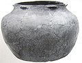 Harrington-pottery-vessel-bussell-tn1.jpg 1,325 × 1,020; 789 KB
-
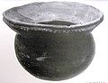 Harrington-pottery-vessel-bussell-tn2.jpg 1,457 × 1,113; 792 KB
-
 Harrington-round-grave-burial-tn1.jpg 1,234 × 1,033; 476 KB
-
 Harrington-round-grave-tn2.jpg 1,056 × 754; 82 KB
-
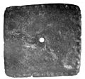
 Harrington-steatite-vessel-bussell-tn1.gif 463 × 387; 74 KB
-
 Tali-coste-chiaha-chiaves-sp1.jpg 630 × 298; 53 KB
-
 Tellico-dam-dike-tn1.jpg 2,048 × 1,536; 1.1 MB


