Category:Bwlch Drws Ardudwy
Jump to navigation
Jump to search

Media in category "Bwlch Drws Ardudwy"
The following 45 files are in this category, out of 45 total.
-
 A path through the forest - geograph.org.uk - 1337066.jpg 640 × 480; 104 KB
-
 Afon Cwmnantcol - geograph.org.uk - 1276473.jpg 480 × 640; 165 KB
-

-
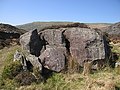 Boulder near Nantcol - geograph.org.uk - 1276485.jpg 640 × 480; 168 KB
-
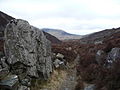
 Bwlch Drws Ardudwy - geograph.org.uk - 1273971.jpg 640 × 640; 204 KB
-
 Bwlch Drws Ardudwy - geograph.org.uk - 1273979.jpg 640 × 480; 154 KB
-
 Bwlch Drws Ardudwy - geograph.org.uk - 1276463.jpg 480 × 640; 159 KB
-
 Bwlch Drws Ardudwy - geograph.org.uk - 803500.jpg 640 × 480; 128 KB
-
 Bwlch Drws Ardudwy - geograph.org.uk - 803501.jpg 640 × 480; 104 KB
-
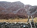
 Curved stone wall, Bwlch Drws Ardudwy - geograph.org.uk - 1276389.jpg 640 × 480; 130 KB
-
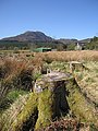
 Cwm Hosan - geograph.org.uk - 1276454.jpg 480 × 640; 148 KB
-
 Diffwys ridge and the Rhinogydd - geograph.org.uk - 1755049.jpg 1,024 × 768; 345 KB
-
 Foot of Rhinog Fach - geograph.org.uk - 1273863.jpg 640 × 480; 134 KB
-
 Footpath to Graigddu Isaf - geograph.org.uk - 1273444.jpg 480 × 640; 176 KB
-
 Forest approach to Bwlch Drws Ardudwy - geograph.org.uk - 803737.jpg 640 × 480; 88 KB
-
 Forestry track at Graigddu Isaf - geograph.org.uk - 1273313.jpg 640 × 480; 99 KB
-
 From near Bwlch Drws Ardudwy - geograph.org.uk - 883861.jpg 640 × 480; 137 KB
-
 Graigddu forest track - geograph.org.uk - 1273576.jpg 640 × 480; 166 KB
-

-
 Into Bwlch Drws Ardudwy - geograph.org.uk - 1273706.jpg 640 × 480; 131 KB
-
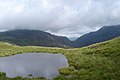
 Llyn Cwmhosan - geograph.org.uk - 883871.jpg 640 × 480; 138 KB
-
 Llyn Cwmhosan sparkling in the sunshine - geograph.org.uk - 807093.jpg 640 × 480; 118 KB
-
 Mixed woodland near Grugle - geograph.org.uk - 1273617.jpg 640 × 480; 159 KB
-
 Nantcol - geograph.org.uk - 1276522.jpg 640 × 480; 138 KB
-
 Pen Cwm Nantcol - geograph.org.uk - 1276762.jpg 640 × 480; 134 KB
-
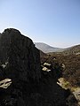
 Rhinog Fawr from Bwlch Drws Ardudwy - geograph.org.uk - 534793.jpg 482 × 640; 75 KB
-
 Rhinog Fawr from path junction. - geograph.org.uk - 1754539.jpg 800 × 600; 201 KB
-
 Rhinog Fawr.jpg 768 × 1,024; 273 KB
-
 Rhinogs view - geograph.org.uk - 803699.jpg 640 × 480; 50 KB
-

-
 Southeast face of Rhinog Fawr - geograph.org.uk - 1273786.jpg 640 × 480; 177 KB
-
 Southern buttress on Rhinog Fawr - geograph.org.uk - 1274001.jpg 640 × 640; 268 KB
-

-
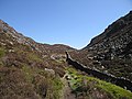 Stone wall along Bwlch Drws Ardudwy - geograph.org.uk - 1276382.jpg 640 × 480; 144 KB
-
 Stone walls in Bwlch Drws Ardudwy - geograph.org.uk - 1273887.jpg 480 × 640; 169 KB
-
 The door to the pass is open - geograph.org.uk - 1752084.jpg 640 × 480; 80 KB
-
 The lane into upper Cwm Nantcol - geograph.org.uk - 1752066.jpg 640 × 480; 68 KB
-

-
 Towards Bwlch Drws Ardudwy - geograph.org.uk - 1273634.jpg 480 × 640; 205 KB
-
 Western approaches to Bwlch Drws Ardudwy - geograph.org.uk - 745195.jpg 1,024 × 688; 1.15 MB
-
 Western end of Bwlch Drws Ardudwy - geograph.org.uk - 1276403.jpg 480 × 640; 81 KB
-
 A Mountain Pool - geograph.org.uk - 499413.jpg 640 × 428; 51 KB
-
 A walk through the forest - geograph.org.uk - 803740.jpg 640 × 480; 99 KB
-
 Bwlch Drws Ardudwy - geograph.org.uk - 221020.jpg 640 × 480; 69 KB
-
 Bwlch Drws-Ardudwy - geograph.org.uk - 298391.jpg 640 × 480; 139 KB


_(14761998716).jpg)


