Category:Côte-Nord
Jump to navigation
Jump to search

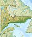
English: Côte-Nord is one of 17 administrative regions of Quebec, Canada.
Français : La Côte-Nord est l'une des 17 régions administratives du Québec.
administrative region in Québec, Canada | |||||
| Upload media | |||||
| Instance of | |||||
|---|---|---|---|---|---|
| Location | Quebec, Canada | ||||
| Capital | |||||
| Population |
| ||||
| Area |
| ||||
| official website | |||||
 | |||||
Subcategories
This category has the following 20 subcategories, out of 20 total.
Media in category "Côte-Nord"
The following 58 files are in this category, out of 58 total.
-
011 032 route 138.jpg 4,106 × 2,741; 7.64 MB
-
011 033 route 138.jpg 4,085 × 2,719; 6.06 MB
-
011 035 route 138.jpg 2,720 × 4,095; 4.15 MB
-
011 036 route 138.jpg 2,709 × 4,095; 6.22 MB
-
011 045 Epilobium.jpg 4,074 × 2,720; 5.9 MB
-
011 102 Iles Mingan.jpg 2,720 × 4,106; 4.1 MB
-
011 138 Niapiskau.jpg 2,762 × 4,095; 4.08 MB
-
012 005 Iles Mingan.jpg 4,127 × 2,719; 4.31 MB
-
012 043 Iles Mingan Niapiscau.jpg 2,698 × 4,117; 4.66 MB
-
013 032 Ekuanitshit.jpg 2,666 × 4,106; 4.71 MB
-
013 033 Ekuanitshit.jpg 2,741 × 4,042; 3.71 MB
-
013 034 Ekuanitshit.jpg 2,570 × 4,042; 4 MB
-
013 040 Ekuanitshit.jpg 4,042 × 2,570; 5.41 MB
-
013 045 Ekuanitshit.jpg 2,709 × 4,042; 7.67 MB
-
013 048 Ekuanitshit.jpg 4,095 × 2,709; 6.11 MB
-
013 049 Ekuanitshit.jpg 2,720 × 4,095; 3.57 MB
-
Baie Comeau 1962 09 02.jpg 3,054 × 2,266; 3.51 MB
-
Baie Trinite 009.jpg 1,600 × 1,200; 684 KB
-
Baie Trinite 029.jpg 1,536 × 2,048; 1.74 MB
-
Baie Trinite 031.jpg 2,048 × 1,536; 944 KB
-
Baie Trinite 034.jpg 1,536 × 2,048; 1.16 MB
-
Baie Trinite 037.jpg 1,536 × 2,048; 1.26 MB
-
Basse-Cote-Nord 1909.jpg 744 × 556; 86 KB
-
Campanula rotundifolia 002a.jpg 2,048 × 1,536; 854 KB
-
Canada Côte-Nord Region Quebec.png 1,120 × 985; 393 KB
-
Chargement minerais Cote-Nord.jpg 1,018 × 669; 117 KB
-
Silver Yard Lac Knob.jpg 1,000 × 669; 278 KB
-
Côte-Nord topo.png 500 × 583; 543 KB
-
Côte-Nord.jpg 800 × 933; 477 KB
-
Côte-Nord.png 920 × 1,160; 36 KB
-
Havre St Pierre 002.jpg 1,600 × 1,200; 537 KB
-
Havre St Pierre 003.jpg 1,600 × 1,200; 372 KB
-
Havre St Pierre 006.jpg 1,600 × 1,200; 501 KB
-
Havre St Pierre 018.jpg 1,600 × 1,200; 476 KB
-
Havre St Pierre 023.jpg 1,600 × 1,200; 386 KB
-
Havre St Pierre 024.jpg 1,600 × 1,200; 358 KB
-
Havre St Pierre 028.jpg 1,600 × 1,200; 360 KB
-
Havre St Pierre 048.jpg 2,048 × 1,536; 803 KB
-
Havre St Pierre 052.jpg 2,048 × 1,536; 1.03 MB
-
Havre St Pierre 067.jpg 2,048 × 1,536; 957 KB
-
Icone Cote-Nord (QC).svg 512 × 345; 28 KB
-
Fin des arbres.jpg 1,021 × 631; 304 KB
-
Puit mine lac Knob.jpg 1,031 × 632; 203 KB
-
Linaria vulgaris 001a.jpg 2,048 × 1,536; 844 KB
-
Localisation Québec 09 Côte-Nord.png 419 × 483; 17 KB
-
LocationCôte-Nord.png 2,000 × 2,437; 1.31 MB
-
Manicouagan.png 559 × 627; 14 KB
-
Mine Fairmount.jpg 1,000 × 631; 198 KB
-
MRC-Côte-Nord.jpg 647 × 733; 141 KB
-
Pointe-des-Monts Côte nord Québec.jpg 5,760 × 3,840; 2.63 MB
-
Pourvoirie Mabec à Sept-îles Duplessis (Côte-Nord) Québec.jpg 445 × 288; 80 KB
-
Quebec MRC Basse-Côte-Nord location map.svg 1,630 × 2,000; 500 KB
-
Ragueneau 001.jpg 1,600 × 1,200; 530 KB
-
Sept Iles 055.jpg 3,456 × 2,304; 2.85 MB
-
Vallee Wacuno.jpg 1,031 × 631; 188 KB


