Category:CIA World Factbook maps of Chile
Jump to navigation
Jump to search
Countries of South America: Argentina · Bolivia · Brazil · Chile · Colombia · Ecuador · Guyana · Paraguay · Peru · Suriname · Trinidad and Tobago‡ · Uruguay · Venezuela
Other territories: Aruba · Curaçao · Falkland Islands · French Guiana · South Georgia and the South Sandwich Islands
‡: partly located in South America
Other territories: Aruba · Curaçao · Falkland Islands · French Guiana · South Georgia and the South Sandwich Islands
‡: partly located in South America
Media in category "CIA World Factbook maps of Chile"
The following 23 files are in this category, out of 23 total.
-
 Atacama desert.jpg 239 × 274; 14 KB
-
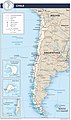
 Chile Administrative Divisions.jpg 1,841 × 3,108; 837 KB
-
 Chile Administrative Map.jpg 1,841 × 3,104; 996 KB
-
 Chile CIA map PL.png 330 × 714; 19 KB
-
 Chile map.png 327 × 713; 22 KB
-
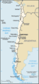
 Chile Physiography.jpg 1,840 × 3,107; 1.32 MB
-
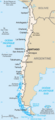
 Chile Transportation.jpg 1,842 × 3,108; 1.33 MB
-
 Chile – U.S. area comparison.jpg 701 × 671; 540 KB
-
 Chile-Charte-gsw.png 327 × 713; 32 KB
-
 Chile-CIA WFB Map ka.png 330 × 714; 67 KB
-
 Chile-CIA WFB Map.png 330 × 714; 24 KB
-
 Chili carte.png 327 × 712; 35 KB
-
 Chyli Mapa Ukr.PNG 327 × 713; 64 KB
-
 Ci-map-CIA hu.png 733 × 1,600; 312 KB
-
 Ci-map-CIA.png 326 × 711; 21 KB
-
 Ci-map-es.png 330 × 714; 25 KB
-
 Ci-map.png 336 × 728; 24 KB
-
 Dichatomap.png 277 × 599; 110 KB
-
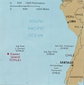
 Easter island and south america.jpg 345 × 345; 78 KB
-
 Sala y gomez.png 370 × 372; 113 KB
-
 World Factbook (1982) Chile.jpg 588 × 758; 104 KB
-
 World Factbook (1990) Chile.jpg 582 × 562; 52 KB
-
 Xile-català.png 325 × 709; 58 KB


_Chile.jpg)
_Chile.jpg)
