Category:CIA maps of North Vietnam
Jump to navigation
Jump to search
Media in category "CIA maps of North Vietnam"
The following 13 files are in this category, out of 13 total.
-
 20172 - North Vietnam Station Locations - NARA - 74797471.jpg 8,138 × 3,616; 3.33 MB
-
 22475 - North Vietnam Water Resources- Surface Water - NARA - 74797473.jpg 5,184 × 6,444; 5.53 MB
-
 22477 - North Vietnam Soils - NARA - 74797477.jpg 5,184 × 6,441; 5.02 MB
-
 22478 - North Vietnam Rock Types - NARA - 74797479.jpg 4,864 × 6,423; 4.78 MB
-
 22480 - North Vietnam State of Ground - NARA - 74797483.jpg 5,216 × 6,446; 5.67 MB
-
 22483 - North Vietnam Suitability for Roads - NARA - 74797489.jpg 5,216 × 6,447; 4.95 MB
-
 29327 - North Vietnam Terrain and Transportation - NARA - 74797493.jpg 4,608 × 5,638; 2.22 MB
-
 29525 - North Vietnam Main Wireline Circuits - NARA - 74797501.jpg 5,152 × 6,275; 3.61 MB
-
 43722 - North Vietnam Ports and Naval Facilities - NARA - 74797503.jpg 3,729 × 4,832; 1.99 MB
-
 500083 - North Vietnam - NARA - 74797507.jpg 5,088 × 5,901; 2.75 MB
-
 55698 - North Vietnam Principal Petroleum Storage Terminals - NARA - 74797517.jpg 3,028 × 3,296; 1.27 MB
-
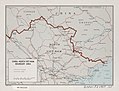 China-North Viet-Nam boundary area. LOC 80691579.jpg 4,148 × 3,161; 1.89 MB
-
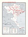 North Vietnam- Administrative Divisions, 1961 - DPLA - 8b591ed872b07fdee19a290a6a40c442.jpg 2,548 × 3,286; 7.79 MB


