Category:Cadastral maps
Jump to navigation
Jump to search
English: A cadastre is a comprehensive register of the metes-and-bounds real property of a country. Cadastral maps show the boundaries and ownership of land parcels.
Deutsch: Ein Kataster ist die flächendeckende Beschreibung sämtlicher Flurstücke eines Landes. Dazu bilden die Kataster- oder Flurkarten den darstellenden Teil.
comprehensive register of the real estate or real property's metes-and-bounds of a country and it's rights holders  Кадастр из Араузиона | |||||
| Upload media | |||||
| Subclass of |
| ||||
|---|---|---|---|---|---|
| Facet of | |||||
| Follows | |||||
| Different from | |||||
| |||||
Subcategories
This category has the following 20 subcategories, out of 20 total.
Media in category "Cadastral maps"
The following 115 files are in this category, out of 115 total.
-
 1681. gads.jpg 750 × 750; 61 KB
-
 1837 plat map of Brooklyn, Illinois.jpg 880 × 542; 114 KB
-
 1870 Index Chart to GTS India-1.jpg 7,308 × 7,006; 25.55 MB
-
 1937. gads.jpg 480 × 480; 72 KB
-
 Altshausen Hartweiher Kataster.jpg 1,804 × 1,889; 621 KB
-
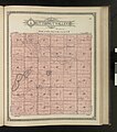
 Beauford Township Plat Map from the Standard Atlas, Blue Earth County, Minnesota.jpg 1,000 × 1,148; 213 KB
-
 Biała (Bielsko-Biała) mapa katastralna 1913, aktualizacja po 1920.jpg 3,670 × 3,900; 2.28 MB
-
 Bukowsko - mapa katastralna (1906).jpg 2,006 × 1,501; 1.14 MB
-
-
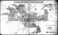
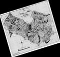
 Cadastre d'Arausio.jpg 849 × 800; 281 KB
-
 Cambria Township Plat Map from the Standard Atlas, Blue Earth County, Minnesota.jpg 1,000 × 1,134; 150 KB
-
 Catastro Machado.png 300 × 180; 87 KB
-
 Centre Hill Survey District.jpg 3,868 × 4,047; 5.34 MB
-
 Ceresco Township Plat Map from the Standard Atlas, Blue Earth County, Minnesota.jpg 1,000 × 1,148; 237 KB
-
 Crookston Survey District.jpg 3,938 × 3,948; 5.24 MB
-
 Danville Township Plat Map from the Standard Atlas, Blue Earth County, Minnesota.jpg 1,000 × 1,148; 209 KB
-
 Decoria Township Plat Map from the Standard Atlas, Blue Earth County, Minnesota.jpg 1,000 × 1,148; 223 KB
-
 Dudynce - mapa 1852.jpg 1,477 × 1,268; 342 KB
-
 Eden, Fayette County, Iowa.png 309 × 471; 390 KB
-
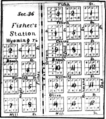 Fisher's Station, Wyoming Township, 1876.png 1,075 × 1,211; 947 KB
-
 Flurgrenzen.PNG 1,870 × 931; 3.6 MB
-
 Flurkarte.jpg 1,333 × 1,000; 1.43 MB
-
 Foto ahpcr.jpg 2,816 × 2,112; 1.79 MB
-
 Foto ahpcr2.jpg 451 × 338; 27 KB
-
 Gallagher-Kieffer House2.png 1,219 × 500; 931 KB
-
 Garden City Township Plat Map from the Standard Atlas, Blue Earth County, Minnesota.jpg 1,000 × 1,148; 219 KB
-
 Greenvale Survey District.jpg 3,740 × 3,757; 3.58 MB
-
 Headquarters2.png 961 × 1,030; 2.25 MB
-
 HerronHill6.jpg 500 × 359; 46 KB
-
 Hietamäki 1687 isojakokartta crop.jpg 935 × 850; 95 KB
-
 Hietamäki 1687 isojakokartta.jpg 2,458 × 1,973; 2.05 MB
-
 Isen Gemarkungen.jpg 1,219 × 1,390; 210 KB
-
-
 Judson Township Plat Map from the Standard Atlas, Blue Earth County, Minnesota.jpg 1,000 × 1,134; 200 KB
-
 KM 12xgreien Bl 3.jpg 6,147 × 5,077; 8.57 MB
-
 KM Bozen Bl 1.jpg 6,165 × 5,201; 5.5 MB
-
 KM Gries Bl 10 Quirein Talfer Fagen.jpg 1,722 × 4,681; 2.25 MB
-
 KM Gries Bl 5 Guntschna St Georgen.jpg 4,877 × 3,437; 3.91 MB
-
 KM Gries Bl 9 (1).jpg 2,420 × 1,605; 1.23 MB
-
 Lawrence-Roxburgh Railway - Proclamation Plan Defining Centre Line.jpg 40,634 × 10,308; 52.8 MB
-
 Le Ray Township Plat Map from the Standard Atlas, Blue Earth County, Minnesota.jpg 1,000 × 1,148; 266 KB
-
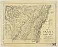
 Lothian and Mataura Hundreds.jpg 3,795 × 2,782; 3.29 MB
-
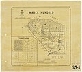 Mabel Hundred.jpg 4,201 × 3,678; 4.15 MB
-
 Map Cartographic examples I 1992 - Touring Club Italiano CART-TEM-122.jpg 5,000 × 3,452; 14.9 MB
-
 Map of Concord, Mass., 1852.tif 7,886 × 6,258; 141.21 MB
-
 Map of Forest Hill Hundred.jpg 3,840 × 5,182; 5.14 MB
-
 Map of Fresh Pond (Cambridge, Mass.), 1841.tif 8,507 × 6,705; 163.21 MB
-
 Map of Harris County - Northeast One-fourth.jpg 598 × 441; 79 KB
-
 Map of Invercargill Hundred and Part of New River Hundred.jpg 16,703 × 11,209; 14.79 MB
-
 Map of Lindhurst Hundred.jpg 4,057 × 3,687; 4.52 MB
-
 Map of Longwood District.jpg 3,723 × 5,376; 5.46 MB
-
 Map of New River Hundred.jpg 4,770 × 3,907; 6.92 MB
-
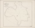
 Map of Taringatura Survey District.jpg 3,707 × 5,587; 5.66 MB
-
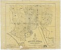
 Map of the Parish of Catahoula, Louisiana LOC 2012592312.jpg 3,099 × 3,394; 1.35 MB
-
 Map of Wakaia and Part of Wart Hill Survey Districts.jpg 4,855 × 3,927; 7.65 MB
-
 Map of Wendon, Wendonside and of Greenvale Survey Districts.jpg 5,359 × 3,635; 6.56 MB
-
 Map of Wyndham Survey District, also Part of the Districts of Mokoreta and Slopedown.jpg 5,341 × 4,054; 5.38 MB
-
 Mapa katastralna wsi Wola Piotrowa 1852.JPG 2,900 × 2,385; 1.38 MB
-
 Mauritius 1880 map by Descubes.jpg 5,744 × 7,696; 12.26 MB
-
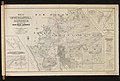
 Melbourne and its suburbs, shewing (sic) a district embracing seventeen parishes, 1858.jpg 1,400 × 1,133; 1.08 MB
-
 Molière (Pailharès) plan cadastral 1837 (Archives départementales Ardèche).jpg 2,064 × 2,923; 637 KB
-
 Mowry1.png 564 × 626; 588 KB
-
 Mowry2.0.png 534 × 642; 711 KB
-
 Mowry3-0.png 409 × 492; 472 KB
-
 Nadolany (Nowoatniec) - mapa katastralna (1852).jpg 1,284 × 961; 264 KB
-
 Nagorzany1852R.jpg 1,513 × 1,518; 1.85 MB
-
 Netherlands, Warmond, Lakerpolder, Tuinder- of Kogjespolder.jpg 5,488 × 3,504; 3.01 MB
-
 OT 135 - Waipahi Survey District.jpg 3,912 × 4,740; 4.51 MB
-
 OT 136 - Pomahaka Survey District.jpg 3,539 × 4,155; 3.98 MB
-
 OT 159 - Woodland Survey District.jpg 4,657 × 3,574; 4 MB
-
 Otago (OT) 143 - Kuriwao Survey District.jpg 3,617 × 3,769; 2.83 MB
-
 Ott Frères, SUUM CUIQUE.jpg 1,536 × 2,000; 1.24 MB
-
 Pauline H. Rosenberg House 3.png 773 × 451; 684 KB
-
 Pielnia 1852.jpg 3,072 × 2,304; 496 KB
-
 Plan cadastral de Nice en 1812 - Section X - Saint-Philippe.jpg 5,880 × 3,709; 2.22 MB
-
 Plan of the Edendale Settlement - Lindhurst, Lothian, Mataura and Oteramika Hundreds.jpg 3,402 × 4,994; 3.96 MB
-
 Plan of the village in old Cambridge,1833.tif 13,995 × 10,634; 425.8 MB
-
 Planimetric.jpg 347 × 341; 53 KB
-
 Plano Catastral Córdoba 1890.jpg 3,133 × 1,680; 3.7 MB
-
-
 Plat Map for Township 11 and Range 08 - DPLA - d6183ec098e1238d825e6e2699895351.jpg 5,264 × 4,264; 1.9 MB
-
 Plat Map for Township 19 and Range 10 - DPLA - ee96fc3eab0cb4a747847f29939ae6cf.jpg 5,296 × 4,264; 1.7 MB
-
-
 Plat Map of the proposed Bingham Canyon twon as part of the incorporation records, 1904.tif 3,469 × 3,746; 18.69 MB
-
 Plat of a Survey For Richard Barnes - DPLA - a5bcece0a6057bbebf6636ab22b06a03.jpg 6,354 × 5,217; 1.62 MB
-
 Plat of the Aptos Rancho.pdf 3,197 × 2,566; 142 KB
-
 Plat of the Shoquel Augmentation Rancho.pdf 3,650 × 4,512; 300 KB
-
 Plat of the Shoquel Rancho.pdf 3,029 × 2,191; 135 KB
-
 Podcast with Dr. Alvita Puspa Handayani.jpg 1,280 × 921; 143 KB
-
 Rancho Aguaje de la Centinela BLM survey map 1872.jpg 648 × 491; 147 KB
-
 Republic of Korea fake Cadastral map.jpg 500 × 400; 26 KB
-
 Reviewing cadastre.jpg 3,840 × 2,160; 765 KB
-
 SD 36 - Map of Hokonui Survey District.jpg 6,069 × 4,920; 9.57 MB
-
 SD 55 - Waimumu Hundred and Part of Hokonui District.jpg 4,708 × 3,428; 4.49 MB
-
 SD 66 - Map of Invercargill Hundred and Part of New River Hundred.jpg 5,975 × 3,848; 6.49 MB
-
 SD 70 - Map of Campbelltown Hundred.jpg 4,744 × 3,877; 5.64 MB
-

-
 Sith and I plan.jpg 288 × 225; 42 KB
-
 Soderakra 1800.jpg 720 × 1,024; 117 KB
-
 Sokhumi City Municipality Cadastral Map, AR of Abkhazia, Georgia.png 1,782 × 1,244; 416 KB
-
 Southland (SD) 44 - Wairio Survey District.jpg 4,756 × 3,728; 4.49 MB
-
 Stadtplan Tübingen 1819.png 3,398 × 2,976; 17.42 MB
-
 Stadtplan Tübingen von C. Kohler (1819).jpg 3,398 × 2,976; 4.11 MB
-
 StBart quartiers 1801.jpg 9,474 × 7,142; 46.54 MB
-
 SurveyCottonSpindleSpike1.jpg 2,576 × 1,986; 773 KB
-
 Toetoes Survey District.jpg 3,492 × 3,660; 4.32 MB
-
 Traversing and Offsetting DP 79152.png 893 × 1,000; 109 KB
-
 Trayectoria de Gabriela Mistral, Años 1922-1958.jpg 7,008 × 3,877; 14.82 MB
-
 Tuturau Survey District.jpg 3,619 × 3,583; 3.58 MB
-
 Ugland1-j.jpg 8,314 × 7,854; 1.43 MB
-
 Urhandriß.jpg 599 × 800; 160 KB
-
 Waikaka Survey District.jpg 3,714 × 3,777; 3.52 MB
-
 Wairaki Survey District.jpg 5,761 × 3,833; 8.7 MB
-
 Wairio Survey District.jpg 4,740 × 3,730; 4.32 MB
-
 Winton Hundred.jpg 2,875 × 3,549; 3.88 MB


_mapa_katastralna_1913,_aktualizacja_po_1920.jpg)
.jpg)


.jpg)


_a_district_embracing_seventeen_parishes,_1858.jpg)
_plan_cadastral_1837_(Archives_d%C3%A9partementales_Ard%C3%A8che).jpg)


_-_mapa_katastralna_(1852).jpg)


_143_-_Kuriwao_Survey_District.jpg)


_44_-_Wairio_Survey_District.jpg)

.jpg)


