Category:Cadastral maps of Michigan
Jump to navigation
Jump to search
States of the United States: Arizona · California · Idaho · Illinois · Michigan · Washington – Washington, D.C.
Subcategories
This category has only the following subcategory.
P
Media in category "Cadastral maps of Michigan"
The following 9 files are in this category, out of 9 total.
-
 1909 plat of Hillsdale County, Michigan LOC 2012593150.jpg 12,097 × 14,196; 42.21 MB
-
 Map of Altona, Michigan (1900).jpg 2,389 × 2,177; 2.82 MB
-
 Map of Chippewa Lake, Michigan (1900).jpg 2,254 × 3,917; 4.89 MB
-
 Map of Holcomb's Addition, Big Rapids, Michigan (1900).jpg 1,651 × 3,910; 3.13 MB
-
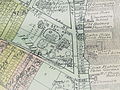
 Map of Millbrook, Michigan (1900).jpg 2,450 × 2,592; 3.45 MB
-
 Map of Paris, Michigan (1900).jpg 2,439 × 4,208; 5.32 MB
-
 Map of Sylvester, Michigan (1900).jpg 2,548 × 1,587; 1.88 MB
-
 Map of West Millbrook, Michigan (1900).jpg 1,701 × 2,116; 1.95 MB
-
 Plat Map detail, Ramona Park, 1907.jpg 2,048 × 1,536; 1.35 MB

.jpg)
.jpg)
.jpg)
.jpg)
.jpg)
.jpg)
.jpg)
