Category:Caer Gybi Roman Fort
Jump to navigation
Jump to search
English: Caer Gybi Roman Fort was a small Roman fortlet at Holyhead (Welsh: Caer Gybi) in Wales. The original Roman name is unknown. The fort only has three walls; the fourth side fronted the sea. In the 6th Century, Saint Cybi is supposed to have founded a monastery here. The Church of St Cybi (13th century, with later extensions and additions) stands within the fort today.
remains of a Roman fortlet in Holyhead, Anglesey, Wales, UK  Caer Gybi: rhan o furiau'r gaer | |||||
| Upload media | |||||
| Pronunciation audio | |||||
|---|---|---|---|---|---|
| Instance of |
| ||||
| Location | Holyhead, Isle of Anglesey, Wales | ||||
| Maintained by | |||||
| Heritage designation |
| ||||
| Elevation above sea level |
| ||||
 | |||||
Media in category "Caer Gybi Roman Fort"
The following 45 files are in this category, out of 45 total.
-

-
 Bridge over the inner harbour - geograph.org.uk - 5931849.jpg 1,024 × 683; 451 KB
-
 Bridge over the Inner Harbour, Holyhead - geograph.org.uk - 5625480.jpg 640 × 427; 321 KB
-
 Captain Skinner's Monument, Holyhead - geograph.org.uk - 3734542.jpg 2,176 × 2,739; 616 KB
-
 Celtic Gateway Bridge, Holyhead - 1 - geograph.org.uk - 3734467.jpg 4,507 × 3,005; 2.69 MB
-
 Celtic Gateway footbridge, Holyhead - geograph.org.uk - 2976521.jpg 640 × 482; 66 KB
-
 Converted warehouses in Holyhead's Inner Harbour - geograph.org.uk - 2159991.jpg 1,024 × 716; 158 KB
-
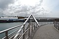
 Crossing the Inner Harbour Bridge - geograph.org.uk - 2164835.jpg 1,024 × 564; 125 KB
-

-
 Ferry terminal, Holyhead - geograph.org.uk - 3150464.jpg 640 × 480; 68 KB
-
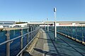
 Footbridge to the railway station - geograph.org.uk - 5870010.jpg 1,024 × 683; 503 KB
-
 Holyhead Harbour - geograph.org.uk - 4297339.jpg 800 × 507; 58 KB
-
 Holyhead Harbour, aerial 2015 - geograph.org.uk - 4691413.jpg 640 × 361; 55 KB
-
 Holyhead Inner Harbour - geograph.org.uk - 4911745.jpg 640 × 480; 155 KB
-
 HSS Stena Explorer at Holyhead, Holy Island - geograph.org.uk - 4000071.jpg 1,024 × 683; 103 KB
-

-
 Inner Harbour Causeway, Holyhead - geograph.org.uk - 3150459.jpg 640 × 480; 91 KB
-
 Inner Harbour Causeway, Holyhead - geograph.org.uk - 3150470.jpg 480 × 640; 72 KB
-

-
 Irish Ferries Jonathan Swift, docked at Holyhead - 1 - geograph.org.uk - 3732183.jpg 3,802 × 2,355; 1.03 MB
-
 Irish Ferries Jonathan Swift, docked at Holyhead - 2 - geograph.org.uk - 3732193.jpg 1,748 × 1,075; 269 KB
-
 Path to the station - geograph.org.uk - 5870022.jpg 1,024 × 683; 494 KB
-
 Platform 2, Holyhead Station - geograph.org.uk - 3150475.jpg 640 × 480; 77 KB
-
-
 Road to the ferry terminal - geograph.org.uk - 5870018.jpg 1,024 × 683; 449 KB
-
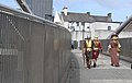
 Roman fort at Holyhead - geograph.org.uk - 1367143.jpg 640 × 480; 96 KB
-
-
 Roman Wall and Edwardian Chimney - geograph.org.uk - 1414129.jpg 480 × 640; 66 KB
-

-
 Sculpture, Pedestrian Link - geograph.org.uk - 2326046.jpg 640 × 480; 84 KB
-

-
 Stena high speed crafts in the Inner Harbour - geograph.org.uk - 2076272.jpg 1,024 × 593; 132 KB
-
 Stena Line ferry at Holyhead - geograph.org.uk - 2938805.jpg 640 × 427; 72 KB
-
-
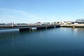
 The Inner Harbour Road Bridge - geograph.org.uk - 2069860.jpg 1,024 × 515; 83 KB
-

-
 The Old Harbour at Holyhead - geograph.org.uk - 5165314.jpg 3,184 × 2,123; 1.94 MB
-
 The Porthdinllaen registered "Harmoni" - geograph.org.uk - 2070211.jpg 1,024 × 757; 162 KB
-

-

-

-
 The upper end of the Inner Harbour at Holyhead - geograph.org.uk - 2069818.jpg 1,024 × 765; 147 KB
-
 Town Centre, viewed from the Celtic Gateway Bridge, Holyhead - geograph.org.uk - 3734464.jpg 4,457 × 2,984; 3.48 MB
-

-


