Category:Calder and Hebble Navigation, Brighouse
Jump to navigation
Jump to search
Subcategories
This category has the following 6 subcategories, out of 6 total.
Media in category "Calder and Hebble Navigation, Brighouse"
The following 46 files are in this category, out of 46 total.
-

-
 Anchor Bridge 9 - geograph.org.uk - 2535741.jpg 800 × 497; 124 KB
-
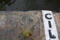 Benchmark on the side of Brighouse Upper Lock - geograph.org.uk - 6007481.jpg 1,024 × 683; 205 KB
-
 Bridge 10 - geograph.org.uk - 2535745.jpg 800 × 497; 99 KB
-
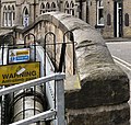
 Bridge Road Works, Brighouse - geograph.org.uk - 170348.jpg 640 × 480; 110 KB
-

-
 Brighouse Lock 28 from below - geograph.org.uk - 2536110.jpg 800 × 497; 117 KB
-
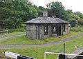 Brookfoot Lock Keeper's Cottage, Brighouse.jpg 800 × 572; 154 KB
-
 Calder & Hebble Navigation at Brighouse (9203868556).jpg 2,945 × 3,766; 10.09 MB
-
 Calder and Hebble Navigation (2944679857).jpg 2,401 × 1,846; 6.13 MB
-
 Calder and Hebble Navigation - 53549999133.jpg 2,560 × 3,200; 7.63 MB
-

-
 Calder and Hebble Navigation - geograph.org.uk - 2265277.jpg 640 × 443; 147 KB
-
 Calder and Hebble Navigation - geograph.org.uk - 2265281.jpg 640 × 480; 141 KB
-
 Calder and Hebble Navigation - geograph.org.uk - 4200223.jpg 3,000 × 2,250; 2.27 MB
-

-
 Calder and Hebble Navigation, Brighouse.jpg 3,024 × 3,024; 9.82 MB
-
 Calder and Hebble Navigation, Cromwell Bottom - geograph.org.uk - 4200221.jpg 3,000 × 2,250; 2.49 MB
-
 Calder ^ Hebble Navigation at Brighouse - geograph.org.uk - 4291499.jpg 4,000 × 3,000; 2.91 MB
-
 Calder ^ Hebble Navigation at Cromwell Bottom - geograph.org.uk - 5761247.jpg 1,600 × 1,065; 756 KB
-
 Calder ^ Hebble Navigation North Cut - geograph.org.uk - 6007235.jpg 1,024 × 683; 167 KB
-
 Calder ^ Hebble Navigation, Brighouse - geograph.org.uk - 5161791.jpg 1,600 × 1,065; 360 KB
-
 Canal Bridge - geograph.org.uk - 2265250.jpg 640 × 608; 192 KB
-

-

-
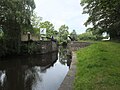
 Canal west of Brighouse - geograph.org.uk - 81021.jpg 640 × 480; 174 KB
-
 Climbing wall on a former grain silo, Brighouse - geograph.org.uk - 6394135.jpg 1,500 × 2,000; 945 KB
-

-
 Cooper Bridge Flood Gate, Calder And Hebble Navigation - geograph.org.uk - 6203457.jpg 2,000 × 1,500; 2.84 MB
-
 Cooper Bridge Low Lock 23 from river - geograph.org.uk - 2537440.jpg 800 × 582; 149 KB
-
 Jeremy's at the Boathouse - geograph.org.uk - 3789644.jpg 1,929 × 1,320; 709 KB
-

-
 Leeds Road Bridge 22 - geograph.org.uk - 2537438.jpg 800 × 493; 157 KB
-
 Memorial seat decorated for Christmas, Brighouse - geograph.org.uk - 6347725.jpg 2,000 × 1,500; 1.02 MB
-

-
 Path to the canal off Bank Street, Brighouse - geograph.org.uk - 6348878.jpg 2,000 × 1,500; 1.86 MB
-
 Plant box next to the towpath, Brighouse - geograph.org.uk - 6355383.jpg 2,000 × 1,468; 1.2 MB
-

-
 Red Beck entering the canal, Brighouse - geograph.org.uk - 253689.jpg 640 × 464; 135 KB
-
 River Calder - geograph.org.uk - 3288047.jpg 3,185 × 2,489; 1.48 MB
-
 River Calder at Cooper Bridge Flood Gate - geograph.org.uk - 6203464.jpg 2,000 × 1,682; 2.84 MB
-
 Stream flowing into the canal, Cromwell Bottom, Southowram - geograph.org.uk - 5307168.jpg 2,000 × 1,500; 1.47 MB
-
 The canal - shades of brown, Brighouse - geograph.org.uk - 6394131.jpg 1,955 × 1,467; 1.17 MB
-
 The North Cut at Brighouse - geograph.org.uk - 5300218.jpg 3,349 × 2,227; 1.15 MB
-
 Waterside Lodges, Cromwell Bottom, Southowram - geograph.org.uk - 6403437.jpg 2,000 × 1,502; 1.26 MB
-
 Wharf Works.jpg 2,000 × 1,383; 2.06 MB


.jpg)
.jpg)


.jpg)


