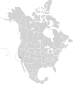
Category:California montane chaparral and woodlands
Jump to navigation
Jump to search
Mediterranean forests, woodlands, and scrub ecoregion in California | |||||
| Upload media | |||||
| Instance of | |||||
|---|---|---|---|---|---|
| Location | California, Pacific States Region | ||||
 | |||||
English: The California Montane Chaparral and Woodlands Ecoregion is a designated ecoregion by WWF and One Earth. It is classified as a Mediterranean Forests, Woodlands & Scrub Biome. It is one of six ecoregions in the Greater California Bioregion. This is a collection of photos that best represent the California montane chaparral and woodlands of Central and Southern California.
Español: Esta es una colección de fotos que mejor representan los montano chaparrales y bosques de California del centro y sur de California.
Subcategories
This category has the following 18 subcategories, out of 18 total.
Media in category "California montane chaparral and woodlands"
The following 61 files are in this category, out of 61 total.
-
California Montane Chaparral and Woodlands map.svg 1,712 × 1,992; 339 KB
-
A good place to get lost (5082186123).jpg 1,200 × 803; 1.12 MB
-
A Sunrise on Vasquez Canyon Road.jpg 7,541 × 4,242; 10.16 MB
-
Angeles National Forest (15480542552).jpg 1,280 × 960; 250 KB
-
Angeles National Forest.jpg 1,536 × 2,048; 601 KB
-
Angelesnationalforest.jpg 1,632 × 1,224; 523 KB
-
Arrastre Canyon-LA County (18474899973).png 938 × 570; 1.36 MB
-
Baldwin Lake prescribed fire project (32192781238).jpg 2,048 × 1,365; 3.22 MB
-
Big Bear Lake (7891777826) (2).jpg 4,750 × 3,166; 8.04 MB
-
Bottchers Gap view south.jpg 1,000 × 751; 163 KB
-
Central Californian Coastline, Big Sur - May 2013.jpg 8,000 × 5,210; 13.57 MB
-
Central Coast @ Lucia - panoramio (3).jpg 4,272 × 2,848; 2.35 MB
-
Chaparral1.jpg 1,600 × 1,200; 298 KB
-
Coast horned lizard (Phrynosoma coronatum), Tehachapi Mountains.jpg 1,280 × 960; 172 KB
-
Dry Canyon Reservoir 2013.JPG 3,648 × 2,736; 4.21 MB
-
Elizabeth Lake - panoramio.jpg 4,288 × 2,848; 2.47 MB
-
Forest and meadow atop Mount Pinos.jpg 1,500 × 1,000; 728 KB
-
Garland Ranch Regional Park - Carmel Valley, CA - DSC06854.JPG 4,320 × 3,240; 4.18 MB
-
Geocaching at Vasquez Rocks (2398110682).jpg 3,456 × 2,592; 4.6 MB
-
Going Down Tehachapi Loop.jpg 5,276 × 2,960; 4.24 MB
-
Jeffrey Pine forest atop Mt Pinos - 19891524319.jpg 4,899 × 3,245; 15.26 MB
-
Jeffrey Pine forest atop Mt Pinos - 20078294095.jpg 4,881 × 3,233; 14.3 MB
-
Jeffrey Pine forest atop Mt Pinos - 20083659651.jpg 4,722 × 3,128; 13.2 MB
-
Jeffrey Pine forest atop Mt Pinos.jpg 4,836 × 3,203; 12.56 MB
-
Josephine Peak & Strawberry Peak.jpg 5,184 × 3,888; 18.33 MB
-
Liebre Mountains 001.jpg 1,280 × 960; 201 KB
-
Lockwood Valley from Mount Pinos highway overlook.jpg 7,733 × 4,488; 27.16 MB
-
Lonely Tree (25118079873).jpg 6,517 × 3,617; 25.36 MB
-
Looking Up (36546138).jpeg 2,048 × 1,365; 1.76 MB
-
Montane chaparral grassland in Santa Clarita Valley.jpg 3,175 × 2,381; 5.46 MB
-
Mount San Jacinto State Park 2.jpg 4,000 × 3,000; 4.94 MB
-
Mount Wilson Road.jpg 3,387 × 2,340; 2.22 MB
-
Mount Wilson Trail (4794325051).jpg 1,635 × 611; 362 KB
-
Mount-Islip.jpg 1,400 × 1,050; 590 KB
-
Mount-waterman.jpg 4,608 × 3,072; 5.65 MB
-
Near Pyramid Reservoir, CA, View S, Stream Course, 2011 - panoramio.jpg 4,000 × 3,000; 4.54 MB
-
North Slope Santa Ynez Mtns.jpg 1,600 × 900; 144 KB
-
Pack of coyotes howling.ogg 44 s; 927 KB
-
Parque nacional Constitución de 1857.jpg 1,200 × 797; 336 KB
-
Pinus flexilis forest Mount Baden-Powell.jpg 3,264 × 2,448; 5.08 MB
-
Pinus jeffreyi MtPinos1.jpg 3,264 × 2,448; 6.5 MB
-
Pinus lambertiana forest Cucamonga Wilderness.jpg 2,566 × 2,006; 3.83 MB
-
Purisma Hills.jpg 2,048 × 1,536; 1.85 MB
-
Saint Francis Dam Site 2012.jpg 3,648 × 2,736; 2.49 MB
-
San Francisquito Canyon2015.jpg 3,264 × 2,448; 2.49 MB
-
Side of the road (5043317778).jpg 1,200 × 803; 1.15 MB
-
Sierra Pelona montane chaparral.jpg 5,911 × 2,786; 12.94 MB
-
Slide, Barton Flats 4-5-14 (13739055504).jpg 1,870 × 1,118; 1.13 MB
-
Summer Clouds (4800793522).jpg 1,200 × 803; 1.09 MB
-
Summit of Mount Pinos.jpg 1,500 × 1,000; 675 KB
-
Tahquitz Peak (31865855108).jpg 2,048 × 1,463; 4.52 MB
-
TejonWest.jpg 2,694 × 2,016; 808 KB
-
Transverse Ranges from Mount Pinos.jpg 4,893 × 3,241; 15.15 MB
-
Vasquez Rocks (15878641765).jpg 5,996 × 3,371; 5.23 MB
-
Vasquez Rocks - 48016767691.jpg 3,000 × 2,247; 5.58 MB
-
Vasquez Rocks - 48016774676.jpg 3,000 × 2,247; 5.68 MB
-
Vasquez Rocks chaparral.jpg 3,000 × 2,247; 5.58 MB
-
Winter ANF HWY 2 in San Gabriel Mountains (33896578744).jpg 875 × 656; 139 KB
-
Yucca in Bloom at Big Tujunga Canyon in Sunland.JPG 3,000 × 4,000; 4.26 MB
-
Cupressussargentii.jpg 800 × 531; 186 KB


