Category:Callow, Derbyshire
Jump to navigation
Jump to search
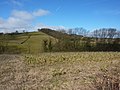
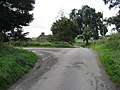
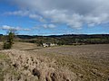
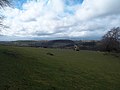
English: Callow is a village and a civil parish in the District of Derbyshire Dales, in the English county of Derbyshire. It is near the small town of
Wirksworth and Carsington Water.
village and civil parish in Derbyshire Dales district, Derbyshire, England  | |||||
| Upload media | |||||
| Instance of | |||||
|---|---|---|---|---|---|
| Location | Derbyshire Dales, Derbyshire, East Midlands, England | ||||
| Population |
| ||||
 | |||||
Subcategories
This category has the following 4 subcategories, out of 4 total.
Media in category "Callow, Derbyshire"
The following 65 files are in this category, out of 65 total.
-
 A corner of Parkhill Wood - geograph.org.uk - 1754438.jpg 640 × 480; 89 KB
-
 Callow - Lane Junction - geograph.org.uk - 1470069.jpg 640 × 480; 89 KB
-
 Callow Lane - geograph.org.uk - 1470081.jpg 640 × 480; 91 KB
-
 Callow Lane - geograph.org.uk - 6377837.jpg 3,008 × 2,000; 2.53 MB
-
 Callow Lane from Stainsborough Lane - geograph.org.uk - 2440290.jpg 800 × 600; 320 KB
-
 Callow Park - geograph.org.uk - 3401116.jpg 750 × 487; 76 KB
-
 Callow Park College - geograph.org.uk - 2893734.jpg 3,648 × 2,736; 4.44 MB
-
 Callow Park Farm - geograph.org.uk - 1754462.jpg 640 × 480; 77 KB
-
 Callow, Derbyshire - geograph.org.uk - 2167303.jpg 2,640 × 1,980; 551 KB
-
 Carsington perimeter cycleway - geograph.org.uk - 1890051.jpg 640 × 480; 81 KB
-
 Carsington Reservoir Circular Trail - geograph.org.uk - 5471693.jpg 1,600 × 1,200; 601 KB
-
 Carsington Water - Footpath - geograph.org.uk - 1500599.jpg 640 × 480; 117 KB
-
 Carsington Water - geograph.org.uk - 3183971.jpg 800 × 600; 137 KB
-
 Carsington Water - north east - geograph.org.uk - 1890062.jpg 640 × 480; 77 KB
-
 Carsington Water foot and cycle path - geograph.org.uk - 3183975.jpg 800 × 600; 149 KB
-
 Carsington Water foot and cycle path - geograph.org.uk - 3183980.jpg 800 × 600; 214 KB
-
 Carsington Water viewed from Big Covert - geograph.org.uk - 4800684.jpg 800 × 600; 170 KB
-

-
 Carsington Water, reed bed - geograph.org.uk - 3772605.jpg 4,912 × 3,264; 7.31 MB
-

-
 Cows and Trees - geograph.org.uk - 254495.jpg 640 × 480; 76 KB
-
 Dark Lane - geograph.org.uk - 3897649.jpg 4,000 × 3,000; 2.27 MB
-
 Dark Lane - geograph.org.uk - 6377842.jpg 3,008 × 2,000; 3.06 MB
-
 Dark Lane near The Kennels - geograph.org.uk - 3401114.jpg 750 × 580; 121 KB
-
 Derbyshire UK parish map highlighting Callow.svg 888 × 1,308; 2.34 MB
-
 Dew pond and wind turbine - geograph.org.uk - 1754737.jpg 640 × 480; 90 KB
-
 Field and footpath - geograph.org.uk - 3094013.jpg 1,024 × 511; 124 KB
-
 Field by Summer Lane - geograph.org.uk - 3094149.jpg 1,024 × 636; 196 KB
-
 Fields with view towards Wirksworth - geograph.org.uk - 3401126.jpg 613 × 750; 110 KB
-
 Footpath and Holly - geograph.org.uk - 254506.jpg 640 × 480; 133 KB
-
 Footpath near Stainsbro' Lane - geograph.org.uk - 3897915.jpg 4,000 × 3,000; 1.64 MB
-

-
 Grazing Land overlooking Carsington Water - geograph.org.uk - 3897654.jpg 3,912 × 2,880; 1.59 MB
-
 Halfmoor Lane from Moor Lane - geograph.org.uk - 2440304.jpg 800 × 600; 293 KB
-
 Hopton Hall - geograph.org.uk - 5357857.jpg 2,000 × 1,333; 1.83 MB
-
 Junction of paths around Carsington Water reservoir - geograph.org.uk - 3187249.jpg 3,000 × 4,000; 3.18 MB
-
 Logging beside Carsington Water reservoir - geograph.org.uk - 3187240.jpg 3,982 × 2,315; 2 MB
-
 Looking along Callow Lane - geograph.org.uk - 6377838.jpg 3,008 × 2,000; 5.66 MB
-
 Moving Cows - geograph.org.uk - 254517.jpg 640 × 480; 101 KB
-
 Pasture to the east of Carsington Water - geograph.org.uk - 3554018.jpg 3,239 × 2,314; 1.43 MB
-
 Path by Carsington Water - geograph.org.uk - 3094025.jpg 1,024 × 806; 224 KB
-
 Path near Callow Park - geograph.org.uk - 3401118.jpg 750 × 563; 101 KB
-
 Path round Carsington Water reservoir at Hall Wood - geograph.org.uk - 3187244.jpg 4,000 × 3,000; 2.57 MB
-
 Reed beds at head of Carsington Water reservoir - geograph.org.uk - 3187253.jpg 4,000 × 3,000; 3.26 MB
-
 Road junction - geograph.org.uk - 3578131.jpg 640 × 459; 109 KB
-
 Seats along the path at Carsington Water - geograph.org.uk - 4800679.jpg 800 × 523; 138 KB
-
 Sheep grazing beside Carsington Water - geograph.org.uk - 3183977.jpg 800 × 490; 101 KB
-
 Stainsborough Hall viewed from Stainsbro' Lane - geograph.org.uk - 3898001.jpg 4,000 × 3,000; 2.35 MB
-
 Stumped beside Carsington Water reservoir - geograph.org.uk - 3187237.jpg 3,886 × 2,840; 2.53 MB
-
 The Kennels from Dark Lane - geograph.org.uk - 3401112.jpg 750 × 563; 80 KB
-
 The Kennels, off Dark Lane - geograph.org.uk - 2893738.jpg 3,648 × 2,736; 4.84 MB
-
 The Kennels, on Dark Lane - geograph.org.uk - 1754441.jpg 480 × 640; 51 KB
-

-

-
 Track along eastern side of Carsington Water - geograph.org.uk - 6084198.jpg 5,184 × 2,920; 5.75 MB
-
 Track leading south into Hall Wood - geograph.org.uk - 4800686.jpg 800 × 540; 135 KB
-
 Track leading towards Hall Wood - geograph.org.uk - 3554021.jpg 3,648 × 2,736; 2.27 MB
-
 Trig point by Hasker Farm, Callow - geograph.org.uk - 6084190.jpg 5,184 × 2,920; 7.43 MB
-
 View across Carsington Water - Derbyshire - geograph.org.uk - 3120325.jpg 1,600 × 1,063; 360 KB
-
 View across Carsington Water - geograph.org.uk - 3094065.jpg 1,024 × 732; 176 KB
-
 View over Carsington Water - geograph.org.uk - 3094037.jpg 1,024 × 768; 186 KB
-
 View over Lendow Wood to Carsington Water reservoir - geograph.org.uk - 3187209.jpg 3,968 × 2,144; 2.04 MB
-
 Walking Carsington perimeter footpath - geograph.org.uk - 1890032.jpg 640 × 480; 109 KB
-
 Wetland area by Carsington Water - geograph.org.uk - 3094079.jpg 1,024 × 612; 155 KB
-
 Woodland footpath, Big Covert - geograph.org.uk - 3094056.jpg 1,024 × 768; 405 KB


