Category:Can Rovira (Calafell)
Jump to navigation
Jump to search
| Object location | | View all coordinates using: OpenStreetMap |
|---|
house in Calafell, Spain  | |||||
| Upload media | |||||
| Instance of | |||||
|---|---|---|---|---|---|
| Location | Calafell, Baix Penedès, Tarragona Province, Catalonia | ||||
| Street address |
| ||||
| Architectural style | |||||
| Heritage designation |
| ||||
| Elevation above sea level |
| ||||
 | |||||
Català: Can Rovira (Calafell)
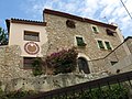
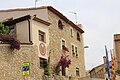
This is a category about a building listed in the Catalan heritage register as Bé Cultural d'Interès Local (BCIL) under the reference IPA-41565. |
Media in category "Can Rovira (Calafell)"
The following 9 files are in this category, out of 9 total.
-
 003 Rellotge de sol de Cal Rovira, c. Penyes 1 (Calafell).jpg 2,816 × 2,112; 2.04 MB
-
 007 Cal Rovira, c. Penyes 1 (Calafell).jpg 2,816 × 2,112; 2.47 MB
-
 043 Plaça de Catalunya.jpg 2,272 × 1,704; 1.22 MB
-
 045 Casal amb rellotge de sol al carrer de les Penyes.jpg 2,272 × 1,704; 1.45 MB
-
 071 Casal al carrer de les Penyes.jpg 2,272 × 1,704; 1.45 MB
-
 073 Plaça de Catalunya.jpg 2,272 × 1,704; 1.31 MB
-
 CAL ROVIRA PLAÇA CATALUNYA - 14478760645.jpg 5,184 × 3,456; 3.76 MB
-
 Centre històric (Calafell) - 1.jpg 2,686 × 2,000; 3.01 MB
-
.jpg)
.jpg)


_-_1.jpg)
