Category:Canterbury
Jump to navigation
Jump to search

cathedral city in Kent, England   | |||||
| Upload media | |||||
| Pronunciation audio | |||||
|---|---|---|---|---|---|
| Instance of |
| ||||
| Location | Canterbury, Kent, South East England, England | ||||
| Significant event |
| ||||
| Population |
| ||||
| Area |
| ||||
| Elevation above sea level |
| ||||
| official website | |||||
 | |||||
Subcategories
This category has the following 20 subcategories, out of 20 total.
*
C
- Canterbury Pride (275 F)
- Cityscapes of Canterbury (21 F)
- Coats of arms of Canterbury (3 F)
- Canterbury City Council (1 F)
F
- Fleur de Lis Hotel (6 F)
G
- Great Stour at Canterbury (206 F)
H
- Hales Place (8 F)
N
P
S
- River Stour, Canterbury (72 F)
T
~
Media in category "Canterbury"
The following 200 files are in this category, out of 299 total.
(previous page) (next page)-
De-Canterbury.ogg 1.9 s; 18 KB
-
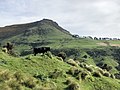
 16th Tee in Canterbury Golf Course - geograph.org.uk - 2017452.jpg 3,072 × 2,304; 1.58 MB
-
 45th regiment fire upon Sir William Courtney.jpg 960 × 776; 271 KB
-

-
 A view to Canterbury.jpg 1,460 × 1,200; 281 KB
-
 Allotments off Norfolk Road, Canterbury - geograph.org.uk - 367347.jpg 640 × 427; 121 KB
-
 Allotments, Canterbury, 1965 - geograph.org.uk - 3194310.jpg 640 × 478; 71 KB
-
 Almshouses by St Mildred's - geograph.org.uk - 2655535.jpg 640 × 430; 94 KB
-
 Army assault course - geograph.org.uk - 984502.jpg 640 × 430; 64 KB
-
 Augustine House, Canterbury Christ Church University - geograph.org.uk - 2607684.jpg 4,288 × 3,216; 3.12 MB
-
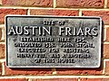 Austin Friars in Whitefriars, Canterbury.jpg 2,048 × 1,536; 1.25 MB
-
 Back of Pound Lane - panoramio.jpg 2,304 × 3,072; 2.5 MB
-
 Barton Road Post Office - geograph.org.uk - 1773319.jpg 3,072 × 2,304; 1.45 MB
-
 Beckett House, New Dover Road, Canterbury - geograph.org.uk - 2831826.jpg 4,320 × 3,240; 4.33 MB
-
 BH ablution block.jpg 1,299 × 449; 61 KB
-
 Black Friars Gate, Canterbury - geograph.org.uk - 3138477.jpg 427 × 640; 36 KB
-
 Blackfriars - panoramio (1).jpg 1,000 × 737; 497 KB
-
 Bode, High St - geograph.org.uk - 3121357.jpg 640 × 430; 93 KB
-
 Boer War Memorial Dane John Gardens.png 425 × 600; 134 KB
-
 Broad Oak MINI, Canterbury - geograph.org.uk - 2827749.jpg 4,320 × 3,240; 4.07 MB
-
 Buglar Alarms - geograph.org.uk - 2017674.jpg 2,272 × 1,704; 1.79 MB
-

-

-
 Butchery Lane Canterbury Cathedral 7545.jpg 2,400 × 3,600; 7.93 MB
-
 Butter Market - geograph.org.uk - 2914599.jpg 640 × 480; 101 KB
-
 Byzantine and Romanesque architecture (1913) (14779292081).jpg 1,628 × 2,130; 595 KB
-
 Byzantine and Romanesque architecture (1913) (14779293011).jpg 2,528 × 1,780; 991 KB
-
 Byzantine and Romanesque architecture (1913) (14782120782).jpg 1,170 × 1,312; 216 KB
-
 C. w. allen canterbury.jpg 465 × 742; 61 KB
-
 Cafe du Soleil - geograph.org.uk - 2565375.jpg 1,600 × 1,200; 592 KB
-
 Cafe Du Soleil - geograph.org.uk - 2634970.jpg 640 × 430; 103 KB
-
 Café Rouge, Canterbury - geograph.org.uk - 2266820.jpg 480 × 640; 116 KB
-
 Candy's Store Canterbury.png 425 × 600; 165 KB
-
 Canterbury (10581992165).jpg 4,752 × 3,168; 1.94 MB
-
 Canterbury (10582050854).jpg 4,752 × 3,168; 1.96 MB
-
 Canterbury - 1987 - geograph.org.uk - 2305645.jpg 2,272 × 1,515; 555 KB
-
 Canterbury - 1987 - geograph.org.uk - 2305668.jpg 2,272 × 1,515; 539 KB
-
 Canterbury - 1987 - geograph.org.uk - 2305798.jpg 2,272 × 1,514; 579 KB
-
 Canterbury - 1987 - geograph.org.uk - 2306376.jpg 1,515 × 2,272; 507 KB
-
 Canterbury - 6A, Stour Street - 20220621175131.jpg 4,754 × 3,193; 13.94 MB
-
 Canterbury - geograph.org.uk - 3224438.jpg 3,648 × 2,736; 2.07 MB
-
 Canterbury - geograph.org.uk - 3224440.jpg 3,648 × 2,736; 2.02 MB
-
 Canterbury - geograph.org.uk - 3224442.jpg 3,648 × 2,736; 3.8 MB
-
 Canterbury - geograph.org.uk - 3224444.jpg 3,648 × 2,736; 1.47 MB
-
 Canterbury - geograph.org.uk - 3224446.jpg 3,648 × 2,736; 4.19 MB
-
 Canterbury - June 2015 - The Mask.jpg 4,272 × 2,848; 6.4 MB
-

-
 Canterbury Age Concern - geograph.org.uk - 2099363.jpg 3,072 × 2,304; 1.81 MB
-
 Canterbury Archaeological Trust - geograph.org.uk - 2647505.jpg 640 × 430; 74 KB
-
 Canterbury at Dusk - Aug 2012 - A Stroll Down the Town.jpg 4,260 × 2,828; 5.13 MB
-
 Canterbury Canal - Aug 2014 - Early Evening Reflections.jpg 2,592 × 4,608; 5.51 MB
-
 Canterbury Cathedral Lodge - geograph.org.uk - 1988063.jpg 1,600 × 1,200; 318 KB
-
 Canterbury Christ Church University - geograph.org.uk - 2910976.jpg 640 × 480; 70 KB
-
 Canterbury City - geograph.org.uk - 2983666.jpg 2,014 × 1,035; 828 KB
-
 Canterbury Cross - geograph.org.uk - 1958278.jpg 3,072 × 2,304; 2 MB
-
 Canterbury East (27307489502).jpg 4,896 × 2,759; 4.75 MB
-
 Canterbury East Station carpark - geograph.org.uk - 2277279.jpg 640 × 480; 80 KB
-

-

-
 Canterbury Façade.jpg 2,862 × 1,974; 1.48 MB
-
 Canterbury Golf Club house - geograph.org.uk - 2034718.jpg 3,072 × 2,304; 1.53 MB
-
 Canterbury Golf Course - geograph.org.uk - 2897691.jpg 640 × 430; 44 KB
-
 Canterbury Golf Course - geograph.org.uk - 2897697.jpg 640 × 430; 43 KB
-
 Canterbury High School - geograph.org.uk - 1066277.jpg 640 × 481; 60 KB
-
 Canterbury Kia - geograph.org.uk - 2827268.jpg 4,320 × 3,240; 3.55 MB
-
 Canterbury Kingsmead Stadium c.1980.png 949 × 624; 1,006 KB
-
 Canterbury Lane - geograph.org.uk - 3125661.jpg 640 × 430; 70 KB
-
 Canterbury river boat tours for visitors.jpg 2,400 × 1,653; 4.44 MB
-
 Canterbury Road, Dunkirk - geograph.org.uk - 1241676.jpg 640 × 462; 98 KB
-
 Canterbury Saab, Westminster Road, Canterbury - geograph.org.uk - 2827286.jpg 4,320 × 3,240; 4.1 MB
-
 Canterbury Tales Canterbury.png 600 × 425; 194 KB
-
 Canterbury UK ward map 2023.svg 1,076 × 1,266; 508 KB
-
 Canterbury UK.jpg 2,048 × 1,536; 771 KB
-

-
 Canterbury, (Kent) the Sun Hotel , an early 16th century building.jpg 539 × 640; 245 KB
-
 Canterbury, All Saints Lane - geograph.org.uk - 3229517.jpg 2,736 × 3,648; 1.39 MB
-
 Canterbury, Best Lane - geograph.org.uk - 2642213.jpg 3,648 × 2,736; 2.18 MB
-
 Canterbury, Best Lane - geograph.org.uk - 2642218.jpg 2,736 × 3,648; 1.89 MB
-
 Canterbury, Butchery Lane - geograph.org.uk - 3228402.jpg 2,736 × 3,648; 1.66 MB
-
 Canterbury, Butchery Lane - geograph.org.uk - 3231163.jpg 3,648 × 2,736; 1.7 MB
-
 Canterbury, Butchery Lane - geograph.org.uk - 3231167.jpg 2,736 × 3,648; 1.88 MB
-
 Canterbury, Buttermarket - geograph.org.uk - 3231158.jpg 2,736 × 3,648; 1.79 MB
-
 Canterbury, Buttermarket - geograph.org.uk - 3231159.jpg 3,648 × 2,736; 1.91 MB
-
 Canterbury, Canterbury Lane - geograph.org.uk - 3231329.jpg 3,648 × 2,736; 1.64 MB
-
 Canterbury, Canterbury, Kent, UK - panoramio.jpg 3,072 × 2,048; 4 MB
-
 Canterbury, Clock Tower Square - geograph.org.uk - 3231325.jpg 3,648 × 2,736; 1.55 MB
-
 Canterbury, Gravel Walk - geograph.org.uk - 3228329.jpg 3,648 × 2,736; 1.59 MB
-
 Canterbury, High Street - geograph.org.uk - 3229511.jpg 3,648 × 2,736; 4.11 MB
-
 Canterbury, High Street - geograph.org.uk - 3229512.jpg 3,648 × 2,736; 4.19 MB
-
 Canterbury, High Street - geograph.org.uk - 3231146.jpg 3,648 × 2,736; 1.75 MB
-
 Canterbury, High Street - geograph.org.uk - 3231148.jpg 3,648 × 2,736; 1.42 MB
-
 Canterbury, Mercery Lane - geograph.org.uk - 3228424.jpg 3,648 × 2,736; 4.06 MB
-
 Canterbury, Mercery Lane - geograph.org.uk - 3231152.jpg 2,736 × 3,648; 1.73 MB
-
 Canterbury, Mercery Lane - geograph.org.uk - 3231154.jpg 3,648 × 2,736; 1.84 MB
-
 Canterbury, Mill Lane - geograph.org.uk - 2639433.jpg 3,648 × 2,736; 2.67 MB
-
 Canterbury, Mill Lane - geograph.org.uk - 2639554.jpg 3,648 × 2,736; 3.94 MB
-
 Canterbury, Mill Lane - geograph.org.uk - 2639573.jpg 3,648 × 2,736; 3.21 MB
-
 Canterbury, North Gate Coach Park - geograph.org.uk - 2639126.jpg 3,648 × 2,736; 1.33 MB
-
 Canterbury, North Gate Coach Park - geograph.org.uk - 2642312.jpg 3,648 × 2,736; 1.72 MB
-
 Canterbury, North Gate Coach Park - geograph.org.uk - 2642345.jpg 3,648 × 2,736; 2.11 MB
-

-

-

-
 Canterbury, North Lane - geograph.org.uk - 3230088.jpg 3,648 × 2,736; 1.34 MB
-
 Canterbury, North Lane - geograph.org.uk - 3230091.jpg 3,648 × 2,736; 1.72 MB
-
 Canterbury, Pound Lane - geograph.org.uk - 2639341.jpg 3,648 × 2,736; 2.41 MB
-
 Canterbury, Riverside Walk - geograph.org.uk - 2639305.jpg 3,648 × 2,736; 3.7 MB
-
 Canterbury, Riverside Walk - geograph.org.uk - 2639315.jpg 3,648 × 2,736; 3.19 MB
-
 Canterbury, Riverside Walk - geograph.org.uk - 2642235.jpg 3,648 × 2,736; 3.4 MB
-
 Canterbury, Rose Lane - geograph.org.uk - 3228386.jpg 3,648 × 2,736; 3.93 MB
-
 Canterbury, St Dunstan's Street - geograph.org.uk - 3229520.jpg 3,648 × 2,736; 4.14 MB
-
 Canterbury, St Dunstan's Street - geograph.org.uk - 3230098.jpg 3,648 × 2,736; 1.45 MB
-
 Canterbury, St Dunstan's Street - geograph.org.uk - 3230100.jpg 3,648 × 2,736; 1.94 MB
-
 Canterbury, St Dunstan's Street - geograph.org.uk - 3230106.jpg 3,648 × 2,736; 1.71 MB
-
 Canterbury, St George's Lane - geograph.org.uk - 3228320.jpg 3,648 × 2,736; 1.85 MB
-
 Canterbury, St George's Lane - geograph.org.uk - 3231334.jpg 3,648 × 2,736; 1.84 MB
-
 Canterbury, St George's Place - geograph.org.uk - 3231340.jpg 3,648 × 2,736; 4.11 MB
-
 Canterbury, St George's Street - geograph.org.uk - 3231169.jpg 3,648 × 2,736; 2.02 MB
-
 Canterbury, St George's Street - geograph.org.uk - 3231319.jpg 3,648 × 2,736; 2.74 MB
-
 Canterbury, St George's Street - geograph.org.uk - 3231333.jpg 3,648 × 2,736; 1.75 MB
-
 Canterbury, St Margaret's Street - geograph.org.uk - 3228419.jpg 3,648 × 2,736; 4.14 MB
-
 Canterbury, St Peter's Place - geograph.org.uk - 3230117.jpg 3,648 × 2,736; 1.51 MB
-
 Canterbury, St Peter's Street - geograph.org.uk - 3229513.jpg 3,648 × 2,736; 4.13 MB
-
 Canterbury, St Peter's Street - geograph.org.uk - 3229514.jpg 3,648 × 2,736; 2.35 MB
-
 Canterbury, St Peter's Street - geograph.org.uk - 3229516.jpg 3,648 × 2,736; 4.08 MB
-
 Canterbury, St Peter's Street - geograph.org.uk - 3230984.jpg 3,648 × 2,736; 1.53 MB
-
 Canterbury, St Peter's Street - geograph.org.uk - 3231137.jpg 3,648 × 2,736; 1.43 MB
-
 Canterbury, St Radigunds carpark - geograph.org.uk - 2639331.jpg 3,648 × 2,736; 1.38 MB
-
 Canterbury, The Friars - geograph.org.uk - 3229518.jpg 3,648 × 2,736; 1.21 MB
-
 Canterbury, Town Plan - geograph.org.uk - 2639358.jpg 3,648 × 2,736; 2.23 MB
-
 Canterbury, UK - panoramio (36).jpg 2,048 × 1,150; 590 KB
-
 Canterbury, UK - panoramio (37).jpg 2,048 × 1,150; 556 KB
-
 Canterbury, UK - panoramio - Jean Marc Gfp.jpg 1,200 × 1,600; 1.04 MB
-
 Canterbury, Westgate Grove - geograph.org.uk - 3230111.jpg 3,648 × 2,736; 3.79 MB
-
 Canterbury, Westgate Towers - geograph.org.uk - 3230067.jpg 2,736 × 3,648; 1.72 MB
-
 Canterbury, White Horse Lane - geograph.org.uk - 2642043.jpg 2,736 × 3,648; 1.67 MB
-
 Canterbury, White Horse Lane - geograph.org.uk - 2642047.jpg 2,736 × 3,648; 1.33 MB
-
 Canterbury, White Horse Lane - geograph.org.uk - 2642059.jpg 3,648 × 2,736; 1.63 MB
-
 Canterbury, White Horse Lane - geograph.org.uk - 2642074.jpg 2,736 × 3,648; 1.39 MB
-
 Canterbury, White Horse Lane - geograph.org.uk - 2642113.jpg 2,736 × 3,648; 1.36 MB
-
 Canterbury, White Horse Lane - geograph.org.uk - 2642127.jpg 3,648 × 2,736; 1.76 MB
-
 Canterbury, White Horse Lane - geograph.org.uk - 3228433.jpg 3,648 × 2,736; 4.2 MB
-
 Canterbury, White Horse Lane - geograph.org.uk - 3231142.jpg 3,648 × 2,736; 1.59 MB
-
 Canterbury, Whitefriars Passage - geograph.org.uk - 3228324.jpg 3,648 × 2,736; 1.41 MB
-
 Canterbury, Whitefriars Square - geograph.org.uk - 3228326.jpg 3,648 × 2,736; 1.67 MB
-
 Canterbury, Whitefriars Street - geograph.org.uk - 3228327.jpg 3,648 × 2,736; 1.79 MB
-
 Canterburyfromuniversity.png 2,076 × 1,106; 3.03 MB
-
 CanterburyHollowLane4396.JPG 2,048 × 1,536; 769 KB
-
 CanterburyHollowLane4400.JPG 2,048 × 1,536; 772 KB
-
 CanterburySaxonne.png 2,839 × 2,943; 4.66 MB
-
 Castle Street2.jpg 3,024 × 4,032; 3.22 MB
-
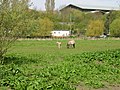
 Cattle in a field - geograph.org.uk - 984383.jpg 640 × 430; 66 KB
-
 Cattle on a farm in Banks Peninsula, New Zealand.jpg 4,032 × 3,024; 2.99 MB
-
 Chapel in Canterbury Cemetery - geograph.org.uk - 3043120.jpg 3,872 × 2,592; 4.32 MB
-
 Chaucer House in Canterbury 01.jpg 1,174 × 1,738; 456 KB
-
 Christ Church Canterbury - geograph.org.uk - 2643233.jpg 640 × 430; 80 KB
-

-
 Christ Church Gate - geograph.org.uk - 3121387.jpg 430 × 640; 73 KB
-
 Christ Church Gate.png 425 × 600; 186 KB
-
 Club Chemistry - geograph.org.uk - 2277422.jpg 640 × 480; 111 KB
-
 Club Chemistry - geograph.org.uk - 2655468.jpg 640 × 430; 62 KB
-
 Club Chemistry, Canterbury - geograph.org.uk - 2831786.jpg 4,320 × 3,240; 4.2 MB
-
 Costa, Canterbury - geograph.org.uk - 3125701.jpg 640 × 430; 77 KB
-
 Dave Lee Bench Cantenbury.png 425 × 600; 203 KB
-
 Decent-doorstop.jpg 3,264 × 1,840; 1.12 MB
-

-
 Dungeness (6109953007).jpg 3,648 × 2,056; 1.03 MB
-
 Eileen C (10399107264).jpg 2,400 × 1,607; 3.46 MB
-
En-uk-Canterbury.ogg 1.5 s; 29 KB
-
 Entering Canterbury - geograph.org.uk - 2500179.jpg 640 × 488; 100 KB
-
 Entrance to Canterbury Cemetery - geograph.org.uk - 2674800.jpg 3,180 × 2,232; 1.3 MB
-
 Ethelbert King Kent.jpg 3,150 × 2,100; 3.6 MB
-
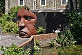
 Face Sculpture.png 477 × 600; 560 KB
-

-
 Flag of Canterbury.png 4,130 × 2,475; 1.6 MB
-

-
 Footpath in Martyrs Field, Canterbury 1.jpg 427 × 640; 124 KB
-
 Footpath in Martyrs Field, Canterbury 2.jpg 640 × 427; 89 KB
-
 Fruit stall at Parade - geograph.org.uk - 2914502.jpg 640 × 480; 112 KB
-

-
 Grave of Mary and Herbert Tourtel.jpg 3,264 × 2,448; 2.41 MB
-
 Greyfriars - panoramio - Jean Marc Gfp (2).jpg 1,200 × 900; 1,023 KB
-
 High Street, Canterbury, Kent (cropped).jpg 463 × 551; 118 KB
-
 High Street, Canterbury, Kent.jpg 1,068 × 667; 271 KB
-
 Holly (5239533970).jpg 2,949 × 2,036; 4.06 MB
-
 Horse and foal in field near River Stour - geograph.org.uk - 778690.jpg 640 × 480; 248 KB
-
 House on Hode Lane - geograph.org.uk - 1257051.jpg 640 × 427; 74 KB
-

-
 In Canterbury-1.jpg 2,932 × 1,955; 1.81 MB
-
 In Canterbury.jpg 4,967 × 3,312; 4.45 MB
-
 Inclined house, Canterbury.jpg 3,072 × 2,241; 1.29 MB
-
 Invicta Motors, Canterbury - geograph.org.uk - 2824617.jpg 4,320 × 3,240; 4.2 MB
-
 Jackdaw Pub 2 - panoramio.jpg 1,536 × 2,048; 1.11 MB
-
 James Daniell Esq-15 10 1802 and Wife St Paul's Church Canterbury.png 425 × 600; 132 KB
-
 Javelin at Canterbury West - geograph.org.uk - 1921822.jpg 640 × 480; 83 KB
-
Jer-Cantorbéry.ogg 1.0 s; 13 KB
-

-
 Kent College, Canterbury (2) - geograph.org.uk - 1133339.jpg 640 × 430; 49 KB
-
 Kentish apple orchard.jpg 640 × 480; 122 KB
-
 KFC Restaurant, Canterbury - geograph.org.uk - 1522688.jpg 640 × 427; 61 KB


.jpg)


_(14779292081).jpg)
_(14779293011).jpg)
_(14782120782).jpg)


.jpg)
.jpg)


.jpg)


.jpg)


_the_Sun_Hotel_,_an_early_16th_century_building.jpg)


.jpg)
.jpg)


.jpg)
.jpg)


.jpg)
.jpg)

.jpg)


_-_geograph.org.uk_-_1133339.jpg)

