Category:Capel Curig
Jump to navigation
Jump to search
village and community in Conwy County Borough, Wales, UK   | |||||
| Upload media | |||||
| Instance of | |||||
|---|---|---|---|---|---|
| Location | Conwy County Borough, Wales | ||||
| Located in or next to body of water | |||||
| Population |
| ||||
| Area |
| ||||
| official website | |||||
 | |||||
Cymraeg: Pentref bychan yng nghanol Eryri yw Capel Curig. Mae'n rhan o fwrdeistref sirol Conwy. Fe'i lleolir ar groesffordd lle mae'r A4086 o/i gyfeiriad Nant Gwynant a Beddgelert yn ymuno â'r A5.
English: Capel Curig ( English: Curig's Chapel) is a village and community in Conwy County Borough, in Wales. It lies in the heart of Snowdonia, on the River Llugwy, and has a population of 226. It is at the junction of the A5 road from Bangor and Bethesda to Betws-y-Coed with the A4086 road from Caernarfon, Llanberis, Pen-y-Pass and Pen-y-Gwryd.
Subcategories
This category has the following 19 subcategories, out of 19 total.
A
- Afon y Bedol (6 F)
B
- Bwlch y Geuallt quarry (1 F)
C
- Caer Llugwy (2 F)
- St Julitta's Church, Capel Curig (58 F)
- Crimpiau (28 F)
- Cwm Lloer (14 F)
F
- Ffynnon Llugwy (14 F)
L
- Llyn Bodgynydd (2 F)
- Llyn Newydd Rhos Quarry (3 F)
- Llyn y Coryn (5 F)
- Llyn y Foel (17 F)
M
- Manod quarry, Conwy (2 F)
- Moel Siabod quarry (4 F)
P
- Pen-y-Gwryd Hotel (7 F)
R
T
- Tŷ Hyll (15 F)
- Tŷ Hyll Bridge (6 F)
Media in category "Capel Curig"
The following 200 files are in this category, out of 1,860 total.
(previous page) (next page)-

-
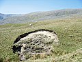
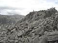
 A boulder and the Glyderau - geograph.org.uk - 1838306.jpg 640 × 480; 90 KB
-
 A broken wall in the foreground - geograph.org.uk - 1887113.jpg 4,592 × 3,056; 4.38 MB
-
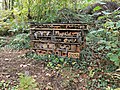 A bug hotel - geograph.org.uk - 4204536.jpg 640 × 480; 151 KB
-
 A closer view of Welsh Mountain Goats - geograph.org.uk - 5335059.jpg 640 × 480; 238 KB
-
 A distinctive split rock - geograph.org.uk - 1977553.jpg 4,592 × 3,056; 4.71 MB
-
 A field with sheep - geograph.org.uk - 1540432.jpg 640 × 426; 95 KB
-
 A fine boulder - geograph.org.uk - 3586120.jpg 1,224 × 918; 531 KB
-
 A footpath above Capel Curig - geograph.org.uk - 5082224.jpg 1,142 × 857; 446 KB
-
 A fork in the track - geograph.org.uk - 1540294.jpg 640 × 426; 84 KB
-
 A fork in the track - geograph.org.uk - 1562853.jpg 640 × 480; 146 KB
-

-
 A glacier passed this way - geograph.org.uk - 73067.jpg 640 × 480; 130 KB
-
 A glimpse of the sea - geograph.org.uk - 1327317.jpg 640 × 426; 67 KB
-
 A House Platform - geograph.org.uk - 1977515.jpg 4,592 × 3,056; 4.11 MB
-
 A large rock guards the path - geograph.org.uk - 1341483.jpg 640 × 426; 62 KB
-
 A little used track - geograph.org.uk - 1540414.jpg 640 × 426; 106 KB
-
 A look back down a steep ascent of Pen yr Ole Wen - geograph.org.uk - 3017975.jpg 3,968 × 2,976; 2.8 MB
-
 A meadow beside the Llugwy - geograph.org.uk - 5068058.jpg 1,306 × 979; 675 KB
-
 A mighty cliff - geograph.org.uk - 1327471.jpg 426 × 640; 67 KB
-
 A momentary cause for concern - geograph.org.uk - 424524.jpg 640 × 480; 82 KB
-

-
 A pair of Canada Geese on Llyn Ogwen - geograph.org.uk - 2330572.jpg 640 × 480; 109 KB
-
 A quad-bike track towards the mountain - geograph.org.uk - 398081.jpg 640 × 480; 111 KB
-
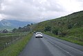
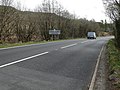
 A quiet A4086 heading west - geograph.org.uk - 4798445.jpg 1,024 × 768; 154 KB
-
 A raging Swallow Falls - geograph.org.uk - 4797893.jpg 768 × 1,024; 228 KB
-
 A rocky outcrop at Dyffryn Mymbyr - geograph.org.uk - 2119710.jpg 1,500 × 1,000; 171 KB
-
 A ruined barn and rough grazing land - geograph.org.uk - 398445.jpg 640 × 480; 91 KB
-
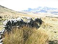 A ruined mountain wall - geograph.org.uk - 399187.jpg 640 × 480; 135 KB
-
 A ruined wall - geograph.org.uk - 1888485.jpg 4,592 × 3,056; 4.61 MB
-
 A seagull on Tryfan - geograph.org.uk - 4706207.jpg 480 × 640; 175 KB
-
 A sheepfold - geograph.org.uk - 1562933.jpg 640 × 426; 90 KB
-
 A slippage of the stream bank - geograph.org.uk - 426862.jpg 640 × 480; 131 KB
-

-
 A small stand of trees - geograph.org.uk - 1888539.jpg 4,592 × 3,056; 4.66 MB
-
 A small unnamed llyn - geograph.org.uk - 1562969.jpg 640 × 426; 72 KB
-
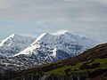 A snowy Snowdon range - geograph.org.uk - 4798414.jpg 1,024 × 768; 127 KB
-
 A sorry looking stile - geograph.org.uk - 1870418.jpg 4,592 × 3,056; 6.34 MB
-
 A stile affording a view of Llynnau Mymbyr - geograph.org.uk - 1887477.jpg 4,592 × 3,056; 4.04 MB
-
 A stile and a path through more trees - geograph.org.uk - 1540442.jpg 640 × 426; 152 KB
-
 A stile with a mountainous skyline - geograph.org.uk - 1888377.jpg 4,592 × 3,056; 4.12 MB
-
 A Stormy Night in Capel Curig (19963421572).jpg 3,000 × 1,996; 3.48 MB
-
 A Straight Path Towards Moel Siabod - geograph.org.uk - 5638334.jpg 4,608 × 3,456; 5.14 MB
-
 A View From Bristly Ridge - geograph.org.uk - 6165075.jpg 1,200 × 1,600; 571 KB
-
 A view of the A5 - geograph.org.uk - 2868423.jpg 1,024 × 768; 222 KB
-
 A view through the trees - geograph.org.uk - 2868386.jpg 1,024 × 768; 343 KB
-
 A waterfall - geograph.org.uk - 1562858.jpg 2,816 × 2,112; 2.31 MB
-
 A waterfall - geograph.org.uk - 1563156.jpg 640 × 426; 148 KB
-
 A well built wall by The Miner's Track - geograph.org.uk - 1977549.jpg 4,592 × 3,056; 6.96 MB
-

-
 A4086 - geograph.org.uk - 20670.jpg 640 × 480; 83 KB
-
 A4086 - geograph.org.uk - 2880184.jpg 1,024 × 525; 122 KB
-
 A4086 - geograph.org.uk - 3185421.jpg 640 × 430; 57 KB
-
 A4086 - geograph.org.uk - 3185462.jpg 640 × 430; 45 KB
-
 A4086 - geograph.org.uk - 3185480.jpg 640 × 430; 50 KB
-
 A4086 at Dyffryn Mymbyr - geograph.org.uk - 2108274.jpg 640 × 480; 81 KB
-
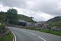
 A4086 at Plas y Brenin - geograph.org.uk - 4797921.jpg 1,024 × 768; 156 KB
-
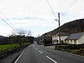 A4086 Capel Curig - geograph.org.uk - 4797903.jpg 1,024 × 768; 129 KB
-
 A4086 heading West - geograph.org.uk - 4797924.jpg 1,024 × 768; 114 KB
-
 A4086 heading West - geograph.org.uk - 4797942.jpg 1,024 × 768; 121 KB
-
 A4086 heading West - geograph.org.uk - 4798435.jpg 1,024 × 662; 119 KB
-
 A4086 in Snowdonia - geograph.org.uk - 3185492.jpg 640 × 430; 53 KB
-
 A4086 in Snowdonia National Park - geograph.org.uk - 2343058.jpg 1,150 × 778; 461 KB
-
 A4086 in the Snowdonia National Park - geograph.org.uk - 4798427.jpg 1,024 × 666; 105 KB
-
 A4086 layby - geograph.org.uk - 2108278.jpg 640 × 480; 70 KB
-
 A4086 looking towards the Snowdon Range - geograph.org.uk - 4798405.jpg 1,024 × 768; 126 KB
-
 A4086 to Capel Curig - geograph.org.uk - 3157593.jpg 640 × 356; 34 KB
-
 A4086, Plas-y-Brenin - geograph.org.uk - 3183720.jpg 640 × 430; 63 KB
-
 A4086, Snowdonia - geograph.org.uk - 3185491.jpg 640 × 430; 54 KB
-
 A5 - geograph.org.uk - 3062548.jpg 640 × 427; 217 KB
-
 A5 - Not much room for pedestrians - geograph.org.uk - 1340903.jpg 640 × 426; 98 KB
-
 A5 approaching Capel Curig - geograph.org.uk - 3183706.jpg 640 × 374; 56 KB
-
 A5 approaching Tal-y-Waun eastbound - geograph.org.uk - 2640660.jpg 640 × 514; 70 KB
-
 A5 at entrance to Tal-y-Braich - geograph.org.uk - 4720980.jpg 640 × 454; 47 KB
-

-
 A5 at Helyg - geograph.org.uk - 4720990.jpg 640 × 463; 63 KB
-
 A5 at Pont Wern Gof - geograph.org.uk - 2640689.jpg 640 × 499; 66 KB
-

-
 A5 near Capel Curig - geograph.org.uk - 4645222.jpg 1,000 × 750; 635 KB
-

-
 A5 passing Bryn Glo - geograph.org.uk - 3183688.jpg 640 × 430; 88 KB
-
 A5 passing Dol Gam - geograph.org.uk - 4720801.jpg 640 × 452; 54 KB
-
 A5 towards Capel Curig - geograph.org.uk - 3391285.jpg 1,280 × 856; 246 KB
-
 A5, Afon Llugwy - geograph.org.uk - 35927.jpg 640 × 480; 139 KB
-
 A5, eastbound - geograph.org.uk - 3157622.jpg 640 × 430; 91 KB
-
 A5, Near Capel Curig - geograph.org.uk - 35923.jpg 640 × 480; 146 KB
-
 A5, westbound - geograph.org.uk - 3183666.jpg 640 × 452; 90 KB
-
 A5, westbound - geograph.org.uk - 3183672.jpg 640 × 430; 83 KB
-
 A5, westbound - geograph.org.uk - 3183684.jpg 640 × 456; 75 KB
-
 A5, westbound - geograph.org.uk - 3183689.jpg 640 × 430; 88 KB
-
 Abandoned field barn beside the Afon Llugwy - geograph.org.uk - 5068060.jpg 1,306 × 979; 678 KB
-
 Abandoned long ago - geograph.org.uk - 2335002.jpg 640 × 480; 137 KB
-
 Abandoned mine level, Cyffty mine - geograph.org.uk - 3349362.jpg 1,280 × 853; 340 KB
-
 Abandoned Quarry Buildings - Moel Siabod - geograph.org.uk - 5638350.jpg 3,691 × 2,097; 2.46 MB
-
 Abandoned sheepfold - geograph.org.uk - 398906.jpg 640 × 480; 105 KB
-
 Above Capel Curig - geograph.org.uk - 1436948.jpg 640 × 426; 205 KB
-
 Above Cwm Lloer - geograph.org.uk - 5857179.jpg 1,600 × 1,200; 625 KB
-
 Above Gelli looking towards Llynnau Mymbyr - geograph.org.uk - 1870138.jpg 4,592 × 3,056; 5.25 MB
-
 Above Llyn Ogwen - geograph.org.uk - 2957300.jpg 640 × 480; 81 KB
-
 Adam and Eve on Tryfan - geograph.org.uk - 3105568.jpg 640 × 480; 32 KB
-
 Adam and Eve on Tryfan's main summit - geograph.org.uk - 2442539.jpg 640 × 480; 61 KB
-

-
 Aero Engine, Cwm Lloer - geograph.org.uk - 2666864.jpg 2,592 × 1,944; 2.42 MB
-
 Afon Cwm Glas below the Ysgolion Duon backwall - geograph.org.uk - 4896652.jpg 1,600 × 1,023; 583 KB
-
 Afon Denau - geograph.org.uk - 3224628.jpg 1,024 × 680; 217 KB
-
 Afon Denau - geograph.org.uk - 5159007.jpg 640 × 480; 111 KB
-
 Afon Idwal - geograph.org.uk - 2957344.jpg 640 × 480; 61 KB
-
 Afon Idwal - geograph.org.uk - 5408754.jpg 640 × 640; 266 KB
-
 Afon Idwal descending from Cwm Idwal - geograph.org.uk - 3340222.jpg 1,600 × 1,067; 329 KB
-
 Afon Idwal descending from Cwm Idwal - geograph.org.uk - 5408708.jpg 640 × 480; 201 KB
-
 Afon Lloer - geograph.org.uk - 2666869.jpg 1,944 × 2,592; 1.38 MB
-
 Afon Lloer - geograph.org.uk - 2923114.jpg 640 × 427; 75 KB
-
 Afon Lloer - geograph.org.uk - 3224664.jpg 680 × 1,024; 247 KB
-
 Afon Llugwy (2) - geograph.org.uk - 5390705.jpg 640 × 427; 106 KB
-
 Afon Llugwy - geograph.org.uk - 1540213.jpg 640 × 426; 112 KB
-
 Afon Llugwy - geograph.org.uk - 1540221.jpg 640 × 426; 123 KB
-
 Afon Llugwy - geograph.org.uk - 1996523.jpg 640 × 427; 107 KB
-
 Afon Llugwy - geograph.org.uk - 1996526.jpg 640 × 427; 117 KB
-
 Afon Llugwy - geograph.org.uk - 2867928.jpg 1,024 × 768; 280 KB
-
 Afon Llugwy - geograph.org.uk - 2868411.jpg 1,024 × 768; 342 KB
-
 Afon Llugwy - geograph.org.uk - 3157626.jpg 640 × 349; 92 KB
-
 Afon Llugwy - geograph.org.uk - 3159504.jpg 640 × 492; 120 KB
-
 Afon Llugwy - geograph.org.uk - 3183652.jpg 640 × 367; 91 KB
-
 Afon Llugwy - geograph.org.uk - 5390698.jpg 427 × 640; 93 KB
-
 Afon Llugwy and Capel Curig - geograph.org.uk - 2321923.jpg 1,365 × 1,024; 463 KB
-
 Afon Llugwy and Stablau Bont - geograph.org.uk - 5066998.jpg 1,306 × 979; 512 KB
-
 Afon Llugwy at Capel Curig - geograph.org.uk - 1335203.jpg 600 × 450; 156 KB
-
 Afon Llugwy at Capel Curig - geograph.org.uk - 1340900.jpg 426 × 640; 124 KB
-
 Afon Llugwy at Capel Curig - geograph.org.uk - 1836622.jpg 640 × 480; 149 KB
-
 Afon Llugwy at Capel Curig - geograph.org.uk - 2444724.jpg 4,000 × 3,000; 3.34 MB
-
 Afon Llugwy at Pont Cyfyng - geograph.org.uk - 2170681.jpg 2,000 × 1,500; 3.25 MB
-
 Afon Llugwy at Stablau Bont - geograph.org.uk - 4198973.jpg 800 × 672; 118 KB
-
 Afon Llugwy below Capel Curig - geograph.org.uk - 5067012.jpg 1,142 × 857; 621 KB
-
 Afon Llugwy below Cyfyng Falls - geograph.org.uk - 5067642.jpg 640 × 427; 117 KB
-

-
 Afon Llugwy from Pont y Capel - geograph.org.uk - 5066051.jpg 979 × 1,306; 734 KB
-
 Afon Llugwy from the Miners Bridge - geograph.org.uk - 181405.jpg 640 × 480; 146 KB
-

-

-

-
 Afon Llugwy looking north - geograph.org.uk - 2108160.jpg 640 × 480; 129 KB
-
 Afon Llugwy near Capel Curig - geograph.org.uk - 2321785.jpg 1,368 × 1,024; 517 KB
-

-
 Afon Llugwy. - geograph.org.uk - 6036313.jpg 1,024 × 683; 218 KB
-
 Afon Nant Gwryd - geograph.org.uk - 4395231.jpg 640 × 480; 78 KB
-
 After the cloud has gone - Tryfan from Y Foel Goch - geograph.org.uk - 3789849.jpg 4,608 × 3,456; 3.69 MB
-
 After the felling - geograph.org.uk - 3354170.jpg 640 × 480; 94 KB
-
 Aircraft Wreckage Below Bwlch Cyfryw-drum - geograph.org.uk - 6211640.jpg 1,200 × 1,600; 694 KB
-

-

-
 Along the A5 just north of Ardincaple - geograph.org.uk - 5065990.jpg 1,469 × 1,102; 704 KB
-

-

-

-

-
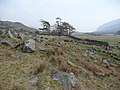
 An abandoned farmhouse - geograph.org.uk - 1976769.jpg 4,592 × 3,056; 4.59 MB
-
 An erratic perched on the edge - geograph.org.uk - 1887258.jpg 4,592 × 3,056; 5 MB
-
 An erratic perched on the edge - geograph.org.uk - 1887282.jpg 4,592 × 3,056; 4.92 MB
-
 An erratic strewn slope - geograph.org.uk - 399635.jpg 640 × 480; 109 KB
-
 An overview of the quarry buildings - geograph.org.uk - 1562889.jpg 640 × 426; 83 KB
-

-
 Approach to Tryfan summit - geograph.org.uk - 1216716.jpg 640 × 480; 218 KB
-
 Approaching Capel Curig on the A5 - geograph.org.uk - 1836606.jpg 640 × 480; 94 KB
-
 Approaching Glyder Fawr - geograph.org.uk - 2631756.jpg 2,592 × 1,944; 1.74 MB
-

-
 Approaching Pont-y-Capel - geograph.org.uk - 3183713.jpg 640 × 430; 53 KB
-
 Approaching Tal y Llyn Ogwen - geograph.org.uk - 2330634.jpg 640 × 480; 88 KB
-

-
 Approaching the summit of Carnedd Dafydd - geograph.org.uk - 2331444.jpg 640 × 480; 100 KB
-
 Arch of Pont Cyfyng in June - geograph.org.uk - 4050406.jpg 640 × 360; 112 KB
-
 Artificial Water Channel - geograph.org.uk - 2319528.jpg 1,377 × 1,024; 472 KB
-
 Artificial Water Channel - geograph.org.uk - 2319538.jpg 1,357 × 1,024; 311 KB
-
 Ascending Pen yr Ole Wen - geograph.org.uk - 3224668.jpg 1,024 × 680; 235 KB
-
 Ascending Tryfan's North Ridge - geograph.org.uk - 3015857.jpg 1,565 × 1,739; 1.33 MB
-
 At the bridge over the Afon Llewesig - geograph.org.uk - 5065994.jpg 1,306 × 979; 694 KB
-
 Autumn sunshine - geograph.org.uk - 1032140.jpg 640 × 480; 109 KB
-
 Avro Anson N9855 - geograph.org.uk - 2912123.jpg 640 × 427; 97 KB
-
 Backwall of Cwm Idwal - geograph.org.uk - 2960302.jpg 640 × 480; 59 KB
-
 Barn by the A4086 - geograph.org.uk - 3185464.jpg 640 × 430; 66 KB
-
 Because it's there. - geograph.org.uk - 2876318.jpg 1,024 × 768; 147 KB
-
 Bell Heather and Rock Debris - geograph.org.uk - 3062553.jpg 640 × 427; 285 KB
-
 Below Idwal Slabs - geograph.org.uk - 3747692.jpg 640 × 480; 88 KB
-
 Bend near Gwydyr Forest - geograph.org.uk - 4720803.jpg 640 × 469; 58 KB
-
 Bend on the Afon Llugwy - geograph.org.uk - 3931073.jpg 640 × 426; 266 KB
-
 Bend, A5 - geograph.org.uk - 3183678.jpg 640 × 430; 61 KB
-
 Bergformen zwischen Capel Curig und Llyn Crafnant.jpg 3,264 × 2,448; 3.66 MB
-

-
 Beside Llyn Bochlwyd in November - geograph.org.uk - 3748929.jpg 640 × 480; 78 KB
-
 Betws-y-coed, Swallow Falls - geograph.org.uk - 3663808.jpg 480 × 640; 131 KB
-
 Blick auf Capel Curig.JPG 2,048 × 1,536; 1.43 MB
-
 Bog Asphodel - geograph.org.uk - 5089446.jpg 1,521 × 2,023; 1.51 MB
-
 Bog Myrtle on the hillside below Waenhir - geograph.org.uk - 5089460.jpg 1,224 × 1,632; 914 KB
-

-
 Boulders and grass on the lower slopes of Tryfan - geograph.org.uk - 5829995.jpg 1,469 × 1,102; 670 KB
-
 Boulders east of summit of Glyder Fâch - geograph.org.uk - 3183222.jpg 1,500 × 930; 1 MB
-
 Bradley Cox on the Milestone Buttress - geograph.org.uk - 356614.jpg 314 × 448; 74 KB
-
 Braich Bryn-engan - geograph.org.uk - 4118385.jpg 1,024 × 768; 202 KB
-
 Braich y Ddeugwm - geograph.org.uk - 1326864.jpg 640 × 426; 107 KB
-
 Break time at Ogwen Valley - geograph.org.uk - 1553275.jpg 640 × 437; 61 KB
-
 Bridge - geograph.org.uk - 2867893.jpg 1,024 × 768; 254 KB


.jpg)


_-_geograph.org.uk_-_5390705.jpg)


,_RP-P-1983-385.jpg)


