Category:Capital Crescent Trail
Jump to navigation
Jump to search
- English: The Capital Crescent Trail is an 11-mile (18 km) long, shared-use rail trail that runs from Georgetown in Washington, D.C. to Silver Spring, Maryland.
rail-to-trail project trail between Georgetown, Washington, D.C., and Silver Spring, Maryland  Capital Crescent Trail in Bethesda, Maryland | |||||
| Upload media | |||||
| Instance of | |||||
|---|---|---|---|---|---|
| Location |
| ||||
| Owned by |
| ||||
| Operator |
| ||||
| Inception |
| ||||
| Length |
| ||||
| Partially coincident with | |||||
 | |||||
Subcategories
This category has the following 2 subcategories, out of 2 total.
A
- Arizona Avenue Bridge (3 F)
T
- Talbot Avenue bridge (2 F)
Media in category "Capital Crescent Trail"
The following 19 files are in this category, out of 19 total.
-

-

-

-
-

-

-

-
 Capital Bikeshare station Landy Ln Bethesda MD 2014-05-30 10-45-09 1.jpg 7,360 × 4,912; 26.88 MB
-
 Capital Bikeshare station Landy Ln Bethesda MD 2021-11-28 10-53-36 1.jpg 7,360 × 4,912; 26.16 MB
-
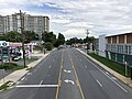
 Capital Crescent Trail - Bethesda.jpg 500 × 356; 114 KB
-
 Capital Crescent Trail sign Little Falls Pkwy Bethesda MD 2021-11-28 11-00-58 1.jpg 6,773 × 4,516; 34.04 MB
-
 Chesapeake and Ohio Canal National Historical Park.jpg 781 × 492; 285 KB
-
 DalecarliaTunnel.JPG 960 × 1,280; 886 KB
-
 DC, Capital Crescent Trail at Potomac River, August 25, 2004 - panoramio.jpg 2,272 × 1,704; 1.49 MB
-
 Neal Potter Plaza sign Bethesda MD 2021-11-28 10-52-57 1.jpg 7,209 × 4,806; 29.71 MB
-
 On the 4 mile level of Georgetown, drained, looking downstream from inclined plane.jpg 4,896 × 3,264; 13.7 MB
-
 Purple Line Rock Creek crossing construction 2021a.jpg 6,240 × 4,160; 14.68 MB
-
 Purple Line Rock Creek crossing construction 2021b.jpg 6,240 × 4,160; 9.14 MB
-
 Separated paths (8711452625).jpg 3,264 × 1,836; 1.94 MB
_from_the_overpass_for_the_Capital_Crescent_Trail_in_Bethesda,_Montgomery_County,_Maryland.jpg)
_from_the_overpass_for_the_Capital_Crescent_Trail_in_Bethesda,_Montgomery_County,_Maryland.jpg)
_from_the_overpass_for_the_Capital_Crescent_Trail_in_Bethesda,_Montgomery_County,_Maryland.jpg)
_from_the_overpass_for_the_Capital_Crescent_Trail_in_Bethesda,_Montgomery_County,_Maryland.jpg)
_from_the_overpass_for_the_Capital_Crescent_Trail_in_Bethesda,_Montgomery_County,_Maryland.jpg)
_from_the_overpass_for_the_Capital_Crescent_Trail_in_Bethesda,_Montgomery_County,_Maryland.jpg)
.jpg)


.jpg)