Category:Carl Friedrich von Wiebeking
Jump to navigation
Jump to search
Deutsch: Carl Friedrich von Wiebeking (1762-1842) war ein deutscher Architekt, Ingenieur (Wasserbaumeister) und Landvermesser.
German architect, art historian and architectural historian (1762-1842)   | |||||
| Upload media | |||||
| Date of birth | 25 July 1762 Wollin | ||||
|---|---|---|---|---|---|
| Date of death | 28 May 1842 Munich | ||||
| Country of citizenship | |||||
| Occupation | |||||
| Member of |
| ||||
| Spouse |
| ||||
| Work location | |||||
| Award received | |||||
| |||||
Pages in category "Carl Friedrich von Wiebeking"
This category contains only the following page.
Media in category "Carl Friedrich von Wiebeking"
The following 35 files are in this category, out of 35 total.
-
 Carl Friedrich von Wiebeking Vilshofen Brücke.jpg 4,770 × 3,942; 2.43 MB
-
 Dobbertin-Lüschow-Goldberg (Wiebeking 1786).jpg 1,729 × 1,273; 510 KB
-
 Dobbiner Plage Hervorhebung Paradieskoppel.png 885 × 764; 491 KB
-
 Dobbiner Plage Mecklenburg.jpg 895 × 783; 280 KB
-
 Dobbiner Plage Mecklenburg.png 885 × 764; 350 KB
-
 Grafenwerth 1796 D.jpg 3,125 × 1,780; 2.37 MB
-
 Herrschaft Odenthal.jpg 1,892 × 2,640; 1.72 MB
-
 Honschaft Bensberg.jpg 1,625 × 1,573; 945 KB
-
 Honschaft Breibach.jpg 695 × 675; 179 KB
-
 Honschaft Combüchen Wiebeking.jpg 685 × 1,412; 361 KB
-
 Honschaft Dierdorf.jpg 1,026 × 834; 335 KB
-
 Honschaft Dürscheid - Ausschnitt aus Karte Wiebeking 1789.png 1,015 × 693; 1.22 MB
-
 Honschaft Gladbach Wiebeking.jpg 936 × 578; 204 KB
-
 Honschaft Gronau Wiebeking.jpg 919 × 663; 217 KB
-
 Honschaft Herkenrath.jpg 1,120 × 2,066; 832 KB
-
 Honschaft Kollenbach Kartenausschnitt von Wiebeking 1789.jpg 800 × 531; 157 KB
-
 Honschaft Paffrath Wiebeking.jpg 1,200 × 894; 390 KB
-
 Honschaft Refrath.jpg 980 × 976; 334 KB
-
 Honschaft Sand.jpg 666 × 1,015; 239 KB
-
 Honschaft Scharde.jpg 1,272 × 1,455; 640 KB
-
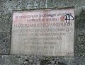 Innbruecke Gedenktafel Rosenheim-1.jpg 2,247 × 1,722; 866 KB
-
 KarlFriedrichWiebeking.jpg 1,143 × 1,512; 490 KB
-
 Kupferstich - Weihmörting - Rottbrücke - Wiebeking - 1809.jpg 6,666 × 5,111; 13.73 MB
-
 Permin wiebeking.png 734 × 762; 1.11 MB
-
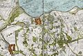
 Plan SPB 1833.jpg 7,575 × 5,850; 15.72 MB
-
 Siechenhauskarte crop.jpg 784 × 529; 126 KB
-
 Stoffeln Wiebeking.png 800 × 510; 535 KB
-
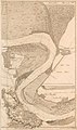 Strom-Veränderung unter Düsseldorf, Karte Rhein, 1798.jpg 1,428 × 2,416; 2.41 MB
-

-
 Wasserburg Bilk Wiebeking.png 822 × 498; 730 KB
-
 Wiebeking roegeliner see.jpg 798 × 1,100; 262 KB
-
 Wiebeking Selmsdorf.jpg 796 × 1,100; 276 KB
-
 WiebekingRZ.jpg 796 × 1,100; 239 KB
-
 Wiebekingsche karte güstrow 1786.jpg 894 × 917; 121 KB
-
 WP Carl Friedrich von Wiebeking.jpg 1,077 × 1,645; 507 KB

.jpg)


