Category:Carlton, Selby
Jump to navigation
Jump to search
village and civil parish in Selby, North Yorkshire, United Kingdom | |||||
| Upload media | |||||
| Instance of | |||||
|---|---|---|---|---|---|
| Location | Selby, North Yorkshire, Yorkshire and the Humber, England | ||||
| Population |
| ||||
| Different from | |||||
 | |||||
English: Carlton is a village and civil parish in the Selby district of North Yorkshire, England. It is situated approximately south east of the town of Selby on the A1041.
Subcategories
This category has the following 7 subcategories, out of 7 total.
Media in category "Carlton, Selby"
The following 200 files are in this category, out of 323 total.
(previous page) (next page)-
 15 High Street, Carlton - geograph.org.uk - 5057982.jpg 1,280 × 1,280; 419 KB
-
 4 old cottages, High Street, Carlton, North Yorkshire - geograph.org.uk - 6043690.jpg 5,376 × 3,024; 4.86 MB
-
 A flat landscape over the River Aire - geograph.org.uk - 4997132.jpg 4,602 × 3,448; 4.74 MB
-
 A.D 1862 - geograph.org.uk - 6015777.jpg 1,280 × 960; 479 KB
-
 A1041 towards Camblesforth - geograph.org.uk - 2275692.jpg 1,600 × 1,200; 380 KB
-
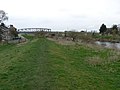
 Across the fields and River Aire towards Drax Power Station - geograph.org.uk - 6530360.jpg 3,505 × 1,675; 1.45 MB
-
 Alongside Robson Wood - geograph.org.uk - 3029152.jpg 1,024 × 768; 168 KB
-
 Anglican church of St Mary, Carlton - geograph.org.uk - 6015780.jpg 960 × 1,280; 447 KB
-
 Anglican church of St Mary, Carlton - geograph.org.uk - 6015781.jpg 960 × 1,280; 453 KB
-
 Approaching Jacky Duffin Wood level crossing - geograph.org.uk - 6011692.jpg 1,280 × 920; 364 KB
-
 Barn on Low Street, Carlton - geograph.org.uk - 6215566.jpg 1,600 × 1,065; 706 KB
-
 Barn, Quosquo House Farm - geograph.org.uk - 2396701.jpg 1,600 × 1,200; 359 KB
-
 Belfitt Clough pumping station - geograph.org.uk - 6016436.jpg 1,280 × 960; 516 KB
-
 Bench mark, High Street, Carlton - geograph.org.uk - 5057938.jpg 1,280 × 960; 385 KB
-
 Bench mark, The Gables, Carlton - geograph.org.uk - 5057962.jpg 960 × 1,280; 335 KB
-
 Bend in the River Ouse at Eskamhorn - geograph.org.uk - 6235303.jpg 1,600 × 1,200; 608 KB
-
 Blocked track to Mill Carr's Hill - geograph.org.uk - 4795057.jpg 1,024 × 614; 121 KB
-
 Borehole top, Mill Lane pumping station - geograph.org.uk - 6016397.jpg 1,280 × 960; 598 KB
-
 Bridge Farm - geograph.org.uk - 663678.jpg 640 × 480; 346 KB
-
 Bridge over the Aire - geograph.org.uk - 5781312.jpg 640 × 427; 245 KB
-
 Bridges Old and New - geograph.org.uk - 1198439.jpg 640 × 480; 68 KB
-
 Bull Alley Lane - geograph.org.uk - 5251709.jpg 1,024 × 768; 281 KB
-
 Bungalows on Hirst Road - geograph.org.uk - 3068510.jpg 800 × 600; 80 KB
-
 Carlton Bridges - geograph.org.uk - 6016439.jpg 1,280 × 960; 309 KB
-

-
 Carlton Marsh - geograph.org.uk - 5654707.jpg 1,024 × 768; 201 KB
-
 Carlton Methodist Church - geograph.org.uk - 5057978.jpg 1,280 × 1,280; 340 KB
-
 Carlton Methodist Church - geograph.org.uk - 6235232.jpg 1,600 × 1,200; 516 KB
-
 Carlton Methodist Church, North Yorkshire - geograph.org.uk - 6043176.jpg 5,376 × 3,024; 5.14 MB
-

-

-

-
 Carlton Nr Goole, Derelict Pumphouse - geograph.org.uk - 159632.jpg 640 × 480; 203 KB
-
 Carlton Railway Bridge - geograph.org.uk - 1287422.jpg 640 × 480; 45 KB
-
 Carlton Supermarket ^ Post Office - geograph.org.uk - 6215433.jpg 1,600 × 1,065; 609 KB
-
-
 Carlton Toll Bridge remains - geograph.org.uk - 3794265.jpg 1,280 × 960; 442 KB
-
 Carlton Towers cricket club - geograph.org.uk - 5781382.jpg 640 × 427; 230 KB
-
 Carlton Towers Lake - geograph.org.uk - 1337905.jpg 640 × 480; 109 KB
-
 Carlton – Hangar Lane pumping station - geograph.org.uk - 6015782.jpg 1,280 × 960; 533 KB
-
 Carlton – Mill Lane Water Treatment Works - geograph.org.uk - 6016395.jpg 1,280 × 960; 369 KB
-
 Cemetery chapel, Carlton - geograph.org.uk - 6235229.jpg 1,600 × 1,200; 583 KB
-
 Chestnut Cottage, Low Street, Carlton - geograph.org.uk - 6215493.jpg 1,600 × 1,065; 881 KB
-
 Coates Hall Farm - geograph.org.uk - 312079.jpg 640 × 480; 149 KB
-
 Coates Marsh Lane - geograph.org.uk - 6235250.jpg 1,600 × 1,200; 843 KB
-
 Convent Walk, Carlton - geograph.org.uk - 6215484.jpg 1,600 × 1,065; 532 KB
-
 Corner of the field - geograph.org.uk - 3032637.jpg 1,024 × 768; 219 KB
-
 Cottage by Kennel Plantation - geograph.org.uk - 3030663.jpg 1,024 × 768; 198 KB
-
 Cottages on Carlton High Street - geograph.org.uk - 5728476.jpg 800 × 600; 133 KB
-
 Cricket ground - geograph.org.uk - 5781317.jpg 640 × 427; 212 KB
-
 Cyclists on the Trans Pennine Trail - geograph.org.uk - 5727868.jpg 800 × 600; 94 KB
-
 Dark ripples - geograph.org.uk - 662829.jpg 640 × 480; 325 KB
-
 Date panel, Carlton Methodist Church - geograph.org.uk - 5057979.jpg 960 × 1,280; 240 KB
-
 Dead in the water - geograph.org.uk - 662809.jpg 640 × 480; 305 KB
-
 Diamond pond - geograph.org.uk - 664522.jpg 640 × 480; 237 KB
-
 Drain alongside Sandwith Lane - geograph.org.uk - 4794054.jpg 1,024 × 768; 141 KB
-
 Drax in the sunlight - geograph.org.uk - 6015760.jpg 1,280 × 819; 176 KB
-
 Drax Power Station - geograph.org.uk - 3032618.jpg 1,024 × 768; 121 KB
-
 Drax Power Station from SW, 1988 - geograph.org.uk - 4281675.jpg 2,328 × 1,311; 3.39 MB
-
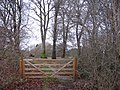
 Duffin Wood Gatehouse - geograph.org.uk - 5250855.jpg 1,024 × 768; 116 KB
-
 Eggborough power station - geograph.org.uk - 4257154.jpg 2,560 × 1,920; 932 KB
-
 Ell Pond - geograph.org.uk - 6683747.jpg 1,600 × 1,200; 807 KB
-
 Ell pond ^ - geograph.org.uk - 662807.jpg 640 × 480; 288 KB
-
 Entrance to Carlton Towers from the A1041 - geograph.org.uk - 4256972.jpg 1,024 × 768; 309 KB
-
 Eskamhorn Farm - geograph.org.uk - 1287293.jpg 640 × 480; 49 KB
-
 Estate cottages, 9-15 High Street, Carlton - geograph.org.uk - 5057968.jpg 1,280 × 875; 305 KB
-
 Farm access track off Mill Lane, Carlton - geograph.org.uk - 6016391.jpg 1,280 × 960; 271 KB
-
 Farm track near Quosquo Hall - geograph.org.uk - 3032244.jpg 1,024 × 768; 158 KB
-
 Farm track off Wood Lane - geograph.org.uk - 3031722.jpg 1,024 × 768; 158 KB
-
 Farmland near Bank End House - geograph.org.uk - 5781409.jpg 640 × 427; 272 KB
-
 Farmland near Chester Court House Farm - geograph.org.uk - 2396693.jpg 1,600 × 1,200; 495 KB
-
 Farmland north of Hepworth's Lane - geograph.org.uk - 2275740.jpg 1,600 × 1,200; 504 KB
-
 Farmland north of Mill Lane - geograph.org.uk - 2275696.jpg 1,600 × 1,200; 405 KB
-
 Farmland north of New Coates Farm - geograph.org.uk - 4795095.jpg 1,024 × 614; 81 KB
-
 Farmland north of the bend in Sandwith Lane - geograph.org.uk - 4794056.jpg 1,024 × 615; 126 KB
-
 Farmland north of Wheel Lane - geograph.org.uk - 2275709.jpg 1,600 × 1,200; 365 KB
-
 Farmland off Ings Lane - geograph.org.uk - 2275704.jpg 1,600 × 1,200; 306 KB
-
 Farmland on the north side of Hirst Road - geograph.org.uk - 4802074.jpg 1,024 × 768; 148 KB
-
 Farmland south of Sandwith Lane - geograph.org.uk - 4795047.jpg 1,024 × 614; 404 KB
-
 Farmland south of Wheel Lane - geograph.org.uk - 2275717.jpg 1,600 × 1,200; 301 KB
-
 Farmland west of Sandwith Lane - geograph.org.uk - 4795043.jpg 1,024 × 768; 148 KB
-
 Ferry Lane - geograph.org.uk - 664015.jpg 640 × 480; 295 KB
-
 Field beside Wheels Lane - geograph.org.uk - 6309052.jpg 640 × 480; 61 KB
-
 Field boundary - geograph.org.uk - 5782046.jpg 640 × 427; 230 KB
-
 Field boundary south of Wheel Lane - geograph.org.uk - 2275715.jpg 1,600 × 1,200; 440 KB
-
 Field drain beside Wood Lane - geograph.org.uk - 6309045.jpg 640 × 480; 97 KB
-
 Field of carrots near Rosehill Farm - geograph.org.uk - 3032303.jpg 1,024 × 768; 140 KB
-
 Field of oilseed rape - geograph.org.uk - 3032648.jpg 1,024 × 768; 194 KB
-
 Field on Carlton Marsh - geograph.org.uk - 6016400.jpg 1,280 × 960; 485 KB
-
 Fields and Pylons - geograph.org.uk - 1419799.jpg 640 × 480; 119 KB
-
 Fish pond, Carlton Towers - geograph.org.uk - 6016405.jpg 1,280 × 810; 353 KB
-
 Five bar gate - geograph.org.uk - 662798.jpg 640 × 480; 396 KB
-
 Flood defence - geograph.org.uk - 1094350.jpg 480 × 640; 58 KB
-
 Floodbank beside the River Aire - geograph.org.uk - 2275754.jpg 1,600 × 1,200; 489 KB
-

-
 Flooding on Sandwith Lane - geograph.org.uk - 4794062.jpg 1,024 × 768; 170 KB
-
 Flooding on the south side of Sandwith Lane - geograph.org.uk - 4794067.jpg 1,024 × 768; 109 KB
-
 Flow of Aire - geograph.org.uk - 663704.jpg 640 × 480; 262 KB
-
 Folly at Carlton Towers - geograph.org.uk - 5057934.jpg 960 × 1,280; 406 KB
-
 Footpath to Burn - geograph.org.uk - 3032223.jpg 1,024 × 768; 135 KB
-
 Footpath to Quosquo - geograph.org.uk - 3029155.jpg 1,024 × 768; 142 KB
-
 Footpath to Quosquo - geograph.org.uk - 3032213.jpg 1,024 × 768; 147 KB
-
 Footpath towards Coates Marsh Lane - geograph.org.uk - 6235244.jpg 1,600 × 1,200; 593 KB
-
 Former Carlton toll bridge - geograph.org.uk - 6016442.jpg 1,280 × 960; 344 KB
-
 Former Carlton toll bridge - geograph.org.uk - 6016443.jpg 1,280 × 960; 396 KB
-
 Former estate workers' houses - geograph.org.uk - 5728480.jpg 800 × 600; 93 KB
-
 Former Primitive Methodist Chapel - geograph.org.uk - 6215500.jpg 1,600 × 1,065; 470 KB
-
 Gate piers, Carlton - geograph.org.uk - 2714461.jpg 640 × 375; 197 KB
-
 Gatehouse at Hirst Road Crossing - geograph.org.uk - 5250612.jpg 1,024 × 768; 119 KB
-
 Gateway to Carlton Towers - geograph.org.uk - 5057948.jpg 1,280 × 960; 509 KB
-
 Goose House - geograph.org.uk - 664340.jpg 640 × 480; 295 KB
-
 Goose House Borehole Pumping station - geograph.org.uk - 1287280.jpg 640 × 480; 61 KB
-
 Gravel Hole Lane - geograph.org.uk - 3030174.jpg 1,024 × 768; 134 KB
-
 Graveyard at St Mary's Church, Carlton - geograph.org.uk - 6215455.jpg 1,600 × 1,065; 653 KB
-
 Grazing land of Race Lane - geograph.org.uk - 2275529.jpg 1,600 × 1,200; 403 KB
-
 Green Lane - geograph.org.uk - 5654876.jpg 1,024 × 768; 194 KB
-
 Greenacres - geograph.org.uk - 5781413.jpg 640 × 427; 221 KB
-
 Hangar Lane - geograph.org.uk - 5250588.jpg 1,024 × 768; 219 KB
-
 Hardenshaw Lane - geograph.org.uk - 2275528.jpg 1,600 × 1,200; 450 KB
-
 Hardenshaw Lane at Sandwith Lane - geograph.org.uk - 6215671.jpg 1,600 × 1,065; 435 KB
-
 Hardenshaw Lane towards Sandwith Lane - geograph.org.uk - 3068397.jpg 800 × 600; 137 KB
-
 Heading towards Carlton - geograph.org.uk - 6215217.jpg 1,600 × 1,065; 621 KB
-
 Heading towards Carlton - geograph.org.uk - 6215219.jpg 1,600 × 1,065; 729 KB
-
 Hepworth's Lane heading west - geograph.org.uk - 2275734.jpg 1,600 × 1,200; 421 KB
-
 Hepworth's Lane, Carlton - geograph.org.uk - 1419808.jpg 640 × 480; 68 KB
-
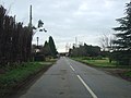
 High Street, Carlton (A1041) - geograph.org.uk - 2275729.jpg 1,600 × 1,200; 374 KB
-
 High Street, Carlton - geograph.org.uk - 5921558.jpg 1,024 × 778; 144 KB
-
 High Street, Carlton - geograph.org.uk - 6215430.jpg 1,600 × 1,065; 490 KB
-
 High Street, Carlton - geograph.org.uk - 6215459.jpg 1,600 × 1,065; 566 KB
-
 Highway Board boundary marker - geograph.org.uk - 654949.jpg 427 × 640; 106 KB
-
 Hirst Road at Greenacres - geograph.org.uk - 4795083.jpg 1,024 × 768; 132 KB
-
 Hirst Road at New Coates Farm - geograph.org.uk - 4795091.jpg 1,024 × 768; 143 KB
-
 Hirst Road from a footpath to Snaith - geograph.org.uk - 5781411.jpg 640 × 427; 241 KB
-
 Hirst Road near Low Street - geograph.org.uk - 5781407.jpg 640 × 427; 221 KB
-
 Hirst Road towards Carlton - geograph.org.uk - 5735231.jpg 1,600 × 1,065; 547 KB
-
 Holly Tree Court, Low Street, Carlton - geograph.org.uk - 6215582.jpg 1,600 × 1,065; 559 KB
-
 Houses on Church Lane, Carlton - geograph.org.uk - 6215458.jpg 1,600 × 1,065; 574 KB
-
 Houses on Mill Lane, Carlton - geograph.org.uk - 6215368.jpg 1,600 × 1,065; 503 KB
-
 Houses on Mill Lane, Carlton - geograph.org.uk - 6215370.jpg 1,600 × 1,065; 428 KB
-
 Hump back level crossing near Carlton, North Yorkshire - geograph.org.uk - 6043858.jpg 5,376 × 3,024; 5.03 MB
-
 Hump back level crossing near Carlton, North Yorkshire - geograph.org.uk - 6043860.jpg 5,376 × 3,024; 2.2 MB
-
 Ings Lane - geograph.org.uk - 1287369.jpg 640 × 480; 110 KB
-
 Ings Lane - geograph.org.uk - 2275701.jpg 1,600 × 1,200; 398 KB
-
 Ings Lane - geograph.org.uk - 6309055.jpg 640 × 480; 102 KB
-
 Ings Lane, Carlton - geograph.org.uk - 3029179.jpg 1,024 × 768; 185 KB
-
 Jacky Duffin Wood level crossing - geograph.org.uk - 6015785.jpg 1,280 × 962; 335 KB
-
 Jacky Duffin Wood level crossing - geograph.org.uk - 6015791.jpg 960 × 1,280; 470 KB
-

-
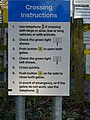 Jacky Duffin Wood level crossing – instructions - geograph.org.uk - 6015788.jpg 960 × 1,280; 363 KB
-
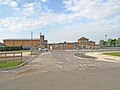
 Jandrem Industrial Estate, Carlton, North Yorkshire - geograph.org.uk - 6043855.jpg 5,376 × 3,024; 4.9 MB
-
 Jowland Winn - geograph.org.uk - 1347641.jpg 640 × 480; 98 KB
-
 Jowland Winn - geograph.org.uk - 2396699.jpg 1,600 × 1,200; 541 KB
-

-
 Lane at Carlton Ings, North Yorkshire - geograph.org.uk - 316978.jpg 640 × 480; 147 KB
-
 Lane from Quosquo Hall to Jowland Winn Lane - geograph.org.uk - 3032300.jpg 1,024 × 768; 168 KB
-
 Lane to Quosquo Hall - geograph.org.uk - 3029059.jpg 1,024 × 768; 173 KB
-
 Leaving Carlton - geograph.org.uk - 5995180.jpg 1,024 × 576; 91 KB
-
 Lets ditch it here - geograph.org.uk - 664021.jpg 640 × 480; 336 KB
-
 Level crossing near Carlton - geograph.org.uk - 2275532.jpg 1,600 × 1,200; 400 KB
-
 Level crossing on Hanger Lane - geograph.org.uk - 6215894.jpg 1,600 × 1,065; 744 KB
-
-
 Level Crossing over Hirst Road - geograph.org.uk - 5781415.jpg 640 × 427; 218 KB
-
 Level Crossing, Hirst Road - geograph.org.uk - 2396709.jpg 1,600 × 1,200; 553 KB
-
 Linwith Lane level crossing - geograph.org.uk - 6015773.jpg 1,280 × 846; 243 KB
-
 Lone tree in barley field - geograph.org.uk - 3032647.jpg 1,024 × 768; 217 KB
-
 Long Hedge Lane towards Carlton - geograph.org.uk - 6215252.jpg 1,600 × 1,065; 496 KB
-
 Long Hedge Lane towards Mill Lane, Carlton - geograph.org.uk - 6215365.jpg 1,600 × 1,065; 831 KB
-

-
 Looking west to the level crossing on Hirst Road - geograph.org.uk - 4802082.jpg 1,024 × 768; 140 KB
-
 Low Street - geograph.org.uk - 5781398.jpg 640 × 427; 275 KB
-
 Low Street at Lynwith Lane, Carlton - geograph.org.uk - 6215497.jpg 1,600 × 1,065; 589 KB
-
 Low Street, Carlton - geograph.org.uk - 6215491.jpg 1,600 × 1,065; 611 KB
-
 Low Street, Carlton - geograph.org.uk - 6215584.jpg 1,600 × 1,065; 647 KB
-
 Lynwith Lane - geograph.org.uk - 259202.jpg 640 × 425; 71 KB
-
 Marsh Lane - geograph.org.uk - 5654598.jpg 1,024 × 768; 362 KB
-
 Marsh Lane - geograph.org.uk - 5654711.jpg 1,024 × 768; 320 KB
-
 Marsh Lane - geograph.org.uk - 5654874.jpg 1,024 × 768; 291 KB
-
 Marsh Lane - geograph.org.uk - 6016403.jpg 1,280 × 960; 727 KB
-
 Marsh Lane - geograph.org.uk - 6016426.jpg 1,280 × 960; 524 KB
-
 Marsh Lane - geograph.org.uk - 663596.jpg 640 × 480; 345 KB
-
 Mill Lane - geograph.org.uk - 6309056.jpg 640 × 480; 101 KB
-
 Mill Lane heading east - geograph.org.uk - 2275699.jpg 1,600 × 1,200; 369 KB
-
 Mill Lane Junction - geograph.org.uk - 1287399.jpg 640 × 480; 78 KB
-
 Mill Lane near Park Farm - geograph.org.uk - 5921553.jpg 1,024 × 755; 163 KB
-
 Mill Lane, Carlton - geograph.org.uk - 1287378.jpg 640 × 480; 56 KB
-
 Mill Lane, Carlton - geograph.org.uk - 1287387.jpg 640 × 480; 43 KB
-
 Mill Lane, Carlton - geograph.org.uk - 2275695.jpg 1,600 × 1,200; 620 KB
-
 Mill Lane, Carlton - geograph.org.uk - 284790.jpg 640 × 480; 128 KB
-
 Mill Lane, Carlton - geograph.org.uk - 6016393.jpg 1,280 × 955; 357 KB
-
 Mill Lane, Carlton - geograph.org.uk - 6215367.jpg 1,600 × 1,065; 553 KB
-
 Mill Lane, Carlton - geograph.org.uk - 6215423.jpg 1,600 × 1,065; 527 KB
-
 Mr Blue Sky - geograph.org.uk - 664333.jpg 640 × 480; 201 KB
-
 Neat ditch - geograph.org.uk - 664367.jpg 640 × 480; 329 KB
-
 New Bank, Carlton - geograph.org.uk - 1735638.jpg 640 × 480; 94 KB
-
 Overgrown Drain alongside Wheels Lane - geograph.org.uk - 3032654.jpg 1,024 × 768; 236 KB
-
 Paddock at Carlton Caravan Site, off Race Lane - geograph.org.uk - 4795073.jpg 1,024 × 768; 537 KB
-
 Parkland at Carlton Towers - geograph.org.uk - 6309057.jpg 640 × 480; 133 KB
-
 Path leading to Clay Pit Lane - geograph.org.uk - 6215590.jpg 1,600 × 1,065; 529 KB
-
 Path leading to Clay Pit Lane - geograph.org.uk - 6215603.jpg 1,600 × 1,065; 527 KB
-
 Path leading to Clay Pit Lane - geograph.org.uk - 6215605.jpg 1,600 × 1,065; 716 KB


_-_geograph.org.uk_-_2275729.jpg)


