Category:Carrathool
Jump to navigation
Jump to search
village in Australia  | |||||
| Upload media | |||||
| Instance of | |||||
|---|---|---|---|---|---|
| Location |
| ||||
| Population |
| ||||
| Elevation above sea level |
| ||||
 | |||||
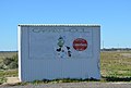
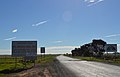
English: Carrathool ( north of the Sturt Highway between Darlington Point and Hay (on the opposite side of the Murrumbidgee River to the highway). The village is situated on the plain a few kilometres north of the river, clustered around the now-disused railway station.
Nederlands: Carrathool is een plaats in de Australische deelstaat Nieuw-Zuid-Wales en telt 99 (schatting) inwoners (2006).
Subcategories
This category has the following 8 subcategories, out of 8 total.
B
C
- Carrathool Bridge (20 F)
- Carrathool Public School (3 F)
- Carrathool Racecourse (3 F)
- Carrathool railway station (7 F)
Media in category "Carrathool"
The following 20 files are in this category, out of 20 total.
-
 Carrathool Bus Stop.JPG 5,439 × 3,652; 5.81 MB
-
 Carrathool Hay Branch Line.JPG 6,016 × 4,000; 8.43 MB
-
 Carrathool Herriott St.JPG 6,016 × 4,000; 9 MB
-
 Carrathool Lawrence Park.JPG 5,401 × 3,735; 9.07 MB
-
 Carrathool Murrumbidgee River 001.JPG 6,016 × 4,000; 10.17 MB
-
 Carrathool Murrumbidgee River 002.JPG 6,016 × 4,000; 8.58 MB
-
 Carrathool NSW 2711, Australia - panoramio (1).jpg 3,280 × 2,168; 1.3 MB
-
 Carrathool Road Advisory Sign.JPG 5,714 × 3,663; 7.27 MB
-
 Carrathool Sturt Highway Intersection.JPG 5,154 × 3,602; 5.82 MB
-
 Carrathool Town Entry Sign North.JPG 5,753 × 3,690; 6.67 MB
-
 Carrathool Town Entry Sign South.JPG 5,627 × 3,636; 6.75 MB
-
 Carrathool Underground Cable Marker.JPG 4,000 × 6,016; 11.22 MB
-
 Carrathool Wade Street 001.JPG 6,016 × 4,000; 11.43 MB
-
 Carrathool Wade Street Park.JPG 6,016 × 4,000; 11.1 MB
-
 CarrathoolMurrumbidgee River001.JPG 3,872 × 2,592; 2.25 MB
-
 CarrathoolMurrumbidgeeRiver002.JPG 3,872 × 2,592; 2.3 MB
-
 CarrathoolRoadSign.JPG 3,248 × 2,160; 1.47 MB
-
 CarrathoolTownEntrySign.JPG 3,580 × 2,416; 1.85 MB
-
 Dromaius novaehollandiae, Carrathool, NSW 1.jpg 1,600 × 1,200; 1.13 MB
-
 Sheep 41.JPG 194 × 194; 11 KB


.jpg)


