Category:Category B listed buildings in East Ayrshire
Jump to navigation
Jump to search
Council areas (municipalities) of Scotland: Aberdeen · Aberdeenshire · Angus · Argyll and Bute · Clackmannanshire · Dumfries and Galloway · Dundee · East Ayrshire · East Dunbartonshire · East Lothian · East Renfrewshire · Edinburgh · Falkirk · Fife · Glasgow · Highland · Inverclyde · Midlothian · Moray · North Ayrshire · North Lanarkshire · Outer Hebrides · Orkney Islands · Perth and Kinross · Renfrewshire · Scottish Borders · Shetland Islands · South Ayrshire · South Lanarkshire · Stirling · West Dunbartonshire · West Lothian
Wikimedia category | |||||
| Upload media | |||||
| Instance of | |||||
|---|---|---|---|---|---|
| |||||
Subcategories
This category has the following 37 subcategories, out of 37 total.
A
- Annick Water viaduct (12 F)
- Auchenharvie Castle (8 F)
B
- Barony Colliery (30 F)
- Burns Monument, Kilmarnock (5 F)
- Burnton Viaduct (12 F)
C
D
- Dean Castle Dower House (5 F)
E
- East Mossgiel Farm (4 F)
F
- Fenwick Kirk (81 F)
G
- Glaisnock Viaduct (4 F)
J
K
- Kilmarnock cholera pit (3 F)
- Kilmarnock railway station (90 F)
- Kilmarnock railway viaduct (10 F)
- Kilmaurs mercat cross (4 F)
L
- Lainshaw House (6 F)
N
- Newmilns Tower (2 F)
- Newmilns Viaduct (6 F)
O
- Ochiltree Market Cross (11 F)
- Old Barskimming Bridge (7 F)
- Old Courthouse, Kilmarnock (2 F)
P
- Poosie Nansie's (8 F)
R
S
- Sorn Castle Entrance Lodge (1 F)
T
- Terringzean Castle (11 F)
- The Palace Bar, Waterside (2 F)
W
Media in category "Category B listed buildings in East Ayrshire"
The following 14 files are in this category, out of 14 total.
-
 Ayrshire New Cumnock Nith Bridge.jpg 3,968 × 2,976; 10.43 MB
-
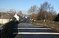 Bridge over the river Doon, Dalrymple - geograph.org.uk - 1150706.jpg 640 × 418; 235 KB
-
 Derelict Farm Steading. - geograph.org.uk - 433059.jpg 640 × 480; 71 KB
-
 East Ayrshire - Dumfries House, Coach Houses - 20220913173012.jpg 4,000 × 3,000; 4.53 MB
-
 East Ayrshire - Dumfries House, Coach Houses - 20220913173035.jpg 4,000 × 3,000; 4.85 MB
-
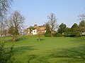
 Glaisnock House, Cumnock - geograph.org.uk - 207078.jpg 640 × 430; 96 KB
-
 Kilmarnock War Memorial.jpg 2,848 × 2,134; 1.12 MB
-
 Lainshaw Mains Farm - geograph.org.uk - 1632519.jpg 635 × 476; 134 KB
-
 Lamlash House (Formerly Bank House).jpg 1,124 × 976; 816 KB
-
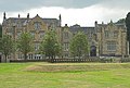
 National Burns Memorial Homes - Mauchline.JPG 2,150 × 1,308; 1.56 MB
-
 Ochiltree, East Ayrshire.jpg 640 × 480; 70 KB
-
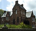
 Shawhill House, Crookedholm.JPG 2,288 × 1,712; 1.34 MB
-
 Sorn bridge over the river Ayr - geograph.org.uk - 106820.jpg 640 × 480; 176 KB
-
 Weston Tavern, Kilmaurs - geograph.org.uk - 1715046.jpg 3,648 × 2,736; 2.96 MB


.jpg)


