Category:Catharijnepoort (Dordrecht)
Jump to navigation
Jump to search
| Object location | | View all coordinates using: OpenStreetMap |
|---|
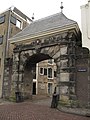
city gate in Dordrecht, Netherlands  | |||||
| Upload media | |||||
| Instance of | |||||
|---|---|---|---|---|---|
| Location | Dordrecht, South Holland, Netherlands | ||||
| Street address |
| ||||
| Heritage designation |
| ||||
 | |||||
Nederlands: Catharijnepoort
|
This is a category about rijksmonument number 13489
|
| Address |
|
Media in category "Catharijnepoort (Dordrecht)"
The following 29 files are in this category, out of 29 total.
-
 13489 Catharijnepoort.jpg 2,117 × 3,000; 4.76 MB
-
 Aanzicht Catharijnepoort - Dordrecht - 20060332 - RCE.jpg 958 × 1,200; 186 KB
-
 Catharijnepoort - Dordrecht - 20060320 - RCE.jpg 1,200 × 781; 253 KB
-
 Catharijnepoort aan de Hooikade - Dordrecht - 20060321 - RCE.jpg 892 × 1,200; 223 KB
-
 Catharijnepoort aan de Hooikade - Dordrecht - 20060322 - RCE.jpg 878 × 1,200; 229 KB
-
 Catharijnepoort aan de Hooikade - Dordrecht - 20060323 - RCE.jpg 884 × 1,200; 210 KB
-
 Catharijnepoort Korte Engelenburgerkade, Dordrecht (24625980006).jpg 4,000 × 6,000; 11.93 MB
-

-
 Catharijnepoort, Hooikade, Dordrecht (26032598454).jpg 4,008 × 6,012; 11.48 MB
-
 Catharijnepoort, Korte Engelenburgerkade, Dordrecht (26572853201).jpg 4,000 × 6,000; 10.8 MB
-
 Dordrecht (The Netherlands) 05.JPG 3,240 × 4,320; 2.68 MB
-
 Dordrecht (The Netherlands) 07.JPG 3,240 × 4,320; 3 MB
-
 Dordrecht (The Netherlands) 08.JPG 4,320 × 3,240; 2.78 MB
-
Dordrecht, Holland's aelteste Stadt-114838.ogv 12 min 35 s, 384 × 288; 119.38 MB
-
 Dordrecth Catharijnepoort 017 9447.jpg 5,939 × 3,959; 21.37 MB
-
 Groenmarkt, 3311 Dordrecht, Netherlands - panoramio (41).jpg 4,896 × 3,264; 3.3 MB
-
 May 2009 in Dordrecht 15.jpg 2,592 × 3,888; 9.36 MB
-
 May 2009 in Dordrecht 20.jpg 2,592 × 3,888; 8.65 MB
-
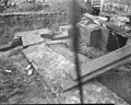
 Opgraving bij de Catharijnepoort - Dordrecht - 20060325 - RCE.jpg 958 × 1,200; 356 KB
-
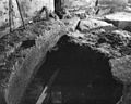
 Opgraving bij de Catharijnepoort - Dordrecht - 20060326 - RCE.jpg 1,200 × 964; 315 KB
-
 Opgraving bij de Catharijnepoort - Dordrecht - 20060327 - RCE.jpg 1,200 × 958; 346 KB
-
 Opgraving bij de Catharijnepoort - Dordrecht - 20060328 - RCE.jpg 1,200 × 958; 335 KB
-
 Opgraving bij de Catharijnepoort - Dordrecht - 20060329 - RCE.jpg 1,200 × 957; 292 KB
-
 Overzicht poort - Dordrecht - 20376972 - RCE.jpg 1,200 × 1,200; 362 KB
-
 Overzicht poort aan stadzijde - Dordrecht - 20411426 - RCE.jpg 907 × 1,200; 268 KB
-
 Overzicht stadspoort buitenzijde - Dordrecht - 20319002 - RCE.jpg 913 × 1,200; 252 KB
-

-
 RM13489 Dordrecht - Catharijnepoort.jpg 2,448 × 3,264; 1.93 MB
-


.jpg)

.jpg)
.jpg)
_05.JPG)
_07.JPG)
_08.JPG)

.jpg)


