Category:Caves in Devon
Jump to navigation
Jump to search
Ceremonial counties of England: Devon · East Riding of Yorkshire · Merseyside ·
City-counties:
Former historic counties: Westmorland ·
Other former counties:
City-counties:
Former historic counties: Westmorland ·
Other former counties:
| Upload media | |||||
| Location |
| ||||
|---|---|---|---|---|---|
| |||||
Subcategories
This category has the following 6 subcategories, out of 6 total.
A
- Ash Hole Cavern (6 F)
B
- Beer Quarry Caves (8 F)
C
- Caves in Lundy (1 F)
K
- Kents Cavern (71 F)
R
- Reeds Cave (6 F)
W
- Windmill Hill Cavern (7 F)
Media in category "Caves in Devon"
The following 41 files are in this category, out of 41 total.
-
 Baker's Pit Cave entrance in 1961.jpg 996 × 823; 274 KB
-

-
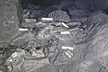
 BeerStoneMineAdit.jpg 2,816 × 2,112; 2.27 MB
-
 Benson's Cave - geograph.org.uk - 601551.jpg 450 × 600; 140 KB
-
-
 Briary Cave, Watermouth, Ilfracombe (NBY 438165).jpg 2,336 × 3,600; 2.17 MB
-
 Brixham - Churston Cove - geograph.org.uk - 1625337.jpg 640 × 480; 130 KB
-
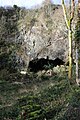
 Cave near Durl Head.jpg 6,000 × 4,000; 13 MB
-
 Cave, Tom Tizzard's Hole, Beer - geograph.org.uk - 218527.jpg 640 × 480; 129 KB
-
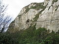
 Caves in the chalk near Beer. - geograph.org.uk - 770935.jpg 640 × 480; 107 KB
-
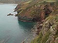
 Caves on Rillage Point - geograph.org.uk - 819523.jpg 640 × 425; 72 KB
-
 Chalk cliffs, Beer - geograph.org.uk - 7260.jpg 640 × 480; 133 KB
-
 Cliffs west of Durl Head - geograph.org.uk - 1049159.jpg 640 × 480; 85 KB
-
 Cow Cave Gate.jpg 5,152 × 3,864; 4.27 MB
-
 Crookhorn Cavern Ilfracombe by Stephen Thompson 1875.jpg 865 × 712; 234 KB
-
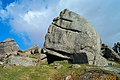 Cuckoo rock - Dartmoor - geograph.org.uk - 21345.jpg 640 × 425; 118 KB
-
 Desolation Point. Exmoor - geograph.org.uk - 643726.jpg 480 × 640; 97 KB
-

-
 Entrance to Cow Cave, Chudleigh Rocks.jpg 5,152 × 3,864; 5.69 MB
-
 Entrance to Fairy's Hole, Chudleigh Rocks.jpg 5,152 × 3,864; 3.95 MB
-
 Entrance to potato cave - geograph.org.uk - 1763455.jpg 1,024 × 683; 308 KB
-
 Grotto beside the Long Quarry Path.jpg 6,000 × 4,000; 12.83 MB
-
 Higher Kiln Quarry Caves - geograph.org.uk - 1097485.jpg 640 × 427; 120 KB
-
 Higher Kiln Quarry Caves - geograph.org.uk - 1097493.jpg 640 × 427; 131 KB
-
 Higher Kiln Quarry Caves, Buckfastleigh - geograph.org.uk - 1137038.jpg 427 × 640; 125 KB
-
 Kitley Show Cave, Yealmpton, Devon.jpg 1,000 × 676; 776 KB
-

-
 Open cave at Middle Tor - geograph.org.uk - 895452.jpg 640 × 485; 50 KB
-
 Pixie's Hole, Chudleigh Rocks.jpg 5,468 × 5,793; 28.99 MB
-
 Plant on rock roof of Middle Tor cave - geograph.org.uk - 895459.jpg 640 × 485; 118 KB
-
 Potato cave - geograph.org.uk - 1408684.jpg 640 × 427; 91 KB
-
 Pridhamsleigh Cavern, Devon. - geograph.org.uk - 1197963.jpg 457 × 640; 103 KB
-
 Puritans Pit.jpg 1,200 × 627; 272 KB
-
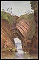
 Saxon arches - geograph.org.uk - 832383.jpg 409 × 283; 32 KB
-
 Sea Cave (4901825039).jpg 2,736 × 3,648; 4.44 MB
-
 Small cove and cave, Hartland Quay - geograph.org.uk - 1318917.jpg 480 × 640; 162 KB
-
 The Gun Caverns. - geograph.org.uk - 644878.jpg 480 × 640; 68 KB
-
 Watermouth caves Ilfracombe England.jpg 832 × 1,075; 195 KB
-
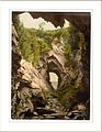
 Watermouth caves, Ilfracombe, England-LCCN2002696821.jpg 2,727 × 3,700; 3.5 MB
-
 Watermouth caves, Ilfracombe, England-LCCN2002696821.tif 2,727 × 3,700; 28.9 MB
-
 Within a Cave near the Mill Pond below Berry Pomeroy Castle.jpg 3,464 × 4,618; 3.08 MB


.jpg)


.jpg)


