Category:Cedar River
Jump to navigation
Jump to search
river in King County, Washington, United States  | |||||
| Upload media | |||||
| Instance of | |||||
|---|---|---|---|---|---|
| Location | Washington, Pacific Northwest, Washington, Pacific States Region | ||||
| Length |
| ||||
| Mouth of the watercourse | |||||
| Tributary |
| ||||
| Different from | |||||
 | |||||
Cedar River flows from Chester Morse Lake to Lake Washington.
See also Category:Seattle water supply system.
Subcategories
This category has the following 8 subcategories, out of 8 total.
C
- Cedar Falls Hydroelectric Works (53 F)
- Cedar River pipe line (30 F)
- Cedar River Trail (14 F)
- Chester Morse Lake (15 F)
L
- Landsburg Park (12 F)
M
Media in category "Cedar River"
The following 48 files are in this category, out of 48 total.
-
 Alders 7419.jpg 3,072 × 4,608; 5.85 MB
-

-
 Cedar Creek dam and falls at Hall, Washington (4153665111).jpg 2,502 × 1,690; 741 KB
-
 Cedar Creek Falls at high water (4154427784).jpg 3,277 × 1,893; 571 KB
-
 Cedar Creek Falls near Hall, Washington (4154427290).jpg 3,265 × 1,881; 676 KB
-
 Cedar Falls, 1917 (47307484572).jpg 700 × 919; 138 KB
-
 Cedar River - 1900.jpg 637 × 765; 144 KB
-
 Cedar River 0004.jpg 4,608 × 3,072; 4.41 MB
-
 Cedar River 7404.jpg 4,608 × 3,072; 5.75 MB
-
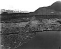
 Cedar River dam under construction.jpg 2,179 × 1,190; 1.08 MB
-
 Cedar River development, 1911 (49469116676).jpg 1,200 × 953; 456 KB
-
 Cedar River development, 1930 (33753217314).jpg 1,200 × 958; 349 KB
-

-
 Cedar River hydroelectric project, 1920 (CURTIS 538).jpeg 768 × 593; 71 KB
-
 Cedar River hydroelectric project, 1920 (CURTIS 539).jpeg 768 × 623; 81 KB
-
 Cedar River hydroelectric project, 1920 (CURTIS 540).jpeg 768 × 626; 56 KB
-
 Cedar River Watershed land ownership map, 1920 (51897543771).jpg 3,040 × 1,620; 869 KB
-
 Cedar River Watershed, 1911 (36952091370).jpg 1,200 × 971; 594 KB
-
 Cedar River Watershed, 1911 (50148622247).jpg 699 × 566; 129 KB
-
 Cedar River Watershed, Washington, 1990 (29734917991).jpg 1,200 × 785; 204 KB
-
 Cedar River, ca. 1880 - DPLA - 260c13789f5b549a39333660b29a25f5.jpg 5,171 × 3,231; 1.67 MB
-
 Cedar river.jpg 800 × 600; 183 KB
-
 Cedarrivermap.png 2,083 × 2,225; 1.59 MB
-
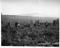
 Cleared land in Cedar River Watershed, 1911 (38955058432).jpg 1,200 × 977; 457 KB
-
-

-

-
 Family at their house in the Cedar River Watershed, 1911 (30481322108).gif 1,200 × 968; 805 KB
-
 Fish Creek, Cedar River watershed, 2000 (27511917171).jpg 576 × 864; 178 KB
-
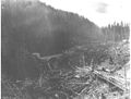
 Logged land in Cedar River Watershed, 1923 (50372616956).jpg 700 × 537; 117 KB
-

-
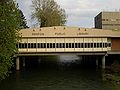
 Looking downstream on Cedar River from Renton, WA public library.jpg 3,264 × 2,448; 2.17 MB
-

-
 Mature sockeye salmon in Cedar River Watershed, 2000 (21767360964).jpg 800 × 597; 155 KB
-

-
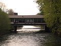
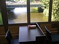 Renton library over river (1457024718).jpg 1,024 × 768; 672 KB
-
 Renton Library; "sitting by the brook, reading my book." (1457024168).jpg 1,024 × 768; 714 KB
-
 Renton, WA - tubing on the Cedar River 01.jpg 3,264 × 2,448; 1.42 MB
-
 Renton, WA - tubing on the Cedar River 02.jpg 3,264 × 2,448; 2.26 MB
-
 Renton-Library-3560.jpg 2,048 × 1,536; 1.1 MB
-
 Renton-Library-3561.jpg 2,048 × 1,536; 1.13 MB
-

-

-

-
 Seattle watershed is protected (10508482514).jpg 2,048 × 1,536; 977 KB
-

-
-

.jpeg)
.jpg)
.jpg)
.jpg)
.jpg)


.jpg)
.jpg)
.jpeg)
.jpeg)
.jpeg)
.jpeg)
.jpg)
.jpg)
.jpg)
.jpg)


.jpeg)
.jpg)
.jpg)
.gif)
.jpg)
.jpg)
.jpeg)

.jpg)
.jpg)
.jpeg)
.jpg)
.jpg)


.jpg)
.jpg)
.jpeg)
.jpg)
.jpeg)
.jpg)
.jpg)
.jpg)