Category:Cemetery in Janów Podlaski
Jump to navigation
Jump to search
| Object location | | View all coordinates using: OpenStreetMap |
|---|
 | |||||
| Upload media | |||||
| Instance of | |||||
|---|---|---|---|---|---|
| Location | Janów Podlaski, Gmina Janów Podlaski, Biała Podlaska County, Lublin Voivodeship, Poland | ||||
| Heritage designation |
| ||||
 | |||||
Polski: Janów Podlaski, zespół cmentarza katolicko-unickiego, później także prawosławnego, ob. rzym.-kat.:
- cmentarz unicki, ob. rzym.-kat., k. XVIII, 1930 (ID 604185)
- kaplica cmentarna pw. św. Rocha, poł. XIX (ID 604186)
- ogrodzenie z bramą, 1936, l. 80. XX (ID 604187)
Media in category "Cemetery in Janów Podlaski"
The following 39 files are in this category, out of 39 total.
-
 Alexandrowicz tablica kaplica cmentarna Janów.jpg 2,560 × 1,920; 1.99 MB
-
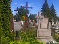
 Cmentarz Janów.jpg 2,560 × 1,920; 2.81 MB
-
 Cmentarz Janów2.jpg 2,560 × 1,920; 2.59 MB
-
 Cmentarz unicki (XVIIIw.) - Janów Podlaski powiat bialski woj. lubelskie ArPiCh A-79.JPG 3,648 × 2,736; 4.14 MB
-

-

-

-
 Groby Jaszczyńskich i Izabeli Orłowskiej.jpg 2,560 × 1,920; 2.74 MB
-
 Groby Orłowskich Janów.jpg 1,920 × 2,560; 2.3 MB
-
 Groby przy kaplicy w Janowie.jpg 2,560 × 1,920; 1.62 MB
-
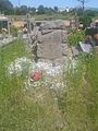
 Grób Alexandra Richtha.jpg 1,920 × 2,560; 2.17 MB
-
 Grób Jakuba Zdanowskiego powstańca.jpg 1,920 × 2,560; 2.2 MB
-
 Grób Ludwika Bryndzy Janów.jpg 1,920 × 2,560; 1.43 MB
-
 Grób Makarego Chojnackiego detal.jpg 1,920 × 2,560; 2.04 MB
-
 Grób Makarego Chojnackiego.jpg 1,920 × 2,560; 2.1 MB
-
 Grób Rościszewskiego prezydenta Suwałk.jpg 1,920 × 2,560; 2.87 MB
-
 Grób Serwińskich z Klonownicy.jpg 1,920 × 2,560; 2.34 MB
-
 Grób Stokowskich.jpg 1,920 × 2,560; 2.36 MB
-
 Grób Surdykowskiej i Adamskiej.jpg 1,920 × 2,560; 2.57 MB
-
 Grób Tomasza Horocha Janów.jpg 1,920 × 2,560; 2.66 MB
-
 Grób Wiktora Maleszewskiego w Janowie.jpg 1,920 × 2,560; 2.34 MB
-
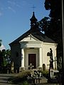 JanowPodlaski KaplicaSwRocha.jpg 1,536 × 2,048; 1.32 MB
-
 Janów cmentarz kwatera przy kaplicy.jpg 2,560 × 1,920; 2.14 MB
-
 Janów grób 1896.jpg 1,920 × 2,560; 2.74 MB
-
 Janów nagrobek prawosławny.jpg 1,920 × 2,560; 1.94 MB
-
 Maleszewski grób Janów.jpg 1,920 × 2,560; 2.88 MB
-
 Nagrobek polskich żołnierzy Janów.jpg 1,920 × 2,560; 2.76 MB
-
 Nagrobki duchowieństwa na cmentarzu w Janowie.jpg 2,560 × 1,920; 2.86 MB
-
 Nagrobki duchownych prawosławnych Janów.jpg 1,920 × 2,560; 1.65 MB
-
 Nagrobki prawosławne Janów.jpg 1,920 × 2,560; 1.8 MB
-
 Nagrobki z XIX w. Janów.jpg 2,560 × 1,920; 2.54 MB
-
 PL Janow Podlaski, cmentarz, brama.jpg 1,919 × 1,000; 1.17 MB
-
 PL Janow Podlaski, cmentarz, kaplica.jpg 2,592 × 1,944; 1.14 MB
-
 PL Janow Podlaski, cmentarz, pomnik.jpg 1,944 × 2,592; 2.34 MB
-
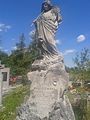
 Pomnik powstańców na cmentarzu w Janowie.jpg 1,920 × 2,560; 2.44 MB
-
 Stanisław Urniaż zniszczony nagrobek Janów.jpg 1,920 × 2,560; 2.38 MB
-
 Tablica nagrobna Serwińskich.jpg 1,920 × 2,560; 2.34 MB
-
 XIX-wieczny nagrobek Janów.jpg 1,920 × 2,560; 2.82 MB
-
 Zniszczony nagrobek Janów.jpg 1,920 × 2,560; 2.72 MB


_-_Jan%C3%B3w_Podlaski_powiat_bialski_woj._lubelskie_ArPiCh_A-79.JPG)
_-_Jan%C3%B3w_Podlaski_powiat_bialski_woj._lubelskie_ArPiCh_A-79.JPG)
_-_Jan%C3%B3w_Podlaski_powiat_bialski_woj._lubelskie_ArPiCh_A-79.JPG)
_-_Jan%C3%B3w_Podlaski_powiat_bialski_woj._lubelskie_ArPiCh_A-79.JPG)


