Category:Cemetery in Kurozwęki
Jump to navigation
Jump to search
| Object location | | View all coordinates using: OpenStreetMap |
|---|
Polski: Kurozwęki, ul. Kościelna - cmentarz parafialny
 | |||||
| Upload media | |||||
| Instance of | |||||
|---|---|---|---|---|---|
| Location | Kurozwęki, Gmina Staszów, Staszów County, Świętokrzyskie Voivodeship, Poland | ||||
| Street address |
| ||||
| Heritage designation |
| ||||
 | |||||
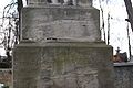
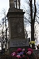
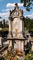
Media in category "Cemetery in Kurozwęki"
The following 10 files are in this category, out of 10 total.
-
 Kurozweki cmentarz brama p8212251.jpg 3,648 × 2,056; 1.42 MB
-
 422 A Cmentarz parafialny Kurozwęki 2.jpg 3,872 × 2,592; 909 KB
-
 422 A Cmentarz parafialny Kurozwęki 3.jpg 2,592 × 3,872; 1.56 MB
-
 422 A Cmentarz parafialny Kurozwęki 4.jpg 2,592 × 3,872; 1.28 MB
-
 422 A Cmentarz parafialny Kurozwęki 5.jpg 3,629 × 2,331; 1.4 MB
-
 422 A Cmentarz parafialny Kurozwęki.jpg 2,592 × 3,872; 1.8 MB
-
 Kurozweki cmentarz p8212247.jpg 2,056 × 3,648; 1.04 MB
-
 Kurozweki cmentarz p8212250.jpg 2,056 × 3,648; 1.13 MB
-
 Kurozweki cmentarz p8212253.jpg 2,056 × 3,648; 1.37 MB
-
 Kurozweki cmentarz p8212255.jpg 2,056 × 3,648; 1.46 MB


