Category:Central Europe
둘러보기로 이동
검색으로 이동
유럽의 지역 .svg) | |||||
| 미디어 올리기 | |||||
| 다음 종류에 속함 | |||||
|---|---|---|---|---|---|
| 다음의 한 부분임 | |||||
| 다음으로 이루어져 있음 | |||||
 | |||||
하위 분류
다음은 이 분류에 속하는 하위 분류 21개 가운데 21개입니다.
"Central Europe" 분류에 속하는 미디어
다음은 이 분류에 속하는 파일 47개 가운데 47개입니다.
-
 Balkans year 925.png 472 × 605; 288 KB
-
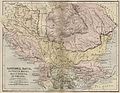
 BalkVolkPutzger1898.jpg 2,033 × 1,890; 2.96 MB
-

-
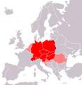
 Central Europe (countries and regions).PNG 1,218 × 1,245; 82 KB
-
 Central Europe (definitions).png 6,460 × 3,403; 1.36 MB
-
 Central Europe (MODIS 2020-11-22).jpg 3,937 × 3,189; 1.61 MB
-
 Central Europe (proposal 1).PNG 1,218 × 1,245; 81 KB
-
 Central Europe - Envisat.jpg 2,295 × 3,000; 4.84 MB
-
 Central Europe on February 16, 2017.jpg 6,400 × 5,000; 6.77 MB
-
 Central Europemap Pannonia Dacia and others.jpg 3,717 × 2,866; 1.11 MB
-
 Centraleu2.jpg 343 × 296; 16 KB
-
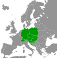
 CentralEurope2.PNG 1,093 × 1,093; 155 KB
-
En-us-Central Europe.ogg 1.1 s; 13 KB
-
 Europa srodkowa-mapa.png 507 × 422; 36 KB
-
 Europe centrale, Castellan.png 839 × 854; 269 KB
-
 Europe centrale, Wackermann.png 841 × 852; 271 KB
-
 Europe midpoint.jpg 800 × 704; 146 KB
-
 Europe médiane, Czesław Miłosz.png 839 × 830; 274 KB
-
 Europe médiane.png 834 × 851; 282 KB
-
 Germanisch-Slawisch-Ungarisches Mitteleuropa um 1000.jpg 602 × 821; 574 KB
-
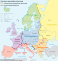 Grossgliederung Europas-ua.svg 631 × 659; 1,017 KB
-
 Handbücher der Binnenfischerei Mitteleuropas, der Seefischerei Nordeuropas.png 1,277 × 477; 1.21 MB
-
 Islamic occupation of the central part of the Hungarian Kingdom - 1629.tif 6,390 × 5,084; 52.38 MB
-
Jer-Ûrope du Mitan.ogg 1.4 s; 16 KB
-
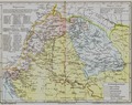
 KaisertumOsterreich-es.svg 855 × 642; 321 KB
-
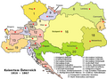 KaisertumOsterreich.png 800 × 593; 213 KB
-
 Karte von Deutschland, dem Königr. der Niederlande und der Schweiz.jpg 5,821 × 4,769; 7.38 MB
-
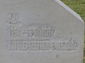
 Kitelepítettek emlékműve (2).jpg 4,000 × 3,000; 4.76 MB
-
 Kitelepítettek emlékműve (3).jpg 4,000 × 3,000; 4.55 MB
-
 Kitelepítettek emlékműve (4).jpg 4,000 × 3,000; 4.5 MB
-
 Kitelepítettek emlékműve.jpg 4,000 × 3,000; 4.6 MB
-
 Map of Central Europe.png 415 × 422; 12 KB
-
 Map of the Austrian Empire, 1855.jpg 640 × 522; 87 KB
-
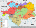 Minorités ethniques d'Autriche-Hongrie (1910).svg 1,360 × 1,052; 1.24 MB
-
 Mittel- und Südosteuropa.jpg 8,745 × 10,228; 10.38 MB
-

-
 Neutral and Non-Aligned European States.png 697 × 684; 92 KB
-
 Regnum Marianum.png 1,299 × 964; 2.1 MB
-
Ro-Europa Centrală.ogg 2.0 s; 25 KB
-
 Rough Map of German speaking countries and partitions.png 2,048 × 1,360; 92 KB
-
 Silesia-map-es.svg 547 × 508; 311 KB
-
 Silesia-map.svg 547 × 508; 306 KB
-
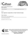 Sub-regional cooperation in East Central Europe (IA subregionalcoope109452950).pdf 1,275 × 1,650, 88쪽; 5.27 MB
-
 Tower - Great Owl Mountains - Poland - panoramio.jpg 1,046 × 700; 871 KB
-
-
-
 Örkény István Színház.jpg 4,000 × 3,000; 5.17 MB


.PNG)
.png)
.jpg)
.PNG)


.jpg)
.jpg)
.jpg)


.svg)

._Entrance_exsample._4900_-_4700_BC.jpg)


