Category:Central Europe
Jump to navigation
Jump to search
region of Europe .svg) | |||||
| Upload media | |||||
| Instance of | |||||
|---|---|---|---|---|---|
| Part of | |||||
| Has part(s) | |||||
 | |||||
Subcategories
This category has the following 20 subcategories, out of 20 total.
Pages in category "Central Europe"
This category contains only the following page.
Media in category "Central Europe"
The following 54 files are in this category, out of 54 total.
-
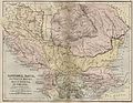
 Balkans year 925.png 472 × 605; 288 KB
-
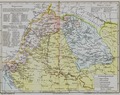
 BalkVolkPutzger1898.jpg 2,033 × 1,890; 2.96 MB
-
 Candace OWENS (2).jpg 2,736 × 3,648; 1.07 MB
-
 Candace OWENS (3).jpg 2,677 × 2,788; 1.11 MB
-
 Candace OWENS - CPAC Hungary 2022.jpg 5,120 × 2,901; 3.02 MB
-
 Candace OWENS.jpg 2,736 × 3,648; 1.04 MB
-

-
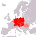
 Central Europe (countries and regions).PNG 1,218 × 1,245; 82 KB
-
 Central Europe (definitions).png 6,460 × 3,403; 1.36 MB
-
 Central Europe (MODIS 2020-11-22).jpg 3,937 × 3,189; 1.61 MB
-
 Central Europe (proposal 1).PNG 1,218 × 1,245; 81 KB
-
 Central Europe - Envisat.jpg 2,295 × 3,000; 4.84 MB
-
 Central Europe on February 16, 2017.jpg 6,400 × 5,000; 6.77 MB
-
 Central Europemap Pannonia Dacia and others.jpg 3,717 × 2,866; 1.11 MB
-
 Centraleu2.jpg 343 × 296; 16 KB
-
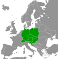
 CentralEurope2.PNG 1,093 × 1,093; 155 KB
-
En-us-Central Europe.ogg 1.1 s; 13 KB
-
 Europa srodkowa-mapa.png 507 × 422; 36 KB
-
 Europe centrale, Castellan.png 839 × 854; 269 KB
-
 Europe centrale, Wackermann.png 841 × 852; 271 KB
-
 Europe midpoint.jpg 800 × 704; 146 KB
-
 Europe médiane, Czesław Miłosz.png 839 × 830; 274 KB
-
 Europe médiane.png 834 × 851; 282 KB
-
 Germanisch-Slawisch-Ungarisches Mitteleuropa um 1000.jpg 602 × 821; 574 KB
-
 Grossgliederung Europas-ua.svg 631 × 659; 1,017 KB
-
 Handbücher der Binnenfischerei Mitteleuropas, der Seefischerei Nordeuropas.png 1,277 × 477; 1.21 MB
-
 Islamic occupation of the central part of the Hungarian Kingdom - 1629.tif 6,390 × 5,084; 52.38 MB
-
Jer-Ûrope du Mitan.ogg 1.4 s; 16 KB
-
 KaisertumOsterreich-es.svg 855 × 642; 321 KB
-
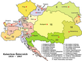 KaisertumOsterreich.png 800 × 593; 213 KB
-
 Karte von Deutschland, dem Königr. der Niederlande und der Schweiz (3).jpg 5,788 × 4,686; 8.13 MB
-
 Karte von Deutschland, dem Königr. der Niederlande und der Schweiz.jpg 5,821 × 4,769; 7.38 MB
-
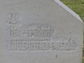
 Kitelepítettek emlékműve (2).jpg 4,000 × 3,000; 4.76 MB
-
 Kitelepítettek emlékműve (3).jpg 4,000 × 3,000; 4.55 MB
-
 Kitelepítettek emlékműve (4).jpg 4,000 × 3,000; 4.5 MB
-
 Kitelepítettek emlékműve.jpg 4,000 × 3,000; 4.6 MB
-
 Magyarország XII-XIII század második felében.jpg 2,062 × 3,231; 2.7 MB
-
 Map of Central Europe.png 415 × 422; 12 KB
-
 Map of the Austrian Empire, 1855.jpg 640 × 522; 87 KB
-
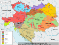 Minorités ethniques d'Autriche-Hongrie (1910).svg 1,360 × 1,052; 1.24 MB
-
 Mittel- und Südosteuropa.jpg 8,745 × 10,228; 10.38 MB
-

-

-
 Regnum Marianum.png 1,299 × 964; 2.1 MB
-
Ro-Europa Centrală.ogg 2.0 s; 25 KB
-
 Rough Map of German speaking countries and partitions.png 2,048 × 1,360; 92 KB
-
 Silesia-map-es.svg 547 × 508; 311 KB
-
 Silesia-map.svg 547 × 508; 306 KB
-
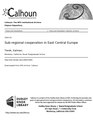 Sub-regional cooperation in East Central Europe (IA subregionalcoope109452950).pdf 1,275 × 1,650, 88 pages; 5.27 MB
-
 Süd-Östliches Deutschland, enthält die Oesterreichischen Lande.jpg 1,681 × 1,987; 1.12 MB
-
 Tower - Great Owl Mountains - Poland - panoramio.jpg 1,046 × 700; 871 KB
-
-
-
 Örkény István Színház.jpg 4,000 × 3,000; 5.17 MB


.jpg)
.jpg)


.PNG)
.png)
.jpg)
.PNG)


.jpg)

.jpg)
.jpg)
.jpg)


.svg)

._Entrance_exsample._4900_-_4700_BC.jpg)


