Category:Chagford
Jump to navigation
Jump to search
town and civil parish in Devon, England  | |||||
| Upload media | |||||
| Instance of | |||||
|---|---|---|---|---|---|
| Located in protected area | |||||
| Location | West Devon, Devon, South West England, England | ||||
| Area |
| ||||
| Said to be the same as | Chagford (Wikimedia duplicated page, civil parish) | ||||
| official website | |||||
 | |||||
Subcategories
This category has the following 15 subcategories, out of 15 total.
2
B
- Batworthy (8 F)
C
- Chagford Bridge (5 F)
F
- Fernworthy Reservoir (37 F)
- Frenchbeer (3 F)
G
- Great Weeke (19 F)
K
- Kestor Rock (9 F)
M
- Meldon Hill, Chagford (9 F)
R
T
- The Market House, Chagford (9 F)
- Three Crowns, Chagford (5 F)
W
- Week Down Cross (5 F)
Y
- Yellam, Devon (7 F)
Media in category "Chagford"
The following 200 files are in this category, out of 853 total.
(previous page) (next page)-
 "Unsuitable for motors" - geograph.org.uk - 1468797.jpg 640 × 480; 85 KB
-
 20130813.Chagford.-011.jpg 5,344 × 4,008; 2.02 MB
-
 20130813.Chagford.-012.jpg 5,960 × 7,425; 2.45 MB
-
 20130813.Chagford.-013.jpg 5,915 × 4,437; 2.07 MB
-
 20130813.Chagford.-014.jpg 5,477 × 4,108; 2.59 MB
-
 20130813.Chagford.-015.jpg 5,504 × 4,128; 2.43 MB
-
 20130813.Chagford.-016.jpg 5,504 × 4,128; 2.67 MB
-
 20130813.Chagford.-017.jpg 5,220 × 3,915; 3 MB
-
 20130813.Chagford.-018.jpg 5,760 × 4,320; 3 MB
-
 A Book of the West - Barrow on Chagford Common.png 1,716 × 2,687; 517 KB
-
 A gate on the bridleway - geograph.org.uk - 5943297.jpg 4,320 × 3,240; 4.57 MB
-
 A gate on the path - geograph.org.uk - 5941147.jpg 4,089 × 3,065; 4.18 MB
-
 A Murder of Crows - At Lower Shapley Farm - geograph.org.uk - 4546370.jpg 3,888 × 5,184; 5.63 MB
-
 A small earth wall in the valley near Horselake - geograph.org.uk - 5931408.jpg 1,600 × 1,200; 991 KB
-
 A very soggy Two Moors Way - geograph.org.uk - 4328474.jpg 800 × 532; 153 KB
-
 A View of Jurston - geograph.org.uk - 6165016.jpg 1,600 × 1,200; 503 KB
-
 A way to the fields - geograph.org.uk - 5943296.jpg 4,320 × 3,240; 4.6 MB
-
 A382 just north of Easton - geograph.org.uk - 3923331.jpg 1,600 × 1,021; 266 KB
-
 Across the field - geograph.org.uk - 5942345.jpg 4,320 × 3,240; 4.53 MB
-
 Adley House - geograph.org.uk - 5942433.jpg 4,320 × 3,240; 2.35 MB
-
 Adley Lane, east of Chagford - geograph.org.uk - 4228396.jpg 1,600 × 1,064; 615 KB
-
 Aladdin's cave - geograph.org.uk - 3053637.jpg 1,024 × 768; 180 KB
-
 Ancient thorn in front of Middle Tor - geograph.org.uk - 895440.jpg 640 × 485; 102 KB
-
 Animals grazing at Lower Shapley - geograph.org.uk - 1589014.jpg 640 × 480; 89 KB
-
 Approaching Chagford Bridge - geograph.org.uk - 3345397.jpg 640 × 500; 95 KB
-
 Approaching Thorn - geograph.org.uk - 3001795.jpg 480 × 640; 117 KB
-
 Ash house, Yellands - geograph.org.uk - 1468882.jpg 480 × 640; 125 KB
-

-
 B3212 crossing Dartmoor - geograph.org.uk - 5257478.jpg 640 × 426; 38 KB
-
 Bales by Stiniel Cross - geograph.org.uk - 1469242.jpg 640 × 480; 95 KB
-
 Bales, Batworthy Mill Cross - geograph.org.uk - 4142441.jpg 1,882 × 1,347; 693 KB
-

-
 Barn and letterbox, Middlecott - geograph.org.uk - 5699782.jpg 4,101 × 2,789; 2.03 MB
-
 Barn at Yeo - geograph.org.uk - 3001939.jpg 640 × 480; 107 KB
-
 Barn, Rushford Barton - geograph.org.uk - 2999257.jpg 640 × 480; 98 KB
-
 Barns near Hole Farm - geograph.org.uk - 3001638.jpg 640 × 480; 88 KB
-
 Barns, Rushford Mill Farm - geograph.org.uk - 5083893.jpg 2,000 × 1,333; 2.11 MB
-
 Batworthy Corner - geograph.org.uk - 1710987.jpg 640 × 480; 130 KB
-
 Batworthy Corner - geograph.org.uk - 1710991.jpg 640 × 450; 83 KB
-
 Batworthy Mill Cross - geograph.org.uk - 4142385.jpg 1,920 × 1,440; 744 KB
-
 Bedford, Chagford - View at Holy Street.jpg 6,107 × 3,052; 18.61 MB
-
 Between the gardens - geograph.org.uk - 5942395.jpg 3,240 × 4,320; 5.39 MB
-
 Blacks Delicatessen - geograph.org.uk - 6274909.jpg 3,024 × 4,032; 2.65 MB
-
 Boulder dyking - geograph.org.uk - 895402.jpg 640 × 485; 100 KB
-
 Bovey valley near Jurston Cross - geograph.org.uk - 1468896.jpg 640 × 442; 87 KB
-
 Bridge near Forder - geograph.org.uk - 3922713.jpg 1,920 × 1,440; 720 KB
-
 Bridleway approaching Hurston - geograph.org.uk - 4571873.jpg 800 × 532; 187 KB
-
 Bridleway junction near Yellam - geograph.org.uk - 3344088.jpg 640 × 480; 116 KB
-
 Bridleway leaves the road - geograph.org.uk - 5933714.jpg 4,320 × 3,240; 4.7 MB
-
 Bridleway to Chagford Common - geograph.org.uk - 3354993.jpg 1,024 × 683; 254 KB
-
 Bridleway to Hurston - geograph.org.uk - 4571866.jpg 800 × 532; 166 KB
-
 Bridleway to Yellam - geograph.org.uk - 3344056.jpg 640 × 480; 126 KB
-
-

-
 Broom Hill - geograph.org.uk - 5942389.jpg 4,320 × 3,240; 3.78 MB
-
 Buildings at Thorn - geograph.org.uk - 3001836.jpg 640 × 480; 102 KB
-
 Bullers Arms, Chagford - geograph.org.uk - 3857475.jpg 480 × 640; 58 KB
-
 Bullocks near Thorn - geograph.org.uk - 1469421.jpg 640 × 368; 64 KB
-
 Byway from Leigh Bridge to Teigncombe - geograph.org.uk - 4229366.jpg 1,600 × 1,064; 561 KB
-
 Cairn and stone row on Shovel Down - geograph.org.uk - 1512904.jpg 640 × 427; 92 KB
-
 Car park by the cross - geograph.org.uk - 5937497.jpg 4,320 × 3,240; 3.11 MB
-
 Car park entrance near Water Hill - geograph.org.uk - 4034657.jpg 640 × 348; 79 KB
-
 Car park in Chagford - geograph.org.uk - 3068770.jpg 1,000 × 750; 458 KB
-
 Castle Drogo from Chagford (6209).jpg 4,288 × 2,848; 4.98 MB
-
 Castle Drogo under wraps - geograph.org.uk - 3923328.jpg 4,912 × 3,264; 5.38 MB
-
 Cattle above Drewston - geograph.org.uk - 4141917.jpg 1,920 × 1,261; 712 KB
-
 Cattle grazing east of Chagford - geograph.org.uk - 5899257.jpg 1,600 × 1,200; 980 KB
-
 Cattle Grazing Valley Bottom Land - geograph.org.uk - 5537174.jpg 1,024 × 768; 416 KB
-
-
 Cattle grid near Yardworthy - geograph.org.uk - 1588978.jpg 640 × 480; 108 KB
-
 Cattle grid on Meldon Road, Chagford - geograph.org.uk - 3068751.jpg 1,000 × 750; 550 KB
-
 Cattle grid on the edge of open moor - geograph.org.uk - 3068565.jpg 1,000 × 750; 557 KB
-
 Cattle grid on Week Down - geograph.org.uk - 1940642.jpg 640 × 480; 78 KB
-
 Cattle grid, Nattadon Common - geograph.org.uk - 3343195.jpg 640 × 480; 95 KB
-
 Cattle near Batworthy Corner - geograph.org.uk - 6256758.jpg 4,000 × 3,000; 4.83 MB
-
 Cattle near Cleave Wood - geograph.org.uk - 4142652.jpg 1,920 × 1,308; 677 KB
-
 Chagford (2022-08-25) 01.jpg 5,568 × 3,712; 21.2 MB
-
 Chagford (2022-08-25) 06.jpg 5,568 × 3,712; 12.25 MB
-
 Chagford (2022-08-25) 07.jpg 5,568 × 3,712; 25.42 MB
-
 Chagford (2022-08-25) 08.jpg 5,568 × 3,712; 23.97 MB
-
 Chagford (2022-08-25) 10.jpg 5,568 × 3,712; 20.9 MB
-
 Chagford (2022-08-25) 29.jpg 3,712 × 5,568; 17.51 MB
-
 Chagford (2022-08-25) 31.jpg 3,712 × 5,568; 14.69 MB
-
 Chagford (2022-08-25) 32.jpg 3,712 × 5,568; 19.67 MB
-
 Chagford (2022-08-25) 33.jpg 5,568 × 3,712; 21.88 MB
-
 Chagford (2022-08-25) 34.jpg 3,712 × 5,568; 17.45 MB
-
 Chagford (2022-08-25) 36.jpg 5,568 × 3,712; 18.15 MB
-
 Chagford (2022-08-25) 37.jpg 5,568 × 3,712; 15.46 MB
-
 Chagford (2022-08-25) 38.jpg 5,568 × 3,712; 12.74 MB
-
 Chagford (2022-08-25) 39.jpg 5,568 × 3,712; 13.22 MB
-
 Chagford (2022-08-25) 40.jpg 3,712 × 5,568; 14.07 MB
-
 Chagford (2022-08-25) 41.jpg 3,712 × 5,568; 14.05 MB
-
 Chagford (2022-08-25) 42.jpg 3,712 × 5,568; 15.49 MB
-
 Chagford (2022-08-25) 43.jpg 3,712 × 5,568; 13.02 MB
-
 Chagford (2022-08-25) 44.jpg 3,712 × 5,568; 15.69 MB
-
 Chagford (2022-08-25) 45.jpg 5,568 × 3,712; 16.11 MB
-
 Chagford (2022-08-25) 47.jpg 3,712 × 5,568; 15.52 MB
-
 Chagford (2022-08-25) 50.jpg 5,568 × 3,712; 13.6 MB
-
 Chagford (2022-08-25) 52.jpg 3,712 × 5,568; 16.36 MB
-
 Chagford (2022-08-25) 53.jpg 3,712 × 5,568; 14.14 MB
-
 Chagford (2022-08-25) 54.jpg 5,568 × 3,712; 14.97 MB
-
 Chagford (2022-08-25) 56.jpg 5,568 × 3,712; 13.33 MB
-
 Chagford (2022-08-25) 57.jpg 5,568 × 3,712; 14.69 MB
-
 Chagford (2022-08-25) 59.jpg 5,568 × 3,712; 14.61 MB
-
 Chagford (2022-08-25) 64.jpg 5,568 × 3,712; 21.3 MB
-
 Chagford (2022-08-25) 65.jpg 5,568 × 3,712; 15.12 MB
-
 Chagford (2022-08-25) 66.jpg 5,568 × 3,712; 14.72 MB
-
 Chagford (2022-08-25) 67.jpg 5,568 × 3,712; 13.94 MB
-
 Chagford (2022-08-25) 68.jpg 5,568 × 3,712; 15.21 MB
-
 Chagford (2022-08-25) 69.jpg 5,568 × 3,712; 12.76 MB
-
 Chagford (2022-08-25) 70.jpg 5,568 × 3,712; 12.28 MB
-
 Chagford (2022-08-25) 71.jpg 3,712 × 5,568; 16.09 MB
-
 Chagford (2022-08-25) 73.jpg 5,568 × 3,712; 12.38 MB
-
 Chagford (2022-08-25) 76.jpg 5,568 × 3,712; 13.84 MB
-
 Chagford (2022-08-25) 77.jpg 5,568 × 3,712; 14.42 MB
-
 Chagford (2022-08-25) 78.jpg 5,568 × 3,712; 12.26 MB
-
 Chagford (2022-08-25) 79.jpg 5,568 × 3,712; 12.27 MB
-
 Chagford (2022-08-25) 80.jpg 5,568 × 3,712; 14.69 MB
-
 Chagford (2022-08-25) 81.jpg 3,712 × 5,568; 13.75 MB
-
 Chagford (2022-08-25) 87.jpg 3,712 × 5,568; 13.53 MB
-
 Chagford (2022-08-25) 88.jpg 5,568 × 3,712; 13.07 MB
-
 Chagford (2022-08-25) 89.jpg 3,712 × 5,568; 14.49 MB
-
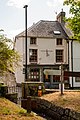
 Chagford Bridge (1) - geograph.org.uk - 5941097.jpg 4,320 × 3,240; 4.65 MB
-
 Chagford Bridge (2) - geograph.org.uk - 5941109.jpg 4,320 × 3,240; 5.26 MB
-
 Chagford Bridge - geograph.org.uk - 3066473.jpg 1,000 × 750; 642 KB
-
 Chagford Bridge - geograph.org.uk - 5083898.jpg 2,000 × 1,333; 3.14 MB
-
 Chagford Common - geograph.org.uk - 1356933.jpg 640 × 427; 60 KB
-
 Chagford Common - geograph.org.uk - 1710997.jpg 640 × 480; 112 KB
-
 Chagford Common - geograph.org.uk - 6277037.jpg 1,600 × 1,200; 821 KB
-
 Chagford cricket ground - geograph.org.uk - 3001564.jpg 640 × 480; 99 KB
-
 Chagford cricket ground - geograph.org.uk - 716818.jpg 640 × 480; 61 KB
-
 Chagford Fire Station - geograph.org.uk - 68022.jpg 640 × 426; 195 KB
-
 Chagford from Meldon Hill - geograph.org.uk - 1478783.jpg 640 × 480; 87 KB
-
 Chagford from Meldon Hill - geograph.org.uk - 1479104.jpg 640 × 480; 114 KB
-
 Chagford from Nattadon Common - geograph.org.uk - 5944187.jpg 4,320 × 3,240; 3.91 MB
-
 Chagford Health centre - geograph.org.uk - 3053599.jpg 1,024 × 768; 268 KB
-
 Chagford house (12) - geograph.org.uk - 5945217.jpg 4,320 × 3,240; 2.6 MB
-
 Chagford houses (1) - geograph.org.uk - 5941045.jpg 4,083 × 3,063; 2.29 MB
-
 Chagford houses (10) - geograph.org.uk - 5945186.jpg 4,109 × 3,083; 1.85 MB
-
 Chagford houses (11) - geograph.org.uk - 5945194.jpg 4,320 × 3,240; 2 MB
-
 Chagford houses (13) - geograph.org.uk - 5945226.jpg 4,109 × 3,083; 1.71 MB
-
 Chagford houses (4) - geograph.org.uk - 5944241.jpg 4,320 × 3,240; 3.09 MB
-
 Chagford houses (5) - geograph.org.uk - 5944246.jpg 4,320 × 3,240; 2.5 MB
-
 Chagford houses (6) - geograph.org.uk - 5944248.jpg 4,320 × 3,240; 2.09 MB
-
 Chagford houses (8) - geograph.org.uk - 5945175.jpg 4,109 × 3,083; 2.02 MB
-
 Chagford houses (9) - geograph.org.uk - 5945177.jpg 4,320 × 3,240; 2.27 MB
-
 Chagford houses (geograph 5944225).jpg 4,320 × 3,240; 4.78 MB
-
 Chagford houses (geograph 5945174).jpg 4,320 × 3,240; 3.85 MB
-
 Chagford open air swimming pool - geograph.org.uk - 5931443.jpg 1,600 × 1,200; 807 KB
-
 Chagford post office and pillar box - geograph.org.uk - 716281.jpg 390 × 640; 52 KB
-

-
 Chagford Square - geograph.org.uk - 3955033.jpg 1,280 × 851; 308 KB
-
 Chagford Swimming Pool - geograph.org.uk - 89389.jpg 640 × 480; 114 KB
-
 Chagford swimming pool building - geograph.org.uk - 5931441.jpg 1,600 × 1,200; 805 KB
-
 Chagford swimming pool entrance - geograph.org.uk - 5899230.jpg 1,600 × 1,200; 932 KB
-
 Chagford Wool Mill - geograph.org.uk - 5083902.jpg 2,000 × 1,333; 3.34 MB
-
 Chagford's famous ironmongery stores, Webbers and Bowdens - Flickr - exfordy.jpg 3,888 × 2,592; 5.22 MB
-
 Chagford's famous ironmongery stores, Webbers and Bowdens.jpg 3,888 × 2,592; 558 KB
-
 Chagford, bowling green - geograph.org.uk - 4055812.jpg 1,600 × 1,200; 491 KB
-
 Chagford, bridge over the South Teign - geograph.org.uk - 3652385.jpg 640 × 427; 244 KB
-
 Chagford, by the Teign - geograph.org.uk - 2090836.jpg 640 × 427; 506 KB
-
 Chagford, Dogmarsh Wood - geograph.org.uk - 4055853.jpg 1,600 × 1,200; 1.03 MB
-

-
 Chagford, footpath to Dogmarsh Bridge - geograph.org.uk - 4080790.jpg 768 × 1,024; 294 KB
-
 Chagford, Higher Corndon - geograph.org.uk - 2475287.jpg 640 × 427; 333 KB
-
 Chagford, into the Deer Park - geograph.org.uk - 4080796.jpg 1,600 × 1,200; 1.04 MB
-
 Chagford, leat to mill at Yeo - geograph.org.uk - 3652381.jpg 640 × 427; 275 KB
-
 Chagford, Mill Cottage - geograph.org.uk - 4080793.jpg 1,600 × 1,200; 811 KB
-
 Chagford, Mill End Hotel - geograph.org.uk - 4055856.jpg 1,600 × 1,200; 704 KB
-
 Chagford, Mill Street - geograph.org.uk - 4055820.jpg 1,600 × 1,200; 467 KB
-
 Chagford, Millbrook detail - geograph.org.uk - 4055830.jpg 1,024 × 768; 127 KB
-
 Chagford, Moorlands - geograph.org.uk - 4055807.jpg 1,600 × 1,200; 513 KB
-
 Chagford, near Mill End Hotel - geograph.org.uk - 2090842.jpg 640 × 427; 502 KB
-
 Chagford, new primary school - geograph.org.uk - 5632748.jpg 1,410 × 1,600; 769 KB
-
 Chagford, New Street - geograph.org.uk - 2913626.jpg 640 × 480; 77 KB
-
 Chagford, North Street - geograph.org.uk - 4152227.jpg 1,600 × 1,067; 611 KB
-
 Chagford, path to Whiddon Park House - geograph.org.uk - 4055905.jpg 1,067 × 1,600; 706 KB
-

-
 Chagford, The Bishop's House - geograph.org.uk - 5632744.jpg 1,200 × 1,600; 413 KB
-
 Chagford, the river Teign - geograph.org.uk - 2090850.jpg 640 × 427; 494 KB
-
 Chagford, the Teign - geograph.org.uk - 4055901.jpg 1,600 × 1,067; 672 KB
-
 Chagford, the Teign - geograph.org.uk - 4055908.jpg 1,600 × 1,067; 669 KB
-
 Chagford, towards Whiddon Park - geograph.org.uk - 4055899.jpg 1,600 × 1,067; 648 KB
-

-
 Chagford, woodland path - geograph.org.uk - 2090855.jpg 640 × 427; 543 KB
-
 Chagford-temp-banner.jpg 1,769 × 251; 175 KB
-
 Clapper bridge - geograph.org.uk - 3355012.jpg 1,024 × 683; 325 KB
-
 Commemorative Plaque - geograph.org.uk - 4400271.jpg 800 × 532; 172 KB
-

-
 Corner of churchyard, Chagford - geograph.org.uk - 716425.jpg 640 × 480; 92 KB
-
 Country west of Chagford - geograph.org.uk - 1478797.jpg 640 × 480; 87 KB
-
 Countryside around Weddicott - geograph.org.uk - 1479131.jpg 640 × 414; 92 KB
-
 Countryside at Hillhead Farm - geograph.org.uk - 716054.jpg 640 × 403; 71 KB
-
 Countryside near Coombe Tor - geograph.org.uk - 1355436.jpg 640 × 480; 75 KB
-
 Countryside near Drewston Cross - geograph.org.uk - 4142765.jpg 1,920 × 1,440; 642 KB
-
 Countryside near Middlecott - geograph.org.uk - 1468662.jpg 640 × 480; 112 KB
-
 Countryside near Stiniel - geograph.org.uk - 1469035.jpg 640 × 450; 96 KB
-
 Countryside near Yelfords - geograph.org.uk - 4002828.jpg 1,920 × 1,318; 377 KB
-
 Cricket Ground, Chagford - geograph.org.uk - 1547226.jpg 640 × 480; 81 KB
-
 Cricket match at Chagford - geograph.org.uk - 898399.jpg 640 × 368; 68 KB


.jpg)


_01.jpg)
_06.jpg)
_07.jpg)
_08.jpg)
_10.jpg)
_29.jpg)
_31.jpg)
_32.jpg)
_33.jpg)
_34.jpg)
_36.jpg)
_37.jpg)
_38.jpg)
_39.jpg)
_40.jpg)
_41.jpg)
_42.jpg)
_43.jpg)
_44.jpg)
_45.jpg)
_47.jpg)
_50.jpg)
_52.jpg)
_53.jpg)
_54.jpg)
_56.jpg)
_57.jpg)
_59.jpg)
_64.jpg)
_65.jpg)
_66.jpg)
_67.jpg)
_68.jpg)
_69.jpg)
_70.jpg)
_71.jpg)
_73.jpg)
_76.jpg)
_77.jpg)
_78.jpg)
_79.jpg)
_80.jpg)
_81.jpg)
_87.jpg)
_88.jpg)
_89.jpg)
_-_geograph.org.uk_-_5941097.jpg)
_-_geograph.org.uk_-_5941109.jpg)


_-_geograph.org.uk_-_5945217.jpg)
_-_geograph.org.uk_-_5941045.jpg)
_-_geograph.org.uk_-_5945186.jpg)
_-_geograph.org.uk_-_5945194.jpg)
_-_geograph.org.uk_-_5945226.jpg)
_-_geograph.org.uk_-_5944241.jpg)
_-_geograph.org.uk_-_5944246.jpg)
_-_geograph.org.uk_-_5944248.jpg)
_-_geograph.org.uk_-_5945175.jpg)
_-_geograph.org.uk_-_5945177.jpg)
.jpg)
.jpg)


