Category:Chapelle Saint-Marc de Kervalet (Batz-sur-Mer)
Jump to navigation
Jump to search
| Object location | | View all coordinates using: OpenStreetMap |
|---|
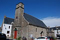
chapel in Batz-sur-Mer, France .jpg) Vue générale de la chapelle. | |||||
| Upload media | |||||
| Instance of | |||||
|---|---|---|---|---|---|
| Dedicated to | |||||
| Made from material | |||||
| Genre | |||||
| Location | Kervalet, Batz-sur-Mer, Loire-Atlantique, Pays de la Loire, Metropolitan France, France | ||||
| Architectural style | |||||
| Diocese | |||||
| Has part(s) | |||||
| Inception |
| ||||
| Width |
| ||||
| Length |
| ||||
| Religion or worldview | |||||
 | |||||
Media in category "Chapelle Saint-Marc de Kervalet (Batz-sur-Mer)"
The following 30 files are in this category, out of 30 total.
-
 44 Eglise Kervalet.JPG 3,872 × 2,592; 4.24 MB
-
 Cadran solaire, Chapelle Saint-Marc de Kervalet, Batz-sur-Mer (1).jpg 3,310 × 2,182; 2.61 MB
-
 Cadran solaire, Chapelle Saint-Marc de Kervalet, Batz-sur-Mer (2).jpg 4,896 × 2,752; 3.18 MB
-
 Cadran solaire, Chapelle Saint-Marc de Kervalet, Batz-sur-Mer (3).jpg 2,623 × 3,269; 2.58 MB
-
 Chapelle Saint-Marc de Kervalet (1).jpg 3,472 × 2,818; 1.53 MB
-
 Chapelle Saint-Marc de Kervalet (2).jpg 3,222 × 2,918; 2.43 MB
-
 Chapelle Saint-Marc de Kervalet (3).jpg 3,000 × 4,000; 3.03 MB
-
 Chapelle Saint-Marc, Kervalet, Batz-sur-Mer, France - Back.jpg 3,076 × 4,576; 6.77 MB
-
 Chapelle Saint-Marc, Kervalet, Batz-sur-Mer, France - Front View.jpg 7,267 × 6,014; 9.5 MB
-
 Chapelle Saint-Marc, Kervalet, Batz-sur-Mer, France - Rear View.jpg 8,724 × 8,267; 19.42 MB
-
 Chapelle Saint-Marc, Kervalet, Batz-sur-Mer, France - Side Door.jpg 4,835 × 6,574; 12.08 MB
-
 Chapelle St Marc Batz-sur-Mer.JPG 4,222 × 3,166; 4.09 MB
-
 Cross and Sundial on Chapelle Saint-Marc, Kervalet, Batz-sur-Mer, France.jpg 5,000 × 5,000; 10.79 MB
-
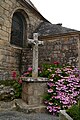 Cross near Chapelle Saint-Marc, Kervalet, Batz-sur-Mer, France.JPG 3,056 × 4,576; 6.77 MB
-
 Vertical Sundial on Chapelle Saint-Marc, Kervalet, Batz-sur-Mer, France.JPG 4,576 × 3,056; 8 MB
-
 W2204-BatzSM Kervalet StMarc XV°1790 93270.JPG 4,752 × 3,168; 5.58 MB
-
 W2205-BatzSM Kervalet StMarc XV°1790 BanniereStJean 93648.JPG 2,370 × 3,544; 2.96 MB
-
 W2206-BatzSM Kervalet StMarc XV°1790 BanniereStMarc 93645.JPG 2,422 × 3,639; 2.78 MB
-
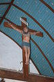 W2207-BatzSM Kervalet StMarc XV°1790 Crucifix 93641.JPG 3,168 × 4,752; 6.32 MB
-
 W2209-BatzSM Kervalet StMarc XV°1790 Jube 93650.JPG 4,752 × 3,168; 5.78 MB
-
 W2210-BatzSM Kervalet StMarc XV°1790 MaitreAutel 93644.JPG 3,168 × 4,752; 6.11 MB
-
 W2211-BatzSM Kervalet StMarc XV°1790 St 93646.JPG 3,168 × 4,752; 5.64 MB
-
 W2212-BatzSM Kervalet StMarc XV°1790 St 93647.JPG 3,168 × 4,752; 5.9 MB
-
 W2213-BatzSM Kervalet StMarc XV°1790 St 93649.JPG 3,168 × 4,752; 6.32 MB
-
 W2214-BatzSM Kervalet StMarc XV°1790 StClair 93642.JPG 3,168 × 4,752; 5.54 MB
-
 W2215-BatzSM Kervalet StMarc XV°1790 SteAnne 93643.JPG 3,168 × 4,752; 5.03 MB
-
 W2216-BatzSM Kervalet StMarc XV°1790 VitrailMortJoseph 93652.JPG 2,658 × 3,723; 5.6 MB
-
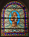 W2217-BatzSM Kervalet StMarc XV°1790 VitrailStAntoine 93651.JPG 2,741 × 3,453; 5.02 MB
-
 Weathercock of Saint-Marc chapel of Kervalet (1).jpg 1,519 × 2,340; 786 KB
-
 Weathercock of Saint-Marc chapel of Kervalet (2).jpg 1,927 × 3,427; 1.3 MB

.jpg)
.jpg)
.jpg)
.jpg)
.jpg)


.jpg)
.jpg)