Category:Chapelle de Locmaria-er-Hoët
Jump to navigation
Jump to search
| Object location | | View all coordinates using: OpenStreetMap |
|---|
|
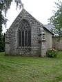
This building is inscrit au titre des monuments historiques de la France. It is indexed in the base Mérimée, a database of architectural heritage maintained by the French Ministry of Culture, under the reference PA00091332
|
| Object location | | View all coordinates using: OpenStreetMap |
|---|
chapel located in Morbihan, in France  | |||||
| Upload media | |||||
| Instance of | |||||
|---|---|---|---|---|---|
| Location | Landévant, Morbihan, Brittany, Q88521114, Metropolitan France, France | ||||
| Street address |
| ||||
| Heritage designation |
| ||||
 | |||||
Media in category "Chapelle de Locmaria-er-Hoët"
The following 12 files are in this category, out of 12 total.
-
 Calvaire Locmaria-er-Hoët.jpg 2,304 × 3,072; 3.75 MB
-
 Chapelle Locmaria-er-Hoët (Landévant).jpg 4,608 × 3,456; 6.86 MB
-
 Chapelle Locmaria-er-Hoët (Landévant)2.jpg 3,456 × 4,608; 6.45 MB
-
 Chapelle Locmaria-er-Hoët (Landévant)3.jpg 4,608 × 3,456; 6.16 MB
-
 Charpente Locmaria-er-Hoët.jpg 2,304 × 3,072; 3.9 MB
-
 Chevet Locmaria-er-Hoët.jpg 2,304 × 3,072; 3.27 MB
-
 Clocher Locmaria-er-Hoët.jpg 2,304 × 3,072; 3.51 MB
-
 Locmaria-er-Hoët.jpg 3,072 × 2,304; 3.66 MB
-
 Peinture Locmaria-er-Hoët.jpg 3,072 × 2,304; 4.11 MB
-
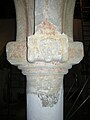 Pilier Nord Locmaria-er-Hoët.jpg 2,304 × 3,072; 3.07 MB
-
 Saint-Paul Locmaria-er-Hoët.jpg 2,304 × 3,072; 4.65 MB
-
 Verrière Chevet Locmaria-er-Hoët.jpg 2,304 × 3,072; 3.35 MB

.jpg)
2.jpg)
3.jpg)


