Category:Charlton-on-Otmoor
Jump to navigation
Jump to search
village and civil parish in Cherwell district, Oxfordshire, England  | |||||
| Upload media | |||||
| Instance of | |||||
|---|---|---|---|---|---|
| Location | Cherwell, Oxfordshire, South East England, England | ||||
| Population |
| ||||
| Area |
| ||||
| official website | |||||
 | |||||
English: Charlton-on-Otmoor is a village and civil parish about south of Bicester in Oxfordshire. The village is close to the River Ray on the northern edge of Otmoor.
Subcategories
This category has the following 2 subcategories, out of 2 total.
C
- Charlton-on-Otmoor Services (22 F)
M
Media in category "Charlton-on-Otmoor"
The following 34 files are in this category, out of 34 total.
-
 A Chiltern Class 165 near Charlton-on-Otmoor - geograph.org.uk - 3131993.jpg 1,024 × 777; 225 KB
-

-
 Base of the cross in St Marys churchyard - geograph.org.uk - 2492849.jpg 1,000 × 1,500; 215 KB
-
 Charlton STW and Hut - geograph.org.uk - 2769021.jpg 1,024 × 616; 143 KB
-
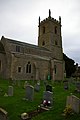
 St Mary the Virgin Church - geograph.org.uk - 1183095.jpg 640 × 480; 51 KB
-
 Charlton-on-Otmoor Tchure.JPG 3,000 × 2,000; 2.56 MB
-
 Charlton-on-Otmoor Telephone Exchange, Oxon (1) - geograph.org.uk - 2279117.jpg 3,072 × 2,304; 1.78 MB
-
 Charlton-on-Otmoor Telephone Exchange, Oxon (2) - geograph.org.uk - 2279138.jpg 3,072 × 2,304; 1.79 MB
-
 Church Lane in Charlton-on-Otmoor - geograph.org.uk - 2492845.jpg 1,500 × 1,000; 214 KB
-
 Church Lane, Charlton-on-Otmoor - geograph.org.uk - 4272121.jpg 1,600 × 1,064; 311 KB
-
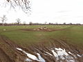
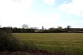 Field by Holts Farm - geograph.org.uk - 2353554.jpg 1,500 × 1,000; 101 KB
-
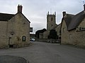
 High Street, Charlton on Otmoor - geograph.org.uk - 2767787.jpg 2,984 × 2,396; 1.4 MB
-
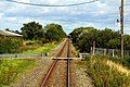
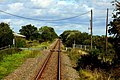 Holts Farm level crossing - geograph.org.uk - 1504909.jpg 640 × 427; 95 KB
-
 Holts Farm level crossing - geograph.org.uk - 1504912.jpg 640 × 427; 99 KB
-
 Lane to Merton - geograph.org.uk - 1183011.jpg 640 × 480; 82 KB
-
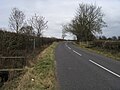
 Mansmoor Road - geograph.org.uk - 1183042.jpg 640 × 480; 83 KB
-
 New Pond Lane - geograph.org.uk - 1183071.jpg 640 × 480; 73 KB
-
 Otter House, Oddington - geograph.org.uk - 2769010.jpg 1,600 × 1,105; 509 KB
-
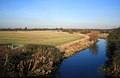 River Ray at Fencott Bridge - geograph.org.uk - 2789215.jpg 1,600 × 1,040; 283 KB
-
 Round the curve to Holts Farm - geograph.org.uk - 1504897.jpg 640 × 427; 90 KB
-
 Sheep and lambs - geograph.org.uk - 352729.jpg 640 × 480; 184 KB
-
 Sheep and Pavilion - geograph.org.uk - 2767801.jpg 1,600 × 1,067; 364 KB
-
 St Mary's church, Charlton-on-Otmoor - geograph.org.uk - 4272116.jpg 1,064 × 1,600; 285 KB
-
 St Mary's church, Charlton-on-Otmoor - geograph.org.uk - 4274275.jpg 1,064 × 1,600; 306 KB
-
 St Mary's church, Charlton-on-Otmoor, The Garland - geograph.org.uk - 4272434.jpg 1,600 × 1,064; 376 KB
-
 St Marys in Charlton-on-Otmoor - geograph.org.uk - 2492842.jpg 1,500 × 1,000; 195 KB
-
 The Crown in Charlton-on-Otmoor - geograph.org.uk - 2492848.jpg 1,500 × 1,000; 180 KB
-
 The Crown, Charlton-on-Otmoor, from the churchyard - geograph.org.uk - 4272499.jpg 1,600 × 1,064; 397 KB
-
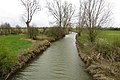
 The River Ray - geograph.org.uk - 742841.jpg 640 × 475; 90 KB
-
 The River Ray from Fencott Bridge - geograph.org.uk - 3981552.jpg 1,500 × 999; 251 KB
-
 The windy road to Charlton-on-Otmmor - geograph.org.uk - 3897198.jpg 1,500 × 999; 168 KB
-
 Home Farm, Charlton on Otmoor - geograph.org.uk - 351935.jpg 640 × 480; 101 KB
-
 Mansmoor Road - geograph.org.uk - 352734.jpg 480 × 640; 242 KB
-
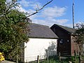
 Open barn - geograph.org.uk - 352740.jpg 640 × 479; 128 KB


_-_geograph.org.uk_-_2279117.jpg)
_-_geograph.org.uk_-_2279138.jpg)


