Category:Checkendon
Jump to navigation
Jump to search
village and civil parish in South Oxfordshire district, Oxfordshire, England  | |||||
| Upload media | |||||
| Instance of | |||||
|---|---|---|---|---|---|
| Location | South Oxfordshire, Oxfordshire, South East England, England | ||||
| Area |
| ||||
| official website | |||||
 | |||||
English: Checkendon is a civil parish and village in South Oxfordshire, England. The parish includes the hamlets of Exlade Street and Hook End. The village is west of Henley-on-Thames.

Subcategories
This category has the following 4 subcategories, out of 4 total.
Media in category "Checkendon"
The following 193 files are in this category, out of 193 total.
-
 'Cedarwood Cottage', Hookend Lane - geograph.org.uk - 5371513.jpg 1,024 × 683; 231 KB
-
 'Heath End Lodge', Hookend Lane - geograph.org.uk - 5371500.jpg 1,024 × 683; 210 KB
-

-
 'White Shutters', Exlade Street - geograph.org.uk - 5333424.jpg 1,024 × 683; 258 KB
-
 1 Langtree Cottages, Checkendon, Oxfordshire - geograph.org.uk - 4622098.jpg 3,762 × 3,809; 2.62 MB
-
 A woodland lane - geograph.org.uk - 5512976.jpg 640 × 480; 207 KB
-

-

-
 Approaching the A4074 - geograph.org.uk - 591807.jpg 640 × 473; 111 KB
-
 Arable land at Checkendon - geograph.org.uk - 1005609.jpg 427 × 640; 175 KB
-
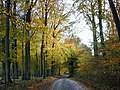
 Autumn colours, Checkendon, Oxfordshire - geograph.org.uk - 4751875.jpg 515 × 640; 240 KB
-
 Barn at Scot's Farm - geograph.org.uk - 3308157.jpg 3,401 × 2,490; 1.3 MB
-

-
 Beech trees, Cane End, Oxfordshire - geograph.org.uk - 4824074.jpg 640 × 447; 188 KB
-
 Benchmark on 'Heath End Lodge' - geograph.org.uk - 5371496.jpg 683 × 1,024; 257 KB
-

-
 Benchmark on 'Whitehall Cottage' - geograph.org.uk - 5265106.jpg 1,024 × 650; 287 KB
-
 Benchmark on building at Wheeler's Farm - geograph.org.uk - 5250928.jpg 1,024 × 683; 277 KB
-
 Benchmark on house at Nut Hatch - geograph.org.uk - 5265102.jpg 1,024 × 683; 309 KB
-
 Benchmark on Lovegrove's Farm - geograph.org.uk - 5251315.jpg 635 × 1,024; 243 KB
-
 Benchmark on Neal's Farm Cottage - geograph.org.uk - 5582723.jpg 640 × 1,024; 191 KB
-
 Benchmark on stable block at The Old Barn House - geograph.org.uk - 5371491.jpg 683 × 1,024; 282 KB
-
 The 'Black Horse' Public House - geograph.org.uk - 808063.jpg 640 × 480; 114 KB
-
 Black Horse pub and outbuildings - geograph.org.uk - 5237967.jpg 1,024 × 683; 159 KB
-

-

-
 Bottom Farm - geograph.org.uk - 1007837.jpg 640 × 427; 192 KB
-
 Braced concrete post beside The Chiltern Way - geograph.org.uk - 5264938.jpg 660 × 1,024; 233 KB
-
 Brick cottage in Checkendon, Oxfordshire, England.jpg 440 × 640; 106 KB
-
 Bridleway and farmland, Checkendon - geograph.org.uk - 1589642.jpg 640 × 480; 165 KB
-
 Bridleway through woods at Checkendon, Oxfordshire.jpg 640 × 477; 145 KB
-
 Bridleway towards Wyfold Lane in Checkendon, Oxfordshire.jpg 477 × 640; 110 KB
-
 Burnt Platt Wood at Checkendon, Oxfordshire.jpg 640 × 481; 43 KB
-
 Bushy Shaw - geograph.org.uk - 3058011.jpg 2,964 × 2,040; 444 KB
-
 Byway, Checkendon, Oxfordshire - geograph.org.uk - 4751145.jpg 640 × 478; 227 KB
-
 Byway, Hammonds, Checkendon - geograph.org.uk - 977141.jpg 480 × 640; 188 KB
-
 Carters Cottage, Exlade Street - geograph.org.uk - 5333404.jpg 1,024 × 683; 235 KB
-
 Beech woods near Hook End - geograph.org.uk - 989471.jpg 480 × 640; 193 KB
-
 Beech woods near Hook End - geograph.org.uk - 989473.jpg 480 × 640; 217 KB
-
 Black Horse pub sign in Checkendon, Oxfordshire.jpg 640 × 480; 48 KB
-
 Checkendon Cricket Club pavilion and outfield - geograph.org.uk - 2889896.jpg 3,648 × 2,736; 2.52 MB
-
 Checkendon Village - geograph.org.uk - 36367.jpg 640 × 481; 39 KB
-
 Checkendon village sign - geograph.org.uk - 1005640.jpg 427 × 640; 183 KB
-
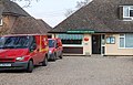 Checkendon Village Store - geograph.org.uk - 377987.jpg 639 × 408; 172 KB
-
 Checkendon, Small village green - geograph.org.uk - 5191798.jpg 3,678 × 2,456; 6.95 MB
-
 Checkendon, UK - panoramio (1).jpg 3,264 × 2,448; 2.88 MB
-
 Checkendon, UK - panoramio (2).jpg 3,264 × 2,448; 1.57 MB
-
 Checkendon, UK - panoramio (3).jpg 3,264 × 2,448; 1.81 MB
-
 Checkendon, UK - panoramio.jpg 3,264 × 2,448; 2.7 MB
-

-
 Clump on Top - geograph.org.uk - 3403621.jpg 2,560 × 1,920; 1.65 MB
-
 Corker's Farm - geograph.org.uk - 1005607.jpg 640 × 427; 169 KB
-
 Corker's Lane bridleway in Checkendon, Oxfordshire.jpg 477 × 640; 146 KB
-
 Corker's Lane bridleway, in Checkendon, Oxfordshire 2.jpg 477 × 640; 142 KB
-
 Corker's Lane bridleway, in Checkendon, Oxfordshire.jpg 477 × 640; 167 KB
-
 Corner of Checkendon Court estate - geograph.org.uk - 591747.jpg 640 × 477; 153 KB
-
 Cottage on Hookend Lane - geograph.org.uk - 591774.jpg 640 × 477; 101 KB
-
 Country crossroads - geograph.org.uk - 5512952.jpg 640 × 480; 135 KB
-
 Country lane, Gallowstree Common, Oxfordshire - geograph.org.uk - 4755356.jpg 5,429 × 3,761; 4.71 MB
-
 Country lane, Hook End, Oxfordshire - geograph.org.uk - 4755339.jpg 521 × 640; 216 KB
-
 Cricket Square - geograph.org.uk - 6078063.jpg 640 × 480; 83 KB
-
 Cycle track in Busgrove Wood - geograph.org.uk - 594854.jpg 640 × 477; 165 KB
-
 Cycle track in Busgrove Wood - geograph.org.uk - 594858.jpg 640 × 477; 121 KB
-
 Damaged benchmark on post beside Bottom Lane - geograph.org.uk - 5264851.jpg 640 × 1,024; 239 KB
-
 Derelict farm building in Checkendon, Oxfordshire.jpg 1,600 × 1,203; 694 KB
-
 Descent to Rummerhedge Farm, in Checkendon, Oxfordshire, England.jpg 640 × 477; 109 KB
-
 Drive to Checkendon Court - geograph.org.uk - 1005651.jpg 640 × 427; 184 KB
-
 Drive to Checkendon Court - geograph.org.uk - 1005653.jpg 640 × 427; 200 KB
-
 Earthwork in New Copse - geograph.org.uk - 1943166.jpg 3,888 × 2,592; 2.49 MB
-
 East Wall of the Fort - geograph.org.uk - 1943192.jpg 2,816 × 1,880; 1.54 MB
-
 Entrance to Bottom Lane Cottage from Bottom Lane - geograph.org.uk - 5250916.jpg 1,024 × 683; 248 KB
-
 Entrance to North Grove woodland - geograph.org.uk - 591716.jpg 640 × 477; 118 KB
-
 Entrance to Payables Farm, Checkendon, Oxfordshire.jpg 640 × 481; 203 KB
-
 Evening walk through Valentine Wood - geograph.org.uk - 591797.jpg 640 × 477; 126 KB
-
 Farmland and path at Checkendon, Oxfordshire.jpg 640 × 481; 264 KB
-
 Farmland at Exlade Street - geograph.org.uk - 1005606.jpg 640 × 427; 154 KB
-
 Farmland near Hammonds at Checkendon, Oxfordshire.jpg 640 × 477; 116 KB
-
 Farmland, Checkendon - geograph.org.uk - 2122857.jpg 640 × 480; 144 KB
-
 Farmland, Checkendon - geograph.org.uk - 2122884.jpg 640 × 480; 162 KB
-
 Farmland, Checkendon - geograph.org.uk - 2680122.jpg 640 × 480; 150 KB
-
 Farmland, Checkendon - geograph.org.uk - 977130.jpg 640 × 480; 136 KB
-
 Farmland, Checkendon - geograph.org.uk - 977131.jpg 640 × 480; 140 KB
-
-
 Field off Park Lane, Checkendon, Oxfordshire.jpg 640 × 481; 203 KB
-
 Field reflected in the evening sunlight - geograph.org.uk - 591775.jpg 640 × 477; 108 KB
-
 Footpath going NE from SU674808 - geograph.org.uk - 37081.jpg 640 × 481; 359 KB
-
 Foundry Cottage, Checkendon, Oxfordshire - geograph.org.uk - 4622228.jpg 800 × 448; 136 KB
-
 Foxgloves on the Fort - geograph.org.uk - 1943157.jpg 2,816 × 1,880; 2.04 MB
-
 Gateway, Exlade Street, Oxfordshire - geograph.org.uk - 4454809.jpg 612 × 800; 236 KB
-
 Hammond's Cottage in Checkendon, Oxfordshire.jpg 640 × 477; 102 KB
-
 Handsome beech trees, Hook End, Oxfordshire - geograph.org.uk - 4749369.jpg 3,967 × 5,345; 6.49 MB
-

-
 Heath End wood at Checkendon, Oxfordshire 2.jpg 640 × 481; 337 KB
-
 Heath End wood at Checkendon, Oxfordshire.jpg 640 × 481; 377 KB
-

-
 House at Lovegrove's Farm, Lovegrove's Lane - geograph.org.uk - 5251327.jpg 1,024 × 712; 144 KB
-
 House at Nut Hatch - geograph.org.uk - 5265103.jpg 1,024 × 683; 224 KB
-

-
 Houses along Wyfold Lane - geograph.org.uk - 3290674.jpg 1,600 × 1,200; 699 KB
-
 Houses in Checkendon - geograph.org.uk - 1005637.jpg 640 × 427; 212 KB
-
 In the Ditch - geograph.org.uk - 1943199.jpg 1,024 × 684; 326 KB
-
 Ipsden Heath - geograph.org.uk - 1005680.jpg 640 × 427; 238 KB
-
 Judges Road - geograph.org.uk - 3033690.jpg 3,264 × 2,192; 1.15 MB
-
 Junction of road with Corker's Lane - geograph.org.uk - 5251512.jpg 1,024 × 683; 194 KB
-
 Junction of rural roads SW of Checkendon - geograph.org.uk - 5250754.jpg 683 × 1,024; 297 KB
-
 Junction on Neals Lane and Busgrove Lane - geograph.org.uk - 5326582.jpg 1,024 × 683; 230 KB
-
 Kate's Cottage, Wyfold Road - geograph.org.uk - 5512946.jpg 640 × 480; 173 KB
-
 Lane along Rummerhedge Bottom - geograph.org.uk - 5512967.jpg 640 × 480; 208 KB
-
 Lane from Woodcote enters Checkendon - geograph.org.uk - 2889940.jpg 3,460 × 2,583; 1.23 MB
-
 Lane north of Checkendon - geograph.org.uk - 5513089.jpg 640 × 480; 200 KB
-
 Lane through the beech woods, Hook End, Oxfordshire - geograph.org.uk - 4739757.jpg 2,414 × 3,380; 5.81 MB
-
 Langtree Cottages in Checkendon - geograph.org.uk - 4752684.jpg 1,500 × 1,125; 160 KB
-
 Langtree Cottages, Checkendon.jpg 1,069 × 1,484; 724 KB
-
 Lay-by near Ipsden - geograph.org.uk - 2166111.jpg 640 × 480; 71 KB
-

-

-
 Listed barn, Exlade Street, Oxfordshire - geograph.org.uk - 4465692.jpg 800 × 567; 154 KB
-
 Logging near Checkendon - geograph.org.uk - 2909160.jpg 1,600 × 1,200; 1.05 MB
-
 Looking Death in the face - geograph.org.uk - 4390202.jpg 1,024 × 683; 91 KB
-

-

-

-
 Name by the Foot - geograph.org.uk - 4390208.jpg 1,024 × 683; 150 KB
-
 Natural art - geograph.org.uk - 1005664.jpg 426 × 640; 171 KB
-
 Neal's Cottage, Neal's Lane - geograph.org.uk - 5582745.jpg 1,024 × 683; 208 KB
-
 Neal's Farm - geograph.org.uk - 3503413.jpg 3,368 × 1,876; 847 KB
-
 Neal's Shaw - geograph.org.uk - 3503430.jpg 2,232 × 3,352; 1.96 MB
-
 Nippers Grove - geograph.org.uk - 2133653.jpg 640 × 427; 273 KB
-

-
 Nuba at Dusk - geograph.org.uk - 4390193.jpg 1,024 × 683; 64 KB
-
 Nuba Evening - geograph.org.uk - 4390204.jpg 1,024 × 683; 91 KB
-
 Nuba Survival - geograph.org.uk - 4390195.jpg 533 × 800; 77 KB
-
 Odd Setting - geograph.org.uk - 4390199.jpg 1,024 × 683; 67 KB
-
 Old Posts in the Woods - geograph.org.uk - 2851023.jpg 3,588 × 2,232; 1.8 MB
-
 Old Tree and Old Barn - geograph.org.uk - 2315788.jpg 2,530 × 2,019; 878 KB
-
 Ouseley Barn - geograph.org.uk - 3403639.jpg 2,560 × 1,920; 1.25 MB
-
 Ouseley Farmhouse - geograph.org.uk - 5250904.jpg 1,024 × 683; 179 KB
-
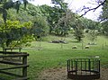
 Paddock behind the church - geograph.org.uk - 1005654.jpg 640 × 427; 195 KB
-
 Park Lane - geograph.org.uk - 989478.jpg 640 × 480; 176 KB
-
 Pasture and farm buildings, Checkendon - geograph.org.uk - 2680140.jpg 640 × 480; 152 KB
-
 Pastures in woodland, Checkendon - geograph.org.uk - 676668.jpg 640 × 480; 192 KB
-
 Path into Hammond's Wood in Checkendon, Oxfordshire.jpg 640 × 477; 153 KB
-
 Path through Chartersfield Wood - geograph.org.uk - 593835.jpg 640 × 477; 142 KB
-
 Path to Wheeler's Copse - geograph.org.uk - 6078130.jpg 640 × 480; 104 KB
-
 Path towards Corker's Lane - geograph.org.uk - 6078070.jpg 640 × 480; 84 KB
-
 Pavilion and cricket field, Checkendon - geograph.org.uk - 3010738.jpg 2,560 × 1,920; 1.13 MB
-

-
 Permissive path into Nippers Grove - geograph.org.uk - 593801.jpg 640 × 477; 145 KB
-
 Pheasant Madras Please^ - geograph.org.uk - 2315771.jpg 2,721 × 2,041; 1.39 MB
-
 Philip Koomen Furniture, Bradley's Street - geograph.org.uk - 5250934.jpg 1,024 × 732; 181 KB
-
 Pig pens, Busgrove Wood - geograph.org.uk - 5513060.jpg 640 × 480; 213 KB
-
 Pigs not in clover - geograph.org.uk - 5514466.jpg 640 × 480; 180 KB
-
 Pond at Corker's Farm - geograph.org.uk - 1005608.jpg 640 × 427; 218 KB
-
 Pond near Whitewood Heath - geograph.org.uk - 591803.jpg 640 × 477; 139 KB
-
 Pony at Neal's Farm - geograph.org.uk - 593892.jpg 640 × 477; 112 KB
-
 Post box in a wood, at Checkendon, Oxfordshire.jpg 640 × 425; 215 KB
-
 Reades Lane crosses Duffield Common - geograph.org.uk - 3308142.jpg 3,648 × 2,736; 2.58 MB
-
 Reades Lane crossroads with Wyfold Lane - geograph.org.uk - 3308127.jpg 3,648 × 2,736; 2.55 MB
-
 Reades Lane junction with track to Beechwood Farm - geograph.org.uk - 3308137.jpg 3,648 × 2,736; 2.87 MB
-
 Reades Lane passes Kate's Cottage - geograph.org.uk - 3308113.jpg 3,648 × 2,736; 2.7 MB
-
 Restricted Byway junction - geograph.org.uk - 591725.jpg 640 × 477; 125 KB
-
 Riding stables - geograph.org.uk - 1005660.jpg 640 × 427; 182 KB
-
 Road in woodland, Checkendon - geograph.org.uk - 1589622.jpg 427 × 640; 168 KB
-
 Road past the Black Horse - geograph.org.uk - 1286404.jpg 640 × 482; 326 KB
-
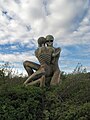
 Scary Sculpture - geograph.org.uk - 1660044.jpg 640 × 473; 69 KB
-
 Scary Sculpture 2 - geograph.org.uk - 1741824.jpg 1,144 × 1,600; 523 KB
-
 Scary Sculpture 3 - geograph.org.uk - 1741868.jpg 1,200 × 1,600; 267 KB
-
 Scot's Common - geograph.org.uk - 1005669.jpg 427 × 640; 212 KB
-
 Sheep grazing on Busgrove Lane, Checkendon, Oxfordshire.jpg 640 × 477; 122 KB
-
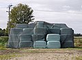 Silage bags at Neal's Farm - geograph.org.uk - 593902.jpg 640 × 477; 82 KB
-
 Skeletal Embrace - geograph.org.uk - 4390422.jpg 1,024 × 683; 81 KB
-
 Skeletons sculpture at Checkendon, Oxfordshire.jpg 1,800 × 2,400; 2.91 MB
-
 Stables at 'The Old Barn House' - geograph.org.uk - 5371494.jpg 1,024 × 675; 247 KB
-
 The Black Horse, Checkendon - geograph.org.uk - 1286392.jpg 640 × 484; 282 KB
-
 The Four Horseshoes - geograph.org.uk - 5251532.jpg 1,024 × 683; 170 KB
-
 The Highwayman Inn, Checkendon - geograph.org.uk - 2836573.jpg 640 × 480; 258 KB
-
 The road through Checkendon - geograph.org.uk - 4758204.jpg 1,500 × 1,125; 236 KB
-
 Tree in the lay-by near Ipsden - geograph.org.uk - 2166107.jpg 640 × 480; 135 KB
-
 Uxmore Road in Checkendon - geograph.org.uk - 4758206.jpg 1,500 × 1,099; 280 KB
-
 Uxmore Road junction with lane to Dogmore End - geograph.org.uk - 2889974.jpg 2,915 × 2,120; 1,006 KB
-
 View from Bottom Lane at Checkendon, Oxfordshire.jpg 640 × 425; 158 KB
-
 View west from Bottom Lane, Checkendon - geograph.org.uk - 1849580.jpg 1,024 × 683; 113 KB
-
 Wartime Relic in the Woods - geograph.org.uk - 2792158.jpg 1,600 × 1,200; 797 KB
-
 Whitewood Heath Pond - geograph.org.uk - 2851002.jpg 3,732 × 2,232; 1.6 MB
-
 Woodland crossroads - geograph.org.uk - 5513096.jpg 640 × 480; 205 KB
-
 Woodland management - geograph.org.uk - 4070140.jpg 1,280 × 960; 285 KB
-
 Woodland on north side of Bottom Lane - geograph.org.uk - 5250759.jpg 1,024 × 683; 292 KB
-
 Woodland tangled branches at Checkendon, Oxfordshire.jpg 640 × 477; 112 KB
-
 Woodland, Checkendon - geograph.org.uk - 676657.jpg 640 × 480; 100 KB
-
 Woods by Neal's Lane - geograph.org.uk - 3503417.jpg 3,968 × 2,232; 2.11 MB
-
 Wyfold Lane at Hook End, Oxfordshire - geograph.org.uk - 4229377.jpg 567 × 800; 237 KB
-
 Wyfold Lane, near Hook End, Oxfordshire - geograph.org.uk - 4228747.jpg 633 × 800; 291 KB
-
 Wyfold Meadows - geograph.org.uk - 3295796.jpg 1,600 × 1,215; 514 KB


.jpg)
.jpg)
.jpg)


