Category:Chellaston
Jump to navigation
Jump to search
village in Derbyshire, United Kingdom  | |||||
| Upload media | |||||
| Instance of | |||||
|---|---|---|---|---|---|
| Location | City of Derby, Derbyshire, East Midlands, England | ||||
| Population |
| ||||
| Different from | |||||
 | |||||
Subcategories
This category has the following 2 subcategories, out of 2 total.
P
T
Media in category "Chellaston"
The following 76 files are in this category, out of 76 total.
-
 1A Green Avenue with 84 High Street, Chellaston - geograph.org.uk - 3642307.jpg 1,280 × 933; 197 KB
-
 A50 west of the Chellaston junction - geograph.org.uk - 2340163.jpg 640 × 480; 59 KB
-
 Back Lane Chellaston - geograph.org.uk - 5452550.jpg 2,000 × 1,333; 2.27 MB
-
 Back lane off Glenwood Road, Chellaston - geograph.org.uk - 6184097.jpg 1,024 × 768; 189 KB
-
 Bench Mark on Chellaston church - geograph.org.uk - 3642294.jpg 1,280 × 960; 358 KB
-
 Bonnieprincechellaston.jpg 3,264 × 2,176; 3.02 MB
-
 Bridge over Cuttle Brook - geograph.org.uk - 2792009.jpg 1,200 × 900; 285 KB
-
 Brighter Derby - geograph.org.uk - 3640816.jpg 960 × 1,280; 363 KB
-
 Catholic Church, Chellaston - geograph.org.uk - 287980.jpg 640 × 408; 117 KB
-
 Chellaston Beauty Tulip.jpg 538 × 888; 81 KB
-
 Chellaston Co-operative supermarket - geograph.org.uk - 3642279.jpg 1,280 × 946; 240 KB
-
 Chellaston Library - geograph.org.uk - 3642285.jpg 1,280 × 952; 236 KB
-
 Chellaston Methodist Chapel - geograph.org.uk - 287947.jpg 455 × 640; 111 KB
-
 Chellaston Methodist Church - geograph.org.uk - 3642289.jpg 960 × 1,280; 345 KB
-
 Chellaston milestone.jpg 2,176 × 3,264; 3.43 MB
-
 Chellaston Park Pavilion 2.jpg 3,024 × 4,032; 2.93 MB
-
 Chellaston Park Pavilion.jpg 4,032 × 3,024; 1.4 MB
-
 Chellaston Post Office - geograph.org.uk - 3642275.jpg 1,280 × 960; 235 KB
-

-
 Chellaston School entrance, September 2007.jpg 400 × 316; 60 KB
-
 Chellaston, Royal Glen Park - geograph.org.uk - 4666637.jpg 640 × 481; 465 KB
-
 ChellastonCarnivalSite.JPG 3,264 × 2,176; 3.24 MB
-
 ChellastonCatholic.jpg 3,264 × 2,176; 3.62 MB
-
 Chellastonmethodist.JPG 3,264 × 2,176; 1.99 MB
-
 Chellastonpostbox.JPG 2,176 × 3,264; 3.08 MB
-
 ChellastonPostOffice.JPG 3,264 × 2,176; 2.9 MB
-
 ChellastonShops.jpg 640 × 378; 46 KB
-
 ChelloSchool.jpg 400 × 316; 94 KB
-
 Cherry blossom - geograph.org.uk - 2353548.jpg 1,200 × 900; 196 KB
-
 Cloud Trail - geograph.org.uk - 3557559.jpg 640 × 480; 101 KB
-
-
 Cuttle Brook - geograph.org.uk - 3557558.jpg 480 × 640; 130 KB
-
 Demolition contractors at the Rose and Crown - geograph.org.uk - 6039448.jpg 1,280 × 960; 355 KB
-
 Derby Road, Chellaston - geograph.org.uk - 3794176.jpg 1,280 × 851; 238 KB
-
 Derby Road, Chellaston - geograph.org.uk - 3795586.jpg 1,280 × 851; 246 KB
-
 Entrance to Chellaston Park - geograph.org.uk - 3626575.jpg 640 × 480; 221 KB
-
 Glenwood Road Chellaston - geograph.org.uk - 5445529.jpg 2,000 × 1,333; 2.08 MB
-
 Glenwood Road, Chellaston - geograph.org.uk - 2920446.jpg 1,888 × 1,260; 1.03 MB
-
 Glenwood Road, Chellaston - geograph.org.uk - 6184103.jpg 1,024 × 768; 223 KB
-
 High Street Chellaston - geograph.org.uk - 5452569.jpg 2,000 × 1,333; 2.4 MB
-
 High Street Chellaston - geograph.org.uk - 5452576.jpg 2,000 × 1,333; 2.06 MB
-
 High Street, Chellaston - geograph.org.uk - 6184147.jpg 1,024 × 768; 122 KB
-
 Infinity Park Way - geograph.org.uk - 5445542.jpg 2,000 × 1,333; 2.07 MB
-
 Infinity Park Way - geograph.org.uk - 5445545.jpg 2,000 × 1,333; 1.75 MB
-
 Lych gate, St. Peter's, Chellaston - geograph.org.uk - 3642302.jpg 1,280 × 960; 371 KB
-
 Maple Drive, Chellaston - geograph.org.uk - 3642314.jpg 1,280 × 960; 228 KB
-
 Milepost at Chellaston (geograph 3640809).jpg 960 × 1,280; 346 KB
-
 Ming's Court - geograph.org.uk - 3642272.jpg 1,280 × 960; 222 KB
-
 Modern office buildings - geograph.org.uk - 5445553.jpg 2,000 × 1,333; 1.74 MB
-
 New Houses, Station Road, Chellaston - geograph.org.uk - 2075673.jpg 640 × 480; 60 KB
-
 Newgate Close, Chellaston - geograph.org.uk - 6184179.jpg 1,024 × 768; 158 KB
-
 North end of St Peter's Road, Chellaston - geograph.org.uk - 6184159.jpg 1,024 × 768; 140 KB
-

-
 Parkway, Chellaston - geograph.org.uk - 3640812.jpg 1,280 × 960; 271 KB
-
 Pinfold seating area - geograph.org.uk - 2483064.jpg 1,200 × 900; 259 KB
-
 Playground, Chellaston School - geograph.org.uk - 3642313.jpg 1,280 × 960; 258 KB
-
 Public conveniences, Chellaston - geograph.org.uk - 3642287.jpg 1,280 × 960; 294 KB
-
 Roundabout at Maple Drive - geograph.org.uk - 3640814.jpg 1,280 × 961; 304 KB
-
 Royal Approach - geograph.org.uk - 5445539.jpg 2,000 × 1,333; 1.79 MB
-
 Royal Glen Park, Chellaston - geograph.org.uk - 4666640.jpg 640 × 480; 418 KB
-
 School Lane, Chellaston - geograph.org.uk - 3642309.jpg 1,280 × 948; 349 KB
-
 Shopping parade, High Street, Chellaston - geograph.org.uk - 3642312.jpg 1,280 × 960; 228 KB
-
 Sinfin Moor Lane - geograph.org.uk - 3640803.jpg 1,280 × 960; 349 KB
-
 Snicket at the Southern Edge of Chellaston - geograph.org.uk - 3858905.jpg 3,846 × 2,782; 2.89 MB
-
 South end of Springfield Road, Chellaston - geograph.org.uk - 6184086.jpg 1,024 × 768; 147 KB
-
 Station road chellaston.jpg 3,264 × 2,448; 1.76 MB
-
 Swarkstone Road - geograph.org.uk - 5445534.jpg 2,000 × 1,333; 2 MB
-
 The Lawns Hotel, Chellaston - geograph.org.uk - 287955.jpg 640 × 426; 92 KB
-
-
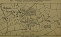 The Quarterly journal of the Geological Society of London (1918) (14760138826).jpg 3,248 × 2,010; 561 KB
-
 The Rose ^ Crown - geograph.org.uk - 2481270.jpg 1,200 × 900; 163 KB
-
 TheLawns.JPG 3,264 × 2,176; 4.43 MB
-
 This is South Derbyshire.jpg 3,008 × 1,200; 2.37 MB
-
 View over Derby from Chellaston Hill - geograph.org.uk - 3858930.jpg 4,000 × 3,000; 3.01 MB
-
 Woodgate Drive is not a bus route - geograph.org.uk - 4610653.jpg 1,200 × 900; 327 KB
-


.jpg)


_(14760138826).jpg)


