Category:Cherokee County, Alabama
Jump to navigation
Jump to search
Counties of Alabama: Autauga · Baldwin · Barbour · Bibb · Blount · Bullock · Butler · Calhoun · Chambers · Cherokee · Chilton · Choctaw · Clarke · Clay · Cleburne · Coffee · Colbert · Conecuh · Coosa · Covington · Crenshaw · Cullman · Dale · Dallas · DeKalb · Elmore · Escambia · Etowah · Fayette · Franklin · Geneva · Greene · Hale · Henry · Houston · Jackson · Jefferson · Lamar · Lauderdale · Lawrence · Lee · Limestone · Lowndes · Macon · Madison · Marengo · Marion · Marshall · Mobile · Monroe · Montgomery · Morgan · Perry · Pickens · Pike · Randolph · Russell · Shelby · St. Clair · Sumter · Talladega · Tallapoosa · Tuscaloosa · Walker · Washington · Wilcox · Winston
county in Alabama, United States   | |||||
| Upload media | |||||
| Instance of | |||||
|---|---|---|---|---|---|
| Named after | |||||
| Location | Alabama | ||||
| Capital | |||||
| Inception |
| ||||
| Population |
| ||||
| Area |
| ||||
| Elevation above sea level |
| ||||
| Different from | |||||
| official website | |||||
 | |||||
Subcategories
This category has the following 17 subcategories, out of 17 total.
1
A
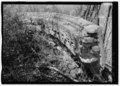
- Augusta Ridge Iron Quarry (2 F)
C
- Centre, Alabama (5 F)
G
- Gaylesville, Alabama (3 F)
L
M
- Maps of Cherokee County, Alabama (21 F)
- Minerals of Indian Mountain (2 F)
P
S
T
- Turkeytown (Cherokee town) (6 F)
V
W
Media in category "Cherokee County, Alabama"
The following 40 files are in this category, out of 40 total.
-
 1994piedmont.jpg 368 × 334; 10 KB
-
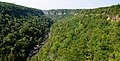
 Cherokee County, AL, USA - panoramio (1).jpg 3,872 × 1,925; 3.91 MB
-
 Cherokee County, AL, USA - panoramio (2).jpg 3,872 × 1,961; 3.7 MB
-
 Cherokee County, AL, USA - panoramio.jpg 3,872 × 2,592; 3.62 MB
-
 Cherokee Tribe of Northeast Alabama Logo 2014-05-31 09-11.jpg 1,500 × 1,602; 601 KB
-
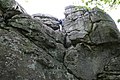
 Comfortably Numb topping out - panoramio.jpg 2,048 × 1,360; 1.32 MB
-
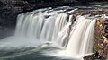
 Fall in Fall - panoramio (1).jpg 3,872 × 2,592; 3.62 MB
-
 Fall in Fall - panoramio.jpg 3,872 × 2,592; 3.12 MB
-
 Flag of Cherokee County, Alabama.svg 1,379 × 919; 129 KB
-
 Fully-Fledged - panoramio.jpg 3,696 × 2,063; 3.54 MB
-
-

-

-
 Holiday Block toproping - panoramio.jpg 2,048 × 1,360; 1.48 MB
-
 Hyla cinerea pitcher plant.jpg 3,312 × 4,416; 7.6 MB
-

-
 Off shore - panoramio.jpg 3,493 × 2,269; 6.75 MB
-
 Piers at Yellow Creek Falls.jpg 3,888 × 2,916; 4.54 MB
-
-
-

-
 Sandrock 5.6 route - panoramio.jpg 2,048 × 1,360; 1.07 MB
-
 Sandstone comglomerate - panoramio.jpg 2,048 × 1,360; 1.5 MB
-
 Seal of Cherokee County, Alabama.svg 921 × 921; 127 KB
-
 Spring Garden High School - panoramio.jpg 3,456 × 2,304; 4.14 MB
-
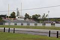 Spring Garden High School football field - panoramio.jpg 3,456 × 2,304; 3.46 MB
-
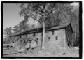
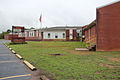 Spring Garden School, Spring Garden, Alabama.JPG 3,456 × 2,304; 3.99 MB
-
 TAG Yellow Creek IMG 3952.JPG 640 × 480; 34 KB
-
 US411 North - Cherokee CR695 CR202 Signs (27980887774).jpg 1,200 × 800; 534 KB
-
 US411 North - CR805 +CR101 Signs (28491161372).jpg 1,200 × 800; 553 KB
-
 US411nRoad-CherokeeCR265-CR505signs (32883365424).jpg 2,400 × 1,600; 1.55 MB
-
 US411nRoad-CR378signWhite (28491160782).jpg 1,200 × 800; 563 KB
-
 US411nRoad-CR384sign (27980887004).jpg 1,200 × 800; 523 KB
-
 US411nRoad-CR936sign (28491159902).jpg 1,200 × 800; 555 KB
-
 USA Cherokee County, Alabama age pyramid.svg 520 × 600; 7 KB
-

-

-

-
-
 Yellow River Canyon waterfall dry - panoramio.jpg 1,024 × 1,536; 461 KB

.jpg)
.jpg)


.jpg)


.jpg)
.jpg)
.jpg)
.jpg)
.jpg)
.jpg)

