Category:Chieveley
Jump to navigation
Jump to search
English: Chieveley is a village and civil parish in the English county of Berkshire, located approximately to the north of Newbury, close to the M4 motorway and A34 road.
Nederlands: Chieveley is een plaats in het bestuurlijke gebied West Berkshire, in het Engelse graafschap Berkshire. De plaats telt 1.481 inwoners.
village and civil parish in Berkshire, UK  Eglwys Santes Fair y Forwyn, Chieveley | |||||
| Upload media | |||||
| Instance of | |||||
|---|---|---|---|---|---|
| Location | West Berkshire, Berkshire, South East England, England | ||||
| Area |
| ||||
| Said to be the same as | Chieveley (Wikimedia duplicated page, civil parish) | ||||
| official website | |||||
 | |||||
Subcategories
This category has the following 12 subcategories, out of 12 total.
A
- A34 road at Chieveley (23 F)
B
- Bridges at Chieveley (24 F)
- Bussock Camp (4 F)
C
- Chieveley services (41 F)
- Chieveley War Memorial (6 F)
- Curridge (34 F)
D
- Denison Barracks (2 F)
M
- Mary Hare School (4 F)
O
W
- The Wheatsheaf, Chieveley (6 F)
Y
- Ye Olde Red Lion, Chieveley (2 F)
Media in category "Chieveley"
The following 200 files are in this category, out of 395 total.
(previous page) (next page)-
 A Bigger Pond - geograph.org.uk - 4906411.jpg 4,000 × 3,000; 2.26 MB
-
 A Chieveley roundabout - geograph.org.uk - 42328.jpg 640 × 480; 125 KB
-
 A New Gate - geograph.org.uk - 4906421.jpg 640 × 480; 86 KB
-
 A34 footbridge south of J13 - geograph.org.uk - 2905847.jpg 3,648 × 2,657; 1.23 MB
-
 A34 near Chieveley services - geograph.org.uk - 927819.jpg 640 × 427; 188 KB
-
 A34 northbound - geograph.org.uk - 3338479.jpg 640 × 466; 36 KB
-
 A34 northbound - geograph.org.uk - 3338494.jpg 640 × 480; 40 KB
-
 A34 northbound - geograph.org.uk - 3338504.jpg 640 × 480; 37 KB
-
 A34 northbound - geograph.org.uk - 3341272.jpg 640 × 480; 41 KB
-
 A34 northbound - geograph.org.uk - 5637355.jpg 640 × 428; 88 KB
-
 A34 northbound - geograph.org.uk - 5637402.jpg 640 × 428; 72 KB
-
 A34 northbound - geograph.org.uk - 5637410.jpg 640 × 428; 88 KB
-
 A34 northbound - geograph.org.uk - 5637416.jpg 640 × 428; 79 KB
-
 A34 south of Langley Wood - geograph.org.uk - 3103637.jpg 640 × 481; 40 KB
-

-

-
 A34-M4 Junction - geograph.org.uk - 3292031.jpg 640 × 480; 420 KB
-
 After the show - geograph.org.uk - 975998.jpg 640 × 427; 147 KB
-
 After the show - geograph.org.uk - 976001.jpg 640 × 427; 176 KB
-
 Along Red Shute Hill - geograph.org.uk - 2857052.jpg 1,024 × 683; 186 KB
-
 Angel's Hill between Newbury and Hermitage - geograph.org.uk - 35871.jpg 640 × 480; 215 KB
-
 Apple Travel coach in Chieveley - geograph.org.uk - 4967455.jpg 800 × 646; 120 KB
-
 Approaching a minor road junction - geograph.org.uk - 2376189.jpg 640 × 467; 42 KB
-
 Approaching Bussock Wood bridge - geograph.org.uk - 608922.jpg 640 × 477; 82 KB
-
 Approaching Junction 13 on the M4 - geograph.org.uk - 5543839.jpg 640 × 480; 70 KB
-

-
 Archie's Farm, Hermitage - geograph.org.uk - 5251460.jpg 2,048 × 1,536; 1.04 MB
-
 Arlington Grange Farm - geograph.org.uk - 927824.jpg 640 × 427; 192 KB
-
 B4009 southwest of Hermitage - geograph.org.uk - 2904649.jpg 3,451 × 2,674; 1.64 MB
-
 B4494 heads under the M4 bridge - geograph.org.uk - 2158472.jpg 640 × 480; 70 KB
-
 B4494 through Barrett's Wood - geograph.org.uk - 2833440.jpg 3,648 × 2,736; 2.12 MB
-
 B4494 to Wantage - geograph.org.uk - 2376179.jpg 640 × 480; 112 KB
-
 Balancing Pond by the A34 - geograph.org.uk - 5697306.jpg 3,888 × 2,592; 4.6 MB
-
 Bardown at the junction of High Street Chieveley - geograph.org.uk - 6063905.jpg 1,892 × 1,236; 1.23 MB
-
 Bark path entering Hermitage - geograph.org.uk - 927932.jpg 640 × 427; 175 KB
-
 Barn in the fields - geograph.org.uk - 4799523.jpg 3,780 × 2,769; 1.91 MB
-
 Basketball Court - geograph.org.uk - 4803170.jpg 1,600 × 1,200; 630 KB
-
 Benchmark on St Mary's Chieveley - geograph.org.uk - 6053247.jpg 533 × 800; 151 KB
-
 BP filling station, Chieveley Services - geograph.org.uk - 4967591.jpg 800 × 524; 124 KB
-
 Bridge from the field - geograph.org.uk - 2857059.jpg 1,024 × 683; 236 KB
-
 Bridleway to Breach Copse - geograph.org.uk - 5433150.jpg 1,024 × 768; 300 KB
-
 Bussock Wood - geograph.org.uk - 3351990.jpg 640 × 430; 33 KB
-
 But it says its a sand pit Dad - geograph.org.uk - 888965.jpg 640 × 427; 89 KB
-
 Bypassing Marsh Lane - geograph.org.uk - 4904338.jpg 3,817 × 2,800; 2.62 MB
-
 Byway by Snelsmore Farm - geograph.org.uk - 2158376.jpg 640 × 480; 116 KB
-
 Byway through Bussock Wood - geograph.org.uk - 1130587.jpg 640 × 427; 91 KB
-
 Byway to Long Lane - geograph.org.uk - 2158329.jpg 640 × 480; 70 KB
-
 Byway towards Downend - geograph.org.uk - 608976.jpg 640 × 477; 73 KB
-
 Byway towards North Heath - geograph.org.uk - 596295.jpg 640 × 477; 79 KB
-
 Cars parked at Chieveley services by M4 - geograph.org.uk - 5443101.jpg 1,600 × 888; 563 KB
-

-
 Cast grave cross - geograph.org.uk - 6058718.jpg 533 × 800; 142 KB
-
 Cast memorial - geograph.org.uk - 6058716.jpg 1,024 × 683; 205 KB
-
 Catkins down Gidley Lane - geograph.org.uk - 5679739.jpg 2,592 × 3,498; 3.47 MB
-
 Chalky Lane - geograph.org.uk - 927811.jpg 640 × 427; 239 KB
-

-
 Chieveley High Street - geograph.org.uk - 4478157.jpg 1,024 × 683; 173 KB
-
 Chieveley High Street - geograph.org.uk - 5775510.jpg 897 × 1,024; 228 KB
-
 Chieveley Playing Fields - geograph.org.uk - 1271484.jpg 640 × 480; 67 KB
-
 Chieveley Residence - geograph.org.uk - 39274.jpg 640 × 480; 186 KB
-
 Chieveley sewage works - geograph.org.uk - 862908.jpg 640 × 419; 64 KB
-
 Chieveley Telephone Exchange - geograph.org.uk - 2516362.jpg 3,072 × 2,304; 1.78 MB
-
 Chieveley Village Hall - geograph.org.uk - 4478136.jpg 1,024 × 683; 139 KB
-
 Chieveley, bus shelter - geograph.org.uk - 4478181.jpg 1,024 × 683; 165 KB
-
 Chieveley, cottages - geograph.org.uk - 4478222.jpg 1,024 × 683; 158 KB
-
 Chieveley, farm road - geograph.org.uk - 4478111.jpg 683 × 1,024; 115 KB
-
 Chieveley, former Methodist Church - geograph.org.uk - 4478241.jpg 1,024 × 663; 171 KB
-
 Chieveley, molehills - geograph.org.uk - 1138056.jpg 640 × 480; 97 KB
-
 Chieveley, Old Street, Oare - geograph.org.uk - 3477972.jpg 640 × 480; 77 KB
-
 Chieveley, Old Vicarage (geograph 4478174).jpg 1,024 × 683; 220 KB
-
 Chieveley, post office ^ store - geograph.org.uk - 4478192.jpg 1,024 × 683; 160 KB
-
 Chieveley, rape field - geograph.org.uk - 4478150.jpg 1,024 × 683; 151 KB
-
 Chieveley, The Green - geograph.org.uk - 4478145.jpg 1,024 × 683; 235 KB
-
 Chieveley, The pond, Oare - geograph.org.uk - 3477989.jpg 640 × 480; 112 KB
-
 Chieveley, traffic sign - geograph.org.uk - 4478267.jpg 1,024 × 683; 171 KB
-
 Churchyard extension - geograph.org.uk - 6058707.jpg 1,024 × 683; 178 KB
-
 Coaches in Chieveley - geograph.org.uk - 4967475.jpg 800 × 537; 117 KB
-
 Commercial Buildings off Priors Court Road - geograph.org.uk - 5695624.jpg 3,888 × 2,592; 3.29 MB
-
 Concrete in the Snow - geograph.org.uk - 5695614.jpg 3,888 × 2,592; 2.98 MB
-
 Coo, mine won't turn - geograph.org.uk - 608959.jpg 640 × 477; 37 KB
-
 Costcutter Store, Hermitage - geograph.org.uk - 4803185.jpg 3,368 × 2,282; 3.35 MB
-
 Cottage on Northfields, Downend - geograph.org.uk - 6071596.jpg 1,920 × 1,280; 1.07 MB
-
 Cross in the shrubbery - geograph.org.uk - 6059156.jpg 533 × 800; 142 KB
-
 Crosville coach arrives at Chieveley - geograph.org.uk - 4967469.jpg 800 × 538; 114 KB
-
 Curridge Road bends at Sandy Lane junction - geograph.org.uk - 2824952.jpg 3,579 × 2,674; 1.85 MB
-
 Curridge Road bridge over A339 near A34 junction - geograph.org.uk - 3043006.jpg 1,000 × 752; 405 KB
-
 Curridge Road bridge over A34 - geograph.org.uk - 5443184.jpg 1,600 × 799; 517 KB
-
 Curridge Road heads towards Snelsmore East Common - geograph.org.uk - 2824965.jpg 3,648 × 2,736; 1.02 MB
-
 Curridge Road is about to cross A34 - geograph.org.uk - 2824981.jpg 3,648 × 2,736; 1.41 MB
-
 Cycle tennis anyone^ - geograph.org.uk - 597500.jpg 640 × 477; 117 KB
-
 Dallas Autos - geograph.org.uk - 2860054.jpg 1,024 × 683; 191 KB
-
-
 Difficult corner in Chieveley - geograph.org.uk - 862915.jpg 640 × 427; 85 KB
-
 Divided field off Crabtree Lane - geograph.org.uk - 927902.jpg 640 × 427; 217 KB
-
 Door at the base - geograph.org.uk - 6053246.jpg 1,024 × 683; 190 KB
-
 Down Farm overbridge - geograph.org.uk - 889024.jpg 640 × 427; 113 KB
-
 Early medieval coin, Penny of Edward the Confessor (FindID 449093).jpg 1,023 × 605; 190 KB
-
 East Lane at the junction of High Street, Chieveley - geograph.org.uk - 5125903.jpg 2,014 × 1,490; 886 KB
-
 Eastbound M4 - geograph.org.uk - 3415312.jpg 640 × 480; 378 KB
-
 Eastbound M4, Exit at Junction 13 - geograph.org.uk - 3415327.jpg 640 × 480; 386 KB
-
 Elmgrove Farm, Downend - geograph.org.uk - 6071594.jpg 1,880 × 1,218; 946 KB
-
 Enclosures in the corner - geograph.org.uk - 4227189.jpg 4,000 × 3,000; 2.24 MB
-
 Entrance gate to Newbury Showground - geograph.org.uk - 2355716.jpg 3,633 × 2,104; 1.24 MB
-

-
 Entrance to Chalky Lane - geograph.org.uk - 927796.jpg 640 × 427; 237 KB
-
 Entrance to Copyhold sand quarry - geograph.org.uk - 927939.jpg 640 × 427; 175 KB
-
 Entrance to Down Farm - geograph.org.uk - 4217630.jpg 1,600 × 1,200; 444 KB
-
 Entrance to Down Farm on Oxford Road - geograph.org.uk - 3523704.jpg 800 × 600; 130 KB
-
 Entrance to the sewage works on School Road - geograph.org.uk - 5125852.jpg 2,014 × 1,490; 1.25 MB
-
 Exit from the showground - geograph.org.uk - 1271462.jpg 640 × 480; 84 KB
-
 Faircross Plantation - geograph.org.uk - 927895.jpg 640 × 427; 219 KB
-
 Faircross, Hermitage - geograph.org.uk - 4803190.jpg 1,600 × 1,050; 445 KB
-
 Farm Machine with Springs - geograph.org.uk - 4906884.jpg 4,000 × 3,000; 3.94 MB
-
 Farmland and track, Chieveley - geograph.org.uk - 2228936.jpg 640 × 480; 144 KB
-
 Farmland in Horsemoor - geograph.org.uk - 39232.jpg 640 × 480; 172 KB
-
 Farmland near Chieveley - geograph.org.uk - 5775568.jpg 1,024 × 841; 90 KB
-
 Farmland, Chieveley - geograph.org.uk - 2122717.jpg 640 × 480; 130 KB
-
 Farmland, Chieveley - geograph.org.uk - 2122726.jpg 640 × 480; 163 KB
-
 Farmland, Chieveley - geograph.org.uk - 2122734.jpg 640 × 480; 169 KB
-
 Farmland, Chieveley - geograph.org.uk - 2122780.jpg 640 × 480; 146 KB
-
 Farmland, Chieveley - geograph.org.uk - 2122788.jpg 640 × 480; 167 KB
-
 Farmland, Chieveley - geograph.org.uk - 2122791.jpg 640 × 480; 159 KB
-
 Farmland, Chieveley - geograph.org.uk - 2122830.jpg 640 × 480; 119 KB
-
 Farmland, Chieveley - geograph.org.uk - 2228912.jpg 640 × 480; 140 KB
-
 Farmland, Chieveley - geograph.org.uk - 2228922.jpg 640 × 480; 128 KB
-
 Farmland, Chieveley, Berkshire - geograph.org.uk - 4825152.jpg 5,086 × 3,436; 5.53 MB
-
 Field north of Arlington Lane - geograph.org.uk - 4191112.jpg 640 × 480; 76 KB
-
 Five minutes from the services - geograph.org.uk - 927799.jpg 640 × 427; 240 KB
-
 Flyover for A339 northbound over A34 - geograph.org.uk - 5443192.jpg 1,600 × 1,201; 722 KB
-
 Flyover on the A34 - geograph.org.uk - 1101332.jpg 640 × 480; 38 KB
-

-

-

-
 Footbridge over A34 south of M4 junction 13 - geograph.org.uk - 5443178.jpg 1,600 × 1,200; 714 KB
-
 Footbridge over the M4 - geograph.org.uk - 2293170.jpg 640 × 430; 29 KB
-
 Footpath and farmland, Hermitage - geograph.org.uk - 2228932.jpg 640 × 480; 115 KB
-
 Footpath at Chieveley - geograph.org.uk - 3499776.jpg 800 × 600; 202 KB
-
 Footpath going east from Chieveley - geograph.org.uk - 3522709.jpg 800 × 600; 133 KB
-

-
 Ford at Chapel Wood - geograph.org.uk - 1804716.jpg 1,898 × 1,422; 1.09 MB
-
 Forgotten in the shrubbery - geograph.org.uk - 6059154.jpg 533 × 800; 125 KB
-
 Garden Centre at Hermitage - geograph.org.uk - 927918.jpg 640 × 427; 195 KB
-
 Garden Centre at Hermitage - geograph.org.uk - 927927.jpg 640 × 427; 201 KB
-
 Gates of Bradley Court - geograph.org.uk - 888991.jpg 640 × 422; 90 KB
-
 Gateway on Oxford Road - geograph.org.uk - 3523718.jpg 800 × 600; 132 KB
-
 George VI letter box - geograph.org.uk - 888829.jpg 427 × 640; 87 KB
-
 Gidley Lane - geograph.org.uk - 854308.jpg 640 × 427; 114 KB
-
 Gidley Lane - geograph.org.uk - 854312.jpg 427 × 640; 91 KB
-
 Grace Lane crosses the A34 - geograph.org.uk - 4578749.jpg 1,500 × 971; 120 KB
-
 Grassland, Chieveley - geograph.org.uk - 2228925.jpg 640 × 480; 160 KB
-
 Green on High Street Chieveley - geograph.org.uk - 6071598.jpg 1,920 × 1,280; 1,014 KB
-
 Greggs, Chieveley - geograph.org.uk - 4967425.jpg 800 × 445; 68 KB
-
 Hazelhanger - geograph.org.uk - 854327.jpg 427 × 640; 84 KB
-
 Hazelhanger Farm - geograph.org.uk - 4800116.jpg 4,000 × 3,000; 3.2 MB
-
 Hedge along Northfields - geograph.org.uk - 3983181.jpg 640 × 480; 88 KB
-
 High Street, Chieveley - geograph.org.uk - 3983162.jpg 640 × 480; 100 KB
-
 Hillier Garden Centre in Hermitage - geograph.org.uk - 1466102.jpg 640 × 427; 59 KB
-
 Hillier Garden Centre in Hermitage - geograph.org.uk - 1466105.jpg 640 × 427; 64 KB
-
 Home Farm - geograph.org.uk - 2824984.jpg 3,560 × 2,649; 1.62 MB
-
 Home Farm - geograph.org.uk - 4906654.jpg 1,600 × 1,067; 647 KB
-
 Horsemoor House - geograph.org.uk - 5775432.jpg 1,024 × 766; 198 KB
-
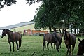 Horses at Woods Folly - geograph.org.uk - 854305.jpg 640 × 427; 72 KB
-
 House on High Street, Chieveley - geograph.org.uk - 5125899.jpg 1,972 × 1,428; 1,003 KB
-
 House on High Street, Chieveley - geograph.org.uk - 5125933.jpg 2,048 × 1,536; 1.35 MB
-
 Houses on Crabtree Lane - geograph.org.uk - 927892.jpg 640 × 427; 191 KB
-
 Houses on Graces Lane, Chieveley - geograph.org.uk - 5125890.jpg 2,048 × 1,536; 1.52 MB
-
 Junction 13 - geograph.org.uk - 1079130.jpg 640 × 426; 37 KB
-
 Junction 13 M4 - geograph.org.uk - 599141.jpg 640 × 480; 62 KB
-
 Junction of Oxford Road and Downend Lane - geograph.org.uk - 3523708.jpg 800 × 600; 133 KB
-

-
 Junction of the ... what^ - geograph.org.uk - 854321.jpg 640 × 427; 84 KB
-
 Junction with the B4494 - geograph.org.uk - 2158454.jpg 640 × 480; 70 KB
-
 Keep ooooouuuuuuttttt ... - geograph.org.uk - 888973.jpg 640 × 427; 84 KB
-
 Keeping the fence line - geograph.org.uk - 4799536.jpg 4,000 × 3,000; 2.9 MB
-
 Kiln drive - geograph.org.uk - 1016716.jpg 640 × 480; 89 KB
-
 Kiln Drive - geograph.org.uk - 3240776.jpg 3,648 × 2,432; 1.29 MB
-
 Layby on the A34 - geograph.org.uk - 3292059.jpg 640 × 480; 434 KB
-
 Longlane - geograph.org.uk - 2376193.jpg 640 × 437; 77 KB
-
 Looking east from Priors Court School - geograph.org.uk - 2233576.jpg 1,024 × 768; 113 KB
-

-
 Looking south - geograph.org.uk - 6053254.jpg 1,024 × 683; 167 KB
-

-

-
 Lorry park, Chieveley services by M4 - geograph.org.uk - 5443091.jpg 1,600 × 640; 353 KB
-
 M4 approaching Junction 13 - geograph.org.uk - 3630874.jpg 2,343 × 1,492; 1.83 MB
-
 M4 footbridge - Chievley to Snelsmore Common path - geograph.org.uk - 2507542.jpg 3,641 × 2,459; 1.09 MB
-
 M4 looking east - geograph.org.uk - 597518.jpg 640 × 477; 61 KB
-
 M4 near Chieveley (1) - geograph.org.uk - 2297260.jpg 2,421 × 1,584; 3.06 MB
-
 M4 near Chieveley (2) - geograph.org.uk - 2305139.jpg 2,368 × 1,512; 2.81 MB
-
 M4 west of J13 - geograph.org.uk - 3655688.jpg 640 × 400; 25 KB
-
 M4 west of J13 - geograph.org.uk - 3655690.jpg 640 × 391; 32 KB
-
 M4 west of Junction 13 - geograph.org.uk - 3630892.jpg 2,352 × 1,374; 1.52 MB
-
 M4 westbound near Phillip's Hill - geograph.org.uk - 4240087.jpg 640 × 480; 41 KB
-
 M4 westbound passing Junction 13 - geograph.org.uk - 3630883.jpg 1,944 × 1,153; 1.16 MB
-
 M4 westbound towards Junction 13 - geograph.org.uk - 3629515.jpg 2,088 × 1,227; 1.39 MB
-
 M4, half a mile to Junction 13 - geograph.org.uk - 3629525.jpg 2,307 × 1,482; 1.69 MB
-
 M4, J13 - geograph.org.uk - 3655667.jpg 640 × 392; 21 KB
-
 M4, westbound - geograph.org.uk - 4815785.jpg 640 × 341; 33 KB
-
 Manor Lane turns into Old Street - geograph.org.uk - 2904613.jpg 3,533 × 2,671; 1.49 MB
-
 Marquis Motorhomes - geograph.org.uk - 4217610.jpg 1,600 × 1,038; 296 KB


.jpg)


.jpg)


_-_geograph.org.uk_-_2297260.jpg)
_-_geograph.org.uk_-_2305139.jpg)


