Category:Chimneys in Cornwall
Jump to navigation
Jump to search
Ceremonial counties of England: Bedfordshire · Berkshire · Buckinghamshire · Cambridgeshire · Cheshire · Cornwall · Cumbria · Derbyshire · Devon · Dorset · Durham · East Riding of Yorkshire · East Sussex · Essex · Gloucestershire · Greater London · Greater Manchester · Hampshire · Herefordshire · Hertfordshire · Kent · Lancashire · Leicestershire · Lincolnshire · Merseyside · Norfolk · North Yorkshire · Northamptonshire · Northumberland · Nottinghamshire · Oxfordshire · Shropshire · Somerset · South Yorkshire · Staffordshire · Suffolk · Surrey · Tyne and Wear · Warwickshire · West Midlands · West Sussex · West Yorkshire · Wiltshire · Worcestershire
City-counties: Bristol ·
Former historic counties:
Other former counties:
City-counties: Bristol ·
Former historic counties:
Other former counties:
Subcategories
This category has the following 5 subcategories, out of 5 total.
Media in category "Chimneys in Cornwall"
The following 31 files are in this category, out of 31 total.
-
 A good vantage point - geograph.org.uk - 1470343.jpg 467 × 640; 42 KB
-
 Breage - Great Wheal Fortune (01).jpg 1,242 × 1,396; 424 KB
-
 Cabbage Field - geograph.org.uk - 58521.jpg 640 × 480; 97 KB
-
 Chimney at Levant Mine.jpg 2,848 × 3,632; 1.93 MB
-
 Chimney at Trevellas Cove, nr. St Agnes, Cornwall - July 2022.jpg 3,456 × 4,608; 3.43 MB
-

-
 Chimney detail, Trevellas Cove, nr. St Agnes, Cornwall - July 2022.jpg 4,032 × 3,024; 2.18 MB
-
 Chimney on Carn Gloose - geograph.org.uk - 493141.jpg 640 × 427; 112 KB
-
 Chimney Stack. - geograph.org.uk - 385044.jpg 480 × 640; 139 KB
-
 Chimney, Abandoned Tin Mine - geograph.org.uk - 218896.jpg 450 × 572; 78 KB
-
 Chimney, Parson's Park - geograph.org.uk - 711291.jpg 480 × 640; 68 KB
-
 Chimney, Trethowel clay works - geograph.org.uk - 688627.jpg 422 × 640; 123 KB
-
 Chimneys at Slegaan - geograph.org.uk - 1592569.jpg 427 × 640; 224 KB
-
 Church at Lelant from Riviere Towans - geograph.org.uk - 958146.jpg 640 × 480; 77 KB
-
 Clayworks chimney - geograph.org.uk - 61840.jpg 640 × 480; 58 KB
-
 Greenburrow engine house - geograph.org.uk - 33459.jpg 640 × 480; 87 KB
-
 Herodsfoot Mine - geograph.org.uk - 893249.jpg 640 × 480; 84 KB
-
 Kit Hill mine stacks - geograph.org.uk - 357295.jpg 480 × 640; 91 KB
-
 Mine Chimney in Danescombe Valley - geograph.org.uk - 34595.jpg 441 × 640; 141 KB
-
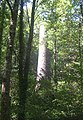
 Mine chimney in the trees - geograph.org.uk - 34655.jpg 640 × 480; 74 KB
-
 Old mine chimney at Trehane - geograph.org.uk - 574571.jpg 480 × 640; 55 KB
-
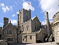
 Courtyard in St. Michael's Mount - geograph.org.uk - 13471.jpg 457 × 640; 101 KB
-
 The Church, St Michael's Mount - geograph.org.uk - 893622.jpg 640 × 488; 104 KB
-
 St Austell, near Bugle - geograph.org.uk - 379062.jpg 640 × 427; 181 KB
-

-
 The King’s Pipe.jpg 1,445 × 2,869; 1.73 MB
-
 Tregurtha Downs Mine (01).jpg 1,439 × 1,941; 559 KB
-
 Tregurtha Downs Mine (02).jpg 2,487 × 1,738; 2.12 MB
-
 Tregurtha Downs Mine (03).jpg 3,023 × 3,224; 3.54 MB
-
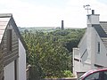
 Trew Parc and Sea View Terrace, Redruth, August 2022.jpg 4,032 × 3,024; 7.63 MB
-


.jpg)


.jpg)
.jpg)
.jpg)

