Category:Chinnor
Jump to navigation
Jump to search
village and civil parish in South Oxfordshire district, Oxfordshire, England  | |||||
| Upload media | |||||
| Instance of | |||||
|---|---|---|---|---|---|
| Location | South Oxfordshire, Oxfordshire, South East England, England | ||||
| Area |
| ||||
| Said to be the same as | Chinnor (Wikimedia duplicated page, civil parish) | ||||
| official website | |||||
 | |||||
English: Chinnor is a village on the Icknield Way below the Chiltern escarpment in South Oxfordshire. It is about southeast of Thame. It was formerly home to a cement works and artisans supporting High Wycombe's furniture making industry, but in the 21st century is primarily a dormitory for Thame, High Wycombe, Aylesbury and London.
Subcategories
This category has the following 12 subcategories, out of 12 total.
A
- St Andrew's Church, Chinnor (19 F)
C
- Chinnor Chalk Pit (1 F)
- Chinnor Hill (6 F)
- Chinnor railway station (36 F)
- Chinnor War Memorial (1 F)
E
H
O
- Oakley Hill (2 F)
- Oakley, Oxfordshire (9 F)
S
W
- Chinnor Windmill (2 F)
Media in category "Chinnor"
The following 200 files are in this category, out of 340 total.
(previous page) (next page)-
 "Heart" England Dont Litter - geograph.org.uk - 4384242.jpg 3,536 × 2,724; 1.79 MB
-
 1369 at Chinnor - geograph.org.uk - 4707338.jpg 640 × 480; 117 KB
-
 A common hair style these days - geograph.org.uk - 3943335.jpg 640 × 480; 126 KB
-
 A Tomb with a Yew - geograph.org.uk - 4384164.jpg 2,658 × 3,078; 1.9 MB
-

-
 A40 Fireworks, Chinnor - geograph.org.uk - 5390268.jpg 5,202 × 3,465; 3.28 MB
-
 Abandoned Truck in Crowell Wood - geograph.org.uk - 104581.jpg 640 × 480; 198 KB
-
 Access land in woodland area - geograph.org.uk - 1819634.jpg 3,648 × 2,736; 5.19 MB
-
 Access to Emmington Church - geograph.org.uk - 4384180.jpg 4,000 × 3,000; 2.17 MB
-
 Antique furniture shop on Station Road, Chinnor - geograph.org.uk - 4875673.jpg 2,048 × 1,536; 944 KB
-
 Autumn Colours near Chinnor, Oxfordshire - geograph.org.uk - 5169976.jpg 1,400 × 1,050; 1.52 MB
-
 Autumn Colours near Chinnor, Oxfordshire - geograph.org.uk - 5169986.jpg 1,400 × 1,050; 1.91 MB
-
-

-
 B4445 near Emmington - geograph.org.uk - 4857111.jpg 640 × 481; 41 KB
-
 B4445 Thame Road - geograph.org.uk - 4857117.jpg 640 × 481; 34 KB
-
 B4445 towards Thame - geograph.org.uk - 5947262.jpg 1,024 × 684; 177 KB
-
 B4445 towards Thame - geograph.org.uk - 5947268.jpg 1,024 × 684; 297 KB
-
 Baboon sculpture - geograph.org.uk - 4352992.jpg 640 × 480; 106 KB
-
 Bear sculpture - geograph.org.uk - 4353030.jpg 640 × 480; 123 KB
-
 Bledlow Great Wood at Chinnor Hill - geograph.org.uk - 1818423.jpg 2,736 × 3,648; 6.78 MB
-
 Bridge over railway, Chinnor - geograph.org.uk - 4706504.jpg 640 × 480; 134 KB
-
 Bridleway on Chinnor Hill - geograph.org.uk - 5717804.jpg 1,600 × 1,174; 955 KB
-
 Bungalow on Thame Road, Sydenham - geograph.org.uk - 4875571.jpg 2,048 × 1,536; 808 KB
-
 Bus shelter on Thame Road, Chinnor - geograph.org.uk - 4875639.jpg 2,048 × 1,536; 1.51 MB
-
 Bus Stop on Chinnor Road - geograph.org.uk - 4473837.jpg 3,000 × 4,000; 3.93 MB
-
 Businesses in Thame Road, Chinnor - geograph.org.uk - 2888420.jpg 1,280 × 942; 1.02 MB
-
 Car park of Chinnor Hill Nature Reserve - geograph.org.uk - 1819538.jpg 3,058 × 2,294; 5.36 MB
-
 Cattle handling chute, Oakley Hill Nature Reserve - geograph.org.uk - 4677160.jpg 2,330 × 3,106; 1.85 MB
-
 Cattle, Chinnor - geograph.org.uk - 1014160.jpg 640 × 480; 140 KB
-
 Cherry blossom on Wainhill - geograph.org.uk - 1819700.jpg 3,648 × 2,736; 3.2 MB
-
 Chinnor Congregational Church - geograph.org.uk - 751329.jpg 640 × 451; 64 KB
-
 Chinnor - Church - geograph.org.uk - 5277413.jpg 2,560 × 1,920; 2.7 MB
-
 Chinnor - Disused Chalk Pit - geograph.org.uk - 5277526.jpg 2,560 × 1,920; 2.59 MB
-
 Chinnor - Font - geograph.org.uk - 5277431.jpg 1,920 × 2,560; 2.91 MB
-
 Chinnor - GWR Heritage - geograph.org.uk - 5277492.jpg 2,560 × 1,920; 1.86 MB
-
 Chinnor - Heritage Railway - geograph.org.uk - 5277483.jpg 2,560 × 1,920; 2.5 MB
-
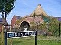 Chinnor - Kiln Avenue - geograph.org.uk - 5277512.jpg 2,560 × 1,920; 2.66 MB
-
 Chinnor - mobile corn mill - geograph.org.uk - 4960944.jpg 640 × 427; 103 KB
-
 Chinnor - Railway Station - geograph.org.uk - 5277464.jpg 2,560 × 1,920; 2.8 MB
-
 Chinnor - Railway Yard - geograph.org.uk - 5277498.jpg 2,560 × 1,920; 2.19 MB
-
 Chinnor - Signal Box - geograph.org.uk - 5277466.jpg 1,920 × 2,560; 2.27 MB
-
 Chinnor - Signal Box - geograph.org.uk - 5277476.jpg 2,560 × 1,920; 2.7 MB
-
 Chinnor - St Andrew's Church - geograph.org.uk - 5277425.jpg 1,920 × 2,560; 2.55 MB
-

-

-

-
-
 Chinnor Barrows - geograph.org.uk - 4660251.jpg 3,648 × 2,736; 3.83 MB
-
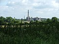
 Chinnor cement plant - geograph.org.uk - 2978902.jpg 1,600 × 1,238; 338 KB
-
 Chinnor Cement Works - geograph.org.uk - 2748001.jpg 1,689 × 1,194; 273 KB
-
 Chinnor Cement Works - geograph.org.uk - 2748017.jpg 1,712 × 1,187; 274 KB
-
-
 Chinnor cement works.jpg 640 × 480; 93 KB
-
 Chinnor Community Church - geograph.org.uk - 5390554.jpg 640 × 448; 73 KB
-
 Chinnor Garden Centre - geograph.org.uk - 1458657.jpg 640 × 427; 73 KB
-
 Chinnor Hill - geograph.org.uk - 4877337.jpg 1,970 × 1,428; 1.04 MB
-
 Chinnor Indian Cuisine - geograph.org.uk - 5390551.jpg 5,202 × 3,465; 3.93 MB
-
 Chinnor Oxon Red Lion.JPG 2,559 × 1,851; 2.08 MB
-
 Chinnor Oxon Thatched Cottages.JPG 2,739 × 1,704; 2.12 MB
-
 Chinnor Playing Field - geograph.org.uk - 941413.jpg 640 × 480; 65 KB
-
 Chinnor playing field, pavilion - geograph.org.uk - 2890374.jpg 1,280 × 960; 481 KB
-
 Chinnor post mill - geograph.org.uk - 4957834.jpg 427 × 640; 80 KB
-
 Chinnor Post Mill - geograph.org.uk - 5391148.jpg 1,600 × 1,200; 343 KB
-
 Chinnor Post Mill - geograph.org.uk - 5395298.jpg 1,064 × 1,600; 267 KB
-
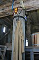
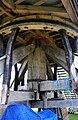 Chinnor post mill - the main support - geograph.org.uk - 4957866.jpg 415 × 640; 99 KB
-
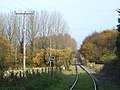
 Chinnor railway station - geograph.org.uk - 3338812.jpg 1,024 × 768; 273 KB
-
 Chinnor railway station - geograph.org.uk - 3927026.jpg 4,320 × 3,240; 6.43 MB
-
 Chinnor railway station - geograph.org.uk - 4738663.jpg 2,000 × 1,500; 616 KB
-
 Chinnor railway, class 08 loco - geograph.org.uk - 5390230.jpg 5,202 × 3,465; 3.6 MB
-
 Chinnor railway, class 17 diesel loco - geograph.org.uk - 5390224.jpg 5,202 × 3,465; 2.15 MB
-
 Chinnor shops - geograph.org.uk - 2890654.jpg 1,280 × 960; 593 KB
-
 Chinnor signal box - geograph.org.uk - 5390246.jpg 5,202 × 3,465; 3 MB
-
 Chinnor station platform - geograph.org.uk - 5390570.jpg 5,202 × 3,465; 3.03 MB
-
 Chinnor station sidings - geograph.org.uk - 5390239.jpg 5,202 × 3,465; 3.64 MB
-
 Chinnor station, signal box and crossing - geograph.org.uk - 5390235.jpg 5,202 × 3,465; 3.45 MB
-
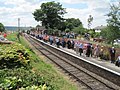
 Chinnor station, staff and passengers - geograph.org.uk - 5390568.jpg 3,954 × 2,491; 2.42 MB
-
 Chinnor station. Visiting class 20 locomotives - geograph.org.uk - 5390581.jpg 5,202 × 3,465; 3.05 MB
-
 Chinnor station. Visiting class 45 diesel locomotive - geograph.org.uk - 5390243.jpg 5,202 × 3,465; 3.2 MB
-
 Chinnor station. Visiting class 50 locomotive - geograph.org.uk - 5390245.jpg 5,202 × 3,465; 3.39 MB
-
 Chinnor Village Centre.JPG 2,730 × 1,692; 1.99 MB
-
 Chinnor Village Hall - geograph.org.uk - 5390564.jpg 4,366 × 2,967; 2.4 MB
-
 Chinnor village hall.jpg 640 × 480; 79 KB
-
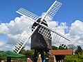
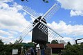
 Chinnor Windmill - geograph.org.uk - 4777731.jpg 4,000 × 2,664; 3.02 MB
-
 Chinnor Windmill - geograph.org.uk - 4951646.jpg 427 × 640; 112 KB
-
 Chinnor, aerial 2017 - geograph.org.uk - 5443942.jpg 800 × 533; 85 KB
-
 Chinnor, High Street - geograph.org.uk - 750998.jpg 640 × 480; 88 KB
-
 Chinnor, Oakley Hill nature reserve - geograph.org.uk - 753026.jpg 640 × 480; 99 KB
-
 Chinnor, post mill - geograph.org.uk - 4957899.jpg 640 × 427; 92 KB
-
 Chinnor, post mill - geograph.org.uk - 4960935.jpg 640 × 427; 69 KB
-
 Chinnor, post mill - stone floor - geograph.org.uk - 4958485.jpg 640 × 427; 71 KB
-
 Chinnor, post mill - the post - geograph.org.uk - 4960925.jpg 423 × 640; 74 KB
-
 Chinnor, The 1878 Reading Room - geograph.org.uk - 751026.jpg 640 × 480; 100 KB
-
 Chinnor, The Red Lion public house - geograph.org.uk - 751495.jpg 640 × 461; 65 KB
-
 Chinnor, The Ridgeway (2) - geograph.org.uk - 752955.jpg 640 × 480; 82 KB
-
 Chinnor, The Ridgeway (3) - geograph.org.uk - 753203.jpg 640 × 480; 89 KB
-
 Chinnor Methodist Church - geograph.org.uk - 753728.jpg 640 × 480; 73 KB
-
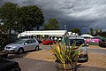
 Coaches at Station, Chinnor, Oxfordshire - geograph.org.uk - 5169964.jpg 788 × 1,050; 462 KB
-
 Coal to Chinnor - geograph.org.uk - 3152689.jpg 1,689 × 1,194; 528 KB
-
 Community Cafe, High St, Chinnor - geograph.org.uk - 5390559.jpg 4,753 × 3,115; 2.78 MB
-
 Cottage for sale, Chinnor - geograph.org.uk - 2888319.jpg 1,280 × 960; 1.25 MB
-
 Cottage in Lower Road, Chinnor - geograph.org.uk - 2888408.jpg 1,280 × 960; 948 KB
-
 Cottage on Chinnor Hill - geograph.org.uk - 4877336.jpg 2,004 × 1,476; 826 KB
-
 Cottage with blue door, Lower Road, Chinnor - geograph.org.uk - 5390286.jpg 5,202 × 3,465; 3.66 MB
-
 Cottages at a crossroads, Chinnor - geograph.org.uk - 2888446.jpg 1,280 × 960; 937 KB
-

-
 Cottages in Station Road, Chinnor - geograph.org.uk - 2890473.jpg 1,280 × 960; 542 KB
-
 Cowleaze, Chinnor - geograph.org.uk - 2233409.jpg 640 × 427; 103 KB
-
 Cows, Chinnor - geograph.org.uk - 1014178.jpg 640 × 480; 169 KB
-
 Crossing at the end of Keens Lane - geograph.org.uk - 5717816.jpg 3,888 × 2,592; 2.73 MB
-
 Derelict quarry in Chinnor - geograph.org.uk - 4876009.jpg 2,048 × 1,536; 1.59 MB
-

-
 Druid's Walk, Chinnor - geograph.org.uk - 2233447.jpg 640 × 427; 112 KB
-
 Electrical junction on Ridgeway, Chinnor - geograph.org.uk - 4876017.jpg 2,048 × 1,536; 1.26 MB
-
 Extensive Renovation - geograph.org.uk - 4384155.jpg 4,000 × 3,000; 1.78 MB
-
 Farm Junk near Emmington - geograph.org.uk - 4384238.jpg 3,832 × 2,660; 2.29 MB
-
 Farmland and bridleway, Chinnor - geograph.org.uk - 2233476.jpg 640 × 480; 182 KB
-

-
 Farmland and pylons, Chinnor - geograph.org.uk - 2233451.jpg 640 × 480; 119 KB
-
 Farmland and pylons, Chinnor - geograph.org.uk - 2315021.jpg 480 × 640; 90 KB
-
 Farmland, Chinnor - geograph.org.uk - 1049119.jpg 640 × 480; 138 KB
-
 Farmland, Chinnor - geograph.org.uk - 2233348.jpg 640 × 480; 151 KB
-
 Farmland, Chinnor - geograph.org.uk - 2233417.jpg 640 × 427; 161 KB
-
 Farmland, Chinnor - geograph.org.uk - 2233418.jpg 640 × 480; 189 KB
-
 Farmland, Chinnor - geograph.org.uk - 2233458.jpg 640 × 480; 153 KB
-
 Farmland, Chinnor - geograph.org.uk - 2233462.jpg 640 × 480; 176 KB
-
 Farmland, Emmington, Chinnor - geograph.org.uk - 2233404.jpg 640 × 480; 158 KB
-
 Female torso sculpture - geograph.org.uk - 4353016.jpg 640 × 480; 150 KB
-
 Field and electrical supply by Thame Road - geograph.org.uk - 4875623.jpg 2,048 × 1,536; 1.47 MB
-
 Field path to Emmington - geograph.org.uk - 5390546.jpg 5,202 × 3,465; 4.32 MB
-
 Floral tributes - geograph.org.uk - 2890778.jpg 1,280 × 1,684; 857 KB
-

-
-
 Footpath near Henton - geograph.org.uk - 4565911.jpg 4,000 × 2,664; 2.35 MB
-
 Footpath nearing Great Covert - geograph.org.uk - 1155583.jpg 640 × 480; 44 KB
-
 Footpath off Thame Road - geograph.org.uk - 5390541.jpg 5,202 × 3,465; 4.88 MB
-
 Footpath to Emmington - geograph.org.uk - 34001.jpg 480 × 640; 131 KB
-
 Former KX300 Telephone Kiosk at Henton - geograph.org.uk - 5334616.jpg 2,592 × 1,944; 1.35 MB
-
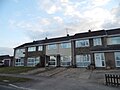
 Former school, Chinnor - geograph.org.uk - 2890592.jpg 1,280 × 960; 731 KB
-
 Former steam mill, Chinnor - geograph.org.uk - 4956306.jpg 640 × 427; 53 KB
-
 Garden at Wain Hill - geograph.org.uk - 4660275.jpg 3,648 × 2,736; 4.11 MB
-
 Grassland, Chinnor - geograph.org.uk - 1013387.jpg 640 × 480; 142 KB
-
 Graveyard, St Andrew's church, Chinnor - geograph.org.uk - 3895651.jpg 4,320 × 3,240; 2.86 MB
-
 Green Fields by the Phoenix Trail - geograph.org.uk - 3989087.jpg 1,600 × 1,240; 710 KB
-
 High Street, Chinnor - geograph.org.uk - 2888294.jpg 1,280 × 960; 1.34 MB
-
 High Street, Chinnor - geograph.org.uk - 2890734.jpg 1,280 × 894; 468 KB
-
 High Street, Chinnor - geograph.org.uk - 5390552.jpg 5,202 × 3,465; 3.21 MB
-
 Hill Top Lane - geograph.org.uk - 4473844.jpg 4,000 × 3,000; 4.67 MB
-
 Hill Top Lane - geograph.org.uk - 941324.jpg 640 × 480; 84 KB
-
 Hilltop Cottages, Hilltop Lane - geograph.org.uk - 4706480.jpg 640 × 480; 147 KB
-
 House on Lower Icknield Way, Chinnor - geograph.org.uk - 5493655.jpg 2,304 × 1,728; 1.12 MB
-
 House with terrace built into the side of Chinnor Hill - geograph.org.uk - 3926976.jpg 4,320 × 3,240; 5.88 MB
-
 Houses on Lower Icknield Way, Chinnor - geograph.org.uk - 5493664.jpg 2,304 × 1,728; 825 KB
-
 Houses on Station Road, Chinnor - geograph.org.uk - 4875665.jpg 2,048 × 1,536; 977 KB
-
 Houses on Station Road, Chinnor - geograph.org.uk - 4875669.jpg 2,048 × 1,536; 964 KB
-
 Implement by the Ridgeway - geograph.org.uk - 5717775.jpg 3,734 × 2,592; 2.56 MB
-
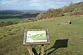
 Information Board at Chinnor Hill - geograph.org.uk - 5714759.jpg 2,592 × 1,944; 1.38 MB
-
 Inside St Andrew, Chinnor (I) - geograph.org.uk - 4104238.jpg 640 × 480; 60 KB
-
 Inside St Andrew, Chinnor (II) - geograph.org.uk - 4104242.jpg 640 × 496; 38 KB
-
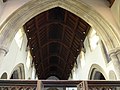 Inside St Andrew, Chinnor (III) - geograph.org.uk - 4104243.jpg 640 × 480; 66 KB
-
 Inside St Andrew, Chinnor (IV) - geograph.org.uk - 4104244.jpg 640 × 480; 58 KB
-
 Inside St Andrew, Chinnor (V) - geograph.org.uk - 4104249.jpg 640 × 480; 76 KB
-
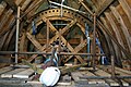
 Installing the tail wheel track at Chinnor Mill - geograph.org.uk - 5395284.jpg 1,600 × 1,064; 458 KB
-
 Junction in the woods - geograph.org.uk - 3926982.jpg 4,320 × 3,240; 5.92 MB
-
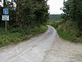
 Junction on Chinnor Road - geograph.org.uk - 4875703.jpg 2,048 × 1,536; 1.66 MB
-
 Junction on Chinnor Road - geograph.org.uk - 5678872.jpg 2,048 × 1,536; 1,010 KB
-
 Lane near Henton - geograph.org.uk - 4976059.jpg 4,000 × 3,000; 3.11 MB
-
 Lane to Wainhill - geograph.org.uk - 941406.jpg 640 × 480; 90 KB
-
 Last house for now - geograph.org.uk - 4197656.jpg 4,000 × 3,000; 2.08 MB
-
 Life on the Chalk - geograph.org.uk - 5717796.jpg 3,888 × 2,592; 3.86 MB
-
 Lime Grove, Chinnor - geograph.org.uk - 2890605.jpg 1,280 × 1,707; 1.28 MB
-

-
-

-
 London Transport Steam Locomotive, Chinnor, Oxfordshire - geograph.org.uk - 5169951.jpg 1,400 × 1,050; 1.23 MB
-

-
 London Transport Steam Locomotive, Chinnor, Oxfordshire - geograph.org.uk - 5169957.jpg 1,400 × 1,050; 1.11 MB
-
 Looking across the Chalk Pit near Chinnor, Oxfordshire - geograph.org.uk - 5169979.jpg 1,400 × 1,050; 1.49 MB
-
 Looking Down On You - geograph.org.uk - 3989103.jpg 1,484 × 1,600; 710 KB
-
 Lower Icknield Way, Chinnor - geograph.org.uk - 2807755.jpg 800 × 600; 127 KB
-
 Lower Icknield Way, Chinnor - geograph.org.uk - 5493696.jpg 2,304 × 1,728; 850 KB
-
 Lower Icknield Way, Chinnor - geograph.org.uk - 5493697.jpg 2,304 × 1,728; 830 KB
-
 Lower Road, Chinnor - geograph.org.uk - 5501013.jpg 2,304 × 1,728; 1.47 MB
-
 Manor Farm, Chinnor - geograph.org.uk - 4876029.jpg 2,048 × 1,536; 1.16 MB
-
 Manor Farm, Chinnor Hill - geograph.org.uk - 1014056.jpg 640 × 480; 114 KB
-
 Manor House, Chinnor - geograph.org.uk - 2890717.jpg 1,280 × 960; 848 KB
-
 Meadow in May - geograph.org.uk - 4976067.jpg 1,600 × 1,195; 615 KB
-
 Methodist Chapel, Chinnor - geograph.org.uk - 5390255.jpg 5,202 × 3,465; 2.29 MB
-
 Middle Farm - geograph.org.uk - 5390319.jpg 5,202 × 3,465; 3.83 MB
-
 Middle Way, Chinnor - geograph.org.uk - 4197553.jpg 1,600 × 1,112; 287 KB
-
 Midsomer Murders in Chinnor - geograph.org.uk - 2057480.jpg 2,048 × 1,536; 727 KB
-
 Midsomer Murders in Chinnor 2 - geograph.org.uk - 2057525.jpg 2,048 × 1,536; 631 KB
-
 Mill Lane - geograph.org.uk - 941429.jpg 640 × 480; 91 KB
-
 Mill Lane looking towards Middle Farm - geograph.org.uk - 5390313.jpg 5,202 × 3,465; 4.04 MB
-
 Mill Lane, approaching Middle Farm - geograph.org.uk - 5390315.jpg 5,202 × 3,465; 3.12 MB
-
 Mill Lane, Chinnor - geograph.org.uk - 1849542.jpg 1,024 × 683; 185 KB
-
 Mill Lane, Chinnor - geograph.org.uk - 5390301.jpg 5,202 × 3,465; 2.37 MB
-
 Morland House, Lower Road, Chinnor - geograph.org.uk - 5390297.jpg 5,202 × 3,465; 2.51 MB
-
 My kind of garden shed^ - geograph.org.uk - 2890748.jpg 1,280 × 960; 699 KB
-
 New Close Farm House - geograph.org.uk - 3989116.jpg 1,600 × 1,101; 354 KB


_-_geograph.org.uk_-_750486.jpg)
_-_geograph.org.uk_-_750499.jpg)
_-_geograph.org.uk_-_750516.jpg)


_-_geograph.org.uk_-_752955.jpg)
_-_geograph.org.uk_-_753203.jpg)


_-_geograph.org.uk_-_4104238.jpg)
_-_geograph.org.uk_-_4104242.jpg)
_-_geograph.org.uk_-_4104243.jpg)
_-_geograph.org.uk_-_4104244.jpg)
_-_geograph.org.uk_-_4104249.jpg)


