Category:Christophoruskapelle (Hasliberg)
Jump to navigation
Jump to search
| Object location | | View all coordinates using: OpenStreetMap |
|---|
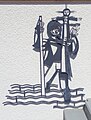
Deutsch: Römisch-katholische Kapelle St. Christophorus Hasliberg.
church building in Hasliberg in the canton of Bern, Switzerland .jpg) .jpg) | |||||
| Upload media | |||||
| Instance of | |||||
|---|---|---|---|---|---|
| Part of | |||||
| Named after | |||||
| Location | Hasliberg, Interlaken-Oberhasli administrative district, Oberland administrative region, Bern, Switzerland | ||||
| Street address |
| ||||
| Diocese | |||||
| Heritage designation |
| ||||
 | |||||
Media in category "Christophoruskapelle (Hasliberg)"
The following 4 files are in this category, out of 4 total.
-
 Christophorus Hasliberg (1).jpg 3,737 × 2,803; 2.69 MB
-
 Christophorus Hasliberg (2).jpg 3,857 × 2,893; 5.99 MB
-
 Christophorus Hasliberg (3).jpg 4,087 × 3,065; 7.14 MB
-
 Christophorus Hasliberg (4).jpg 2,321 × 3,051; 3.67 MB
.jpg)
.jpg)