Category:Church in Gramzow (Krusenfelde)
Jump to navigation
Jump to search
| Object location | | View all coordinates using: OpenStreetMap |
|---|
church building  | |||||
| Upload media | |||||
| Instance of | |||||
|---|---|---|---|---|---|
| Location | Krusenfelde, Vorpommern-Greifswald District, Mecklenburg-Western Pomerania, Germany | ||||
| Heritage designation | |||||
 | |||||
Media in category "Church in Gramzow (Krusenfelde)"
The following 8 files are in this category, out of 8 total.
-
 Gramzow Krusenfelde Kirche 1.JPG 4,000 × 3,000; 4.51 MB
-
 Gramzow Krusenfelde Kirche Grabplatte Budde.jpg 3,000 × 4,000; 4.81 MB
-
 Gramzow Krusenfelde Kirche Innenraum.JPG 4,000 × 3,000; 3.28 MB
-
 Gramzow Krusenfelde Kirche Nordseite.JPG 3,548 × 2,419; 2.77 MB
-
 Gramzow Krusenfelde Kirche Ostgiebel.JPG 4,000 × 3,000; 4.61 MB
-
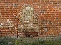 Gramzow Krusenfelde Kirche Südportal.JPG 3,041 × 2,286; 2.27 MB
-
 Gramzow Krusenfelde Kirche Südseite.jpg 4,550 × 2,463; 3.92 MB
-
 Gramzow Krusenfelde Kirche Westgiebel.JPG 4,000 × 3,000; 3.74 MB


