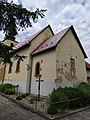
Category:Church of Saint Barnabas (Hradište)
Jump to navigation
Jump to search
| This category shows the protected monument with the number 305-167/1 (other) in the Slovak Republic. |
| This category shows the protected monument with the number 305-167/2 (other) in the Slovak Republic. |
| This category shows the protected monument with the number 305-167/3 (other) in the Slovak Republic. |
| Camera location | | View all coordinates using: OpenStreetMap |
|---|
 | |||||
| Upload media | |||||
| Instance of | |||||
|---|---|---|---|---|---|
| Location | Hradište, Partizánske District, Trenčín Region, Slovakia | ||||
| Architectural style | |||||
| Heritage designation |
| ||||
| Inception |
| ||||
 | |||||
Media in category "Church of Saint Barnabas (Hradište)"
The following 4 files are in this category, out of 4 total.
-
 Hradište kostol 01.jpg 4,000 × 3,000; 5.99 MB
-
 Hradište kostol 02.jpg 4,000 × 3,000; 4.03 MB
-
 Hradište kostol 03.jpg 3,000 × 4,000; 2.19 MB
-
 Hradište kostol 04.jpg 4,000 × 3,000; 2.9 MB


