Category:Church of St. Anthony the Abbot, Xagħra
Jump to navigation
Jump to search
| Object location | | View all coordinates using: OpenStreetMap |
|---|
 | |||||
| Upload media | |||||
| Instance of | |||||
|---|---|---|---|---|---|
| Named after | |||||
| Made from material | |||||
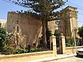
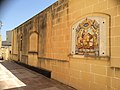
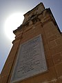
| Location | Xagħra, Gozo Region (Ghawdex), Malta | ||||
| Date of official closure |
| ||||
| Dissolved, abolished or demolished date |
| ||||
 | |||||
Media in category "Church of St. Anthony the Abbot, Xagħra"
The following 9 files are in this category, out of 9 total.
-
 Church of St. Anthony the Abbot 1.jpg 2,592 × 1,936; 1.95 MB
-
 Church of St. Anthony the Abbot 2.jpg 2,592 × 1,936; 1.84 MB
-
 Church of St. Anthony the Abbot 3.jpg 2,592 × 1,936; 1.85 MB
-
 Church of St. Anthony the Abbot 4.jpg 2,592 × 1,936; 1.12 MB
-
 Church of St. Anthony the Abbot 5.jpg 2,592 × 1,936; 2.2 MB
-
 Church of St. Anthony the Abbot 6.jpg 2,592 × 1,936; 1.04 MB
-
 Church of St. Anthony the Abbot 7.jpg 1,936 × 2,592; 1.45 MB
-
 Church of St. Anthony the Abbot 8.jpg 1,936 × 2,592; 1,020 KB
-
 Church of St. Anthony the Abbot.jpg 4,608 × 3,456; 7.38 MB


