Category:Churches in Brighton, East Sussex
Jump to navigation
Jump to search
Churches of all Christian denominations within the former Borough of Brighton (now part of the City of Brighton and Hove), covering the following ancient parishes:
And the following areas, estates and suburbs: Bear Road/Coombe Road area, Bevendean, Carlton Hill/Albion Hill area, Coldean, Elm Grove area, Hanover, Hollingbury, Hollingdean, Kemptown, Montpelier, Moulsecoomb, New England Quarter, North Laine, Preston Park, Queen's Park, Round Hill, Saltdean, Westdene, West Hill, Whitehawk and Woodingdean.
Subcategories
This category has the following 59 subcategories, out of 59 total.
B
C
- Clarendon Centre, Brighton (4 F)
D
- Dorset Gardens Methodist Church (11 F)
F
G
H
- Hanover Chapel, Brighton (7 F)
- Hollingbury Methodist Church (11 F)
J
- St Joseph's Church, Brighton (32 F)
K
- Kingdom Hall, Woodingdean (6 F)
L
M
O
- Oxford Street Chapel, Brighton (11 F)
P
- Patcham Methodist Church (6 F)
- Fountain Centre, Patcham (16 F)
- St Mary's Church, Preston Park (22 F)
Q
R
- Rudyard Hall, Woodingdean (9 F)
S
- St Patrick's Church, Woodingdean (12 F)
T
U
- Brighton Unitarian Church (10 F)
W
- Woodingdean Methodist Church (8 F)
- Woodvale Chapels and Crematorium (10 F)
Media in category "Churches in Brighton, East Sussex"
The following 37 files are in this category, out of 37 total.
-
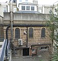
 Brighton and Hove Central Spiritualist Church, Boundary Passage, Brighton.JPG 1,800 × 2,200; 1.07 MB
-

-
 Brighton Little Theatre (former Clarence Baptist Chapel).jpg 1,800 × 2,500; 1,002 KB
-
 Calvary Church, Viaduct Road, Brighton - geograph.org.uk - 4716102.jpg 640 × 471; 102 KB
-

-

-

-

-

-
-

-

-
 Chapel at Ian Fraser House, St Dunstan's, Greenways, Ovingdean (IoE Code 480787).JPG 2,400 × 1,600; 909 KB
-
-
 Church of Christ the King, Brighton - geograph.org.uk - 3233888.jpg 1,600 × 1,200; 401 KB
-
 Church on Davigdor Rd - geograph.org.uk - 3670570.jpg 640 × 430; 112 KB
-
 City Gate Centre, London Road, Brighton.jpg 1,800 × 1,400; 836 KB
-
 Countess of Huntingdon's Chapel Brighton before 1871.jpg 800 × 530; 91 KB
-
 Ebeneezer Baptist Chapel, Richmond Parade - geograph.org.uk - 231510.jpg 463 × 640; 138 KB
-
 Chapel at Brighton Extramural Cemetery (IoE Code 482029).jpg 1,800 × 2,200; 994 KB
-
 Florence Road Baptist Church - geograph.org.uk - 2277409.jpg 1,600 × 1,229; 585 KB
-
 Former Church of St Martin - geograph.org.uk - 5941077.jpg 1,024 × 681; 168 KB
-
 Former Church of St Martin - geograph.org.uk - 5941079.jpg 1,024 × 681; 160 KB
-

-
 Former Islingword Road Baptist Mission, Hanover, Brighton.JPG 1,400 × 2,400; 413 KB
-
 Former Jireh Strict Baptist Chapel, Robert Street, Brighton.jpg 1,600 × 2,300; 846 KB
-
 Former Queen Square Baptist Chapel, Brighton.JPG 1,800 × 2,000; 509 KB
-
 High altar, St. Patrick's, Hove - geograph.org.uk - 4295666.jpg 1,600 × 1,169; 500 KB
-

-
 Montpelier Place Baptist Church, Hove - geograph.org.uk - 2858370.jpg 1,600 × 1,023; 336 KB
-

-
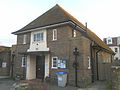 Park Road Hall, Park Road, Rottingdean.JPG 2,400 × 1,800; 1.15 MB
-
 Portslade United Reformed Church - geograph.org.uk - 2859597.jpg 2,048 × 1,536; 667 KB
-
 Portslade URC - geograph.org.uk - 4714814.jpg 640 × 426; 74 KB
-
 Portslade URC - geograph.org.uk - 4714817.jpg 640 × 426; 63 KB
-
 Portslade URC - geograph.org.uk - 4714821.jpg 640 × 426; 66 KB
-


,_Clarence_Gardens,_Brighton_(April_2013).JPG)
.jpg)

,_Greenways,_Ovingdean_(NHLE_Code_1380547)_(December_2016)_(1).JPG)
,_Greenways,_Ovingdean_(NHLE_Code_1380547)_(December_2016)_(2).JPG)
,_Greenways,_Ovingdean_(NHLE_Code_1380547)_(December_2016)_(3).JPG)
,_Greenways,_Ovingdean_(NHLE_Code_1380547)_(December_2016)_(4).JPG)
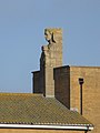
,_Greenways,_Ovingdean_(NHLE_Code_1380547)_(December_2016)_(Carved_Figure)_(1).JPG)
,_Greenways,_Ovingdean_(NHLE_Code_1380547)_(December_2016)_(Carved_Figure)_(2).JPG)
,_Greenways,_Ovingdean_(NHLE_Code_1380547)_(February_2011)_(1).JPG)
,_Greenways,_Ovingdean_(NHLE_Code_1380547)_(February_2011)_(2).JPG)
.JPG)
_(January_2012).JPG)


.jpg)


.jpg)


