Category:Circular maps
Jump to navigation
Jump to search
Subcategories
This category has the following 4 subcategories, out of 4 total.
Media in category "Circular maps"
The following 60 files are in this category, out of 60 total.
-
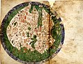
 1154 world map by Moroccan cartographer al-Idrisi for king Roger of Sicily.jpg 1,296 × 1,296; 741 KB
-
 1420 Sallust de Geneve.jpg 1,139 × 1,118; 170 KB
-
 1702 – Carte des Environs de Paris à 3 lieues à la ronde - edited.jpg 6,740 × 6,710; 23.03 MB
-
 1702 – Carte des Environs de Paris à 3 lieues à la ronde.jpg 6,672 × 9,304; 7.39 MB
-

-

-

-
 1830 map of the environs of Paris.jpg 19,807 × 20,045; 122.16 MB
-
-
-

-

-

-

-
 Achin, Nouvelle carte routière du voyageur aux environs de Paris, 1839.jpg 6,694 × 6,603; 21.96 MB
-
 Achin, Nouvelle carte routière du voyageur aux environs de Paris, 1839.tif 6,731 × 6,656; 128.26 MB
-
 Al Masudi's Map of the World.JPG 404 × 402; 29 KB
-
 Al-idrisi world map.jpg 6,828 × 5,068; 11.05 MB
-
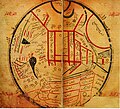
 Al-Idrisi's world map.JPG 1,424 × 1,552; 917 KB
-
 Al-Idrisi-s world map.jpg 492 × 570; 72 KB
-
 Auguste Logerot, Environs de Paris, 1876 - David Rumsey.jpg 13,254 × 10,043; 61.36 MB
-
 Biancomap.jpg 700 × 536; 154 KB
-
 Charlottenburg 1780.jpg 500 × 439; 32 KB
-
 Cheonhado Map.jpg 800 × 771; 392 KB
-
 Claim.jpg 300 × 295; 15 KB
-
 Die Gartenlaube (1891) b 307.jpg 829 × 828; 63 KB
-
 Die Gartenlaube (1891) b 763.jpg 794 × 795; 78 KB
-
 Dīwān Lughāt al-Turk (original).jpg 3,226 × 2,780; 8.93 MB
-
 Earth Map according to Al-Masudi.svg 559 × 523; 648 KB
-
 Ebstorfer Weltkarte 2.jpg 7,849 × 7,798; 28.66 MB
-
 Ebstorfer-stich2.jpg 3,571 × 3,566; 4.02 MB
-
 Flat earth.jpg 498 × 498; 31 KB
-
 Flat earth.png 543 × 543; 396 KB
-
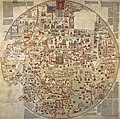
 FraMauroMap.jpg 493 × 493; 124 KB
-
 Grondplan van bolwerk PK-T-1007.jpg 385 × 417; 41 KB
-
 Islamic map of the world Wellcome L0035009.jpg 3,576 × 4,072; 2.54 MB
-
 Joseph Edmund Herder, Bayonne, 1838 - David Rumsey.jpg 19,366 × 15,126; 70.66 MB
-
 Joseph Edmund Herder, Bayonne, 1850 - David Rumsey.jpg 16,668 × 14,444; 69.82 MB
-
 Karte der Steiermark als Brustschild des Doppeladlers.jpg 4,710 × 5,196; 24.33 MB
-
 Kashgari map.jpg 741 × 670; 129 KB
-
 Lake Washington Ship Canal Fish Ladder pamphlet 04.jpg 1,641 × 1,639; 818 KB
-
 Lange diercke sachsen nördlicher sternhimmel.png 3,427 × 2,614; 2.01 MB
-
 Louis-Charles Desnos, Plan de Paris divisé en six tribunaux, ca 1780 - BHVP.jpg 2,252 × 2,395; 1.18 MB
-
 Mahmud al-Kashgari map (Türkçe).png 1,746 × 1,672; 2.48 MB
-
 Mahmud al-Kashgari map.jpg 1,488 × 1,361; 257 KB
-
 Map of Jericho in 14c Farhi Bible by Elisha ben Avraham Crescas.jpg 700 × 752; 168 KB
-
 Mappemonde Fleury.jpg 1,976 × 2,528; 1,021 KB
-
 Meldeman-Plan.jpg 1,156 × 1,068; 1.24 MB
-
 OROGRAPHE ALGAS 2.jpg 2,000 × 2,439; 4.25 MB
-
 Península del Cabo 03.jpg 1,986 × 1,256; 2.68 MB
-
 Plan-Guide du pélerin à Paris, 1894 - Gallica.jpg 9,030 × 7,103; 7.62 MB
-
 Rowbotham's flat Earth map.jpg 600 × 600; 81 KB
-
 Russia Cosmography early 18th century lubok.jpg 3,000 × 3,546; 4.09 MB
-
 Sea ice.svg 706 × 705; 117 KB
-
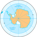 Southern Ocean.svg 600 × 600; 55 KB
-
 St. Stephen's Cathedral, Vienna, 1530.JPG 1,676 × 1,625; 2.9 MB
-
 Urbano Monti — World Map as of 1587.jpg 3,000 × 3,004; 3.57 MB
-
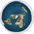
 Van der Grinten projection SW.jpg 2,058 × 2,058; 1.05 MB
-
 Viena 1529.JPG 3,360 × 3,132; 10.96 MB
-
 Океани Землі.png 2,058 × 2,058; 4.67 MB


_-_Geographicus_-_London24-mogg-1820.jpg)


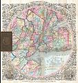
_-_Geographicus_-_NYC33Miles-colton-1879.jpg)
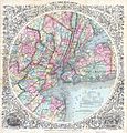
_-_Geographicus_-_NewYork33MilesAround-colton-1855.jpg)
_-_Geographicus_-_NewYork33Miles-colton-1848.jpg)
_-_Geographicus_-_NewYork33Miles-colton-1853.jpg)
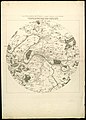
_-_Geographicus_-_EasternHemisphere-stieler-1873.jpg)


_b_307.jpg)
_b_763.jpg)
.jpg)


.png)


