Category:City of Peterborough
Jump to navigation
Jump to search

unitary authority area in Cambridgeshire, England, United Kingdom   | |||||
| Upload media | |||||
| Instance of |
| ||||
|---|---|---|---|---|---|
| Location | Cambridgeshire, East of England, England | ||||
| Capital | |||||
| Legislative body |
| ||||
| Inception |
| ||||
| Population |
| ||||
| Area |
| ||||
| official website | |||||
 | |||||

Subcategories
This category has the following 34 subcategories, out of 34 total.
A
- Ailsworth (148 F)
B
- Borough Fen, Cambridgeshire (92 F)
- Bretton, Cambridgeshire (71 F)
C
D
E
G
H
- Hampton Hargate and Vale (66 F)
M
N
O
P
S
- Stanground North (4 F)
T
U
W
Media in category "City of Peterborough"
The following 200 files are in this category, out of 519 total.
(previous page) (next page)-
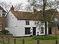
 25 Church Street, Werrington (geograph 7060128).jpg 1,024 × 768; 135 KB
-
 34-36 Church Street, Werrington (geograph 7060134).jpg 1,024 × 732; 131 KB
-
 A glimpse of Peterborough Cathedral - geograph.org.uk - 2400661.jpg 1,824 × 1,368; 817 KB
-
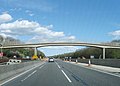
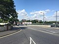
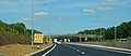
 A1(M) slip road to the A1139 - geograph.org.uk - 4676868.jpg 640 × 310; 41 KB
-
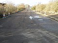
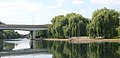 A1139 Bridge - geograph.org.uk - 2059247.jpg 640 × 307; 49 KB
-
 A1139 eastbound - geograph.org.uk - 4536246.jpg 640 × 461; 62 KB
-
 A1139 eastbound - geograph.org.uk - 4536253.jpg 640 × 480; 47 KB
-
 A1139 eastbound - geograph.org.uk - 4536254.jpg 640 × 461; 52 KB
-
 A1139 entering Peterborough - geograph.org.uk - 3630307.jpg 2,034 × 1,299; 1.66 MB
-
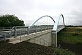
 A1139 footbridge - geograph.org.uk - 3582089.jpg 640 × 480; 57 KB
-
 A1139 northbound - geograph.org.uk - 4536317.jpg 640 × 449; 53 KB
-
 A1139 northbound - geograph.org.uk - 4536359.jpg 640 × 468; 47 KB
-
 A1139 road - geograph.org.uk - 4676911.jpg 640 × 301; 45 KB
-
 A1139, eastbound - geograph.org.uk - 4676914.jpg 640 × 398; 48 KB
-
 A1260 northbound - geograph.org.uk - 4676925.jpg 640 × 332; 45 KB
-
 A15 northwest bound - geograph.org.uk - 5072056.jpg 640 × 480; 47 KB
-
 A15 northwest bound - geograph.org.uk - 5072059.jpg 640 × 480; 58 KB
-
 A15 Werrington Parkway - geograph.org.uk - 5206038.jpg 4,522 × 2,753; 4.8 MB
-
 A16 southbound - geograph.org.uk - 5697513.jpg 640 × 431; 31 KB
-
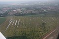
 A605 towards Elton, aerial 2017 - geograph.org.uk - 5444516.jpg 640 × 427; 47 KB
-
 A605 towards Whittlesey - geograph.org.uk - 2937835.jpg 640 × 480; 82 KB
-
 A605 towards Whittlesey - geograph.org.uk - 2937891.jpg 640 × 480; 51 KB
-
-
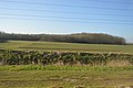
 Agriculture meets industry in Peterborough - geograph.org.uk - 2492200.jpg 4,320 × 3,240; 5.76 MB
-
 All pylons great and small near Peterborough - geograph.org.uk - 2522701.jpg 4,320 × 3,240; 5.43 MB
-
 Allotment Gardens, Werrington - geograph.org.uk - 4158261.jpg 640 × 480; 82 KB
-
 Amazon.co.uk in Peterborough - geograph.org.uk - 2522592.jpg 4,320 × 3,240; 5.51 MB
-
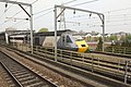
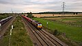
 An East Coast 225 from Hurn Road footbridge - geograph.org.uk - 2455534.jpg 4,000 × 3,000; 4.28 MB
-
 An industrial estate in Werrington - geograph.org.uk - 6401136.jpg 6,252 × 4,164; 5.73 MB
-
 An £80.3 m travellers' site near Peterborough - geograph.org.uk - 2369365.jpg 2,848 × 2,136; 2.97 MB
-

-
 Antonia Grove, Stanground South - geograph.org.uk - 6388599.jpg 5,472 × 3,648; 1.36 MB
-
-
 Autumn leaves on Hodgson Avenue, Werrington - geograph.org.uk - 6651816.jpg 920 × 1,632; 631 KB
-
 Autumn leaves on Serjeant Way, Werrington - geograph.org.uk - 5201415.jpg 4,000 × 3,000; 4.4 MB
-
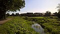
 Balancing pond - geograph.org.uk - 5896606.jpg 1,600 × 1,068; 378 KB
-
-

-
 Benchmark on parapet of Nene Parkway bridge - geograph.org.uk - 6235688.jpg 683 × 1,024; 255 KB
-
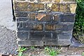
 Benchmark on The Peacock, ^26 London Road - geograph.org.uk - 5989396.jpg 1,024 × 662; 204 KB
-
 Benchmark on wall on NW side of London Road - geograph.org.uk - 5989585.jpg 1,024 × 683; 318 KB
-
 Benchmark on ^124 London Road - geograph.org.uk - 5989541.jpg 1,024 × 683; 287 KB
-
 Benchmark on ^185 London Road - geograph.org.uk - 5917680.jpg 1,024 × 683; 275 KB
-
 Benchmark on ^52 London Road - geograph.org.uk - 5989816.jpg 630 × 1,024; 224 KB
-

-

-
 Block of flats, Peterborough - geograph.org.uk - 2401598.jpg 640 × 430; 43 KB
-
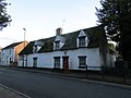
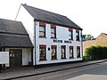 Blue Bell, Werrington - geograph.org.uk - 4158253.jpg 640 × 480; 57 KB
-
 Bluebell Bridge - geograph.org.uk - 1978381.jpg 800 × 536; 167 KB
-
 Bluebell Bridge, Thorpe Wood, Peterborough - geograph.org.uk - 2143752.jpg 2,848 × 2,136; 3.02 MB
-

-
 BMW dealership in Peterborough - geograph.org.uk - 6547643.jpg 4,032 × 3,024; 1.55 MB
-

-
 Bridge taking Nene Parkway over local urban road - geograph.org.uk - 6235731.jpg 1,024 × 683; 270 KB
-
 Bridleway near to disused clay pits - geograph.org.uk - 4626873.jpg 4,320 × 3,240; 4.61 MB
-
 Bridleway towards Eye - geograph.org.uk - 3142588.jpg 640 × 480; 65 KB
-

-
-

-

-
 Brookside Methodist Church - geograph.org.uk - 3119933.jpg 640 × 480; 81 KB
-
 Brookside Methodist Church, Gunthorpe - geograph.org.uk - 6276881.jpg 1,632 × 920; 415 KB
-
 Bungalow on Gunthorpe Road - geograph.org.uk - 3119925.jpg 640 × 480; 75 KB
-
 Bungalow on Gunthorpe Road - geograph.org.uk - 3119932.jpg 800 × 496; 96 KB
-
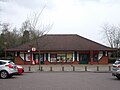
 Bus at Parnwell Centre - geograph.org.uk - 5166277.jpg 1,024 × 768; 116 KB
-
 Bus turning circle, Parnwell Centre - geograph.org.uk - 5166286.jpg 1,024 × 768; 139 KB
-
 Bushes near the Nene Washes - geograph.org.uk - 2523804.jpg 4,320 × 3,240; 5.57 MB
-
 Cannon's Barn Farm, Werrington - geograph.org.uk - 5888006.jpg 1,632 × 920; 590 KB
-
 Car Dyke - geograph.org.uk - 4412888.jpg 640 × 480; 73 KB
-
 Car Dyke Bridge - geograph.org.uk - 2182985.jpg 640 × 427; 44 KB
-
 Car Dyke Bridge - geograph.org.uk - 2182992.jpg 640 × 427; 55 KB
-
 Car Dyke Bridge - Modern bridge over ancient canal - geograph.org.uk - 3159056.jpg 4,320 × 3,240; 5.3 MB
-
 Car Dyke Bridge near Eye, Peterborough - geograph.org.uk - 3159036.jpg 4,320 × 3,240; 5.47 MB
-
 Car Dyke Bridge, Eye near Peterborough - geograph.org.uk - 3159050.jpg 4,320 × 3,240; 5.22 MB
-
 Car Dyke Bridge, Eye, Peterborough - geograph.org.uk - 3159044.jpg 4,320 × 3,240; 5.44 MB
-
 Car Supermarket - geograph.org.uk - 6401135.jpg 6,252 × 4,164; 5.7 MB
-
 Cemetery, Fletton, Cambs. - geograph.org.uk - 6244998.jpg 3,192 × 2,809; 3.27 MB
-

-
 Charnwood Close, Peterborough - geograph.org.uk - 5020789.jpg 640 × 480; 70 KB
-
 Charters and East next to Peterborough town bridge - geograph.org.uk - 2243459.jpg 2,848 × 2,136; 2.94 MB
-
 Chris Turner - geograph.org.uk - 5681781.jpg 1,024 × 683; 105 KB
-
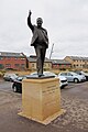 Chris Turner Statue - geograph.org.uk - 5681780.jpg 683 × 1,024; 152 KB
-
 Chris Turner statue at London Road, Peterborough - geograph.org.uk - 5523877.jpg 3,240 × 4,320; 2.72 MB
-
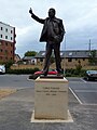 Chris Turner statue, London Road, Peterborough - geograph.org.uk - 5523879.jpg 3,240 × 4,320; 2.79 MB
-
 Church House, Church Street, Werrington - geograph.org.uk - 3951547.jpg 4,000 × 3,000; 2.89 MB
-
 Church on London Road - geograph.org.uk - 3000469.jpg 640 × 480; 68 KB
-
 Church View House, Werrington (geograph 7060023).jpg 1,024 × 768; 152 KB
-
 Construction area, Stanground South - geograph.org.uk - 6388606.jpg 5,472 × 3,648; 1.77 MB
-
-
 Cripple Sidings, Peterborough - geograph.org.uk - 1824711.jpg 640 × 480; 57 KB
-
 Cromwell Road, Peterborough (1) - geograph.org.uk - 5265477.jpg 1,024 × 768; 176 KB
-
 Cuckoo's Hollow, Werrington - geograph.org.uk - 3713901.jpg 4,000 × 3,000; 2.93 MB
-
 Cuckoo's Hollow, Werrington - geograph.org.uk - 3713916.jpg 4,000 × 3,000; 3.5 MB
-
 Cuckoo's Hollow, Werrington - geograph.org.uk - 3798349.jpg 4,000 × 3,000; 2.64 MB
-
 Cuckoo's Hollow, Werrington - geograph.org.uk - 5552773.jpg 4,000 × 3,000; 5.86 MB
-
 Cuckoo's Hollow, Werrington, in autumn - geograph.org.uk - 5552808.jpg 4,000 × 3,000; 4.62 MB
-
 Cycle route junction - geograph.org.uk - 6545635.jpg 3,776 × 2,520; 4.02 MB
-
 Cycle track towards Peterborough - geograph.org.uk - 3020997.jpg 640 × 480; 129 KB
-

-

-

-

-
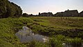
 Ditch near the Lake Settlement, Flag Fen - geograph.org.uk - 2491981.jpg 4,320 × 3,240; 5.52 MB
-
 Don't do it, mate^ - geograph.org.uk - 5021937.jpg 640 × 480; 65 KB
-
 Drain by the railway line - geograph.org.uk - 4391108.jpg 640 × 426; 63 KB
-
 Drain in Werrington - geograph.org.uk - 6276816.jpg 1,632 × 920; 573 KB
-
 Drain in Werrington - geograph.org.uk - 6276823.jpg 1,632 × 920; 561 KB
-
 Drain in Werrington - geograph.org.uk - 6276841.jpg 1,632 × 920; 446 KB
-
 Drain off Storey's Bar Road - geograph.org.uk - 2919837.jpg 640 × 480; 57 KB
-
-
-

-
 East Coast train at the former Hurn Road crossing, Marholm - geograph.org.uk - 4209805.jpg 3,362 × 2,490; 1.73 MB
-
 East Station Road - geograph.org.uk - 2223215.jpg 640 × 480; 93 KB
-
 Edgerley Drain Road heading north - geograph.org.uk - 2919833.jpg 640 × 480; 59 KB
-
 Elm Street, Peterborough - geograph.org.uk - 5016818.jpg 640 × 480; 107 KB
-
 EWS freight train at Marholm Crossing - geograph.org.uk - 5887996.jpg 1,632 × 920; 433 KB
-
 Factory by the railway line - geograph.org.uk - 4340877.jpg 640 × 337; 38 KB
-

-
 Farm building off Newborough Road - geograph.org.uk - 3142561.jpg 640 × 480; 62 KB
-
 Farm buildings, Halfpenny Toll Farm - geograph.org.uk - 2919849.jpg 640 × 480; 54 KB
-
 Farmland near The Bungalow - geograph.org.uk - 3617921.jpg 4,320 × 3,240; 5.8 MB
-
 Farmland near Yaxley - geograph.org.uk - 3000370.jpg 640 × 480; 100 KB
-
 Farmland next to the sewage works - geograph.org.uk - 4920328.jpg 800 × 524; 111 KB
-
 Farmland off Edgerley Drain Road - geograph.org.uk - 2919831.jpg 640 × 480; 69 KB
-
 Farmland off Newborough Road - geograph.org.uk - 3142562.jpg 640 × 480; 72 KB
-
 Farmland off Norwood Lane - geograph.org.uk - 3142565.jpg 640 × 480; 62 KB
-
 Farmland off Pearces Road - geograph.org.uk - 2919845.jpg 640 × 480; 53 KB
-
 Farmland off Storey's Bar Road - geograph.org.uk - 2919839.jpg 640 × 480; 55 KB
-
 Farmland off the A15 - geograph.org.uk - 3000317.jpg 640 × 480; 94 KB
-
 Farmland off Willow Hall Lane - geograph.org.uk - 3142789.jpg 640 × 480; 72 KB
-
 Farmland towards Glinton - geograph.org.uk - 3119816.jpg 800 × 563; 71 KB
-
 Fayreholme, Werrington (geograph 7060036).jpg 1,024 × 893; 203 KB
-
 Fence and pond, Waterworks Lane, Glinton - geograph.org.uk - 3826796.jpg 4,320 × 3,240; 5.52 MB
-
 Fencing beside the A15 - geograph.org.uk - 3119912.jpg 640 × 480; 74 KB
-
 Fenland scene - geograph.org.uk - 4391062.jpg 640 × 426; 51 KB
-
 Field by London Road - geograph.org.uk - 5896563.jpg 1,600 × 1,069; 399 KB
-
 Field by London Road, Yaxley - geograph.org.uk - 6731286.jpg 1,590 × 1,061; 1.36 MB
-
 Flag fen - geograph.org.uk - 2677761.jpg 3,648 × 2,736; 2.04 MB
-
 Flag fen - geograph.org.uk - 2677766.jpg 3,648 × 2,736; 2.09 MB
-
 Flag fen - geograph.org.uk - 2677773.jpg 640 × 480; 97 KB
-
 Flag Fen Bronze Age village, Peterborough - geograph.org.uk - 2492128.jpg 4,320 × 3,240; 5.61 MB
-
 Flats and allotments - geograph.org.uk - 4001281.jpg 1,600 × 1,145; 285 KB
-
-
 Fletton Branch Railway (1) - geograph.org.uk - 2781536.jpg 640 × 480; 127 KB
-
 Fletton Branch Railway (2) - geograph.org.uk - 2781539.jpg 640 × 480; 119 KB
-

-
 Fletton Parkway - geograph.org.uk - 6331418.jpg 640 × 417; 28 KB
-
-
 Flooded clay pit - geograph.org.uk - 4341007.jpg 640 × 430; 39 KB
-
 Flooded clay pit - geograph.org.uk - 4341008.jpg 640 × 430; 29 KB
-
 Flooded former "brick" pit in Fletton, Peterborough - geograph.org.uk - 2514125.jpg 4,320 × 3,240; 5.65 MB
-
 Flooded pit - geograph.org.uk - 4626908.jpg 4,320 × 3,240; 2.99 MB
-
 Flooded workings near the River Nene - geograph.org.uk - 4437686.jpg 640 × 431; 41 KB
-
 Flyover on the A15 Werrington bypass - geograph.org.uk - 3630886.jpg 4,000 × 3,000; 2.64 MB
-
-
 Footbridge across the ECML - geograph.org.uk - 2400370.jpg 640 × 386; 34 KB
-
 Footbridge and road bridge on Fulbridge Road, Werrington - geograph.org.uk - 5552794.jpg 4,000 × 3,000; 5.27 MB
-
 Footbridge over drain in Werrington - geograph.org.uk - 6276829.jpg 1,632 × 920; 577 KB
-
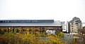
 Footbridge over Soke Parkway, Peterborough - geograph.org.uk - 2369991.jpg 2,848 × 2,136; 2.99 MB
-
 Footbridge over the A1139 - geograph.org.uk - 4676902.jpg 640 × 279; 33 KB
-
 Footpath alongside Lincoln Road near Glinton - geograph.org.uk - 3763674.jpg 4,000 × 3,000; 2.59 MB
-
 Footpath to Two Pond Coppice - geograph.org.uk - 5896743.jpg 1,600 × 1,068; 441 KB
-
 Footpath to Welland, Parnwell - geograph.org.uk - 5166299.jpg 1,024 × 768; 191 KB
-
-
 Former council boundary stone between Glinton and Werrington - geograph.org.uk - 4426288.jpg 3,000 × 4,000; 2.92 MB
-
 Former council boundary stone, Werrington - geograph.org.uk - 4111779.jpg 3,000 × 4,000; 2.97 MB
-
 Former council boundary stone, Werrington - geograph.org.uk - 6365280.jpg 920 × 1,632; 633 KB
-
 Foxcovert Road railway crossing near Werrington - geograph.org.uk - 3710890.jpg 4,000 × 3,000; 2.64 MB
-

-
 Frank Perkins Parkway - geograph.org.uk - 6331525.jpg 640 × 519; 33 KB
-
 Frank Perkins Parkway Bridge - geograph.org.uk - 4920219.jpg 800 × 533; 86 KB
-
 Frank Perkins Parkway Bridge - geograph.org.uk - 4920226.jpg 800 × 500; 122 KB
-

-

-
 Fulbridge Road towards the A47 - geograph.org.uk - 3119943.jpg 640 × 480; 86 KB
-
 Goodwin Walk, Werrington - geograph.org.uk - 5552748.jpg 4,000 × 3,000; 4.34 MB
-
 Goodwin Walk, Werrington - geograph.org.uk - 5552758.jpg 3,000 × 4,000; 4.09 MB
-
 Graffiti covered railway bridge - geograph.org.uk - 2526714.jpg 4,320 × 3,240; 5.77 MB
-
 Grain silos at Cannon's Barn Farm, Werrington - geograph.org.uk - 3523168.jpg 4,000 × 3,000; 2.96 MB
-
 Grain silos at Cannon's Barn Farm, Werrington - geograph.org.uk - 3945259.jpg 4,000 × 3,000; 2.92 MB
-
 Green Backyard, Fletton, Peterborough, Cambs. - geograph.org.uk - 6243656.jpg 2,398 × 1,532; 1.59 MB
-
 Greggs in Fletton Quays, Peterborough - geograph.org.uk - 6765655.jpg 4,032 × 3,024; 5.4 MB
-
 Gunthorpe Road heading west - geograph.org.uk - 3119929.jpg 640 × 480; 61 KB
-
 Gunthorpe Road heading west - geograph.org.uk - 3119937.jpg 640 × 480; 75 KB
-
 Halfpenny Toll House - geograph.org.uk - 2677749.jpg 3,648 × 2,736; 2.1 MB
-
 Hall Lane, Werrington - geograph.org.uk - 3951514.jpg 4,000 × 3,000; 2.98 MB
-
-
-
 High Street, Fletton, Peterborough, Cambs. - geograph.org.uk - 6243914.jpg 4,026 × 2,607; 2.34 MB
-

-
 Hodgson Avenue, Werrington, in the autumn - geograph.org.uk - 6661291.jpg 1,632 × 920; 537 KB
-
 Horsey Hill, Civil War Fort - geograph.org.uk - 2357420.jpg 2,848 × 2,136; 2.97 MB
-
 House on Lincoln Road - geograph.org.uk - 3119812.jpg 640 × 443; 93 KB
-
-

-
 Houses on Hurn Road at Marholm Crossing - geograph.org.uk - 3948752.jpg 4,000 × 3,000; 2.64 MB
-
 Houses on Hurn Road, Werrington - geograph.org.uk - 5887984.jpg 1,632 × 920; 541 KB
-
 Houses on Lincoln Road - geograph.org.uk - 3177634.jpg 640 × 480; 63 KB
-
 Houses on south side of Queen's Walk - geograph.org.uk - 5917511.jpg 1,024 × 646; 170 KB
.jpg)
.jpg)

_slip_road_to_the_A1139_-_geograph.org.uk_-_4676868.jpg)


.jpg)


_-_geograph.org.uk_-_5265477.jpg)


.jpg)


_-_geograph.org.uk_-_2781536.jpg)
_-_geograph.org.uk_-_2781539.jpg)
_over_the_railway_-_geograph.org.uk_-_5989516.jpg)


_heading_south_-_geograph.org.uk_-_2937827.jpg)


