Category:Peterborough
Jump to navigation
Jump to search

cathedral city in Cambridgeshire, England  | |||||
| Upload media | |||||
| Spoken text audio | |||||
|---|---|---|---|---|---|
| Pronunciation audio | |||||
| Instance of | |||||
| Location | City of Peterborough, Cambridgeshire, East of England, England | ||||
| Located in or next to body of water | |||||
| Legislative body | |||||
| Inception |
| ||||
| Population |
| ||||
| Area |
| ||||
| Different from | |||||
| official website | |||||
 | |||||
Subcategories
This category has the following 25 subcategories, out of 25 total.
B
C
- Peterborough City Council (6 F)
F
- Fengate, Peterborough (6 F)
G
- Green Wheel, Peterborough (16 F)
N
P
- Pearl Assurance War Memorial (6 F)
R
S
- Stanground Wash (8 F)
W
- Woodston Ponds (5 F)
Media in category "Peterborough"
The following 200 files are in this category, out of 1,975 total.
(previous page) (next page)-
 00-Clayton-MAIN-Photo-1.jpg 1,920 × 1,440; 387 KB
-
 10, Precincts - geograph.org.uk - 4686307.jpg 640 × 426; 95 KB
-
 12, Minster Precinct - geograph.org.uk - 4686310.jpg 640 × 426; 85 KB
-
 13 tree.jpg 2,127 × 1,704; 1.61 MB
-
 19, Precincts (geograph 4686368).jpg 640 × 426; 94 KB
-

-
 291 London Road, Peterborough - geograph.org.uk - 5020921.jpg 640 × 480; 93 KB
-
 441 Lincoln Road - geograph.org.uk - 6088588.jpg 5,864 × 3,217; 3.64 MB
-
 45 Priestgate, Peterborough - geograph.org.uk - 5012983.jpg 1,600 × 1,009; 568 KB
-
 51 Priestgate, Peterborough - geograph.org.uk - 5010797.jpg 1,280 × 861; 374 KB
-
 71^ 73 Rothesay Terrace - geograph.org.uk - 6070017.jpg 3,808 × 5,660; 3.74 MB
-
 A Bit Of Support - geograph.org.uk - 977021.jpg 640 × 480; 84 KB
-
 A glimpse of Peterborough Cathedral - geograph.org.uk - 2400661.jpg 1,824 × 1,368; 817 KB
-
 A heron in Thorpe Park, Peterborough - geograph.org.uk - 2144846.jpg 2,848 × 2,136; 2.99 MB
-
 A McClock near Cathedral Square - geograph.org.uk - 1618048.jpg 480 × 640; 60 KB
-
 A motto for Geographers^ - geograph.org.uk - 5028545.jpg 1,024 × 768; 240 KB
-
 A ray of light - geograph.org.uk - 3781993.jpg 4,896 × 3,672; 6.46 MB
-
 A sign of the times - geograph.org.uk - 5542922.jpg 5,800 × 3,867; 6.68 MB
-
 A Spire, close up sculpture detail - geograph.org.uk - 1274174.jpg 480 × 640; 25 KB
-
 A superior front door - geograph.org.uk - 6077704.jpg 3,847 × 5,943; 3.87 MB
-

-
 A way into the Close - geograph.org.uk - 4230267.jpg 3,264 × 2,448; 1.69 MB
-
 A1139 northbound - geograph.org.uk - 4536321.jpg 640 × 479; 52 KB
-
 A1179 - geograph.org.uk - 4696646.jpg 640 × 426; 94 KB
-
 A1179 Bridge - geograph.org.uk - 4336349.jpg 640 × 430; 77 KB
-
 A1179 bridge over the East Coast mainline - geograph.org.uk - 5093681.jpg 5,472 × 3,648; 7.47 MB
-

-
 A1179 road Bridge - geograph.org.uk - 4677014.jpg 640 × 426; 61 KB
-
 A1179 road Bridge - geograph.org.uk - 4696649.jpg 640 × 426; 60 KB
-
 A1179 Thorpe Road ^ Crescent Bridge - geograph.org.uk - 5008579.jpg 3,046 × 2,181; 2.27 MB
-
 A1179 Thorpe Road ^ Roadsign - geograph.org.uk - 5008574.jpg 3,072 × 2,304; 1.87 MB
-
 A1179 Thorpe Road, Peterborough - geograph.org.uk - 5008548.jpg 3,072 × 2,304; 1.9 MB
-
 A1179 Thorpe Road, Peterborough - geograph.org.uk - 5008552.jpg 3,072 × 2,304; 1.77 MB
-
 A1179 Thorpe Road, Peterborough - geograph.org.uk - 5008569.jpg 2,607 × 2,067; 2.31 MB
-
 A1179 Thorpe Road, Peterborough - geograph.org.uk - 5009228.jpg 3,072 × 2,304; 1.98 MB
-
 A1179, eastbound - geograph.org.uk - 4677005.jpg 640 × 326; 73 KB
-
 A1179, eastbound - geograph.org.uk - 4677199.jpg 640 × 291; 55 KB
-
 A15 - geograph.org.uk - 4691087.jpg 640 × 426; 74 KB
-
 A15 Bourges Boulevard, Peterborough - geograph.org.uk - 5008684.jpg 3,072 × 2,304; 1.9 MB
-
 A15 Bourges Boulevard, Peterborough - geograph.org.uk - 5009172.jpg 3,072 × 2,304; 1.9 MB
-
 A15 Bourges Boulevard, Peterborough - geograph.org.uk - 5009178.jpg 3,072 × 2,304; 1.77 MB
-
 A15 Bourges Boulevard, Peterborough - geograph.org.uk - 5009186.jpg 3,072 × 2,304; 1.93 MB
-
 A15 Bridge, River Nene - geograph.org.uk - 4691057.jpg 640 × 426; 78 KB
-
 A15 Bridge, River Nene - geograph.org.uk - 4691063.jpg 640 × 426; 85 KB
-
 A15 Bridge, River Nene - geograph.org.uk - 4691065.jpg 640 × 426; 76 KB
-
 A15 Bridge, River Nene - geograph.org.uk - 4691095.jpg 640 × 426; 61 KB
-
 A15 in Peterborough - geograph.org.uk - 4691082.jpg 640 × 426; 60 KB
-
 A15 over the bridge - geograph.org.uk - 4691085.jpg 640 × 426; 66 KB
-
 A47 bridge over the A15 - geograph.org.uk - 3000450.jpg 640 × 480; 65 KB
-
 A47 westbound - geograph.org.uk - 5910350.jpg 640 × 440; 49 KB
-
 Acacia Tree On Cycle Route - geograph.org.uk - 965943.jpg 480 × 640; 92 KB
-
 Access to Fletton Lake - geograph.org.uk - 1547443.jpg 640 × 480; 76 KB
-
 Across the Nene Valley - not far from Oundle - panoramio.jpg 2,288 × 1,712; 826 KB
-
 Across the Nene Valley - panoramio.jpg 2,288 × 1,712; 816 KB
-
 AdeccoUK.jpg 937 × 608; 93 KB
-
-
 Affinity-rec-color.jpg 1,200 × 400; 82 KB
-
 Aglais urticae (34981488653).jpg 5,184 × 3,456; 8.53 MB
-
 Air raid shelter under the trees - May 2013 - panoramio.jpg 4,000 × 3,000; 2.48 MB
-
 Alexandra Road, New England - geograph.org.uk - 5260952.jpg 1,024 × 768; 162 KB
-

-
 All asleep - geograph.org.uk - 5054868.jpg 2,560 × 1,920; 1.25 MB
-
 All Saints Church, Peterborough - geograph.org.uk - 3810537.jpg 2,476 × 2,936; 1.4 MB
-
 All Saints Church, Peterborough - geograph.org.uk - 3810555.jpg 4,000 × 3,000; 2.61 MB
-
 All Saints Church, Peterborough, in the snow - geograph.org.uk - 3810544.jpg 4,000 × 3,000; 2.67 MB
-
 Allen Road, New England - geograph.org.uk - 5260953.jpg 1,024 × 768; 138 KB
-
-
 Alma Road - geograph.org.uk - 6090359.jpg 6,032 × 4,014; 3.44 MB
-
 Almoner's House - geograph.org.uk - 5017354.jpg 640 × 427; 113 KB
-
 Almoners House - geograph.org.uk - 2221908.jpg 640 × 480; 122 KB
-
 Almoners House - geograph.org.uk - 2221924.jpg 480 × 640; 97 KB
-
 Along Broadway - geograph.org.uk - 5018737.jpg 640 × 427; 94 KB
-
 Along Cowgate - geograph.org.uk - 3781971.jpg 4,896 × 3,672; 6.95 MB
-
 Along Priestgate - geograph.org.uk - 5017346.jpg 427 × 640; 82 KB
-

-
 Ambulance on Church Street - geograph.org.uk - 5017367.jpg 640 × 427; 136 KB
-
 An A'thing Shop - geograph.org.uk - 5013436.jpg 640 × 480; 409 KB
-
 An empty car park in Peterborough - geograph.org.uk - 1564511.jpg 640 × 480; 75 KB
-
 An ordinary suburban street - geograph.org.uk - 6089615.jpg 6,032 × 4,014; 3.34 MB
-
 Ancient stone - geograph.org.uk - 6070033.jpg 6,032 × 4,014; 4.06 MB
-
 Anglia Co-operative logo.png 365 × 52; 12 KB
-
 Another hand car wash, Fengate - geograph.org.uk - 1564527.jpg 640 × 480; 71 KB
-

-
 Apartments being built on Fletton Quays in Peterborough - geograph.org.uk - 6029453.jpg 4,032 × 3,024; 2.6 MB
-
 Apartments beside the River Nene - geograph.org.uk - 4138533.jpg 640 × 480; 63 KB
-
 Apartments beside the River Nene - geograph.org.uk - 4138536.jpg 640 × 458; 79 KB
-
 Apex House, New Fletton - geograph.org.uk - 1312936.jpg 480 × 640; 78 KB
-

-
 Arch outside the Chapter House - geograph.org.uk - 4686379.jpg 426 × 640; 79 KB
-
 Argynnis paphia (20795815021).jpg 4,300 × 3,980; 12.29 MB
-
 Argynnis paphia (20795825931).jpg 4,800 × 3,700; 11.1 MB
-
-
 ASDA, Peterborough - geograph.org.uk - 4691099.jpg 640 × 426; 68 KB
-
 ASDA, Peterborough - geograph.org.uk - 4691108.jpg 640 × 426; 78 KB
-

-
 Athletics Ground, Peterborough - geograph.org.uk - 2501526.jpg 538 × 640; 78 KB
-
 Athletics Ground, Peterborough - geograph.org.uk - 2501528.jpg 577 × 640; 63 KB
-
 Attention drivers, big sheds to let - geograph.org.uk - 1274499.jpg 640 × 480; 75 KB
-
 Audley Gate, Netherton - geograph.org.uk - 4535968.jpg 1,280 × 960; 257 KB
-
 Audley Gate, Peterborough - geograph.org.uk - 5014264.jpg 1,024 × 768; 171 KB
-
 Autumn Colours On London Road - geograph.org.uk - 982859.jpg 640 × 480; 85 KB
-
 B ^ Q Peterborough - geograph.org.uk - 2491871.jpg 4,320 × 3,240; 5.46 MB
-
 B ^ Q, Peterborough - geograph.org.uk - 2369860.jpg 640 × 319; 33 KB
-
 B ^ Q, Peterborough - geograph.org.uk - 2402234.jpg 640 × 430; 46 KB
-
 Ba Shoh, Broadway, Peterborough - geograph.org.uk - 5026598.jpg 1,024 × 767; 161 KB
-
 Baby rabbit - geograph.org.uk - 5009387.jpg 2,000 × 2,000; 1.29 MB
-
 Back River - geograph.org.uk - 4340972.jpg 640 × 430; 39 KB
-
 Balloon seller on Cathedral Square, Peterborough - geograph.org.uk - 5772474.jpg 3,456 × 4,608; 6.15 MB
-
 BandQ Peterborough - geograph.org.uk - 1027327.jpg 640 × 468; 69 KB
-
 Banner on the gate - geograph.org.uk - 6067283.jpg 2,716 × 1,362; 1.3 MB
-
 Bar boat - geograph.org.uk - 5054801.jpg 2,555 × 1,917; 1.16 MB
-

-
 Barge on the River Nene, Peterborough, Cambs. - geograph.org.uk - 6245241.jpg 3,965 × 2,974; 3.09 MB
-
 BBC Radio Cambridgeshire - geograph.org.uk - 5008648.jpg 3,072 × 2,304; 1.81 MB
-
 Beales Department Store, Westgate, Peterborough - geograph.org.uk - 5265498.jpg 1,024 × 768; 115 KB
-
 Beautiful bank - geograph.org.uk - 5055767.jpg 2,551 × 1,913; 944 KB
-
 Beeches Avenue - geograph.org.uk - 2616274.jpg 640 × 404; 89 KB
-
-
 Begging in Bridge Street, Peterborough - geograph.org.uk - 5022790.jpg 480 × 640; 109 KB
-
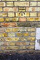
 Bench mark on the Almoners House - geograph.org.uk - 2221907.jpg 480 × 640; 98 KB
-

-
 Benchmark at entrance to Sugar Square West pub - geograph.org.uk - 5921353.jpg 683 × 1,024; 203 KB
-
 Benchmark on Bestway Cash ^ Carry Warehouse - geograph.org.uk - 6235301.jpg 1,024 × 683; 331 KB
-
 Benchmark on Crescent Bridge - geograph.org.uk - 2316103.jpg 640 × 480; 82 KB
-
 Benchmark on Crescent Bridge, Thorpe Road - geograph.org.uk - 5920819.jpg 833 × 1,024; 314 KB
-
 Benchmark on front of ^167 Cromwell Road - geograph.org.uk - 6079494.jpg 683 × 1,024; 323 KB
-

-
 Benchmark on Lodge Hotel, Lime Tree Avenue face - geograph.org.uk - 6085122.jpg 651 × 1,024; 237 KB
-

-
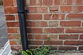
 Benchmark on St John the Baptist's Church - geograph.org.uk - 5989094.jpg 1,024 × 683; 267 KB
-
 Benchmark on St Martin's Church - geograph.org.uk - 6086741.jpg 1,024 × 663; 230 KB
-
 Benchmark on The Beeches Primary School - geograph.org.uk - 6079498.jpg 1,024 × 671; 213 KB
-
 Benchmark on the Blue Bell pub - geograph.org.uk - 6088336.jpg 1,024 × 683; 197 KB
-
 Benchmark on The College Arms - geograph.org.uk - 5969805.jpg 1,024 × 683; 239 KB
-
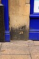
 Benchmark on the Guildhall - geograph.org.uk - 5989035.jpg 645 × 1,024; 302 KB
-

-
 Benchmark on ^1 Westgate - geograph.org.uk - 6117566.jpg 683 × 1,024; 184 KB
-
 Benchmark on ^105 Alma Road - geograph.org.uk - 6086750.jpg 1,024 × 683; 256 KB
-
 Benchmark on ^11 Mayor's Walk - geograph.org.uk - 5921397.jpg 1,024 × 683; 249 KB
-
 Benchmark on ^116 Huntly Grove, 'Cedar Dale' - geograph.org.uk - 6085327.jpg 678 × 1,024; 197 KB
-
 Benchmark on ^121 Dogsthorpe Road - geograph.org.uk - 6086725.jpg 650 × 1,024; 226 KB
-
 Benchmark on ^142 Elmfield Road - geograph.org.uk - 6089235.jpg 1,024 × 667; 230 KB
-
 Benchmark on ^15 Alexandra Road - geograph.org.uk - 6086945.jpg 642 × 1,024; 203 KB
-
 Benchmark on ^15 Garton End Road (The Chestnuts) - geograph.org.uk - 6088039.jpg 656 × 1,024; 225 KB
-
 Benchmark on ^186 St Pauls Road - geograph.org.uk - 5578920.jpg 684 × 1,024; 174 KB
-
 Benchmark on ^19 Cromwell Road - geograph.org.uk - 6079363.jpg 1,024 × 683; 323 KB
-
 Benchmark on ^24 Exeter Road - geograph.org.uk - 6088147.jpg 1,024 × 664; 209 KB
-
 Benchmark on ^292 Dogsthorpe Road (Rocklands) - geograph.org.uk - 6089056.jpg 1,024 × 683; 283 KB
-
 Benchmark on ^32 Priestgate - geograph.org.uk - 5989122.jpg 1,024 × 673; 246 KB
-
 Benchmark on ^40 Elmsfield Road - geograph.org.uk - 6089374.jpg 1,024 × 683; 275 KB
-
 Benchmark on ^41 Granville Street - geograph.org.uk - 6084041.jpg 683 × 1,024; 248 KB
-
 Benchmark on ^47 Burghley Road - geograph.org.uk - 6084966.jpg 1,024 × 665; 245 KB
-
 Benchmark on ^47 Dogsthorpe Road - geograph.org.uk - 6085196.jpg 1,024 × 683; 316 KB
-
 Benchmark on ^48 Alexandra Road - geograph.org.uk - 6086898.jpg 1,024 × 679; 236 KB
-
 Benchmark on ^60 Thorpe Road - geograph.org.uk - 5921262.jpg 1,024 × 683; 223 KB
-
 Benchmark on ^71 Huntly Grove - geograph.org.uk - 6085603.jpg 1,024 × 683; 244 KB
-
 Benchmark on ^85 Gladstone Street - geograph.org.uk - 6079420.jpg 632 × 1,024; 148 KB
-
 Benchmark on ^86 Elmfield Road - geograph.org.uk - 6089291.jpg 1,024 × 671; 237 KB
-
 Benchmark on ^91 Peveril Road - geograph.org.uk - 6088247.jpg 1,024 × 683; 231 KB
-
 Benchmark on ^93 Granville Street - geograph.org.uk - 6084554.jpg 683 × 1,024; 295 KB
-
 Beside the Nene near Ashton - Oundle - July 2014 - panoramio.jpg 4,000 × 3,000; 1.53 MB
-
-
 Beyond Holme Fen NNR - April 2016 - panoramio.jpg 4,000 × 2,038; 960 KB
-
 BHS, Peterborough - closing down sale - geograph.org.uk - 5028592.jpg 1,024 × 768; 220 KB
-
 Big retail - geograph.org.uk - 6087073.jpg 6,032 × 4,014; 4.03 MB
-
 Bike in a tree in Woodston - panoramio.jpg 1,257 × 1,265; 429 KB
-
 Birds on the river (1) - geograph.org.uk - 5054343.jpg 2,443 × 1,833; 1.07 MB
-
 Birds on the river (2) - geograph.org.uk - 5054345.jpg 2,507 × 1,881; 1.19 MB
-
 Birds on the river (3) - geograph.org.uk - 5054346.jpg 2,560 × 1,920; 2.14 MB
-
 Bishop's Rd - geograph.org.uk - 4686409.jpg 640 × 426; 75 KB
-
 Bishop's Rd - geograph.org.uk - 4686410.jpg 640 × 419; 86 KB
-
 Bishop's Road Gardens (1) - geograph.org.uk - 5054875.jpg 2,560 × 1,920; 1.8 MB
-
 Bishop's Road Gardens (2) - geograph.org.uk - 5054922.jpg 2,541 × 1,905; 1.68 MB
-
 Bishop's Road Gardens (3) - geograph.org.uk - 5054934.jpg 1,920 × 2,560; 1.69 MB
-
 Bishop's Road Gardens - geograph.org.uk - 5017352.jpg 640 × 427; 101 KB
-
 Bishop's Road Gardens, Peterborough - geograph.org.uk - 4950080.jpg 4,000 × 3,000; 4.98 MB
-
 Bishop's Road Gardens, Peterborough - geograph.org.uk - 4950083.jpg 3,000 × 4,000; 5.15 MB
-
 Bishops Palace gardens - geograph.org.uk - 1598758.jpg 640 × 425; 141 KB
-

-

-
 Blue Plaque - geograph.org.uk - 6070028.jpg 5,719 × 3,819; 4.25 MB
-
 Blue skies over Holme Fen - April 2016 - panoramio.jpg 4,000 × 3,000; 5.04 MB
-
 Bluebell Walk along River Nene - panoramio.jpg 2,048 × 1,536; 1.88 MB
-
 Bluebells - panoramio (1).jpg 2,048 × 1,536; 1.92 MB
-
 Bluebells at Helpston Heath - geograph.org.uk - 641739.jpg 640 × 480; 152 KB
-
 Boarding the train - geograph.org.uk - 5970557.jpg 6,032 × 4,014; 3.34 MB
-
 Boat House About 500 Yards East South East Of Burghley House.jpg 4,032 × 3,024; 3.33 MB
-
 Boat on the Nene - geograph.org.uk - 4691110.jpg 640 × 426; 67 KB
-
 Boating under the bridge - geograph.org.uk - 5010822.jpg 1,280 × 853; 325 KB
-

-
 Boats on the River Nene at Peterborough - geograph.org.uk - 5123569.jpg 5,376 × 2,485; 1.75 MB
-
 Boundary Stone, Wansford Bridge (geograph 6994235).jpg 768 × 1,024; 142 KB
-
-

-
 Bourges Boulevard (A15) Peterborough - geograph.org.uk - 3119983.jpg 640 × 480; 55 KB
-
 Bourges Boulevard - geograph.org.uk - 1873464.jpg 640 × 480; 163 KB
-
 Bourges Boulevard - geograph.org.uk - 2364865.jpg 640 × 463; 62 KB
-
 Bourges Boulevard - geograph.org.uk - 5017604.jpg 640 × 427; 94 KB
-
 Bourges Boulevard - geograph.org.uk - 5054337.jpg 2,555 × 1,915; 1.22 MB
-
 Bourges Boulevard in Peterborough - geograph.org.uk - 5001484.jpg 1,500 × 1,105; 148 KB


.jpg)


.jpg)


.jpg)
.jpg)


_-_geograph.org.uk_-_6088039.jpg)


_-_geograph.org.uk_-_6089056.jpg)


_-_geograph.org.uk_-_5054343.jpg)
_-_geograph.org.uk_-_5054345.jpg)
_-_geograph.org.uk_-_5054346.jpg)


_-_geograph.org.uk_-_5054875.jpg)
_-_geograph.org.uk_-_5054922.jpg)
_-_geograph.org.uk_-_5054934.jpg)


,_Society_of_Antiquaries_of_London,_UK_(21927205741).jpg)


.jpg)


.jpg)
_heading_north_-_geograph.org.uk_-_2919776.jpg)
_heading_north_-_geograph.org.uk_-_2919778.jpg)
_Peterborough_-_geograph.org.uk_-_3119983.jpg)


