Category:City of St Albans
Vai alla navigazione
Vai alla ricerca
city and district in Hertfordshire, England  St Albans Cathedral   | |||||
| Carica un file multimediale | |||||
| Istanza di |
| ||||
|---|---|---|---|---|---|
| Luogo | Hertfordshire, Est dell'Inghilterra, Inghilterra | ||||
| Capitale | |||||
| Organo legislativo |
| ||||
| Popolazione |
| ||||
| Superficie |
| ||||
| sito web ufficiale | |||||
 | |||||
The City of St Albans, also known as the City and District of St Albans or District of St Albans, is a local government district, in Hertfordshire, England.
Sottocategorie
Questa categoria contiene le 14 sottocategorie indicate di seguito, su un totale di 14.
File nella categoria "City of St Albans"
Questa categoria contiene 200 file, indicati di seguito, su un totale di 632.
(pagina precedente) (pagina successiva)-
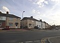
 (Liberal) Club - geograph.org.uk - 4745558.jpg 1 280 × 960; 326 KB
-
 0505222025b~2.jpg 4 656 × 2 566; 3,07 MB
-
 105 St Peter's Street - geograph.org.uk - 4745527.jpg 1 280 × 978; 232 KB
-
 1111211015e HDR.jpg 3 492 × 4 656; 2,59 MB
-
 1128201148a HDR~2.jpg 4 656 × 3 492; 1,58 MB
-
 12 - 14 Chequer Street - geograph.org.uk - 2643379.jpg 425 × 640; 68 KB
-
 153 Victoria Street - geograph.org.uk - 4745601.jpg 1 280 × 937; 281 KB
-
 153 Victoria Street, detail - geograph.org.uk - 4745604.jpg 1 280 × 848; 283 KB
-
 174-176 London Road - geograph.org.uk - 2678495.jpg 640 × 425; 78 KB
-
 2 Chequer Street - geograph.org.uk - 3430448.jpg 640 × 424; 233 KB
-
 32-34 Upper Marlborough Road - geograph.org.uk - 2705831.jpg 640 × 425; 78 KB
-
 36 Ridgmont Road - geograph.org.uk - 2732376.jpg 425 × 640; 56 KB
-
 38 - 42 St Peter's Street - geograph.org.uk - 2643442.jpg 425 × 640; 86 KB
-
 4 - 8 Watling Street - geograph.org.uk - 2740354.jpg 640 × 425; 77 KB
-
 40 - 42 St Peter's Street - geograph.org.uk - 2648494.jpg 425 × 640; 78 KB
-
 40 - 42 St Peter's Street - geograph.org.uk - 2649138.jpg 640 × 425; 83 KB
-
 40 Verulam Road - geograph.org.uk - 2931951.jpg 425 × 640; 270 KB
-
 58 - 60 St Peter's Street - geograph.org.uk - 2649280.jpg 640 × 425; 65 KB
-
 58 ^ 60 St Peter's Street - geograph.org.uk - 4745542.jpg 1 280 × 967; 274 KB
-
 8 - 10 Chequer Street - geograph.org.uk - 2643368.jpg 425 × 640; 69 KB
-
 A choice of low-price shops - geograph.org.uk - 3043038.jpg 1 000 × 751; 697 KB
-
 A favourite perch - geograph.org.uk - 3881989.jpg 768 × 1 024; 488 KB
-

-
 A Saturday stroll in Verulamium Park - geograph.org.uk - 3883363.jpg 1 024 × 768; 298 KB
-
 A wet jog - geograph.org.uk - 3884922.jpg 1 024 × 768; 407 KB
-

-

-
 Abbey Mill bypass cascade from the bottom - geograph.org.uk - 3881980.jpg 1 024 × 768; 284 KB
-
 Abbey Mill bypass cascade, top - geograph.org.uk - 3881979.jpg 1 024 × 768; 424 KB
-
 Abbots Avenue at the junction of Cottonmill Lane - geograph.org.uk - 4083464.jpg 2 560 × 1 920; 2,02 MB
-
 Aboyne Lodge School (geograph 7267816).jpg 1 024 × 768; 788 KB
-
 Alban Way - geograph.org.uk - 5379075.jpg 5 202 × 3 465; 4,66 MB
-
 Alban Way Bridge - geograph.org.uk - 4787796.jpg 480 × 640; 75 KB
-
 Alban Way bridge over Camp Road - geograph.org.uk - 5379829.jpg 5 202 × 3 465; 3,86 MB
-
 Alban Way from Ashley Road bridge - geograph.org.uk - 5379873.jpg 5 202 × 3 465; 4,81 MB
-
 Albert Street - geograph.org.uk - 2739445.jpg 640 × 425; 71 KB
-
 Albert Street - geograph.org.uk - 2931130.jpg 640 × 425; 337 KB
-
 Albion Road - geograph.org.uk - 3300629.jpg 640 × 425; 289 KB
-
 Albion Road - geograph.org.uk - 3300635.jpg 640 × 425; 289 KB
-
 Alexandra Road - geograph.org.uk - 2708172.jpg 640 × 425; 102 KB
-
 Alma Road - geograph.org.uk - 2635767.jpg 425 × 640; 113 KB
-
 Alma Road - geograph.org.uk - 5379063.jpg 5 202 × 3 465; 3,5 MB
-
 Alma Road, St Albans - geograph.org.uk - 5246160.jpg 1 588 × 2 206; 910 KB
-
 Alma Road, St Albans - geograph.org.uk - 5628752.jpg 2 304 × 1 728; 857 KB
-
 Alma Road, St Albans - geograph.org.uk - 5628753.jpg 2 304 × 1 728; 865 KB
-
-
 Approaching Park Street roundabout - geograph.org.uk - 2294215.jpg 1 594 × 1 139; 372 KB
-
 Archers Fields off Sandridge Road - geograph.org.uk - 2667883.jpg 800 × 600; 446 KB
-
 Art deco house on Harpenden Road - geograph.org.uk - 4645017.jpg 2 222 × 1 614; 1 002 KB
-
 Ashley Road bridge - geograph.org.uk - 5379864.jpg 5 202 × 3 465; 5,5 MB
-
 At St Albans City Station - geograph.org.uk - 3983457.jpg 1 820 × 2 547; 1,48 MB
-
 Autumn colour in Sandridge Road - geograph.org.uk - 2667888.jpg 800 × 600; 431 KB
-
 Autumn Colour in St.Albans - geograph.org.uk - 3217435.jpg 4 000 × 2 666; 7,68 MB
-

-
 Autumn colours (25602820583).jpg 4 288 × 3 216; 4,59 MB
-
 Autumn Sunshine in St.Albans - geograph.org.uk - 3217524.jpg 4 000 × 2 792; 6,53 MB
-
 Avenue Road - geograph.org.uk - 2704301.jpg 640 × 425; 93 KB
-
 Avenue Road - geograph.org.uk - 2704379.jpg 640 × 425; 67 KB
-
 Aylett Nurseries, London Colney - geograph.org.uk - 5299281.jpg 2 124 × 1 557; 1,18 MB
-
 Bandstand, Clarence Park - geograph.org.uk - 3297287.jpg 640 × 425; 431 KB
-
 Bardwell Road - geograph.org.uk - 2931423.jpg 640 × 425; 272 KB
-
 Batchwood Drive, St Albans - geograph.org.uk - 3777691.jpg 2 304 × 1 728; 837 KB
-
 Batchwood Drive, Townsend - geograph.org.uk - 5628677.jpg 2 304 × 1 728; 854 KB
-
 Batchwood Drive, Townsend - geograph.org.uk - 5628678.jpg 2 304 × 1 728; 1,23 MB
-
 Batchwood Drive, Townsend - geograph.org.uk - 5628682.jpg 2 304 × 1 728; 851 KB
-
 Batchwood View at the junction of Townsend Road - geograph.org.uk - 5628679.jpg 2 304 × 1 728; 1,12 MB
-
 Batchwood View, Townsend - geograph.org.uk - 5631817.jpg 2 296 × 1 718; 1,09 MB
-
 Battlefield Road - geograph.org.uk - 2626263.jpg 640 × 425; 71 KB
-
 Beach Bottom Dyke explanatory sign - geograph.org.uk - 5391296.jpg 640 × 480; 182 KB
-
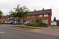
 Beaconsfield Road, St Albans - geograph.org.uk - 5628754.jpg 2 304 × 1 728; 812 KB
-
 Beaumont Avenue - geograph.org.uk - 3450725.jpg 640 × 424; 312 KB
-
 Beaumont Works, Sutton Road - geograph.org.uk - 5379851.jpg 5 098 × 2 940; 2,5 MB
-
 Bedmond Lane - Windridge Road - geograph.org.uk - 205613.jpg 640 × 480; 128 KB
-
 Bedmond Lane, St Stephens - geograph.org.uk - 4645026.jpg 2 304 × 1 728; 869 KB
-
 Bedmond Lane, St Stephens - geograph.org.uk - 4645027.jpg 2 304 × 1 728; 852 KB
-
 Beech Bottom Dyke - geograph.org.uk - 4406794.jpg 800 × 530; 711 KB
-
 Beech Bottom Dyke - geograph.org.uk - 4406797.jpg 800 × 530; 738 KB
-
 Beech Bottom Dyke - geograph.org.uk - 4406800.jpg 800 × 530; 729 KB
-
 Beech Bottom Dyke - geograph.org.uk - 4411556.jpg 800 × 530; 775 KB
-
 Beech Bottom Dyke - geograph.org.uk - 5391291.jpg 640 × 480; 221 KB
-
 Beech Bottom Dyke - geograph.org.uk - 5396828.jpg 640 × 480; 226 KB
-
 Beech leaves sprouting - geograph.org.uk - 3881951.jpg 640 × 480; 62 KB
-
 Beech Road - geograph.org.uk - 4411489.jpg 800 × 530; 396 KB
-
 Beech Road - geograph.org.uk - 4411512.jpg 799 × 537; 439 KB
-
 Beech Road shops - geograph.org.uk - 4411479.jpg 800 × 530; 450 KB
-
 Beech Road, Bernards Heath - geograph.org.uk - 5298364.jpg 2 304 × 1 728; 816 KB
-
 Bell Meadow - geograph.org.uk - 3884916.jpg 1 024 × 768; 437 KB
-
 Bench Mark on The Peacock - geograph.org.uk - 4745571.jpg 1 280 × 1 280; 368 KB
-
 Bench Mark, 53 Victoria Street - geograph.org.uk - 4745579.jpg 1 280 × 1 280; 365 KB
-
 Bench with river carving - geograph.org.uk - 3882013.jpg 1 024 × 768; 520 KB
-

-
 Bernards Heath Infant School - geograph.org.uk - 3302081.jpg 640 × 425; 427 KB
-
 Black Cut - geograph.org.uk - 2707208.jpg 425 × 640; 91 KB
-
 Blandford Road - geograph.org.uk - 3301125.jpg 640 × 425; 269 KB
-
 Boundary Road - geograph.org.uk - 3302101.jpg 640 × 425; 300 KB
-
 Boundary Road - geograph.org.uk - 3302112.jpg 425 × 640; 354 KB
-

-
 Brampton Road - geograph.org.uk - 2649302.jpg 640 × 425; 76 KB
-
 Brampton Road, Fleetville - geograph.org.uk - 4497106.jpg 2 304 × 1 728; 839 KB
-
 Brassica-napus-20050613-015.jpg 3 031 × 2 006; 1,53 MB
-
 Brassica-napus-20050613-016.jpg 3 031 × 2 006; 1,65 MB
-
 Brassica-napus-20050613-017.jpg 3 031 × 2 006; 2,16 MB
-
 Bridge in Verulamium Park, St.Albans - geograph.org.uk - 3215828.jpg 4 200 × 2 800; 6,98 MB
-
 Bridge over Alban Way - geograph.org.uk - 5517948.jpg 640 × 478; 94 KB
-

-
 Burnham Road - geograph.org.uk - 3450693.jpg 640 × 424; 323 KB
-
 Butterfield Lane - geograph.org.uk - 3427318.jpg 640 × 424; 358 KB
-
 By mutual agreement - geograph.org.uk - 3885004.jpg 1 024 × 768; 164 KB
-
 Cafe Alfresco, Victoria Street - geograph.org.uk - 5379058.jpg 3 238 × 3 334; 1,72 MB
-
 Camp Primary and Nursery School, Camp Road, St Albans - geograph.org.uk - 4703176.jpg 1 400 × 1 050; 1,03 MB
-
 Camp Road industrial estate from Alban Way - geograph.org.uk - 5379838.jpg 5 202 × 3 465; 6,16 MB
-
 Camp Road, Fleetville - geograph.org.uk - 4497087.jpg 2 224 × 1 616; 933 KB
-
 Camp Road, St Albans - geograph.org.uk - 4703183.jpg 1 400 × 1 050; 1,12 MB
-
 Camp Road, St Albans - geograph.org.uk - 5379832.jpg 5 202 × 3 465; 3,48 MB
-
 Carnegie Road - geograph.org.uk - 4406575.jpg 800 × 530; 498 KB
-

-
 Catherine Street charity shop - geograph.org.uk - 2458749.jpg 1 024 × 768; 139 KB
-
 Cattle-and-tractor-Hertfordshire-20050613-029.jpg 3 031 × 2 006; 1,13 MB
-
 Cattle-Hertfordshire-20050613-031.jpg 3 031 × 2 006; 1,57 MB
-
 Cattle-Hertfordshire-20050613-032.jpg 3 031 × 2 006; 1,65 MB
-
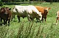 Cattle-Hertfordshire-20050613-033.jpg 3 031 × 2 006; 1,37 MB
-
 Cavendish Road - geograph.org.uk - 3300642.jpg 640 × 425; 291 KB
-
 Cavendish Road - geograph.org.uk - 3300652.jpg 640 × 425; 305 KB
-
 Cell Barnes Lane - geograph.org.uk - 3297253.jpg 640 × 425; 303 KB
-
 Cell Barnes Lane Shopping Parade - geograph.org.uk - 3297259.jpg 640 × 425; 363 KB
-
 Cemetery Lodge - geograph.org.uk - 3300869.jpg 640 × 425; 323 KB
-
 Chequer Street, St.Albans - geograph.org.uk - 3213032.jpg 4 800 × 3 200; 5,42 MB
-
 Christopher Place - geograph.org.uk - 3430551.jpg 640 × 424; 305 KB
-
 Christopher Place - geograph.org.uk - 3430657.jpg 640 × 424; 357 KB
-
 The city of St. Alban - its abbey, and its surroundings (IA cityofstalbanits00ashd).pdf 745 × 1 122, 182 pagine; 17,27 MB
-
 Clarence Park home of St Albans City - geograph.org.uk - 2023527.jpg 2 100 × 1 357; 229 KB
-
 Clarence Park home of St Albans City - geograph.org.uk - 2023528.jpg 2 100 × 1 357; 217 KB
-
 Clarence Park Sensory Garden - geograph.org.uk - 2704511.jpg 640 × 425; 120 KB
-
 Clarence Road - geograph.org.uk - 2704396.jpg 640 × 425; 74 KB
-
 Clarence Road - geograph.org.uk - 2704409.jpg 640 × 425; 76 KB
-
 Clarks Camera Centre - geograph.org.uk - 3884997.jpg 1 024 × 768; 252 KB
-
 Clifton Street - geograph.org.uk - 2705913.jpg 640 × 425; 90 KB
-
 Clifton Street - geograph.org.uk - 2726138.jpg 640 × 425; 65 KB
-
 Close off George Street, St Albans - geograph.org.uk - 5396441.jpg 640 × 480; 133 KB
-
 College Place - geograph.org.uk - 2727476.jpg 425 × 640; 65 KB
-
 College Road, St. Albans - geograph.org.uk - 2226952.jpg 640 × 480; 60 KB
-
 College Street - geograph.org.uk - 2726928.jpg 640 × 425; 76 KB
-
 College Street - geograph.org.uk - 3450553.jpg 424 × 640; 306 KB
-
 Colney Heath Lane bridge over Alban Way - geograph.org.uk - 5379956.jpg 5 202 × 3 465; 5,1 MB
-
 Colney Heath Lane looking south east. - geograph.org.uk - 5379971.jpg 5 202 × 3 465; 3,08 MB
-
 Colney Heath Lane looking westwards - geograph.org.uk - 5379963.jpg 5 202 × 3 465; 3,57 MB
-
 Controlled waste (9740824919).jpg 3 488 × 2 623; 2,75 MB
-

-
 Corner of Mile House Road and London Road Sopwell - geograph.org.uk - 2304137.jpg 1 600 × 1 200; 565 KB
-
 Cottages on Church Green, St Peter's Street - geograph.org.uk - 4745533.jpg 1 280 × 939; 438 KB
-
 Cottages on Church Green, St Peter's Street - geograph.org.uk - 4745535.jpg 1 280 × 960; 309 KB
-
 Cottages on Church Green, St Peter's Street - geograph.org.uk - 4745541.jpg 921 × 1 280; 293 KB
-
 Cottages, Bluehouse Hill - geograph.org.uk - 2724334.jpg 640 × 425; 54 KB
-
 Cottonmill Crescent - geograph.org.uk - 2937609.jpg 640 × 425; 289 KB
-
 Cottonmill Lane, Sopwell - geograph.org.uk - 2304166.jpg 1 600 × 1 200; 592 KB
-
 Cottonmill Lane, Sopwell - geograph.org.uk - 2304172.jpg 1 594 × 1 085; 476 KB
-
 Cottonmill Lane, Sopwell - geograph.org.uk - 4603432.jpg 2 304 × 1 728; 815 KB
-
 Cricket pavilion, Clarence Park - geograph.org.uk - 2704474.jpg 640 × 425; 93 KB
-
 Cricket pavilion, Clarence Park - geograph.org.uk - 2704481.jpg 640 × 425; 79 KB
-
 Culver Road - geograph.org.uk - 2708271.jpg 640 × 425; 93 KB
-
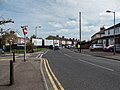
 Cycle path beside Harpenden Road (A1081) - geograph.org.uk - 5318597.jpg 640 × 480; 139 KB
-

-

-
 Cycling past the snowdrops - geograph.org.uk - 3883415.jpg 1 024 × 768; 450 KB
-
 Cyclist on Abbey Mill Lane - geograph.org.uk - 3880727.jpg 1 024 × 768; 324 KB
-
 Dappled Road - geograph.org.uk - 3980403.jpg 1 200 × 1 600; 476 KB
-
 Datestone, former Liberal Club - geograph.org.uk - 4745557.jpg 1 280 × 960; 231 KB
-
 De Novo Place - geograph.org.uk - 2678821.jpg 640 × 425; 73 KB
-
 Demolition of St Albans Gasholders - geograph.org.uk - 3838120.jpg 1 024 × 768; 216 KB
-
 Devdas Bar ^ Restaurant, St Albans - geograph.org.uk - 5318590.jpg 640 × 480; 75 KB
-

-
 Doggetts Way - geograph.org.uk - 3430568.jpg 640 × 424; 191 KB
-
 Doggetts Way, St Albans - geograph.org.uk - 4683362.jpg 640 × 480; 73 KB
-
 Doors on the corner - geograph.org.uk - 5236915.jpg 800 × 737; 158 KB
-

-
 Drakes Drive, Sopwell - geograph.org.uk - 4500297.jpg 2 234 × 1 630; 1,82 MB
-
 Drinking Fountain, Clarence Park - geograph.org.uk - 3297296.jpg 425 × 640; 480 KB
-
 Eaton Road - geograph.org.uk - 3450701.jpg 640 × 424; 309 KB
-
 Edge of Verulam Golf Club, Cottonmill Lane - geograph.org.uk - 2304165.jpg 1 600 × 1 200; 515 KB
-
 Edmond Beaufort Drive - geograph.org.uk - 2649296.jpg 640 × 425; 57 KB
-
 Ely Road, St. Albans - geograph.org.uk - 2226958.jpg 640 × 480; 92 KB
-
 Entrance to Hatfield Road Cemetery - geograph.org.uk - 4801840.jpg 640 × 480; 67 KB
-
 Entrance to Loreto College on Hatfield Road - geograph.org.uk - 4497340.jpg 2 304 × 1 728; 787 KB
-

-

-
 Express viewed from Clarence Park - geograph.org.uk - 2466183.jpg 640 × 399; 65 KB
-
 Farm-road-Childwickbury-20050613-012.jpg 3 031 × 2 006; 1,46 MB
-
 Field by Redbourn Road, St Albans - geograph.org.uk - 5475951.jpg 2 048 × 1 536; 933 KB
-
 Firbank Road - geograph.org.uk - 4411549.jpg 800 × 530; 415 KB
-
 Firbank Road bus stop - geograph.org.uk - 5391311.jpg 640 × 428; 178 KB
-
 First ice cream van of spring - geograph.org.uk - 3881935.jpg 1 024 × 768; 269 KB
-
 Fishpool Street - geograph.org.uk - 3431219.jpg 640 × 424; 339 KB
-
 Flats on Avenue Road, St Albans - geograph.org.uk - 4082905.jpg 2 560 × 1 920; 2,01 MB
-
 Flats on Beaconsfield Road, St Albans - geograph.org.uk - 5628758.jpg 2 304 × 1 728; 868 KB
-
 Flats on Hatfield Road, St Albans - geograph.org.uk - 5628755.jpg 2 304 × 1 728; 833 KB
-
 Flats on Hatfield Road, St Albans - geograph.org.uk - 5628756.jpg 2 304 × 1 728; 826 KB
-
 Flats on Hatfield Road, St Albans - geograph.org.uk - 5628757.jpg 2 304 × 1 728; 802 KB
-
 Flats, Abbots Park - geograph.org.uk - 5318517.jpg 640 × 480; 109 KB
-
 Fleetville Community Centre - geograph.org.uk - 3439082.jpg 640 × 424; 432 KB
-
 Flowering trees in Sandridge Road - geograph.org.uk - 4936316.jpg 1 600 × 1 200; 1,54 MB
_Club_-_geograph.org.uk_-_4745558.jpg)


.jpg)


.jpg)


.jpg)


_-_geograph.org.uk_-_5318597.jpg)


