Category:Watford
Jump to navigation
Jump to search

town in Hertfordshire, England .jpg) Watford Town Hall  | |||||
| Upload media | |||||
| Instance of | |||||
|---|---|---|---|---|---|
| Location | Watford, Hertfordshire, East of England, England | ||||
| Population |
| ||||
| Area |
| ||||
| Elevation above sea level |
| ||||
| Different from | |||||
| official website | |||||
 | |||||
Subcategories
This category has the following 9 subcategories, out of 9 total.
A
C
E
G
H
P
S
T
Media in category "Watford"
The following 20 files are in this category, out of 20 total.
-
 A derelict clock tower - geograph.org.uk - 6277609.jpg 3,747 × 2,811; 1.75 MB
-
 A path through Cassiobury Park - geograph.org.uk - 6277665.jpg 4,000 × 3,000; 4.63 MB
-
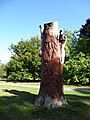
 A tree carving in Cassiobury Park - geograph.org.uk - 6277707.jpg 3,663 × 2,747; 2.06 MB
-
 A tree carving in Cassiobury Park - geograph.org.uk - 6277711.jpg 3,000 × 4,000; 4.19 MB
-
 Ascot Road - geograph.org.uk - 6271107.jpg 4,000 × 3,000; 4.69 MB
-
 Bandstand in Cassiobury Park - geograph.org.uk - 6271516.jpg 3,210 × 2,408; 1.7 MB
-
 First signs of Autumn in Cassiobury Park - geograph.org.uk - 6271513.jpg 3,869 × 2,901; 2.94 MB
-
 Footbridge over Ironbridge Lock - geograph.org.uk - 6277646.jpg 4,000 × 3,000; 4.64 MB
-
 Ironbridge Lock - geograph.org.uk - 6277641.jpg 4,000 × 3,000; 4.86 MB
-
 Leavesden Aerodrome area from the air (geograph 5568998).jpg 600 × 922; 105 KB
-
 Path through Cassiobury Park - geograph.org.uk - 6277662.jpg 3,777 × 2,833; 2.62 MB
-
 Reflections in the Grand Union Canal - geograph.org.uk - 6271290.jpg 4,000 × 3,000; 4.85 MB
-
 Reflections in the Grand Union Canal - geograph.org.uk - 6277636.jpg 3,837 × 2,879; 2.7 MB
-
 Reflections in the River Gade - geograph.org.uk - 6277654.jpg 4,000 × 3,000; 4.68 MB
-
 The Bandstand in Cassiobury Park - geograph.org.uk - 6277703.jpg 3,869 × 2,901; 2.07 MB
-
 The beginning of autumn in Cassiobury Park - geograph.org.uk - 6277659.jpg 4,000 × 3,000; 4.46 MB
-
 Watford Borough Council 2018.svg 360 × 185; 2 KB
-
 Watford UK ward map 2023.svg 990 × 1,266; 168 KB
-
 Watford.JPG 256 × 331; 25 KB
-
 WatfordSkyline.jpg 1,593 × 295; 314 KB


.jpg)


