Category:Sandridge
Jump to navigation
Jump to search
English: Sandridge is a small village between St Albans and Wheathampstead in Hertfordshire, England, United Kingdom.
Português: Sandridge é um pequeno vilarejo entre St. Albans e Wheathampstead, em Hertfordshire, Inglaterra. De acordo com o censo de 2001, a população de Sandridge era de 4.808 habitantes.
village in Hertfordshire, England, United Kingdom  | |||||
| Upload media | |||||
| Instance of | |||||
|---|---|---|---|---|---|
| Location | St Albans, Hertfordshire, East of England, England | ||||
| Area |
| ||||
| Different from | |||||
 | |||||
Subcategories
This category has the following 5 subcategories, out of 5 total.
Media in category "Sandridge"
The following 200 files are in this category, out of 276 total.
(previous page) (next page)-
 'John Bunyan' at Coleman Green - geograph.org.uk - 3344196.jpg 4,288 × 2,848; 1.89 MB
-
 20 and 22 High Street, Sandridge (34631016556).jpg 3,762 × 2,826; 3.82 MB
-
 A Bridleway near Nashes Farm, Sandridge - geograph.org.uk - 1274098.jpg 640 × 480; 203 KB
-
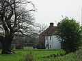
 A Distant View of Fairfolds Farm - geograph.org.uk - 1272146.jpg 640 × 480; 143 KB
-

-

-
 A path through the woods - geograph.org.uk - 2390395.jpg 3,648 × 2,736; 2.29 MB
-

-

-
-
 Ardens Way, Marshalswick - geograph.org.uk - 5244695.jpg 2,304 × 1,728; 1.08 MB
-
 Briar Road, Marshalswick - geograph.org.uk - 5244697.jpg 2,304 × 1,728; 1.26 MB
-
 Bridleway beside Langley Wood - geograph.org.uk - 2667845.jpg 600 × 800; 515 KB
-
 Bridleway leading to Ayres End Lane - geograph.org.uk - 2667867.jpg 600 × 800; 479 KB
-
 Bridleway towards Harpenden - geograph.org.uk - 3549244.jpg 1,200 × 1,600; 678 KB
-
 Byway sign off Coleman Green Lane - geograph.org.uk - 5047874.jpg 2,283 × 3,044; 3.49 MB
-
 Byway towards Sandridge - geograph.org.uk - 3549253.jpg 1,600 × 1,068; 654 KB
-
 Cap's Cottages, Sandridge - geograph.org.uk - 1274096.jpg 640 × 480; 148 KB
-
 Car park and Sandridgebury Lane - geograph.org.uk - 2667840.jpg 600 × 800; 379 KB
-
 Chiltern Road - geograph.org.uk - 3427427.jpg 640 × 424; 353 KB
-
 Chiltern Road at the junction of The Ridgeway - geograph.org.uk - 5245230.jpg 2,304 × 1,728; 1.02 MB
-
 Coleman Green - geograph.org.uk - 24332.jpg 640 × 480; 24 KB
-
 Coleman Green - geograph.org.uk - 5047936.jpg 3,072 × 2,304; 3.36 MB
-
 Coleman Green Lane ^ John Bunyan Public House - geograph.org.uk - 5047689.jpg 3,051 × 2,288; 3.01 MB
-
 Coleman Green Lane, Coleman Green - geograph.org.uk - 5047791.jpg 3,072 × 2,304; 1.85 MB
-
 Coleman Green Lane, Coleman Green - geograph.org.uk - 5047798.jpg 3,072 × 2,304; 1.9 MB
-
 Coleman Green Lane, Coleman Green - geograph.org.uk - 5047888.jpg 3,072 × 2,304; 1.77 MB
-
 Colemans Green Lane, Nomansland - geograph.org.uk - 5244969.jpg 2,304 × 1,728; 1.58 MB
-
 Colemans Green Lane, Nomansland - geograph.org.uk - 5246128.jpg 2,304 × 1,728; 797 KB
-
 Colemans Green Lane, Nomansland - geograph.org.uk - 5246141.jpg 2,304 × 1,728; 834 KB
-
 Communications towers by Nashe's Farm Road - geograph.org.uk - 5245232.jpg 2,304 × 1,728; 1.28 MB
-
 Coopers Green Lane - geograph.org.uk - 4500659.jpg 2,304 × 1,728; 814 KB
-
 Coppicing - geograph.org.uk - 99219.jpg 640 × 512; 194 KB
-
 Countryside seen from Hammonds Lane - geograph.org.uk - 42270.jpg 640 × 480; 24 KB
-
 Cricket field and dog walker - geograph.org.uk - 3428625.jpg 4,320 × 3,240; 4.6 MB
-

-
 Cyclists at the crossroads - geograph.org.uk - 5391795.jpg 640 × 480; 188 KB
-

-
 Den, Heartwood Forest, Sandridge, Hertfordshire - geograph.org.uk - 4428664.jpg 1,238 × 825; 1.8 MB
-
 Electricity poles by Nashe's Farm Sandridge - geograph.org.uk - 5245233.jpg 2,304 × 1,728; 873 KB
-

-

-

-

-
 Entering Wheathampstead - geograph.org.uk - 5319819.jpg 640 × 480; 69 KB
-
 Entrance gates, Sandridgebury - geograph.org.uk - 40086.jpg 640 × 480; 17 KB
-
 Entrance to Coleman Green Kennels - geograph.org.uk - 5047748.jpg 2,915 × 2,186; 4.19 MB
-

-
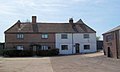
 Fairfolds Farm showing gabled wings - geograph.org.uk - 1272143.jpg 640 × 480; 140 KB
-
-

-
 Farmers field - geograph.org.uk - 2705245.jpg 3,648 × 2,736; 5.66 MB
-
-
 Farmland by Midland Main line - geograph.org.uk - 4737503.jpg 640 × 419; 40 KB
-
 Farmland twixt St Albans and Harpenden - geograph.org.uk - 87045.jpg 640 × 480; 99 KB
-
 Farmland, Sandridgebury - geograph.org.uk - 4792270.jpg 640 × 365; 25 KB
-
 Ferrers Lane - geograph.org.uk - 5319817.jpg 640 × 480; 96 KB
-
 Ferrers Lane by Nomansland Common - geograph.org.uk - 5244823.jpg 2,304 × 1,728; 992 KB
-

-
 Field by House Lane, Sandridge - geograph.org.uk - 5248265.jpg 2,304 × 1,728; 855 KB
-
 Field by Nashe's Farm Lane, Sandridge - geograph.org.uk - 5248672.jpg 2,304 × 1,728; 832 KB
-
 Field by Woodcock Hill, Sandridge - geograph.org.uk - 5248267.jpg 2,304 × 1,728; 921 KB
-
 Field by Woodcock Hill, Sandridge - geograph.org.uk - 5251544.jpg 2,304 × 1,728; 1.73 MB
-
 Field by Woodcock Hill, Sandridge - geograph.org.uk - 5251827.jpg 2,304 × 1,728; 951 KB
-
 Field in the planned Heartwood Forest - geograph.org.uk - 2667850.jpg 800 × 600; 406 KB
-
 Field near Sandridgebury - geograph.org.uk - 5318613.jpg 640 × 414; 34 KB
-
 Field of poppies - geograph.org.uk - 2997202.jpg 2,560 × 1,920; 1.08 MB
-

-

-
 Fields south of Harpenden - geograph.org.uk - 5318612.jpg 640 × 418; 38 KB
-
 Flats on Chiltern Road, Marshalswick - geograph.org.uk - 5245231.jpg 2,304 × 1,728; 834 KB
-
 Footpath arrows Coleman Green, Hertfordshire.jpg 3,000 × 4,000; 10 MB
-

-
 Footpath from Bentsley Spinney onto The Ridgeway - geograph.org.uk - 3549260.jpg 1,200 × 1,600; 618 KB
-
 Footpath in Symondshyde Great Wood - geograph.org.uk - 98417.jpg 640 × 512; 165 KB
-
 Footpath through Skys Wood - geograph.org.uk - 3549257.jpg 1,600 × 1,068; 550 KB
-
 Footpath towards Woodcock Hill through recreation ground - geograph.org.uk - 3549130.jpg 1,600 × 1,065; 509 KB
-
 Fork in the path - geograph.org.uk - 921.jpg 640 × 480; 69 KB
-
 From Coopers Green Lane - geograph.org.uk - 2177323.jpg 640 × 480; 110 KB
-
 Gate on Tower Hill Lane - geograph.org.uk - 4497333.jpg 2,254 × 1,622; 1.42 MB
-
 Grazing by the bridleway to Harpenden - geograph.org.uk - 3549241.jpg 1,600 × 1,068; 470 KB
-
 Hammonds Farm House, 1936 - geograph.org.uk - 2844363.jpg 1,867 × 1,008; 267 KB
-
 Hammonds Lane at the junction of Colemans Green Lane - geograph.org.uk - 5244946.jpg 2,304 × 1,728; 857 KB
-
 Hammonds Lane at the junction of Colemans Green Lane - geograph.org.uk - 5244962.jpg 2,304 × 1,728; 851 KB
-
 Hawthorn embracing a street lamp on Sherwood Avenue - geograph.org.uk - 3549147.jpg 1,200 × 1,600; 532 KB
-
 Hazelmere Road - geograph.org.uk - 3427421.jpg 640 × 424; 278 KB
-
 Heartwood Forest (9182646074).jpg 4,288 × 3,216; 4.23 MB
-
 Heartwood Forest (9183163640).jpg 4,288 × 3,216; 4.11 MB
-
 Heartwood Forest (9183166322).jpg 4,005 × 3,008; 6.79 MB
-
 Heartwood Forest Welcome (27724058054).jpg 2,834 × 2,125; 1.44 MB
-
 Heartwood Forest, Sandridge, Hertfordshire - geograph.org.uk - 4428321.jpg 1,238 × 825; 999 KB
-
 Heartwood Forest, Sandridge, Hertfordshire - geograph.org.uk - 4428327.jpg 1,238 × 825; 1.15 MB
-
 Heartwood Forest, Sandridge, Hertfordshire - geograph.org.uk - 4428372.jpg 1,238 × 825; 1.34 MB
-
 Heartwood Forest, Sandridge, Hertfordshire - geograph.org.uk - 4428651.jpg 1,238 × 825; 1.15 MB
-
 Heartwood Forest, Sandridge, Hertfordshire - geograph.org.uk - 4428669.jpg 1,238 × 825; 1.55 MB
-

-
 Hedge and a seat for walkers - geograph.org.uk - 2667858.jpg 800 × 600; 378 KB
-
 Hedgerow tree - geograph.org.uk - 5391666.jpg 640 × 480; 127 KB
-
 High Street at the junction of Drovers Lane - geograph.org.uk - 5244937.jpg 2,304 × 1,728; 946 KB
-
 High Street at the junction of Ferrers Lane - geograph.org.uk - 5244821.jpg 2,304 × 1,728; 1.09 MB
-
 High Street Sandridge - geograph.org.uk - 4083367.jpg 2,560 × 1,920; 1.35 MB
-
 High Street Sandridge - geograph.org.uk - 5244811.jpg 2,304 × 1,728; 980 KB
-
 High Street Sandridge - geograph.org.uk - 5246142.jpg 2,304 × 1,728; 826 KB
-
 Hill End Farm from across the fields - geograph.org.uk - 3428583.jpg 4,320 × 3,240; 5.17 MB
-
 Hill End Farm, Sandridge, Hertfordshire - geograph.org.uk - 4428349.jpg 1,238 × 825; 943 KB
-
 Hill End Farm, Sandridge, Hertfordshire - geograph.org.uk - 4428675.jpg 1,167 × 875; 874 KB
-
 Hill top near Nashe's farm looking towards Marshalswick - geograph.org.uk - 2997186.jpg 2,560 × 1,920; 1.08 MB
-
 Hillend Farm, Sandridge (51119315794).jpg 4,608 × 3,456; 5.84 MB
-
 Hook's Wood and Sleeve Hall Wood - geograph.org.uk - 2177352.jpg 640 × 480; 92 KB
-
 Hopkins crescent sandrige.jpg 960 × 720; 95 KB
-

-
 HOSDB - geograph.org.uk - 2399034.jpg 640 × 480; 53 KB
-
 HOSDB Research Centre - geograph.org.uk - 2399027.jpg 640 × 480; 57 KB
-
 House Lane at the junction of High Street, Sandridge - geograph.org.uk - 5245234.jpg 2,304 × 1,728; 1.05 MB
-
 House Lane, Marshalswick - geograph.org.uk - 5244777.jpg 2,304 × 1,728; 1.18 MB
-
 House on Woodcock Hill, Sandridge - geograph.org.uk - 5248268.jpg 2,103 × 1,577; 810 KB
-
 Houses by Woodcock Hill, Sandridge - geograph.org.uk - 5248269.jpg 2,304 × 1,728; 862 KB
-
 Houses on Langley Grove, Sandridge - geograph.org.uk - 4083370.jpg 2,560 × 1,920; 2.02 MB
-

-
 Jersey Farm Open Space, Sandridge (41145672834).jpg 4,608 × 3,456; 5.21 MB
-
 Jersey Farm Open Space, Sandridge (41819957072).jpg 4,608 × 3,456; 4.76 MB
-
 John Bunyan Public House sign - geograph.org.uk - 5047731.jpg 2,215 × 2,953; 3.75 MB
-
 John Bunyan Public House sign - geograph.org.uk - 5047734.jpg 2,283 × 3,044; 3.06 MB
-
 John Bunyan Public House, Coleman Green - geograph.org.uk - 5047703.jpg 3,072 × 2,304; 1.95 MB
-
 Junction of Hammonds Lane and Coopers Green lane - geograph.org.uk - 2997215.jpg 2,560 × 1,920; 1.08 MB
-
 Kinsbourne Cars on High Street Sandridge - geograph.org.uk - 5246144.jpg 2,304 × 1,728; 831 KB
-

-
 Langley Grove, Sandridge - geograph.org.uk - 4083067.jpg 2,518 × 1,862; 1.19 MB
-
 Langley Wood - geograph.org.uk - 4792271.jpg 640 × 426; 42 KB
-

-
 Looking north to Sandridge across the fields.jpg 5,472 × 3,648; 6.12 MB
-
 Lych gate at St Leonard's Church, Sandridge (8249648291).jpg 4,288 × 3,216; 4.41 MB
-
 Marshalswick Baptist Church - geograph.org.uk - 3549442.jpg 1,600 × 1,069; 376 KB
-
 Marshalswick Community Centre - geograph.org.uk - 3549188.jpg 1,600 × 1,067; 643 KB
-
 Marshalswick Library - geograph.org.uk - 3549184.jpg 1,600 × 1,068; 493 KB
-

-
 Memorial at St Leonard's Church, Sandridge (8250720232).jpg 4,288 × 3,216; 4.04 MB
-
 Memorial, Heartwood Forest, Sandridge, Hertfordshire - geograph.org.uk - 4428337.jpg 1,238 × 825; 1.12 MB
-

-

-
 Mobile phone masts and assorted junk near Nashe's Farm - geograph.org.uk - 2997183.jpg 2,560 × 1,920; 1.08 MB
-
 Morning Bath - geograph.org.uk - 5347248.jpg 640 × 480; 73 KB
-
 Narrow lane with passing place near to Sandridge - geograph.org.uk - 2997182.jpg 2,560 × 1,920; 1.08 MB
-
 Nashe's Farm Lane, Sandridge - geograph.org.uk - 5251828.jpg 2,246 × 1,646; 1.11 MB
-
 Nashe's Farm Lane, Sandridge - geograph.org.uk - 5251832.jpg 2,304 × 1,728; 835 KB
-
 Nashes Farm Lane at the junction of House Lane - geograph.org.uk - 5244790.jpg 2,304 × 1,728; 1.12 MB
-
 Nashes Farm, Sandridge - geograph.org.uk - 1270348.jpg 640 × 480; 149 KB
-

-

-
 New trees planted - geograph.org.uk - 2392815.jpg 640 × 480; 56 KB
-
 Newly planted trees - geograph.org.uk - 2392821.jpg 640 × 480; 90 KB
-
 Nomansland Common - geograph.org.uk - 5319816.jpg 640 × 480; 67 KB
-
 Oak Farm at Coopers Green Lane. - geograph.org.uk - 40063.jpg 640 × 480; 16 KB
-
 Oak Wood - geograph.org.uk - 2177339.jpg 640 × 480; 111 KB
-
 Old car in front of the pub - geograph.org.uk - 3956308.jpg 640 × 425; 70 KB
-
 Ox-eye Daisy field - geograph.org.uk - 2705233.jpg 4,236 × 1,318; 6.09 MB
-
 Park by House Lane, Marshalswick - geograph.org.uk - 5248262.jpg 2,304 × 1,728; 836 KB
-
 Park by House Lane, Marshalswick - geograph.org.uk - 5248263.jpg 2,304 × 1,728; 823 KB
-
 Park by House Lane, Marshalswick - geograph.org.uk - 5248264.jpg 2,304 × 1,728; 842 KB
-
 Path at Heartwood Forest, Sandridge, Hertfordshire - geograph.org.uk - 4428355.jpg 1,238 × 825; 1.21 MB
-
 Path entrance on Sandpit Lane - geograph.org.uk - 4500657.jpg 2,304 × 1,728; 799 KB
-
 Path off Langley Grove, Sandridge - geograph.org.uk - 4083065.jpg 2,544 × 1,898; 1.68 MB
-
 Path under a willow towards Chiltern Road - geograph.org.uk - 3549143.jpg 1,200 × 1,600; 714 KB
-

-
 Pilgrim Cottage, Coleman Green - geograph.org.uk - 2377656.jpg 1,280 × 960; 432 KB
-
 Pismire Spring (woodland) - geograph.org.uk - 2667855.jpg 800 × 600; 336 KB
-

-
 Pond, Heartwood Forest, Sandridge, Hertfordshire - geograph.org.uk - 4428446.jpg 1,238 × 825; 1.13 MB
-
 Poppy field - geograph.org.uk - 2705216.jpg 3,397 × 2,734; 7.7 MB
-
 Pound Farmhouse, Sandridge (34631013816).jpg 3,579 × 2,690; 2.76 MB
-
 Pound Farmhouse, Sandridge (34631014686).jpg 3,978 × 2,987; 3.4 MB
-
 Pub sign at Coleman Green - geograph.org.uk - 2912538.jpg 480 × 640; 135 KB
-

-

-
 Radio antenna at HOSDB Research Centre Sandridge - geograph.org.uk - 5248270.jpg 1,728 × 2,304; 868 KB
-
 Radio Mast - geograph.org.uk - 2399039.jpg 480 × 640; 48 KB
-
 Railway bridge over Sandridgebury Lane - geograph.org.uk - 3549450.jpg 1,600 × 1,067; 478 KB
-
 Railway bridge over Sandridgebury Lane - geograph.org.uk - 5391317.jpg 640 × 480; 179 KB
-
 Rear of Hammond Farm in 1936 - geograph.org.uk - 2844400.jpg 1,895 × 1,272; 364 KB
-

-
 Rose & Crown, Sandridge (34631015346).jpg 3,843 × 2,887; 2.95 MB
-
 Round Wood and path beside it - geograph.org.uk - 2667870.jpg 800 × 601; 398 KB
-
 S Type Jaguar on St Helier Road, Marshalswick - geograph.org.uk - 5246149.jpg 2,304 × 1,728; 859 KB
-
 Sandpit Lane, Marshalswick - geograph.org.uk - 4498741.jpg 2,304 × 1,728; 1.49 MB
-
 Sandridge (8265155204).jpg 4,288 × 3,216; 4.35 MB
-
 Sandridge , St Albans Road B651 - geograph.org.uk - 6135942.jpg 6,000 × 4,000; 7.06 MB
-
 Sandridge , St Leonard's Church - geograph.org.uk - 6135943.jpg 3,648 × 2,736; 5.9 MB
-
 Sandridge , St Leonard's Church - geograph.org.uk - 6135944.jpg 2,736 × 3,648; 6.69 MB
-
 Sandridge - village shop (geograph 7519306).jpg 1,600 × 1,114; 551 KB
-
 Sandridge F.C. with St. Leonard's Church in the background.jpg 4,881 × 2,989; 2.45 MB
-
 Sandridge Indoor Surf Pool.jpg 620 × 349; 38 KB
-
 Sandridge Parish Council 2023.svg 360 × 185; 2 KB
-
 Sandridge Pavillion (Under Construction 2012).jpg 860 × 325; 132 KB
-
 Sandridge Rovers F.C. with St. Leonard's Church in the background.jpg 4,929 × 3,152; 2.72 MB
-
 Sandridge, Bridleway - geograph.org.uk - 87017.jpg 640 × 480; 122 KB
-
 Sandridge, Hertfordshire - geograph.org.uk - 4428352.jpg 1,238 × 825; 640 KB
-
 Sandridge, Nomansland Common - geograph.org.uk - 3703744.jpg 640 × 480; 127 KB
-
 Sandridge, Well Wood - geograph.org.uk - 87019.jpg 640 × 480; 138 KB
-
 Sandridgebury Lane - geograph.org.uk - 5391653.jpg 640 × 480; 186 KB
-
 Sandringham School - geograph.org.uk - 3450742.jpg 640 × 424; 335 KB

.jpg)


_-_geograph.org.uk_-_2667864.jpg)


.jpg)
.jpg)
.jpg)
.jpg)


.jpg)


_Sandridge_-_geograph.org.uk_-_1272141.jpg)


.jpg)
.jpg)


.jpg)


.jpg)


_-_geograph.org.uk_-_2667855.jpg)


.jpg)
.jpg)


.jpg)


.jpg)


.jpg)


.jpg)