Category:City of St Albans
Here nagîvasyonê
Here lêgerînê
district with city status in Hertfordshire, England  St Albans Cathedral   | |||||
| Medya bar bike | |||||
| Mînakek ji bo |
| ||||
|---|---|---|---|---|---|
| Cih | Hertfordshire, East of England, Îngilistan | ||||
| Paytext | |||||
| Legislative body |
| ||||
| Gelhe |
| ||||
| Rûerd |
| ||||
| malpera fermî | |||||
 | |||||
The City of St Albans, also known as the City and District of St Albans or District of St Albans, is a local government district, in Hertfordshire, England.
Binkategorî
Di vê kategoriyê de 13 binkategorî hene. Jêr 13 binkategorî tên nîşandan.
Medya di kategoriya "City of St Albans" de
Di vê kategoriyê de 591 dane hene. Jêr 200 dane tên nîşandan.
rûpela berî vê ↔ rûpela pêş-
 (Liberal) Club - geograph.org.uk - 4745558.jpg 1280 x 960; 326 KB
-
 0505222025b~2.jpg 4656 x 2566; 3,07 MB
-
 1111211015e HDR.jpg 3492 x 4656; 2,59 MB
-
 1128201148a HDR~2.jpg 4656 x 3492; 1,58 MB
-
 12 - 14 Chequer Street - geograph.org.uk - 2643379.jpg 425 x 640; 68 KB
-
 153 Victoria Street - geograph.org.uk - 4745601.jpg 1280 x 937; 281 KB
-
 153 Victoria Street, detail - geograph.org.uk - 4745604.jpg 1280 x 848; 283 KB
-
 174-176 London Road - geograph.org.uk - 2678495.jpg 640 x 425; 78 KB
-
 2 Chequer Street - geograph.org.uk - 3430448.jpg 640 x 424; 233 KB
-
 32-34 Upper Marlborough Road - geograph.org.uk - 2705831.jpg 640 x 425; 78 KB
-
 36 Ridgmont Road - geograph.org.uk - 2732376.jpg 425 x 640; 56 KB
-
 4 - 8 Watling Street - geograph.org.uk - 2740354.jpg 640 x 425; 77 KB
-
 8 - 10 Chequer Street - geograph.org.uk - 2643368.jpg 425 x 640; 69 KB
-
 A choice of low-price shops - geograph.org.uk - 3043038.jpg 1000 x 751; 697 KB
-
 A favourite perch - geograph.org.uk - 3881989.jpg 768 x 1024; 488 KB
-

-
 A wet jog - geograph.org.uk - 3884922.jpg 1024 x 768; 407 KB
-

-

-
 Abbey Mill bypass cascade from the bottom - geograph.org.uk - 3881980.jpg 1024 x 768; 284 KB
-
 Abbey Mill bypass cascade, top - geograph.org.uk - 3881979.jpg 1024 x 768; 424 KB
-
 Abbots Avenue at the junction of Cottonmill Lane - geograph.org.uk - 4083464.jpg 2560 x 1920; 2,02 MB
-
 Aboyne Lodge School (geograph 7267816).jpg 1024 x 768; 788 KB
-
 Alban Way - geograph.org.uk - 5379075.jpg 5202 x 3465; 4,66 MB
-
 Alban Way Bridge - geograph.org.uk - 4787796.jpg 480 x 640; 75 KB
-
 Alban Way bridge over Camp Road - geograph.org.uk - 5379829.jpg 5202 x 3465; 3,86 MB
-
 Alban Way from Ashley Road bridge - geograph.org.uk - 5379873.jpg 5202 x 3465; 4,81 MB
-
 Albert Street - geograph.org.uk - 2739445.jpg 640 x 425; 71 KB
-
 Albert Street - geograph.org.uk - 2931130.jpg 640 x 425; 337 KB
-
 Albion Road - geograph.org.uk - 3300629.jpg 640 x 425; 289 KB
-
 Albion Road - geograph.org.uk - 3300635.jpg 640 x 425; 289 KB
-
 Alexandra Road - geograph.org.uk - 2708172.jpg 640 x 425; 102 KB
-
 Alma Road - geograph.org.uk - 2635767.jpg 425 x 640; 113 KB
-
 Alma Road - geograph.org.uk - 5379063.jpg 5202 x 3465; 3,5 MB
-
 Alma Road, St Albans - geograph.org.uk - 5246160.jpg 1588 x 2206; 910 KB
-
 Alma Road, St Albans - geograph.org.uk - 5628752.jpg 2304 x 1728; 857 KB
-
 Alma Road, St Albans - geograph.org.uk - 5628753.jpg 2304 x 1728; 865 KB
-
-
 Approaching Park Street roundabout - geograph.org.uk - 2294215.jpg 1594 x 1139; 372 KB
-
 Archers Fields off Sandridge Road - geograph.org.uk - 2667883.jpg 800 x 600; 446 KB
-
 Art deco house on Harpenden Road - geograph.org.uk - 4645017.jpg 2222 x 1614; 1002 KB
-
 Ashley Road bridge - geograph.org.uk - 5379864.jpg 5202 x 3465; 5,5 MB
-
 At St Albans City Station - geograph.org.uk - 3983457.jpg 1820 x 2547; 1,48 MB
-
 Autumn colour in Sandridge Road - geograph.org.uk - 2667888.jpg 800 x 600; 431 KB
-
 Autumn Colour in St.Albans - geograph.org.uk - 3217435.jpg 4000 x 2666; 7,68 MB
-

-
 Autumn colours (25602820583).jpg 4288 x 3216; 4,59 MB
-
 Autumn Sunshine in St.Albans - geograph.org.uk - 3217524.jpg 4000 x 2792; 6,53 MB
-
 Avenue Road - geograph.org.uk - 2704301.jpg 640 x 425; 93 KB
-
 Avenue Road - geograph.org.uk - 2704379.jpg 640 x 425; 67 KB
-
 Aylett Nurseries, London Colney - geograph.org.uk - 5299281.jpg 2124 x 1557; 1,18 MB
-
 Bardwell Road - geograph.org.uk - 2931423.jpg 640 x 425; 272 KB
-
 Batchwood Drive, St Albans - geograph.org.uk - 3777691.jpg 2304 x 1728; 837 KB
-
 Batchwood Drive, Townsend - geograph.org.uk - 5628677.jpg 2304 x 1728; 854 KB
-
 Batchwood Drive, Townsend - geograph.org.uk - 5628678.jpg 2304 x 1728; 1,23 MB
-
 Batchwood Drive, Townsend - geograph.org.uk - 5628682.jpg 2304 x 1728; 851 KB
-
 Batchwood View at the junction of Townsend Road - geograph.org.uk - 5628679.jpg 2304 x 1728; 1,12 MB
-
 Batchwood View, Townsend - geograph.org.uk - 5631817.jpg 2296 x 1718; 1,09 MB
-
 Battlefield Road - geograph.org.uk - 2626263.jpg 640 x 425; 71 KB
-
 Beach Bottom Dyke explanatory sign - geograph.org.uk - 5391296.jpg 640 x 480; 182 KB
-
 Beaconsfield Road, St Albans - geograph.org.uk - 5628754.jpg 2304 x 1728; 812 KB
-
 Beaumont Avenue - geograph.org.uk - 3450725.jpg 640 x 424; 312 KB
-
 Beaumont Works, Sutton Road - geograph.org.uk - 5379851.jpg 5098 x 2940; 2,5 MB
-
 Bedmond Lane - Windridge Road - geograph.org.uk - 205613.jpg 640 x 480; 128 KB
-
 Bedmond Lane, St Stephens - geograph.org.uk - 4645026.jpg 2304 x 1728; 869 KB
-
 Bedmond Lane, St Stephens - geograph.org.uk - 4645027.jpg 2304 x 1728; 852 KB
-
 Beech Bottom Dyke - geograph.org.uk - 4406794.jpg 800 x 530; 711 KB
-
 Beech Bottom Dyke - geograph.org.uk - 4406797.jpg 800 x 530; 738 KB
-
 Beech Bottom Dyke - geograph.org.uk - 4406800.jpg 800 x 530; 729 KB
-
 Beech Bottom Dyke - geograph.org.uk - 4411556.jpg 800 x 530; 775 KB
-
 Beech Bottom Dyke - geograph.org.uk - 5391291.jpg 640 x 480; 221 KB
-
 Beech Bottom Dyke - geograph.org.uk - 5396828.jpg 640 x 480; 226 KB
-
 Beech leaves sprouting - geograph.org.uk - 3881951.jpg 640 x 480; 62 KB
-
 Beech Road - geograph.org.uk - 4411489.jpg 800 x 530; 396 KB
-
 Beech Road - geograph.org.uk - 4411512.jpg 799 x 537; 439 KB
-
 Beech Road shops - geograph.org.uk - 4411479.jpg 800 x 530; 450 KB
-
 Beech Road, Bernards Heath - geograph.org.uk - 5298364.jpg 2304 x 1728; 816 KB
-
 Bell Meadow - geograph.org.uk - 3884916.jpg 1024 x 768; 437 KB
-
 Bench Mark on The Peacock - geograph.org.uk - 4745571.jpg 1280 x 1280; 368 KB
-
 Bench Mark, 53 Victoria Street - geograph.org.uk - 4745579.jpg 1280 x 1280; 365 KB
-
 Bench with river carving - geograph.org.uk - 3882013.jpg 1024 x 768; 520 KB
-

-
 Bernards Heath Infant School - geograph.org.uk - 3302081.jpg 640 x 425; 427 KB
-
 Black Cut - geograph.org.uk - 2707208.jpg 425 x 640; 91 KB
-
 Blandford Road - geograph.org.uk - 3301125.jpg 640 x 425; 269 KB
-
 Boundary Road - geograph.org.uk - 3302101.jpg 640 x 425; 300 KB
-
 Boundary Road - geograph.org.uk - 3302112.jpg 425 x 640; 354 KB
-

-
 Brampton Road - geograph.org.uk - 2649302.jpg 640 x 425; 76 KB
-
 Brampton Road, Fleetville - geograph.org.uk - 4497106.jpg 2304 x 1728; 839 KB
-
 Brassica-napus-20050613-015.jpg 3031 x 2006; 1,53 MB
-
 Brassica-napus-20050613-016.jpg 3031 x 2006; 1,65 MB
-
 Brassica-napus-20050613-017.jpg 3031 x 2006; 2,16 MB
-
 Bridge in Verulamium Park, St.Albans - geograph.org.uk - 3215828.jpg 4200 x 2800; 6,98 MB
-
 Bridge over Alban Way - geograph.org.uk - 5517948.jpg 640 x 478; 94 KB
-

-
 Burnham Road - geograph.org.uk - 3450693.jpg 640 x 424; 323 KB
-
 Butterfield Lane - geograph.org.uk - 3427318.jpg 640 x 424; 358 KB
-
 By mutual agreement - geograph.org.uk - 3885004.jpg 1024 x 768; 164 KB
-
 Cafe Alfresco, Victoria Street - geograph.org.uk - 5379058.jpg 3238 x 3334; 1,72 MB
-

-
 Camp Road industrial estate from Alban Way - geograph.org.uk - 5379838.jpg 5202 x 3465; 6,16 MB
-
 Camp Road, Fleetville - geograph.org.uk - 4497087.jpg 2224 x 1616; 933 KB
-
 Camp Road, St Albans - geograph.org.uk - 4703183.jpg 1400 x 1050; 1,12 MB
-
 Camp Road, St Albans - geograph.org.uk - 5379832.jpg 5202 x 3465; 3,48 MB
-
 Carnegie Road - geograph.org.uk - 4406575.jpg 800 x 530; 498 KB
-

-
 Catherine Street charity shop - geograph.org.uk - 2458749.jpg 1024 x 768; 139 KB
-
 Cattle-and-tractor-Hertfordshire-20050613-029.jpg 3031 x 2006; 1,13 MB
-
 Cattle-Hertfordshire-20050613-031.jpg 3031 x 2006; 1,57 MB
-
 Cattle-Hertfordshire-20050613-032.jpg 3031 x 2006; 1,65 MB
-
 Cattle-Hertfordshire-20050613-033.jpg 3031 x 2006; 1,37 MB
-
 Cavendish Road - geograph.org.uk - 3300642.jpg 640 x 425; 291 KB
-
 Cavendish Road - geograph.org.uk - 3300652.jpg 640 x 425; 305 KB
-
 Cell Barnes Lane - geograph.org.uk - 3297253.jpg 640 x 425; 303 KB
-
 Cell Barnes Lane Shopping Parade - geograph.org.uk - 3297259.jpg 640 x 425; 363 KB
-
 Cemetery Lodge - geograph.org.uk - 3300869.jpg 640 x 425; 323 KB
-
 Chequer Street, St.Albans - geograph.org.uk - 3213032.jpg 4800 x 3200; 5,42 MB
-
 Christopher Place - geograph.org.uk - 3430551.jpg 640 x 424; 305 KB
-
 Christopher Place - geograph.org.uk - 3430657.jpg 640 x 424; 357 KB
-
 The city of St. Alban - its abbey, and its surroundings (IA cityofstalbanits00ashd).pdf 745 × 1122, 182 rûpel; 17,27 MB
-
 Clarence Park home of St Albans City - geograph.org.uk - 2023527.jpg 2100 x 1357; 229 KB
-
 Clarence Park home of St Albans City - geograph.org.uk - 2023528.jpg 2100 x 1357; 217 KB
-
 Clarence Park Sensory Garden - geograph.org.uk - 2704511.jpg 640 x 425; 120 KB
-
 Clarence Road - geograph.org.uk - 2704396.jpg 640 x 425; 74 KB
-
 Clarence Road - geograph.org.uk - 2704409.jpg 640 x 425; 76 KB
-
 Clarks Camera Centre - geograph.org.uk - 3884997.jpg 1024 x 768; 252 KB
-
 Clifton Street - geograph.org.uk - 2705913.jpg 640 x 425; 90 KB
-
 Clifton Street - geograph.org.uk - 2726138.jpg 640 x 425; 65 KB
-
 Close off George Street, St Albans - geograph.org.uk - 5396441.jpg 640 x 480; 133 KB
-
 College Place - geograph.org.uk - 2727476.jpg 425 x 640; 65 KB
-
 College Road, St. Albans - geograph.org.uk - 2226952.jpg 640 x 480; 60 KB
-
 College Street - geograph.org.uk - 2726928.jpg 640 x 425; 76 KB
-
 College Street - geograph.org.uk - 3450553.jpg 424 x 640; 306 KB
-
 Colney Heath Lane bridge over Alban Way - geograph.org.uk - 5379956.jpg 5202 x 3465; 5,1 MB
-
 Colney Heath Lane looking south east. - geograph.org.uk - 5379971.jpg 5202 x 3465; 3,08 MB
-
 Colney Heath Lane looking westwards - geograph.org.uk - 5379963.jpg 5202 x 3465; 3,57 MB
-
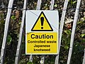 Controlled waste (9740824919).jpg 3488 x 2623; 2,75 MB
-

-

-
 Cottages, Bluehouse Hill - geograph.org.uk - 2724334.jpg 640 x 425; 54 KB
-
 Cottonmill Crescent - geograph.org.uk - 2937609.jpg 640 x 425; 289 KB
-
 Cottonmill Lane, Sopwell - geograph.org.uk - 2304166.jpg 1600 x 1200; 592 KB
-
 Cottonmill Lane, Sopwell - geograph.org.uk - 2304172.jpg 1594 x 1085; 476 KB
-
 Cottonmill Lane, Sopwell - geograph.org.uk - 4603432.jpg 2304 x 1728; 815 KB
-
 Culver Road - geograph.org.uk - 2708271.jpg 640 x 425; 93 KB
-
 Cycle path beside Harpenden Road (A1081) - geograph.org.uk - 5318597.jpg 640 x 480; 139 KB
-

-
 Cycling past the snowdrops - geograph.org.uk - 3883415.jpg 1024 x 768; 450 KB
-
 Cyclist on Abbey Mill Lane - geograph.org.uk - 3880727.jpg 1024 x 768; 324 KB
-
 Dappled Road - geograph.org.uk - 3980403.jpg 1200 x 1600; 476 KB
-
 Datestone, former Liberal Club - geograph.org.uk - 4745557.jpg 1280 x 960; 231 KB
-
 De Novo Place - geograph.org.uk - 2678821.jpg 640 x 425; 73 KB
-
 Demolition of St Albans Gasholders - geograph.org.uk - 3838120.jpg 1024 x 768; 216 KB
-
 Devdas Bar ^ Restaurant, St Albans - geograph.org.uk - 5318590.jpg 640 x 480; 75 KB
-

-
 Doggetts Way - geograph.org.uk - 3430568.jpg 640 x 424; 191 KB
-
 Doggetts Way, St Albans - geograph.org.uk - 4683362.jpg 640 x 480; 73 KB
-
 Doors on the corner - geograph.org.uk - 5236915.jpg 800 x 737; 158 KB
-

-
 Drakes Drive, Sopwell - geograph.org.uk - 4500297.jpg 2234 x 1630; 1,82 MB
-
 Eaton Road - geograph.org.uk - 3450701.jpg 640 x 424; 309 KB
-
 Edmond Beaufort Drive - geograph.org.uk - 2649296.jpg 640 x 425; 57 KB
-
 Ely Road, St. Albans - geograph.org.uk - 2226958.jpg 640 x 480; 92 KB
-
 Entrance to Hatfield Road Cemetery - geograph.org.uk - 4801840.jpg 640 x 480; 67 KB
-
 Entrance to Loreto College on Hatfield Road - geograph.org.uk - 4497340.jpg 2304 x 1728; 787 KB
-

-
 Express viewed from Clarence Park - geograph.org.uk - 2466183.jpg 640 x 399; 65 KB
-
 Farm-road-Childwickbury-20050613-012.jpg 3031 x 2006; 1,46 MB
-
 Field by Redbourn Road, St Albans - geograph.org.uk - 5475951.jpg 2048 x 1536; 933 KB
-
 Firbank Road - geograph.org.uk - 4411549.jpg 800 x 530; 415 KB
-
 Firbank Road bus stop - geograph.org.uk - 5391311.jpg 640 x 428; 178 KB
-
 First ice cream van of spring - geograph.org.uk - 3881935.jpg 1024 x 768; 269 KB
-
 Fishpool Street - geograph.org.uk - 3431219.jpg 640 x 424; 339 KB
-
 Flats on Avenue Road, St Albans - geograph.org.uk - 4082905.jpg 2560 x 1920; 2,01 MB
-
 Flats on Beaconsfield Road, St Albans - geograph.org.uk - 5628758.jpg 2304 x 1728; 868 KB
-
 Flats on Hatfield Road, St Albans - geograph.org.uk - 5628755.jpg 2304 x 1728; 833 KB
-
 Flats on Hatfield Road, St Albans - geograph.org.uk - 5628756.jpg 2304 x 1728; 826 KB
-
 Flats on Hatfield Road, St Albans - geograph.org.uk - 5628757.jpg 2304 x 1728; 802 KB
-
 Flats, Abbots Park - geograph.org.uk - 5318517.jpg 640 x 480; 109 KB
-
 Fleetville Community Centre - geograph.org.uk - 3439082.jpg 640 x 424; 432 KB
-
 Flowering trees in Sandridge Road - geograph.org.uk - 4936316.jpg 1600 x 1200; 1,54 MB
-
 Football pitch on a Roman road - geograph.org.uk - 3883428.jpg 1024 x 768; 177 KB
-
 Footbridge over the vallum - geograph.org.uk - 3883411.jpg 1024 x 768; 540 KB
-
 Footpath to Beech Bottom - geograph.org.uk - 3549456.jpg 1200 x 1600; 553 KB
-
 Footpath to Beech Bottom - geograph.org.uk - 3549462.jpg 1200 x 1600; 451 KB
-
 Former Cricketers - geograph.org.uk - 2635699.jpg 640 x 425; 99 KB
-
 Former Dolphin - geograph.org.uk - 2641925.jpg 425 x 640; 77 KB
-
 Former Ford at St Michaels - geograph.org.uk - 3458728.jpg 3872 x 2592; 2,3 MB
-
 Former Liberal club - geograph.org.uk - 4745554.jpg 1280 x 1280; 290 KB
-
 Former Library - geograph.org.uk - 2732012.jpg 640 x 425; 61 KB
-
 Former Public House, Camp Road, St Albans - geograph.org.uk - 4703180.jpg 1400 x 1050; 1,17 MB
-
 Former Saracen's Head - geograph.org.uk - 2641837.jpg 640 x 425; 77 KB
-
 Former Saracen's Head - geograph.org.uk - 2641856.jpg 425 x 640; 66 KB
-
 Former School of Art and Science - geograph.org.uk - 2731997.jpg 425 x 640; 51 KB
-

-

-
 Former stationmaster's house - geograph.org.uk - 2732225.jpg 640 x 425; 83 KB
-
 Former Tabernacle Baptist Chapel - geograph.org.uk - 2732036.jpg 425 x 640; 71 KB
-

_Club_-_geograph.org.uk_-_4745558.jpg)


.jpg)


.jpg)


.jpg)


_-_geograph.org.uk_-_5318597.jpg)


.jpg)


