Category:Clarenbachkirche (Köln-Braunsfeld)
Jump to navigation
Jump to search
| Object location | | View all coordinates using: OpenStreetMap |
|---|
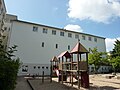
1.jpg) | |||||
| Upload media | |||||
| Instance of | |||||
|---|---|---|---|---|---|
| Named after | |||||
| Location | Braunsfeld, Lindenthal, Cologne, Cologne Government Region, North Rhine-Westphalia, Germany | ||||
| Architect |
| ||||
| Inception |
| ||||
| Religion or worldview | |||||
 | |||||
Subcategories
This category has only the following subcategory.
Media in category "Clarenbachkirche (Köln-Braunsfeld)"
The following 5 files are in this category, out of 5 total.
-
 Clarenbachkirche (Köln-Braunsfeld)1.jpg 1,706 × 1,158; 550 KB
-
 Clarenbachkirche (Köln-Braunsfeld)3.JPG 1,813 × 1,239; 534 KB
-
 Clarenbachkirche (Köln-Braunsfeld)4.JPG 2,048 × 1,536; 1.47 MB
-
 Clarenbachkirche (Köln-Braunsfeld)5.JPG 2,048 × 1,536; 1.51 MB
-
 Clarenbachkirche (Köln-Braunsfeld)6.jpg 3,264 × 2,448; 2.03 MB
3.JPG)
4.JPG)
5.JPG)
6.jpg)